• Skip to primary navigation
  • Skip to main content

Trail Option

A personal geography of landscape and place, art and geo-science.

  • Home
  • TrailOption Blog
  • WayPoints
  • Galleries
  • About
  • Contact TrailOption
  • Subscribe!
  • Show Search
Hide Search

landscape photography

Nevada High Points #103 — Montana Mountains

D. Craig Young · July 31, 2022 · 1 Comment

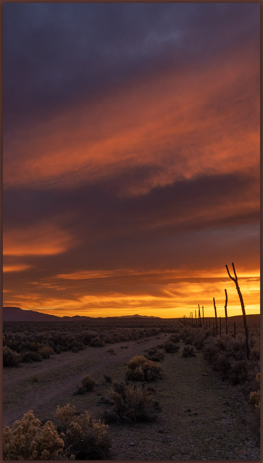
Coyote dust. Evening above Coyote Point, Kings River Valley, Great Basin Desert, NV

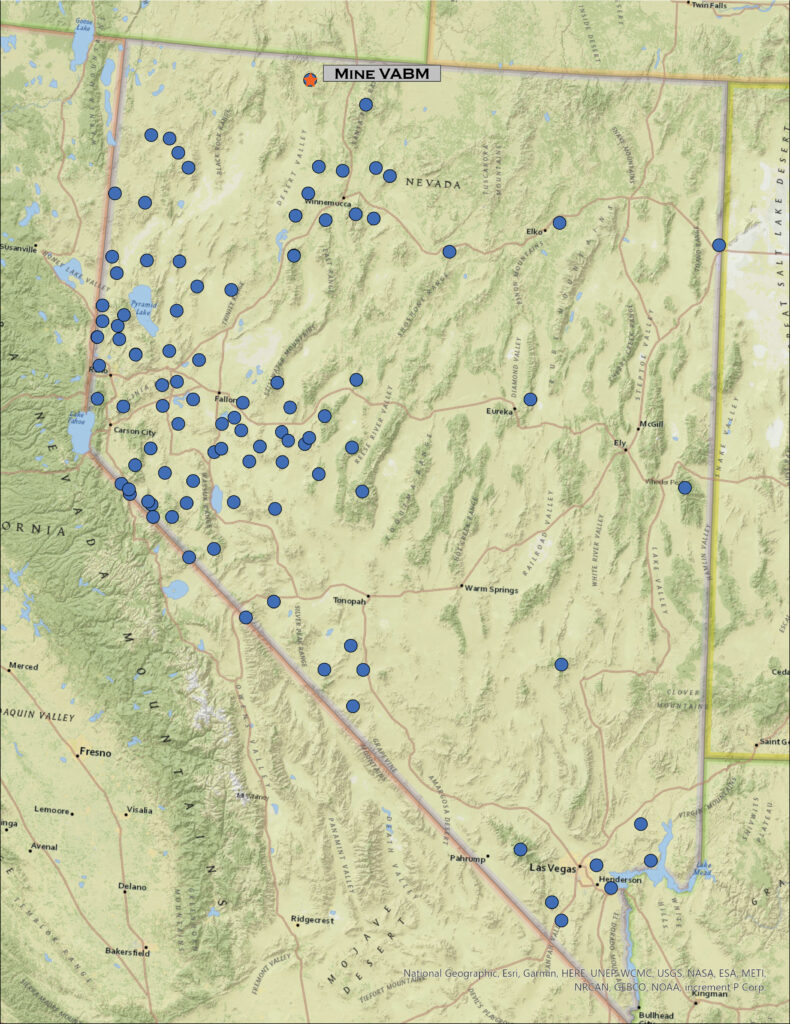
Mine VABM

7129 ft (2173 m) — 418 ft gain

2022.07.10


Motivation is hard to find in the long, repetitive days of summer. The Great Basin Desert seems to curl and fold within itself, even as hazy heatwaves dance across the expanse. The high-pressure domes that keep moisture at bay seem to press downward and inward, sapping energy and making the horizons of endless days barren of interest. I have been in a holding pattern of field days on projects, day-after-day, rarely home for any comfortable time; the repetition threatening to deplete much interest in pursuit of geodata, of photography (either documentarian or creative), and – I’m surprised to admit – of exploration. I typically look forward to the long drives, on-road and off, from project to project or to trailheads leading to peaks and wilderness. Not lately though, this summer is burning me out – not to mention the hordes of black ants that have invaded our home, a summer nuisance, among other chores, that sucks the remaining energy from seemingly every home-time quiet.

And yet, as I make my way up Pole Creek Road into the Montaña Mountains, the air cools and the depth of evening shadows washes some of the stagnant sweat from my eyes. Even if only momentary, the wildland heights heal the ills of summer doldrums and repetition. I am here to walk the range’s high point, “Mining VABM,” a rolling swell in the Montaña escarpment rising above Kings River Valley. Because I am working with a fieldcrew nearby, it made sense to plan this walk to coincide with my visit, and now I see it might do me some good.
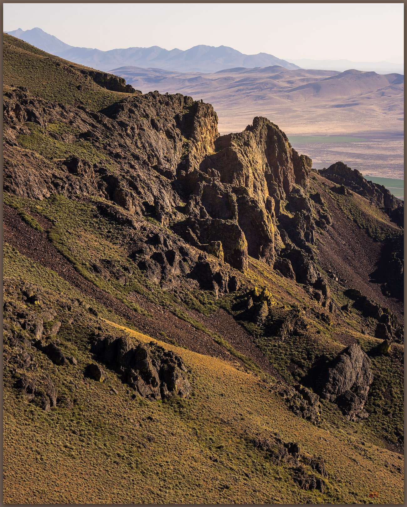
Caldera remnants. Outcrops on the western escarpment of the Montana Mountains, Great Basin Desert, NV

Montana Mountains Collection

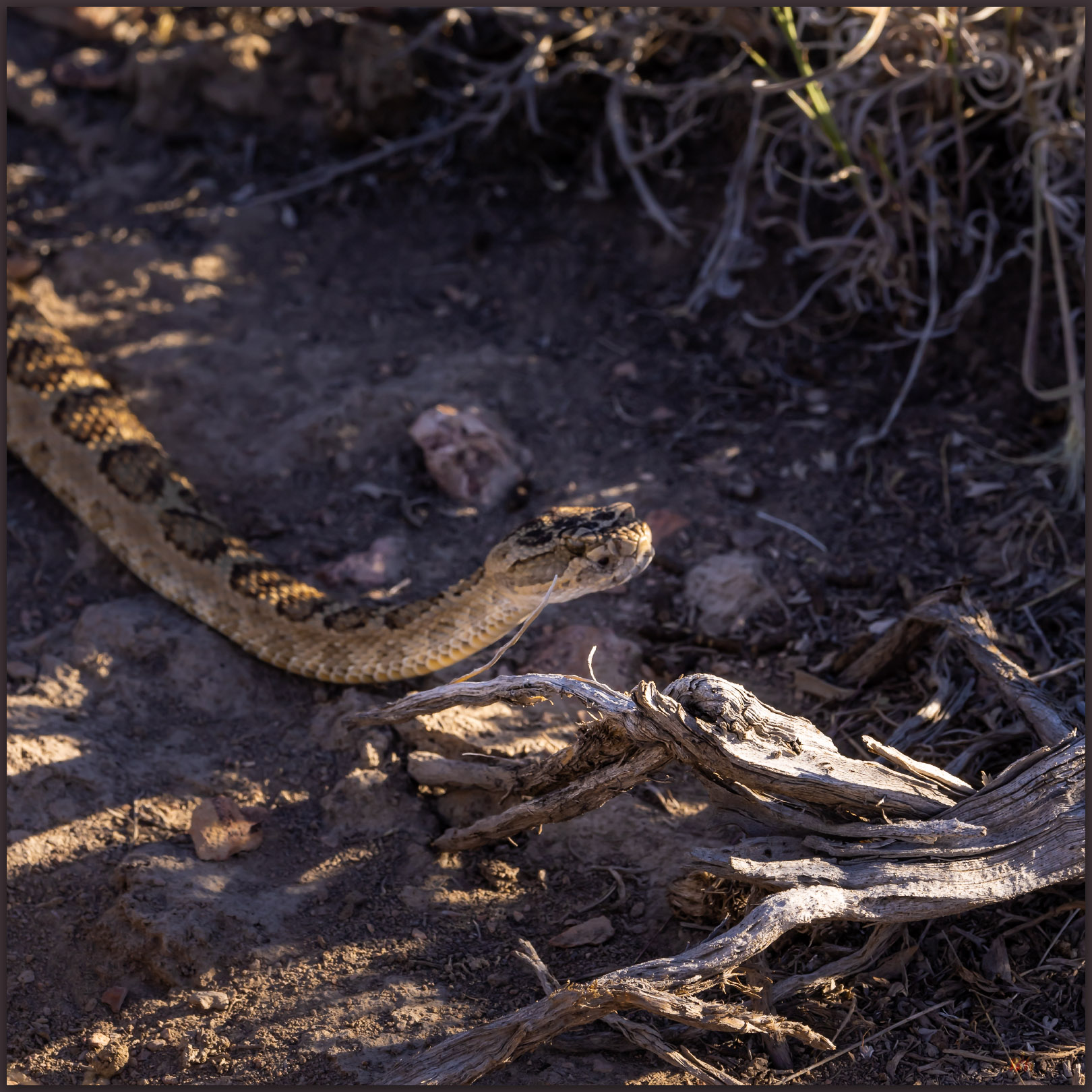
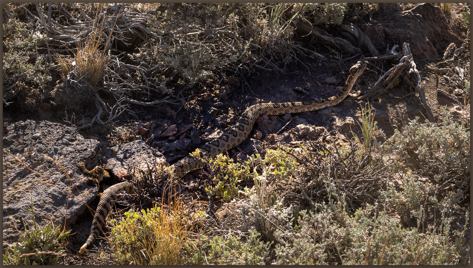
The Montañas are a crumpled and dissected block of uplifted volcanic rocks, with deep canyons splitting rolling tablelands where an occasional butte preserves an old eruptive vent or cone. There is still a little water in the higher streams, and a few of the ponds – often augmented for ranching – hold shallow pools. Although summertime in the sagebrush steppe can seem depleted of wildlife, and many species are definitely hunkered down or simply elsewhere, slow pauses on a canyon rim or along the transition between sage and a grassy burn scar can reveal hints of wild. Walking among rimrocks at the head of a canyon that drops steeply to Kings River Valley, I find a young mule deer, velveted antlers glowing in the setting sun. I step backward to let him be to find a rattlesnake quietly in my way. It does not seem to be bothered by my presence, neither rattling nor posturing, and I can easily bypass it in the quiet.
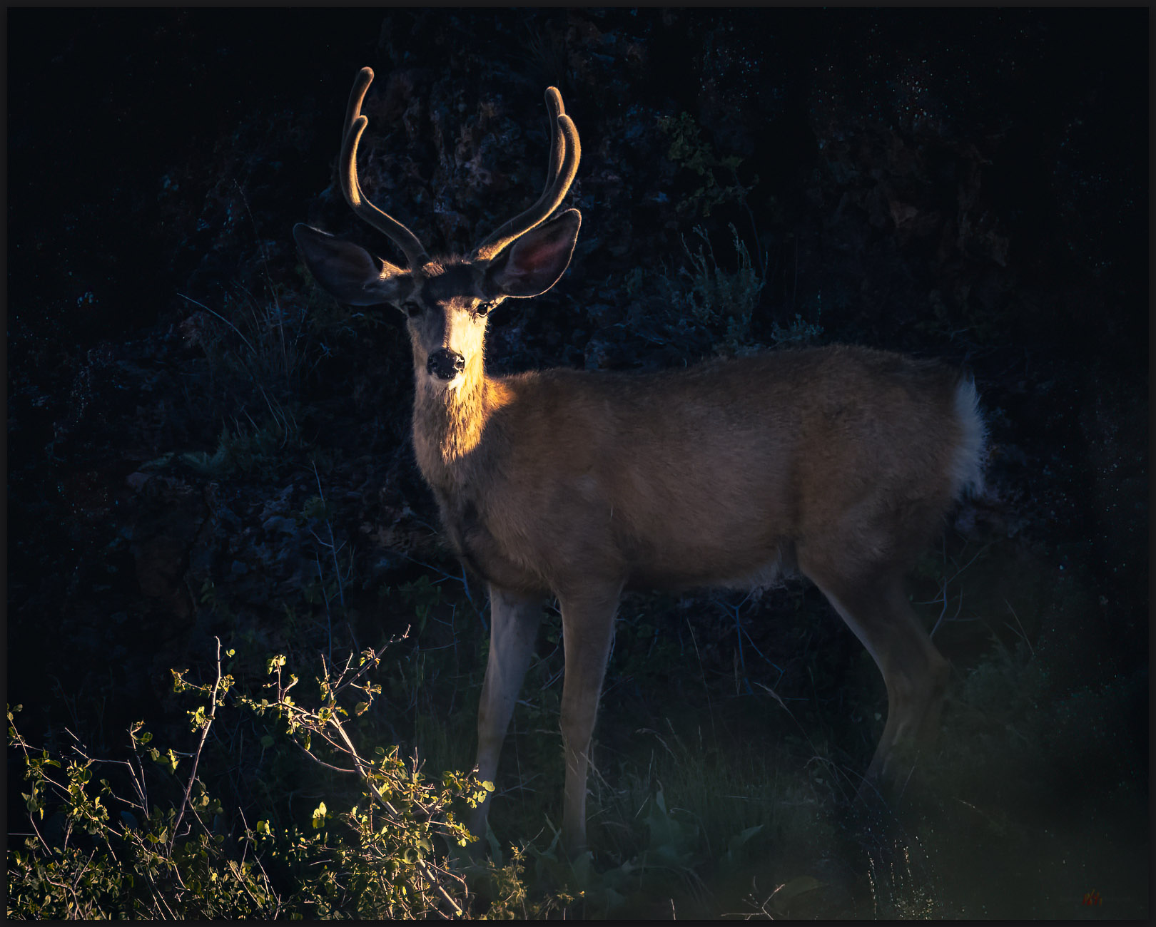
Sound attention. A mule deer peers from a shady alcove in the rimrock of the Montana Mountains, Great Basin Desert, NV
No trail. A Great Basin or Western Rattlesnake waits on an evening hunt, Montana Mountains, Great Basin Desert, NV
Motionless. The Great Basin Rattlesnake waits, Montana Mountains, Great Basin Desert, NV

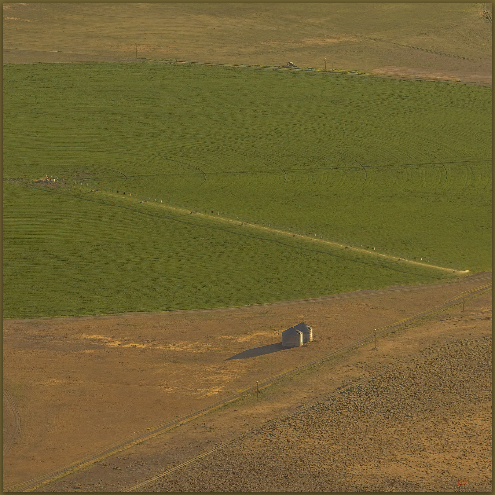
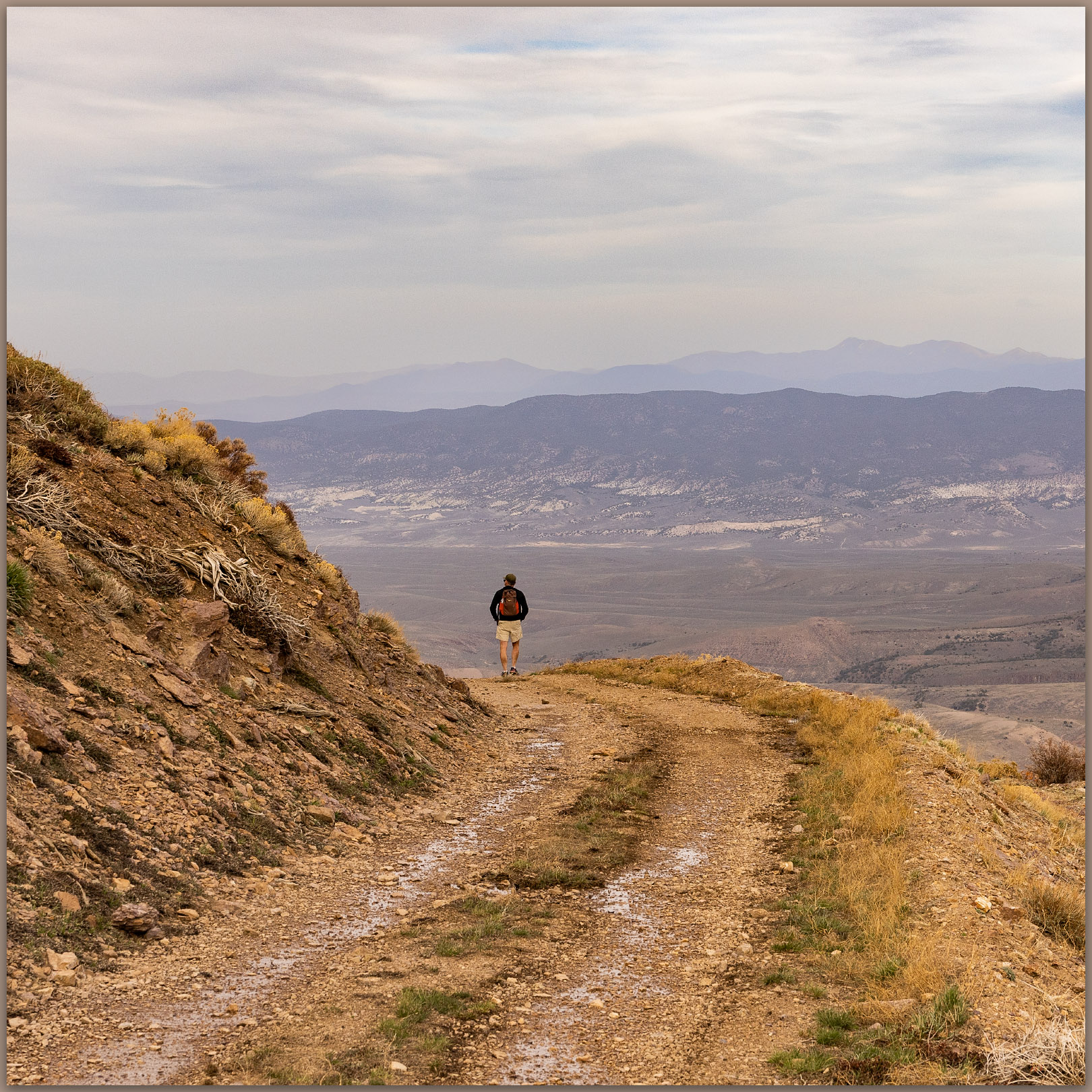
The high point walk is a simple wander along the escarpment edge to a broken-down cairn guarding the summit register. From the rolling summit knoll, I can look down into Kings River Valley and southward into the expanse of Desert Valley. The agricultural imprint of the valley bottom is a regularized pattern of green and brown, but an altered wild surrounds the regularity, and only the sprinkler pivots and ditch irrigation keep the inevitable arid squeeze at bay.
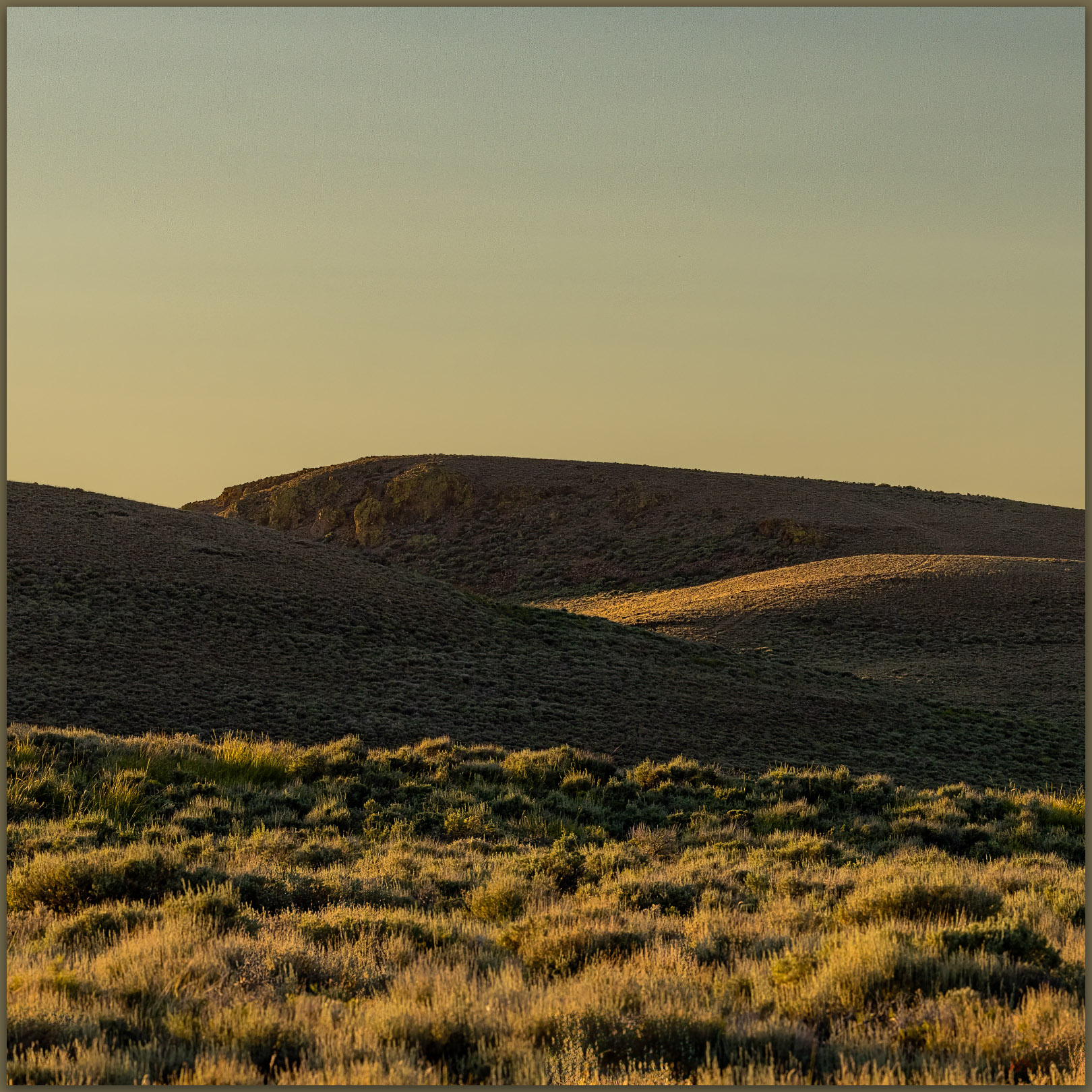
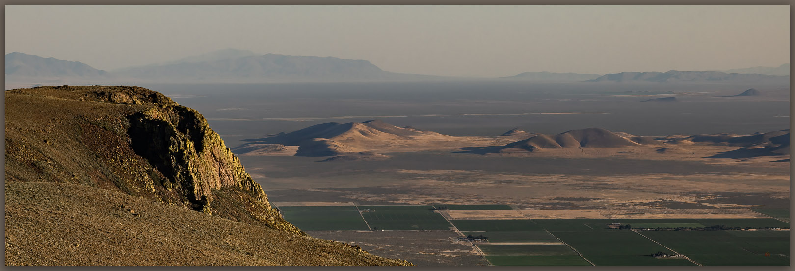
Mine VABM. The unassuming high point of the Montana Mountains, Great Basin Desert, NV
Fading distance. Kings River into Desert Valley from the high point of the Montana Mountains, Great Basin Desert, NV
Pivot and bins. Kings River Valley, Great Basin Desert, NV
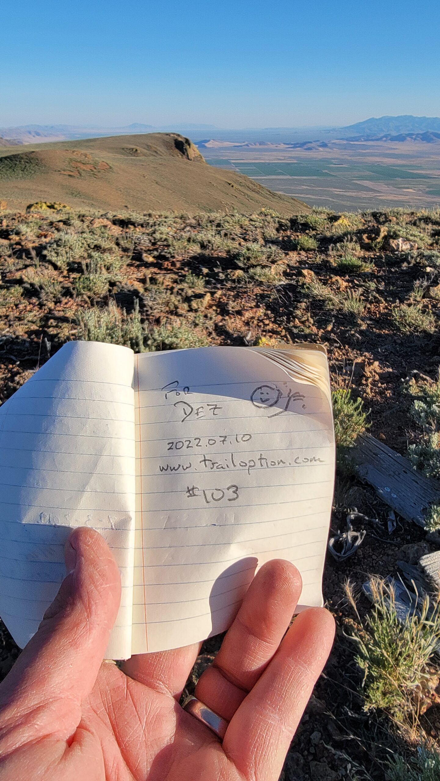
Summit register at Mine VABM, Montana Mountains, NV

Although a well-traveled dirt road traverses close the summit, the cairn seems rarely visited. I register as usual, and the hike back to the truck parked well down the road. There is little elevation gain, but it is a good walk nonetheless. It cools into the evening as I camp on the escarpment edge, where a half-moon stares at me throughout the night, washing the stars in a blue-grey blur, an echo of the dusty haze that bled the color from the day.
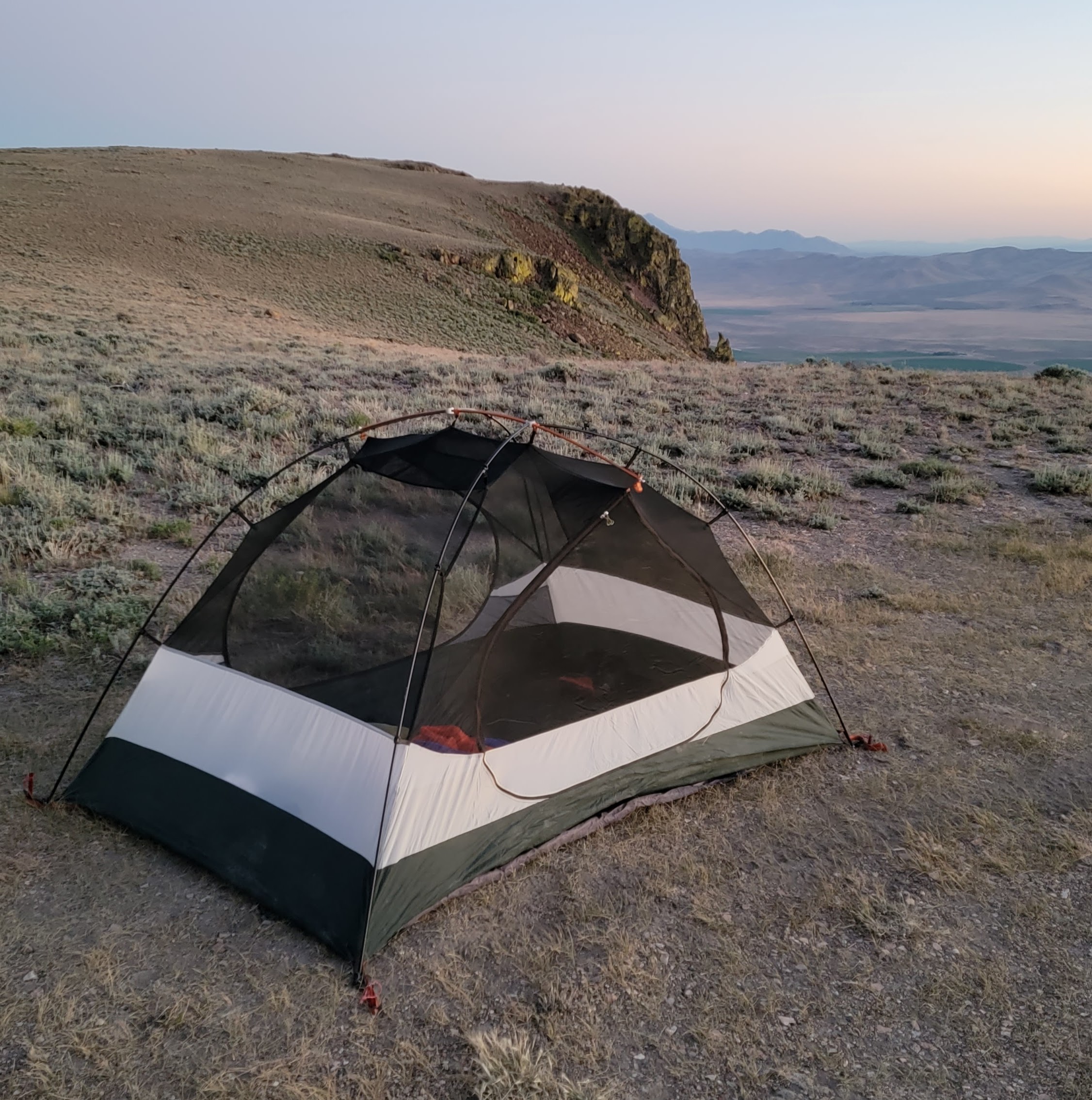
Escarpment camp, Montana Mountains, NV

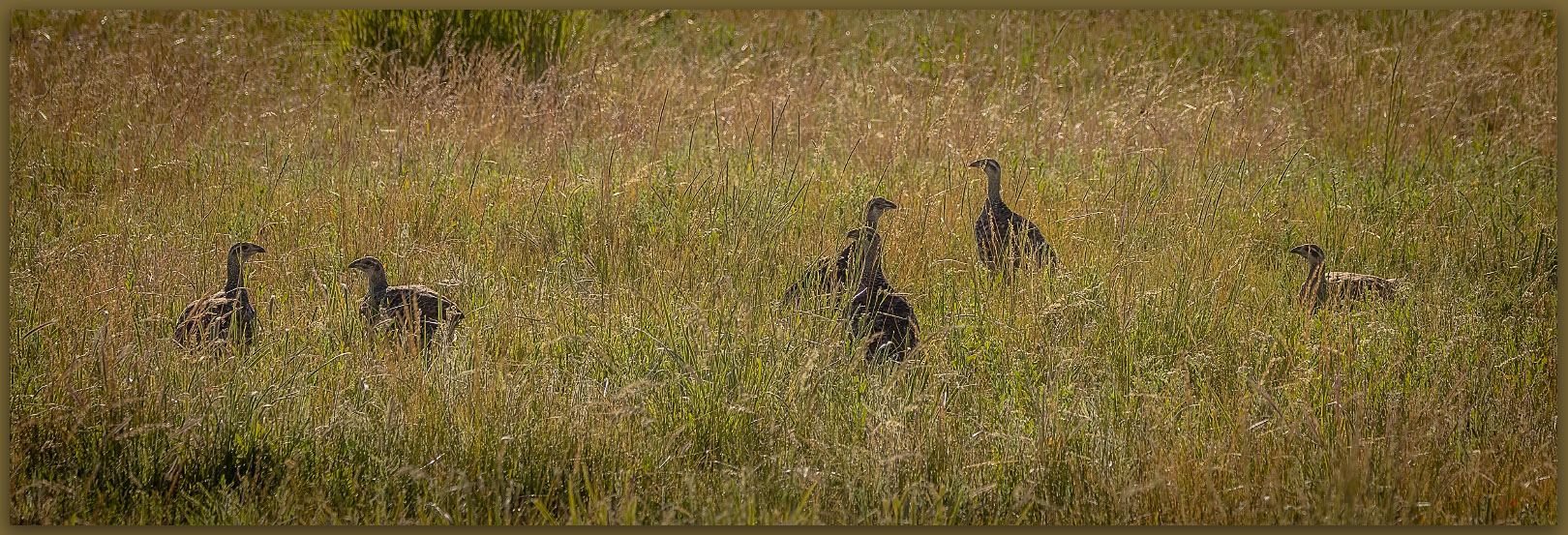
Six hens. Sage Grouse in the Montana Mountains, Great Basin Desert, NV

Montana Mountains Collection

While the high points and wild lands, whether protected wilderness or the altered wild that forms so much of the Nevada outback, bring refreshment even at the height of summer, I worry that the altered wild is taking an unsustainable beating – federally protected wilderness being the one true refuge (for now) from development. As our infrastructure picks and prods at the remaining open space, and all wildlands (protected or not) breathe the global heat of economic and societal engines, I am part of the problem. I live and work in that infrastructure; and though my work seeks to understand and mitigate some of the adverse effects of local development, I am torn by opposing forces and my obvious hypocrisy. Like so many other wild places, the Montaña Mountains provide momentary surcease in the midst of the turmoil of climate change, environmental degradation, and political short-sight. What can these small, non-descript ranges teach me about adapting to and mitigating the pressures of the coming heat and aridity? There remains much beauty and refuge in the altered wild, our impacts are certain and may sometimes be necessary, but we must also proceed with caution, critique, and care.

Keep going.

On the edge of wild — Atacama Desert, Chile

D. Craig Young · July 2, 2022 · 2 Comments

Explaining Atacama. Information along B-245, Atacama Desert, Chile

With the wilds of Patagonia still fresh in our minds, Bill and I spent a short night in Santiago and then climbed on another Latam flight. We were headed north, working our way up the latitudinal expanse of Chile, exploring the regional extremes from glaciers to desert dry lakes, from sea level to the altiplano with volcano summits at 20,000 feet. And, for a time, we were only slightly higher flying into Calama in the dry heart of the Atacama Desert.

Turistas. Exploring the small pans of the high desert, Atacama Desert, Chile
Above the salar. Volcan Licancabur rises to 19,553 feet, looming over the Salar de Atacama, Atacama Desert, Chile

It took quite a while in the queue for a rental, but the little truck was perfect once we got going. I was back in my element, driving desert roads stretching to high horizons, strips of pavement and gravel bounded by salars (dry lake beds) and conical volcanoes. The mountains appear in their simplest form, symmetrical peaks with tonsures of snow, as children draw their first mountain scenes. We based out of the little tourist hive of San Pedro de Atacama; it is the obvious gateway for a short visit to the region, with key tracks leading north and south along the cordillera. While it might not be a wild adventure, it is beautiful way to taste the flavor of the altiplano. Our days do not disappoint.

Atacama Collection

Traveling in the time of covid presents some obvious difficulties. While Chileans tend to practice good caution and care, with vaccinations and masking required in most spaces, it also means many places are closed. This is especially true for those areas, even if wide-open spaces, managed or owned by indigenous communities where limited access to health services and allowing access to exotic tourists is a bad mix. We realize soon enough that some of our plans for visiting water features – springs and wetlands – that pock the vast valley-bottom salars will not work out. We are adaptable in every way, though I keep having to wake up an oxygen-hungry Bill as we drive roads at an elevation above the highest mountains in the contiguous US.

High road. Desert highway near Socaire at over 12,000 feet, Atacama Desert, Chile
Sin agua. The playa of the Salar de Agua Caliantes, Cerro Aracar rises in background, Atacama Desert, Chile

We first explore the region south of the village of Socaire. Our wildlife encounters are fabulous – a fox hunting in coppice dunes and bunch grasses, a family of vicuna cautiously grazing, and flamingos wading in the expanse of Laguna de Aguas Calientes. Our early start allowed us to take advantage of the dusty morning light. Even with the various closures, our first trips into the altiplano were all I had hoped they would be.

Morning patrol. A South American Gray Fox (Lycalopex griseus) in sparse grasses of the Atacam Desert, Chile.
Curiosity. Vicuna family in the altiplano of the Atacama Desert, Chile
Flamingo blue. Andean Flamingos on the Salar de Agua Calientes, Atacama Desert, Chile
One and two. Andean flamingos on the vast Salar de Agua Calientes, Atacama Desert, Chile

A dusty ambient light around San Pedro had caught my attention on the previous evening, and with today’s addition of low clouds, the evening held promise of a stunning sunset. We found the Valle de la Luna (Valley of the Moon) closed – even its back entrance near Tres Marias was blocked by an ad hoc barrier of boulders – due to covid restrictions, so we wandered various dirt tracks looking for a viewpoint to capture the expansive evening desert. We hiked a short way into the park’s margin and set up on a rocky bench overlooking badlands in washes tributary to the Valle de la Luna. I might have been disappointed that the park and various popular viewpoints were closed, but this allowed us to walk a bit, getting to places we might not otherwise see, and maybe shooting images beyond the obvious. Or so we thought. We were alone when I first set up, enjoying the patient anticipation in the early glow of evening. As our wait continued and the light progressed, however, a crowd grew on the hills behind us, dozens of cameras (phones, of course) pointed in the same direction. We were furthest in, maybe half a kilometer down-canyon, so it looked as if the crowds along the roadside (including several tour buses) had turned out to watch me work the scene. Oh well. The sunset was putting on a splendid show, and, with the closures, this stretch of highway provided accessible theater for everyone – I was happy we had walked in a bit.

Dust of dusk. Valle de la Luna, Atacama Desert, Chile
Evening alight. Sunset in the Valley de la Luna, Atacama Desert, Chile

Bart met us after we had been in San Pedro for a couple days; his trip paralleled ours for a time after we left Patagonia. Picking him up in the pre-dawn darkness at the edge of San Pedro, our rental truck joined a train of white vans on the highway to El Tatio geyser. Although we had seen clues around town that the geyser trip was popular (and open), we did not anticipate the early morning rush of guided tours. Trying to not submit the rental to an undo beating on the teeth-shattering washboard of the over-used, multi-tracked road to the geyser, I was passed by an incessant stream of vans, sprinters, and buses of various sizes, a long string of red taillights cresting every hill and switchback for miles as we climbed steeply into the darkness. It was not a pleasant drive.

Early arrival. Visitors at dawn at the El Tatio Geysers, Atacama Desert, Chile
Geyser Bill. El Tatio Geyser, Atacama Desert, Chile
Precipitate I. El Tatio Geyser, Atacama Desert, Chile
Precipitate II. El Tatio Geyser, Atacama Desert, Chile

The geysers – after one navigates the various covid sign-ins – are fascinating and it is a nice walk on the necessarily restricted trails of the park. If there is an up-side to tour groups, it is that they seem to be built on rather strict itineraries, so the groups move quickly through the ‘attraction’ and move on. I’m not sure where they might go next, but not long after sunrise (the promise of the ‘sunrise geyser tour’) the trails empty rather quickly. And, not very long afterward, as the day warms and the steam clouds that highlight the geysers and pools dissipate, the park basically closes. Nothing to see here, I guess.

Green and yellow. Atacama Desert, Chile
Morning watch. Andean Flamingo (Phoenicoparrus andinus), Atacama Desert, Chile
Giant coot. The Giant Coot (Fulica gigantea) of the Atacama Desert, Chile
Not yet. A chick considers the options, Giant Coot (Fulica gigantea), Atacama Desert, Chile

With the tours departed for somewhere and someone else’s great attraction, we have the road home to ourselves. This is the highlight of the day. We stop often, looking for little groups of vicuna on the dry hillsides and wandering among the few isolated wetlands to see birds mostly foreign to us. It takes us quite a while to get back to town where our usual cantina and siesta await.

Magellenics and core. The pleasure of an unaccustomed night sky, Atacama Desert, Chile
Crescents. The early morning crescent Moon and Venus, Atacama Desert, Chile

A pleasure during the day, the drive also highlighted a location or two that would provide good foreground for night-sky photography. With this long-held goal in mind, I picked up Bart at 3.30 AM the following morning; Bill wisely chose not to join at this ungodly hour. We retraced the geyser highway, but we beat the rush and were alone. I had chosen a canyon near the village of Guatin, hoping to get a foreground with cardon cacti spread among red-rock outcrops. We walked into the spooky shapes making sure not to wander off any cliff-edge; the southern milky way and Magellanic clouds glowing above us. The nightscape of the Atacama Desert is unequaled, it was almost tactile. While my technical skill at astrophotography is lacking, it was a pleasure spending this time with Bart marveling at the sky, trying different compositions, and laughing as the bolus of tour buses motored by on their way to another El Tatio sunrise. My resulting images did not work for various reasons, mostly because I failed to capture any foreground, but one or two provide memories of the amazing night above San Pedro de Atacama. Our galactic pleasure was followed by the appearance of a new moon and Venus leading to a dusty sunrise above Andean volcanos. Was this really my last day here?

Volcanic dust. Along the frontier of Bolivia and Chile, Atacama Desert, Chile

Atacama Collection

It was, all in all, a short desert excursion; our four days were not nearly enough to get to know anything about this great landscape, much less of its wild interior. The magnetic attraction of this desert will have a hold on me for a long time, and its pull will allow me to plan for a deeper, slower visit when (if) possible. Bill and I left Bart to his worldly travels and returned to Calama to catch our flight out. And yet, the journey had one more surprise in wait for us.

Balanced nap. Andean Flamingo (Phoenicoparrus andinus), Atacama Desert, Chile

Once back in Santiago, we made our preparations for our outbound flights. This included the requisite covid test, available conveniently, as planned, at our hotel. We lunched and watched sub-titled movies waiting for our results. When my phone lit up with the negative notification, I was ready to go. Bill, however, stared blankly at his screen; he was covid positive. Now what? How could I be negative, having traveled with him for so many days, in such close quarters? He had no apparent symptoms, but we decided quickly that I should get a new room so he could isolate. The hotel was very accommodating; I moved down the hall, and Bill began the process of re-testing in case of a false positive. Bill is a very experienced traveler and though cautious, was not overly concerned – he encouraged me to continue with the planned itinerary. My wife and doctor – two people – thought that if I was going to present symptoms, it would be better for me to get home to deal with them; it seemed even more likely that I managed to dodge the viral bullets shot at me.  I would travel home carefully. Yes, I had been in close proximity to Bill over many days, but with the news of rising variants, it seems travelers are likely in proximity to positive fellow travelers (and so many others), knowingly and unknowingly, throughout any trip. It is clearly going to be common characteristic of travel, especially air-travel, now. The vaccinations and boosters are the best things we have for keeping us going. So, with Bill’s zen attitude and approval, I boarded our scheduled late-night flight home. He would stay isolated in Santiago for an additional week, until a negative test allowed him to reschedule his flights home. If not asymptomatic, his brief encounter with the virus was barely noticeable, he says. Our two-legged itinerary – Patagonia and Atacama – had thrown a final curveball at us, but we made it home without too much inconvenience, though Bill got more room-service meals than expected (or usual).

Mudras de Atacama. Cactus in the early morning of the Atacama Desert, Chile

Looking back, I realize we had the good fortune to experience the edges of only a fraction of the amazing wild lands of Chile, getting powerful glimpses of the interface between these spaces and the indigenous, development, and tourist economies that try, along a vast continuum of success and failure, to accommodate those remnants of the wild and natural world. It is good to walk among the wildness, even if at its edges, and to seek some way to communicate this struggle – I travel to learn, experience, and document, but this trip has made me strongly consider, maybe reconsider, my role in the struggle. I have few answers at this point; I’m hoping that that awareness leads in a helpful direction and, sometimes, maybe that is enough.

Keep going.
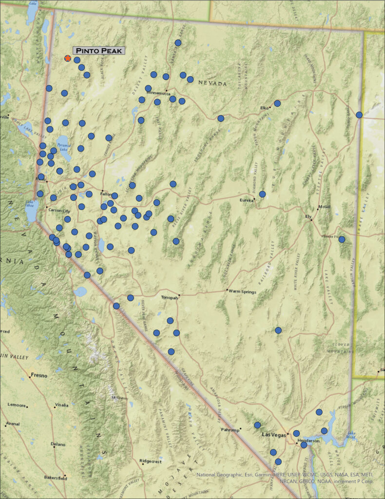
Nevada High Points #102 – Pinto Peak

D. Craig Young · June 13, 2022 · Leave a Comment

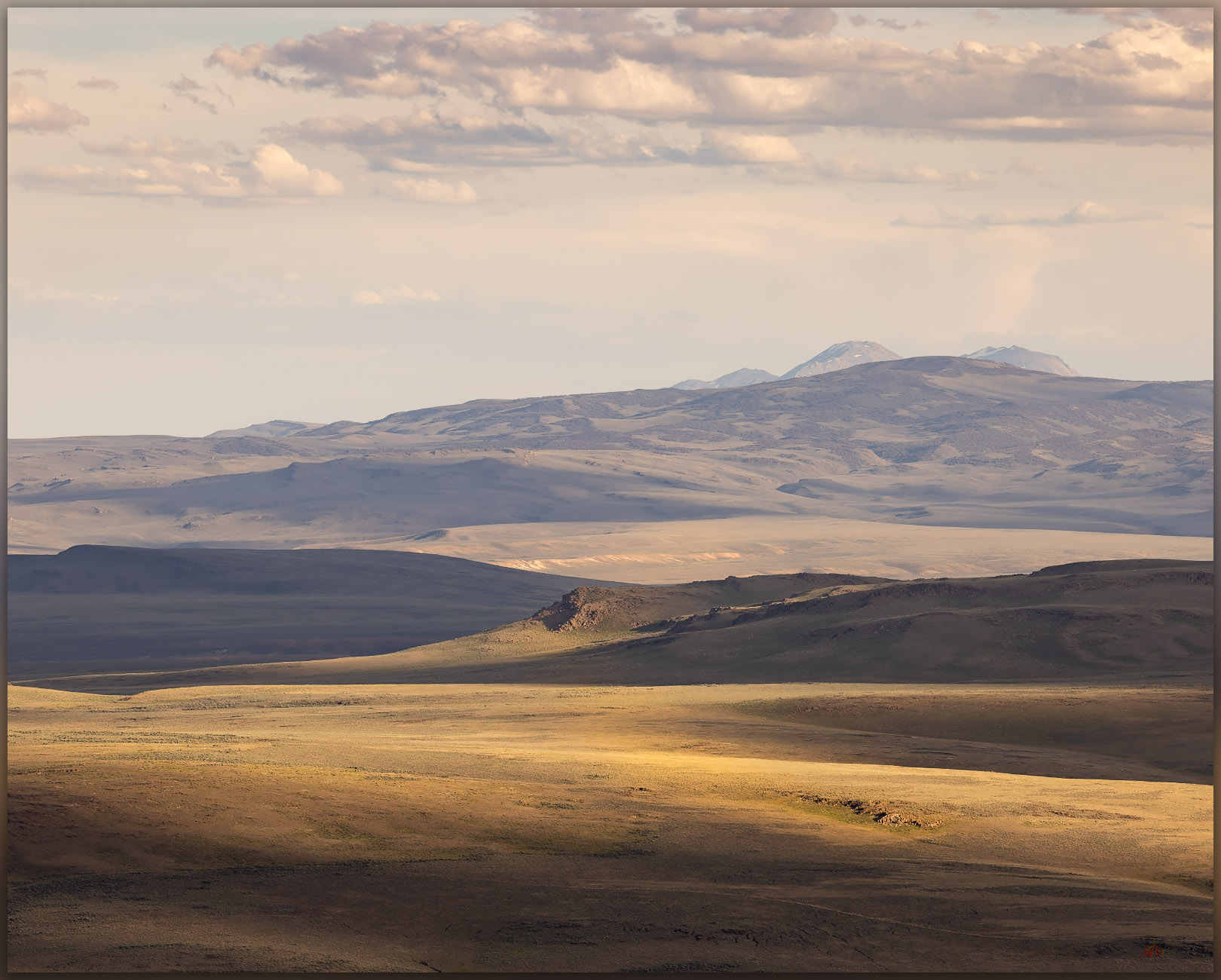
Shadow approaches. Early summer cumulus bring hints of darkness to the warm evening light, Pinto Peak, Great Basin Desert, NV, USA

Pinto Peak

6711 feet (2046 meters) — 630 feet gain

2022.05.25

Pinto Peak Collection


The ancient Cottonwood Caldera, a massive volcano that erupted sometime around 17 million years ago, dominates the landscape west of High Rock Canyon and the Black Rock Desert. With basin-and-range faulting, several small ranges form the rough bounds of the much older caldera. Obsidian that formed during the eruption drapes many area landforms, so I have been gouging around this area for several decades mapping the natural distribution of this traditionally important toolstone to provide geographic setting for archaeological study of the technology, movement, and economy of people who have called northern Nevada and the larger Great Basin home for millennia – the geochemistry of obsidian provides direct connection to these things.

Caldera edge. Evening light on rhyolite outcrops with Granite Range in the distance, Great Basin Desert, NV, USA
Toward Fox. Looking over the Pinto Basin at the edge of the Cottonwood Caldera, Great Basin Desert, NV, USA
Donnelly Peak. A view to the east across the Cottonwood Caldera, Great Basin Desert, NV, USA

But this is a high points blog. I mention calderas and obsidian because quite often, if not always, and among other things, this research motivates my backcountry travel, at times it even funds it. I am fortunate that my vocational and avocational activities are intertwined and embedded with almost everything I do – it is who I am. So here I am out with my field team in the middle of the Cottonwood Caldera, drawn in the evening to Pinto Peak on the caldera margin.

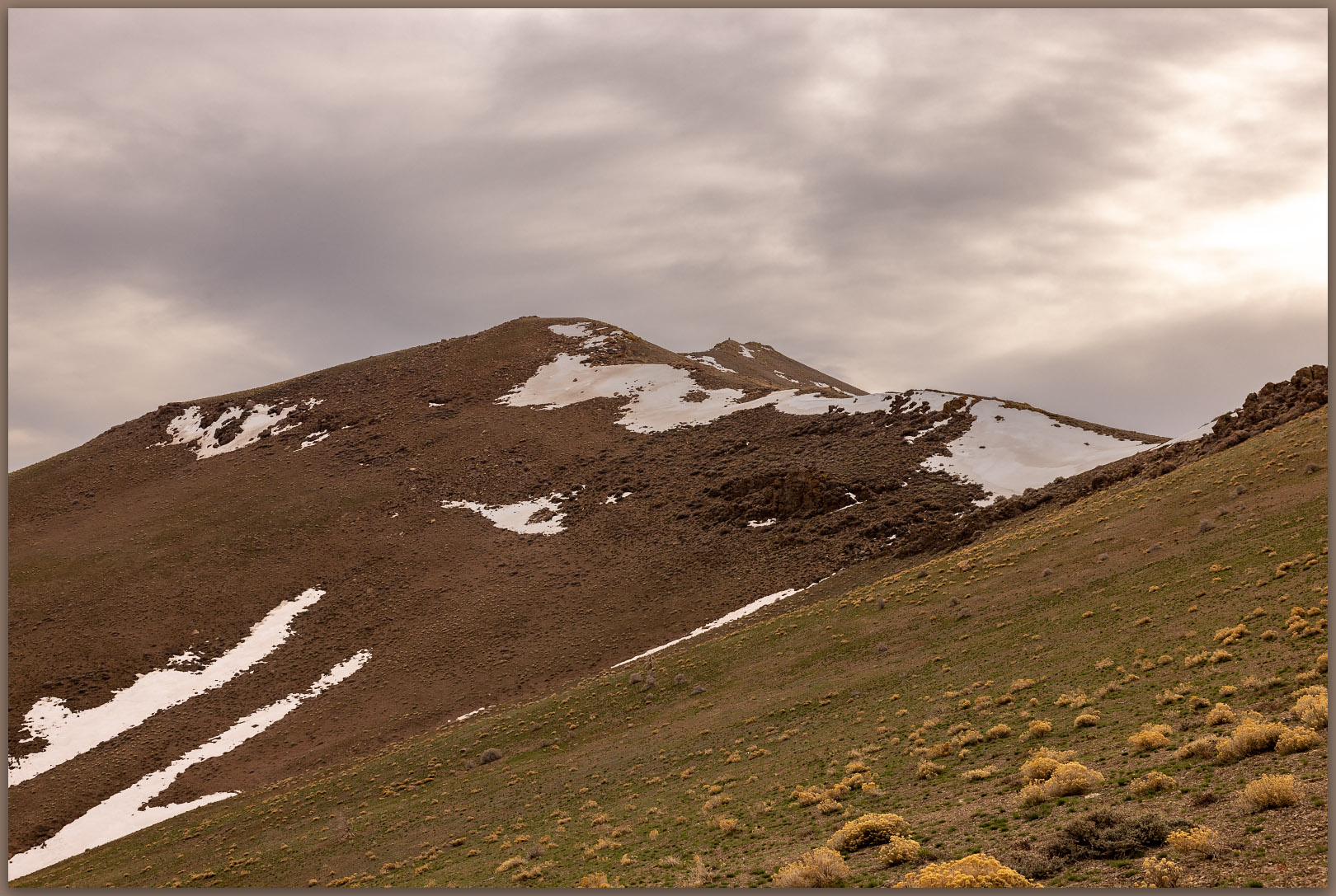
Pinto Peak. An unassuming summit at the edge of the Cottonwood Caldera, Great Basin Desert, NV, USA

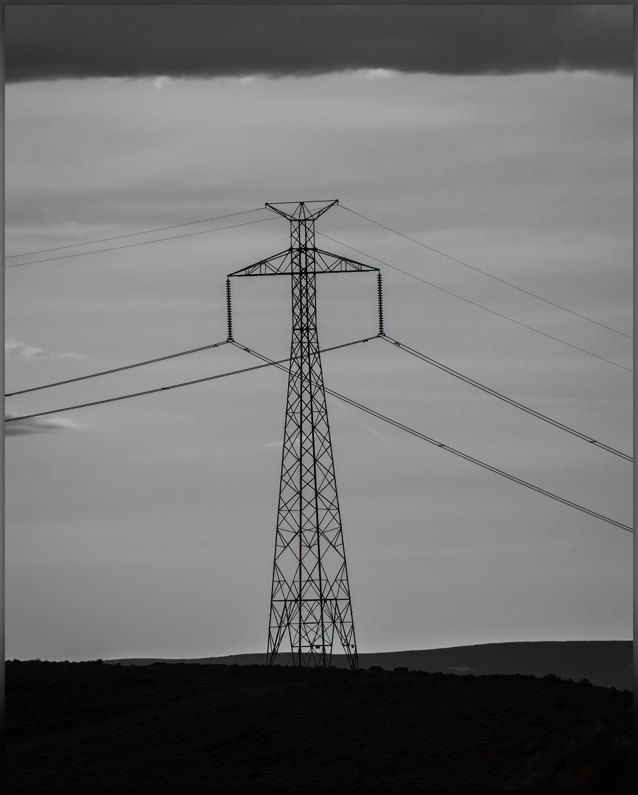
Pinto Peak is a simple walk of about a mile from the old ‘Bonneville DC line’, at one time rumored to be one of the few, if not only, untapped DC transmission lines of its size, spanning the distance from the Columbia River to Los Angeles. Coincidently and maybe unfortunately, the line bisects basins I have long been interested in, from the northern Great Basin to the Mojave Desert. I have followed its maintenance road for hundreds of miles mapping landforms and obsidian. Here I am again, parking under a pylon and walking away from the setting sun.

The line tower. The DC line on a corridor from the Columbia River to Los Angeles, coincidently traversing several major obsidian sources along the way, Pinto Basin, Great Basin Desert, NV, USA

There is no trail and I simply make my way up a gently sloping western ridge. The light is nice, with false storm clouds building into the evening. There doesn’t seem much to photograph but the light and shadows are special tonight. The distances glow as ridge lines and outcrops stand out momentarily and are as quickly gone in shadow and haze. It is a special night even if the climb is little more than a walk among sage, perennial flowers, and rhyolitic boulders.

There are only five other signatures in the register. That’s five signatures since 1999 when the register was placed – I sign on the second page. This is not a peak that would draw your attention from anywhere, one visits when collecting highpoints or hunting birds maybe. Still, the view of the caldera is great and I can see many of the ranges we have visited in the past. The light fades just as the sun cuts through the low western sky and I drop to the truck very satisfied, even though I didn’t hit my usual goals for elevation gain and distance on this minor peak. I did, however, very much enjoy the evening.

Pinto Peak Collection

Driving to camp I could only consider the good fortune I have to work and travel in the Great Basin, especially when evenings like this are revealed. I chased dust on the dirt of Highway 34, rolling along among wild horses and dispersed pronghorn. The vague Irish green of fading spring seems to glow in the early dark. Wind rushing past the open window. Evening like this, watching the light fade and dust settle, make the increasing anxiety of a tumultuous world – even if was volcanic and tectonic tumult that formed this landscape. At least I can smile for the long moments of the drive to camp, and all is good for the evening.

Keep going.
Nevada High Points #101 – Slumbering Hills

D. Craig Young · June 1, 2022 · 4 Comments

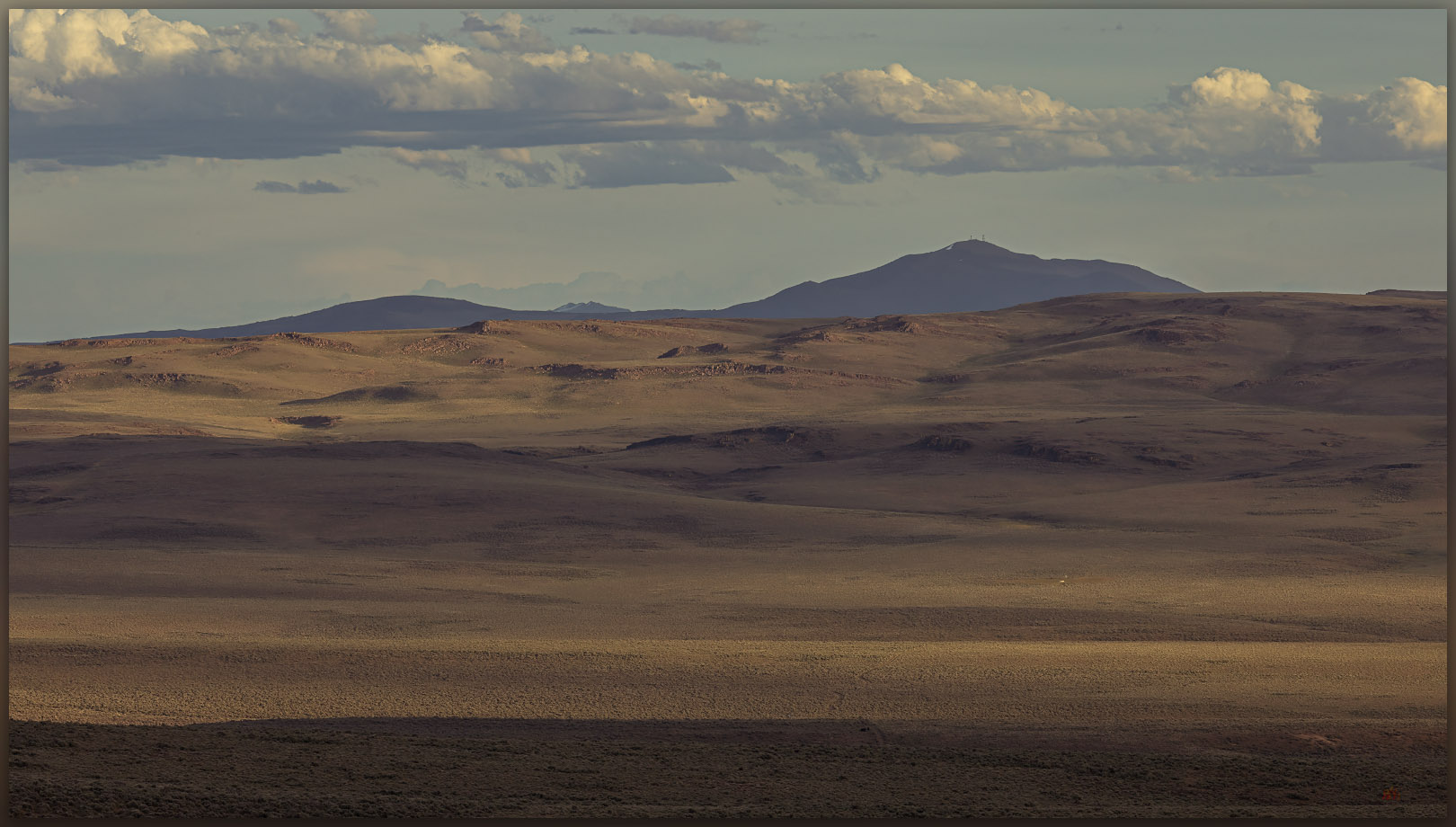
Waking the giants. A granitic pluton emerges from the Slumbering Hills, Great Basin Desert, NV

Unnamed

6531 ft — 1991 m (1593 ft gain)

2022.05.18

Slumbering Images Collection


Slumbering Hills (2018). Great Basin Desert, NV, USA

There is something in the Slumbering Hills. The unnamed high point is below 7000 feet in elevation and there are few riparian areas, only scattered springs, and absolutely no trees. Cheat grass and desiccated plants of sagebrush and saltbush communities show the struggles of fire and scabby recovery; mining pits and piles pock the numerous roads and tracks that traverse the range. It seems unappealing and easily unassuming from the highways where one glimpses higher, snow-capped mountains that rise in the distance, drawing sightlines to obviously higher horizons. And yet, the late evening light of each day turns a brief trick of alchemy as golden hour sets magic at play. Some of my favorite Great Basin imagery comes from these magical hills. Appropriately, the hills’ magic would trick me in other ways too.

Silver State playa. A small playa at the intersection of lacustrine remnants and the distal fans of Silver State Valley, Great Basin Desert, NV
Silent perch. A raptor waits among the rocks, Slumbering Hills, Great Basin Desert, NV

For the past several months I have been working nearby, studying the paleogeography of obsidian and its use in the northern Great Basin, and this provided the opportunity to hike into the Slumbering Hills. Obsidian is absent from this range, but I wanted to get closer to the photographic magic I had experienced several years ago and, of course, find my way to the range’s high point. With this in mind, I left camp one afternoon with Joe Burfield, a collaborator on my current project, working our way into Humboldt Canyon below Awakening Peak. We climbed grassy slopes to gain an east-facing ridge, finding a barking pronghorn antelope as we approached the rocky outcrop of the summit. The climb was a pleasure that later turned to surprise as, downloading my images and checking my high point catalog, I realized that Awakening was not the apex of the range. It was the obvious summit in my early photo, and I had fixated on it, forgetting to check my catalog — I had led us to the wrong summit! Not the third time I have made this mistake. No worries, it simply meant another walk with Joe.

Sleeping green. The grasses of spring begin their fade to summer, Desert Valley, Great Basin Desert, NV

This time we traversed the base of the hills to a point further south, leaving the old site of Daveytown and following a sandy two-track to Pickhandle Pass. As we drove, we climbed into a garden of granitic knobs and outcrops, each a puzzling, bulbous crag or an impossible set of balancing boulders hosting little kingdoms of a ruling raptor or raven. Take Owens Valley’s Alabama Hills, bury it in alluvium, and lift it into the sky; it is something like that. We pointed and laughed at the surprising formations that kept popping into view. I had camped here year’s ago, approaching from the west, so I remembered the ridge-line two-track leading south from Pickhandle Pass. We parked somewhere near my old tent site, looking forward to a three-mile wander among the granite hoodoos to the range’s true, though unnamed, high point (I was sure this time).

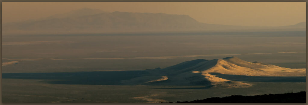
An ancient delta. Distant sand dunes mark a former delta of the Humboldt River below Blue Mountain in southern Desert Valley, Great Basin Desert, NV
Heading home. A ground contrail below the Jackson Mountains, Desert Valley, Great Basin Desert, NV

Vast sand dunes ramp along the southern margin of the range; wind-driven remnants of an ancient course of the Humboldt River, from a time when it veered into Desert Valley to join the Quinn River, probably some time in the Late Pleistocene. Today, the wind was carrying loads of fine-grained desert loess from the playas of the Black Rock Desert and beyond – this is the magic dust that imbues the Slumbering Hills with its golden hour personality. It did not disappoint.

A quick glance. A pronghorn antelope near the summit of the Slumbering Hills, Great Basin Desert, NV
Summit cairn. The high point of the Slumbering Hills, Great Basin Desert, NV
Joe. Making our way into the evening below the summit of the Slumbering Hills, Great Basin Desert, NV

After a brief visit with a pronghorn antelope, yet again grazing below the summit, we climbed into the golden light of the summit, a cairn and register confirming that I had navigated correctly. The sun was setting as we paused for a time, bracing in the wind but warmed by the beautiful glow of the last light. We could look several miles north to see Awakening, where we had been only a few evenings earlier. Our descent would be in twilight, venturing into night. Joe’s headlamp eventually found the rig in the dark grass of the two-track. Our drive’s conversation would inevitably turn to the pleasure of having ventured into this bedraggled little range twice, not disappointed and by no measure a waste of time. We would roll into our camp near Orovada just prior to midnight, a worthy day of magical light.

Slumbering Images Collection

Lenticulars and dust. The wind operates high and low above Silver State Valley, Great Basin Desert, NV

My last few high point excursions – even the one that did not count – have been evening walks. While I enjoy the challenge of photography and will seek out a trail at all times of day, the golden hour of a Great Basin evening, with dust, straggling clouds, and wispy virga – the aborted promise of moisture – among the contrast and saturation of low-angle light, is the epitome of a day’s completion. I have often known summer heat to abate or winter storms to break with the fading light, as the energy of the day wanes and the sun’s last rays scrape the topography to pile shadows into canyons and stack highlights among outcrops and ridge lines. This is the time to wander and see; when the experience of the Great Basin is at once, and almost daily, sublime. The walk out can be dark, but the memories light the way.

Keep going.
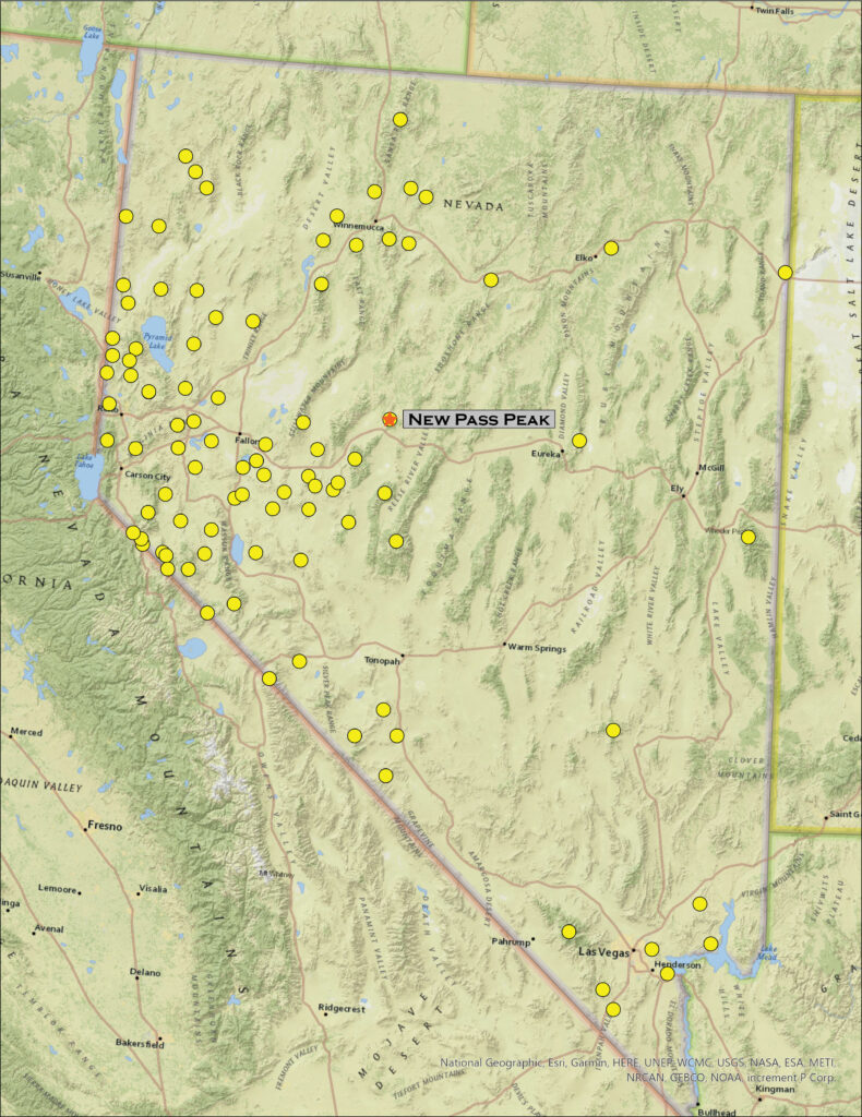
Nevada High Points #100 – New Pass Range

D. Craig Young · April 26, 2022 · 1 Comment

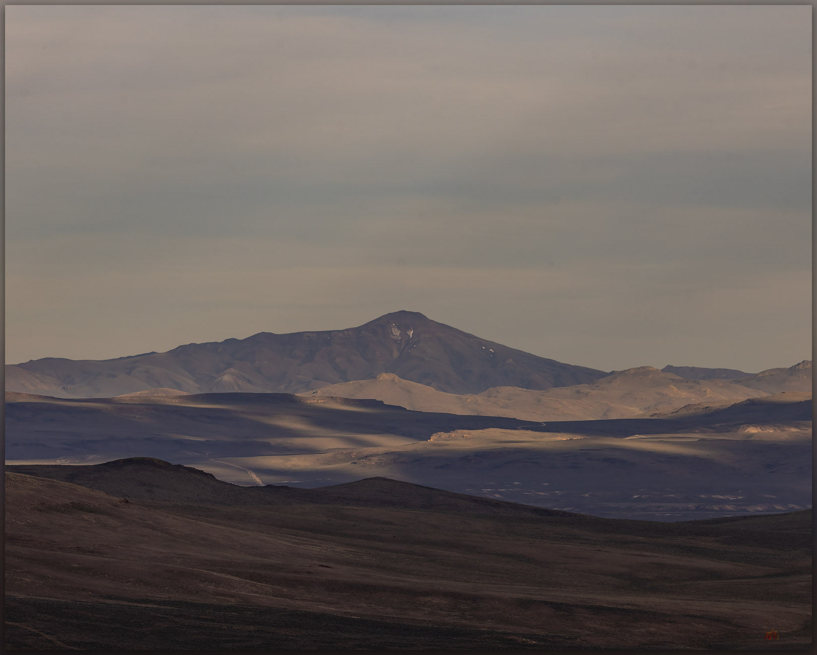
New Pass Peak. The north slopes and upper reaches of Gilbert Canyon, New Pass Range, Great Basin Desert, Nevada

New Pass Peak

9002 ft (2744 m) — 2901 ft gain

2022.04.08

New Pass Peak Collection

Big, round numbers are cool, and here I am at High Point #100. It is simply a step on the journey, but it is also a great measure of motivation and experience in getting here. I started this quest in 1995 visiting high points in earnest for a couple years until, some would say, bigger responsibilities got in the way. But like the 100-mile ultraruns I have completed, the long experience takes time and consists of many unique steps on many different trails. It is the process that matters. I am happy that the earnestness has returned, and I have reached the century mark – New Pass Peak, west of Austin (Nevada, of course).

I chose New Pass because the approach would be relatively straight-forward and due to an upcoming travel schedule, I did not have a full weekend. I also liked it because I see the peak commonly while traveling Highway 50, and I would have a common visual reminder of #100 as I travel across the state. As usual, Darren agreed to join the experience; we would get at least one camp night in.

We set camp on a small outcrop at the edge of the dry lakebed (playa) of Edwards Creek Valley. I have a geologic fascination with dust, so the silt dunes and fine-grained alluvium of valley bottoms are always interesting; I would have occasion to regret that interest later today. With my little camp trailer and Darren’s tent stashed in the valley, we began a driving traverse of the mountain front where the New Pass Range rises abruptly to the east. The road took us along the fire-barren alluvial fans and relict pediments, revealing a general absence of roads or tracks on mountain’s western front. Exploring further north we dropped into Antelope Valley (one of many Antelope Valleys) and explored its high basin with way too many parched wild horse herds. The fires and horses have had a significant adverse impact in this dry and ever-drier basin.

Skeletal pines. The bones of fire on the eastern slopes of New Pass Peak, New Pass Range, Great Basin Desert, Nevada

Our round-about tour led us in full circle to the old New Pass Mine Road where we thought we could start our three-mile (one-way) walk along a south-to-north ridgeline. We were met, however, by private property and cable gates that turned us away. At first disappointed, we felt encouraged when we finally found the roads leading along Gilbert Creek – learning that this is the route to access the communications facilities on the summit. We parked well down-canyon and started up a steep slope to intersect our original ridge route. Skeletal pinyon snags circled small groves that somehow survived the latest fire. Will the surviving groves be enough to seed the pinyon’s return?

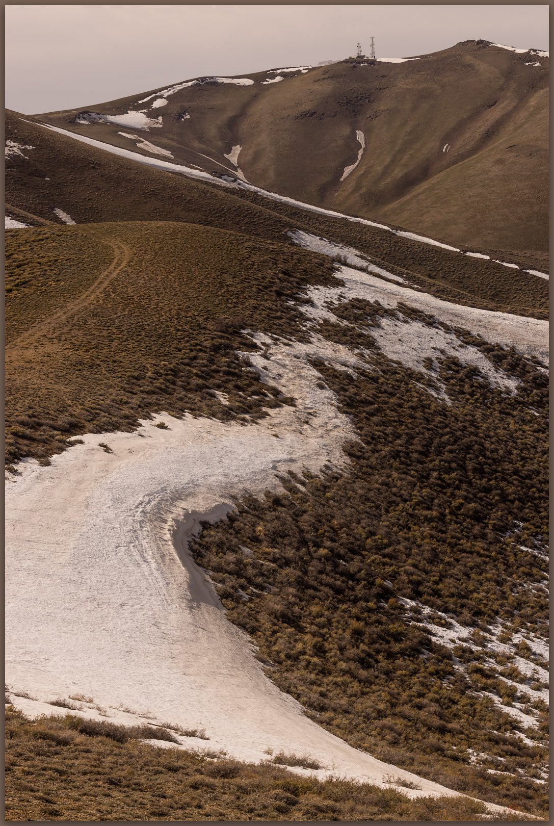
New Pass approach. Circuitous ridge-walk toward the high point, New Pass Range, Great Basin Desert, Nevada
Followers. Pronghorn on the trail behind us, New Pass Range, Great Basin Desert, Nevada

Pronghorn find us near the ridgeline.  We only notice them when looking back on our route, and there they are, standing in the saddle we had passed through only moments ago. Not sure where they came from, but they watched us curiously and similarly as we kept moving away.

It was now windy, the skies smudged with dust from distant dry lakes and playas. We pushed through a few patches of snow to gain the final summit where the communication overwhelmed small patches of snow and glowered from the hilltop. It was nice that the actual highpoint was isolated a bit to the north, peaking at a rocky outcrop that overlooked the facilities and everything else. We tucked into the outcrop to sign the few scraps of paper that made up the register – if we scurried out from the rocks, the wind blasted our jackets into a noisy frenzy. We could see that Edwards Creek Valley was embroiling a dust storm of its own, and, somewhere in that cloud, our camp (or its remnants) was set. Sometimes dust is a bit too interesting and present.

Toiyabe distance. Bunker Hill, high point of Lander County, Toiyabe Range, Great Basin Desert, Nevada
Hints of spring. Green hillsides in the dusty breeze of Edwards Creek Valley and New Pass Range, Great Basin Desert, Nevada
Snow patches. Darren exploring the descent from New Pass Peak, New Pass Range, Great Basin Desert, Nevada
Two-track descent. Darren wanders the road into the upper reaches of Gilbert Canyon, New Pass Range, Great Basin Desert, Nevada

Never mind the gusts, the summit was splendid. Good views of the Toiyabe Range and Shoshone Mountains, along with some colors of the late afternoon working through the storm clouds and whirlwinds. The conditions calmed as we dropped onto the road into Gilbert Canyon where it soon became clear that we might have left the summit a bit early. It took about an hour to get back to the truck but in that time the sun reached the cloud gap at the horizon and shed glorious light on our area of central Nevada. At first, we raced the light on our return drive, hoping to catch a golden hour scene to photograph, but we settled quickly on the simple enjoyment of our warmly lit drive. We slowed considerably to take in the wonderful transition to night.

Closing tracks. Ending the day, leading toward camp, New Pass Range, Great Basin Desert, Nevada

Our camp was a mess. Darren’s tent had clammed into a single dimension but was otherwise in its original location. The wind had calmed after powder-coating everything in sight – an amount, if measurable, would likely have been in the tons per acre for this one event. Dust influx occurs in those kinds of amounts, year after year, throughout the Great Basin. It is awesome (and dusty).

Click here for New Pass Peak Collection

Our skottle dinner provided special celebration. Darren had joined me on #100, a few days before my 58th birthday. Good times. The wind would return in the night, turning cold and occasionally waking us enough to witness new dust clouds blurring the Milky Way and the last of the winter constellations.

In the morning we scouted future access routes into the Clan Alpine Mountains where Mount Augusta awaits. We will get there soon. Of course, we have only 217 yet to go.

Keep going.
Please respect the natural and cultural resources of our public lands.

#naturefirst #keepgoing

  • « Go to Previous Page
  • Page 1
  • Interim pages omitted …
  • Page 5
  • Page 6
  • Page 7
  • Page 8
  • Page 9
  • Interim pages omitted …
  • Page 19
  • Go to Next Page »

Trail Option

Copyright © 2026 · Monochrome Pro on Genesis Framework · WordPress · Log in

  • Contact TrailOption
  • Substack
  • Waypoints Bibliography
  • Young Archives