• Skip to primary navigation
  • Skip to main content

Trail Option

A personal geography of landscape and place, art and geo-science.

  • Home
  • TrailOption Blog
  • About
  • Contact TrailOption
  • Subscribe!
  • Lost Journals
  • Show Search
Hide Search

great basin

Nevada High Points #130 – Pilot Mountains

D. Craig Young · March 24, 2025 · 1 Comment

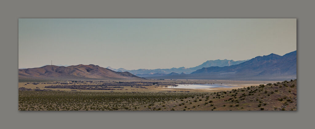
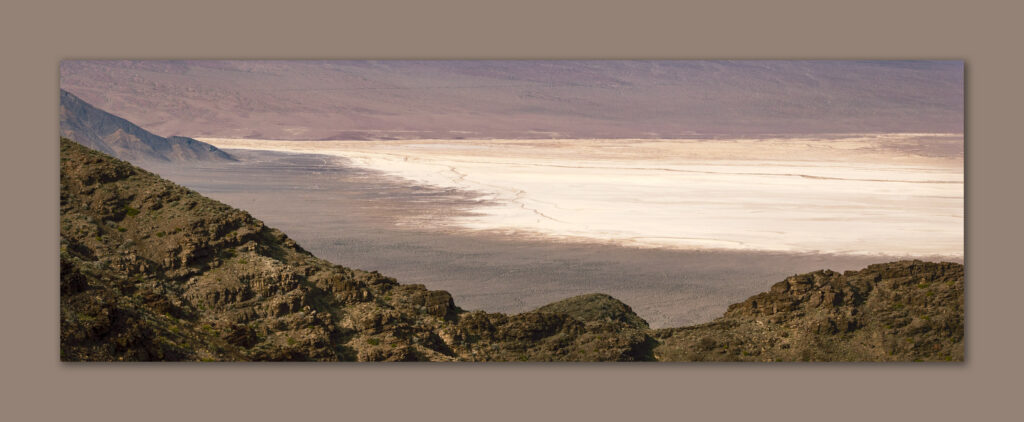
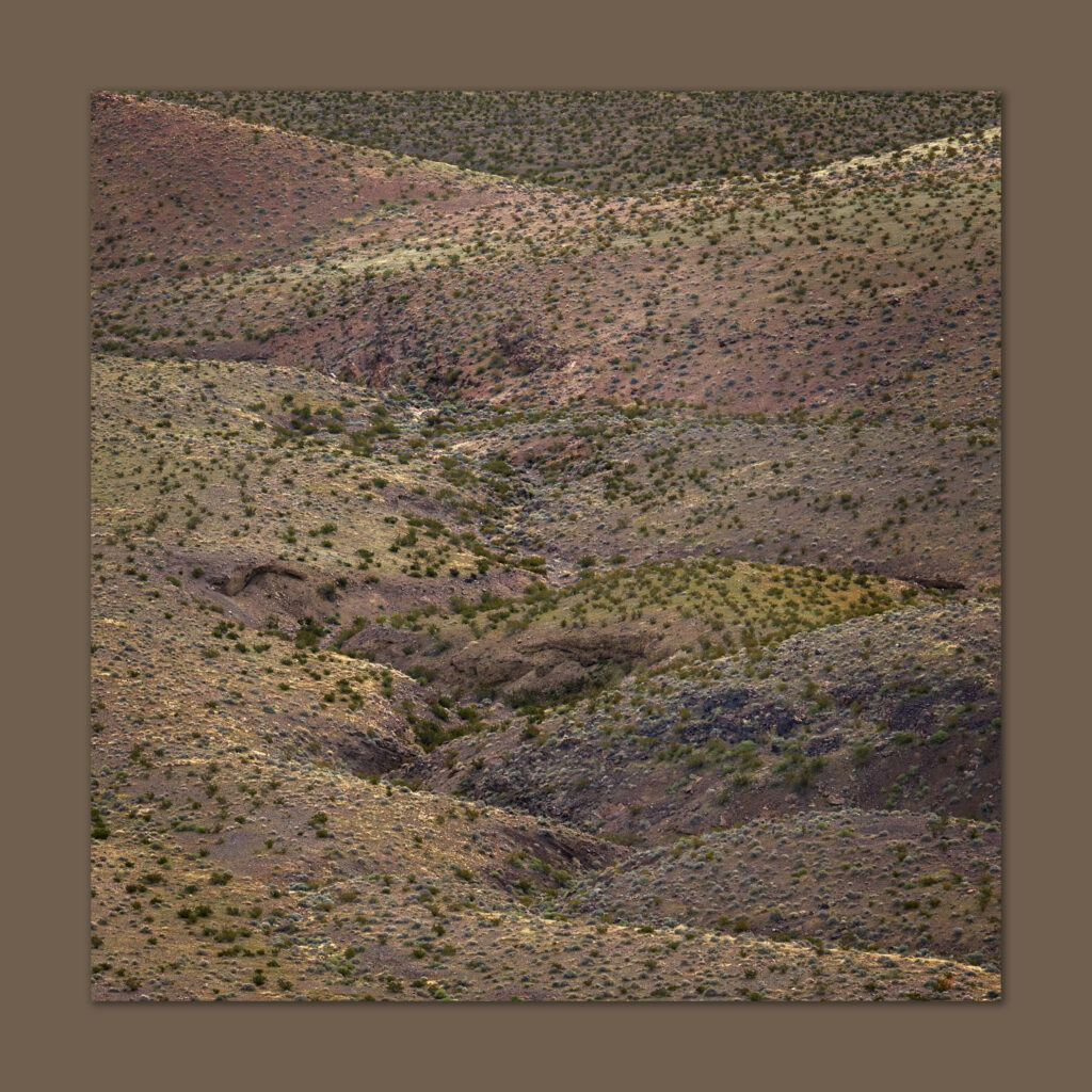
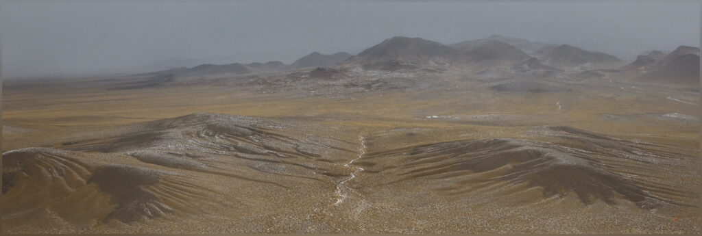
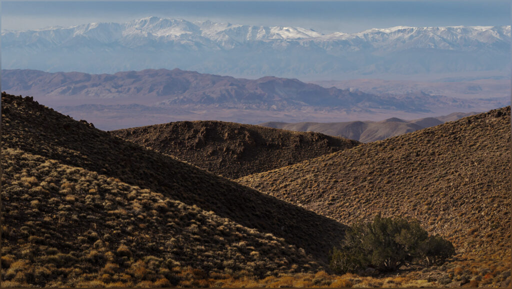
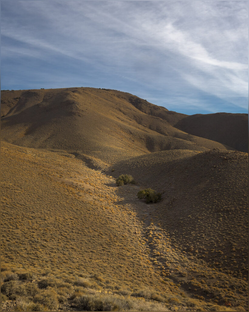
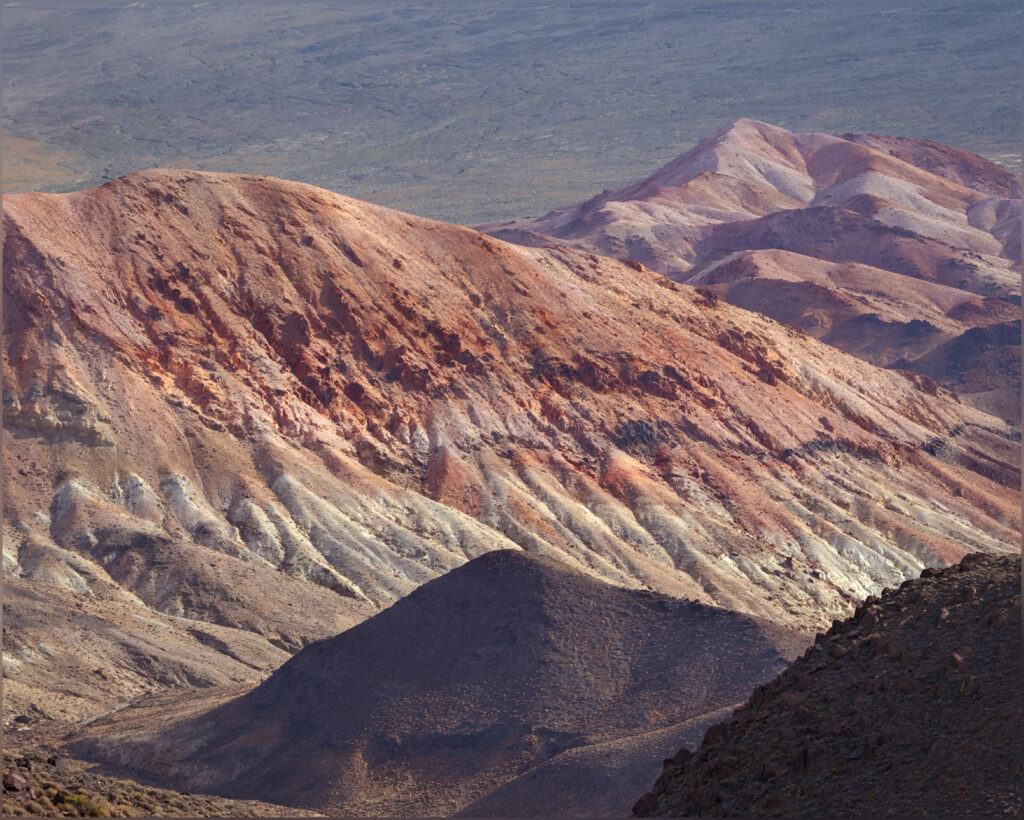
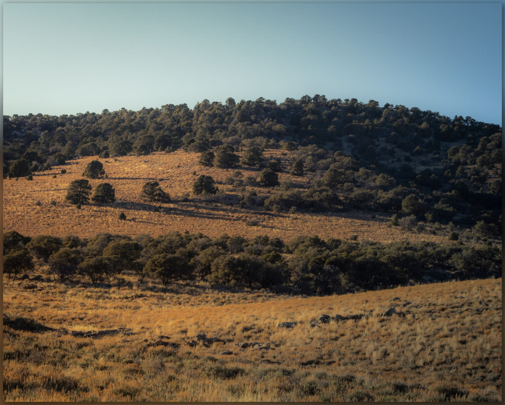
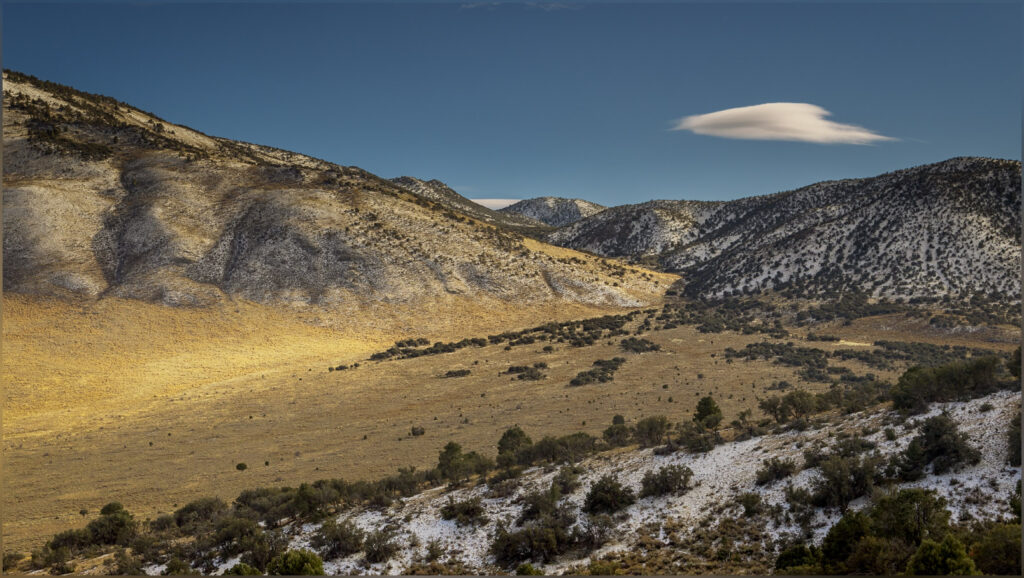
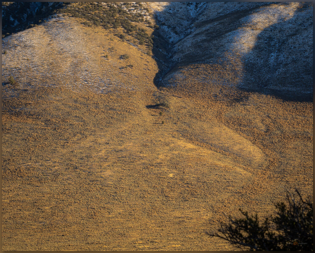
Desert fabric. Alluvial carved hills of the southern Pilot Mountains, Great Basin Desert, NV, USA
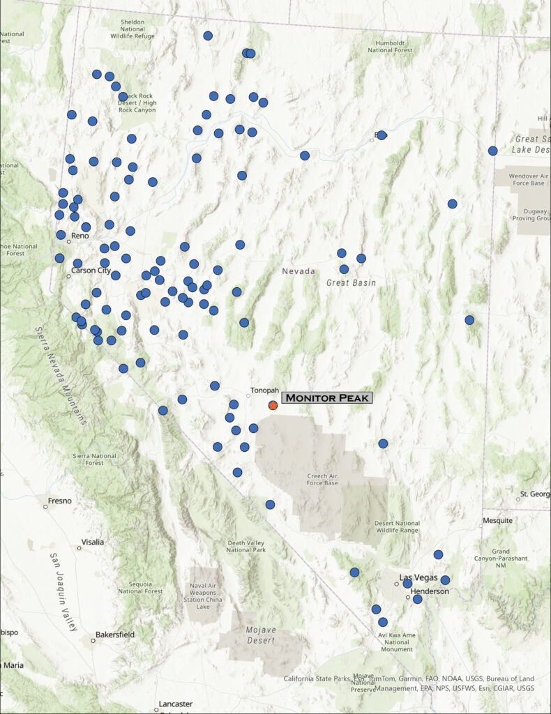
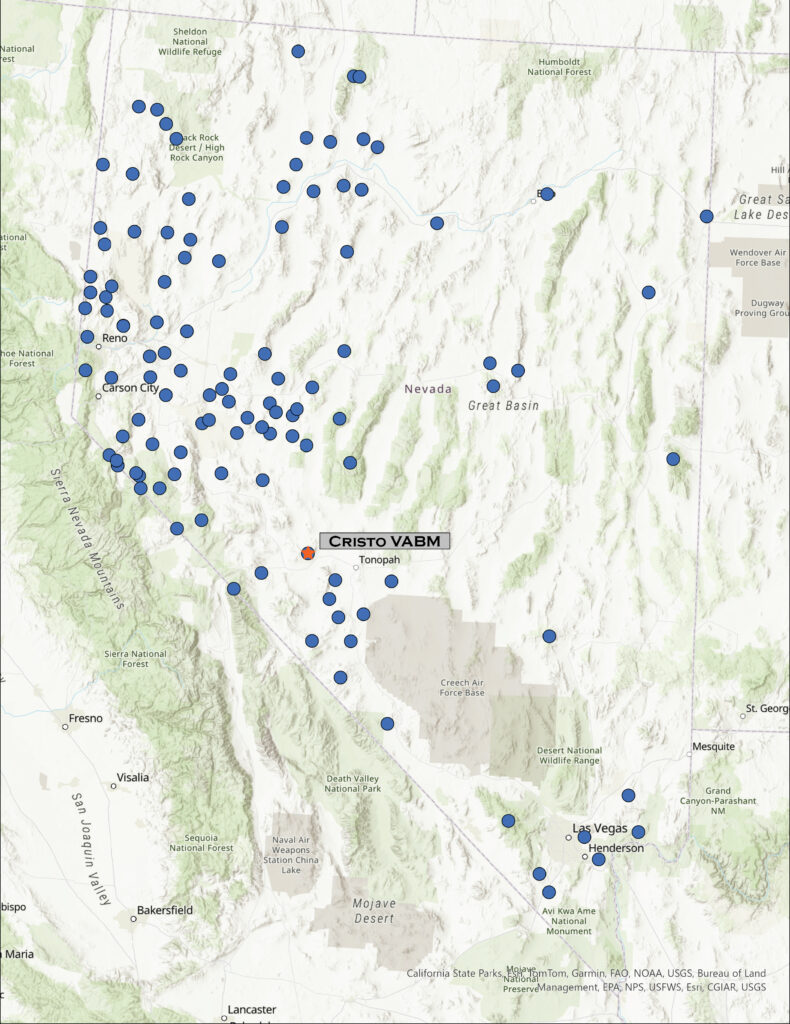
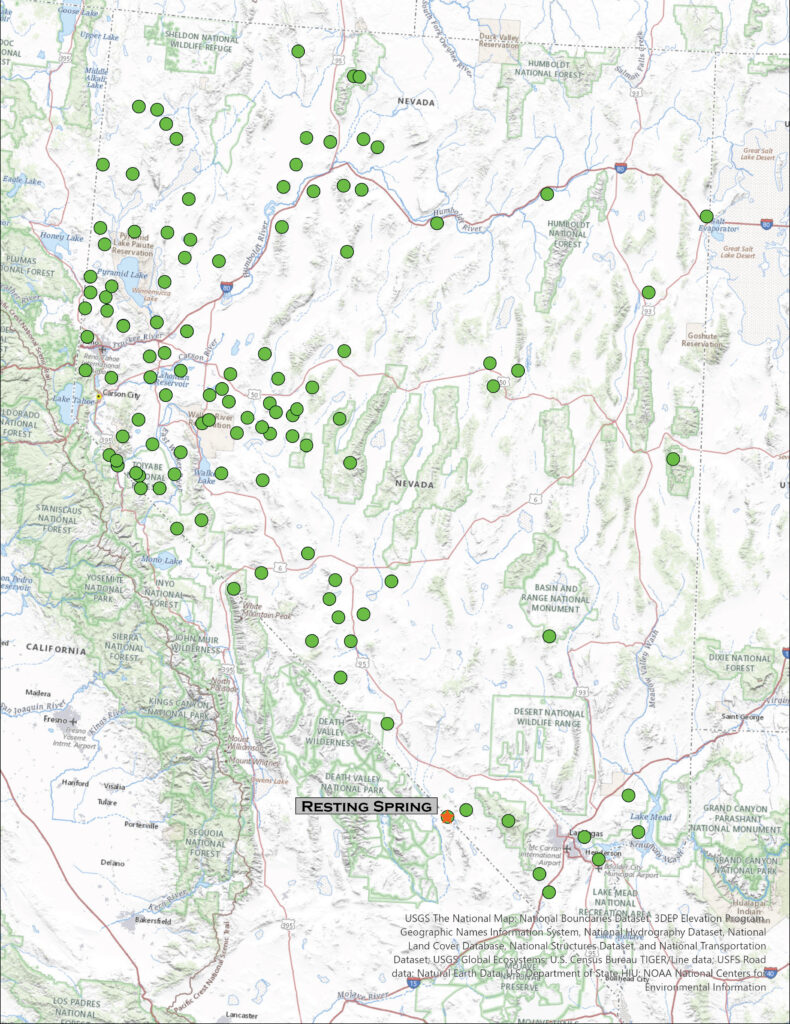
Location map for Pilot Peak in the Pilot Mountains, Nevada

Pilot Peak

9187 ft (2800 m) – 2418 ft gain

2025.02.38

Keep Public Lands Public


Every once in a while, on these high point wanders, I choose a really good route. Not that there are bad routes, but I often end up choosing a misleading side canyon of riparian bushwhacking, leading to bouldery talus below false summits. Other times I get to the evident high point where I notice a confusing array of summits of similar elevation, so I question my maps and wander around visiting each one. Again, this is not a bad thing, it is always good to be in the hills – unless the light is fading, or a storm is coming. My route on Pilot Peak, however, was perfect.

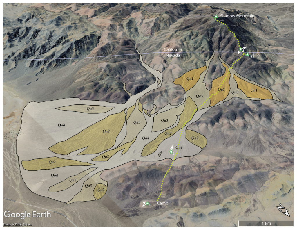
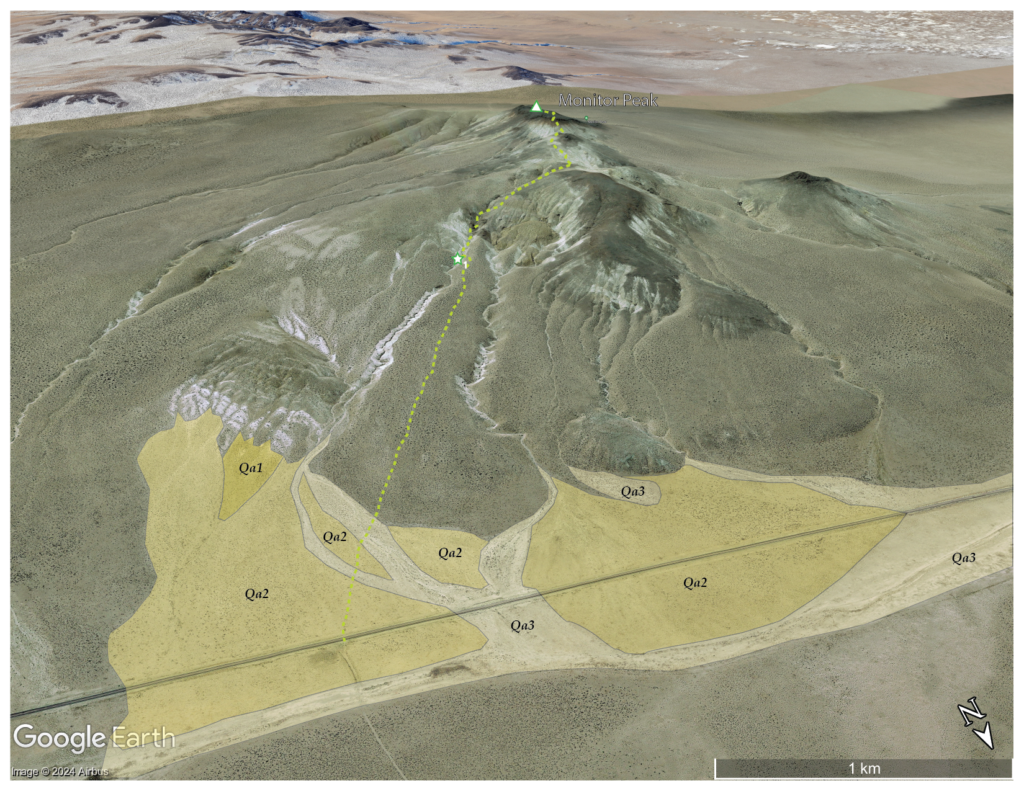
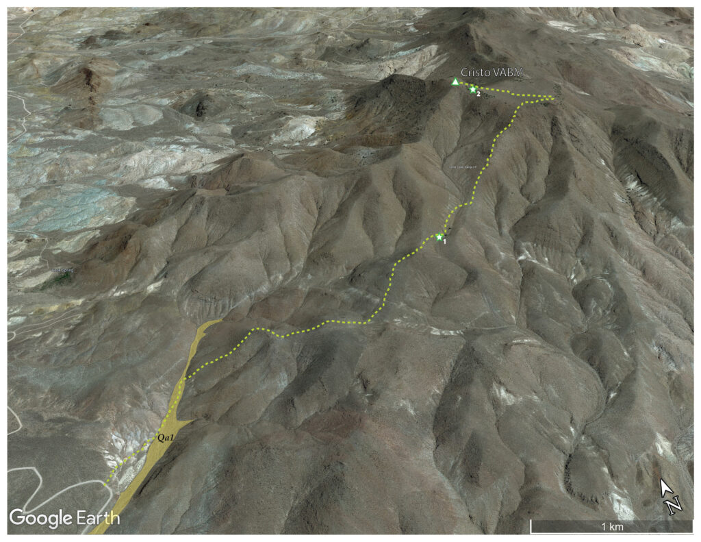
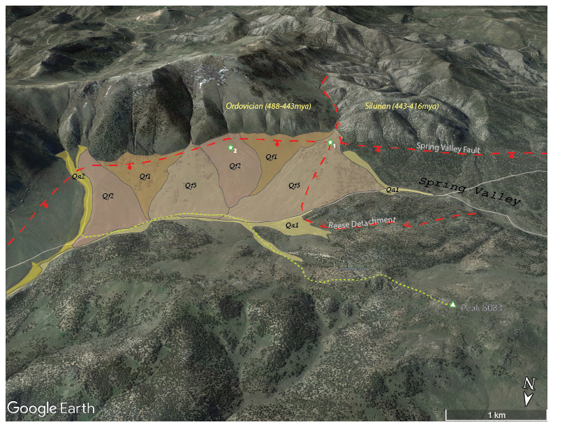
A narrow inset alluvial fan and floodplain in the bottom of Dunlap Canyon is the only mappable Quaternary landform along my route.

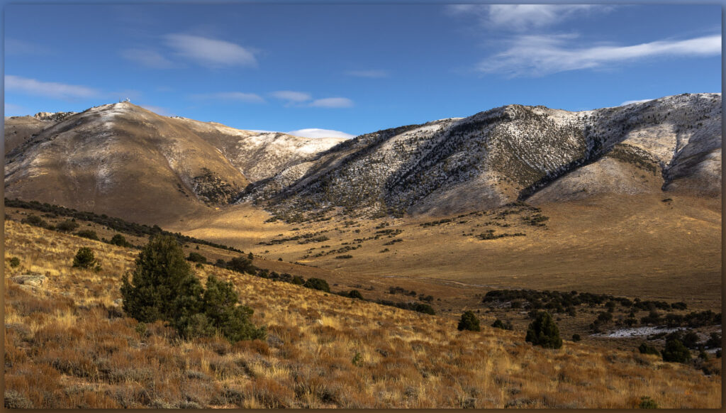
I had turned off Highway 395 just before Mina, NV, heading into Dunlap Canyon. The road is well maintained, likely because it is secondary access to communication towers adorning the summit; the main, newer route is via Telephone Canyon further south and west. I suspect the road originated as the Dunlap mining district developed. I park at a prominent fork in the canyon, leaving my truck in a thick Juniper grove, and I walk the westerly fork heading upward toward Pilot Peak rising a few thousand feet above me.

A mining cabin hangs on in Dunlap Canyon, Pilot Mountains, Great Basin Desert, NV, USA
Lost camp. A mining cabin hangs on in Dunlap Canyon, Pilot Mountains, Great Basin Desert, NV, USA

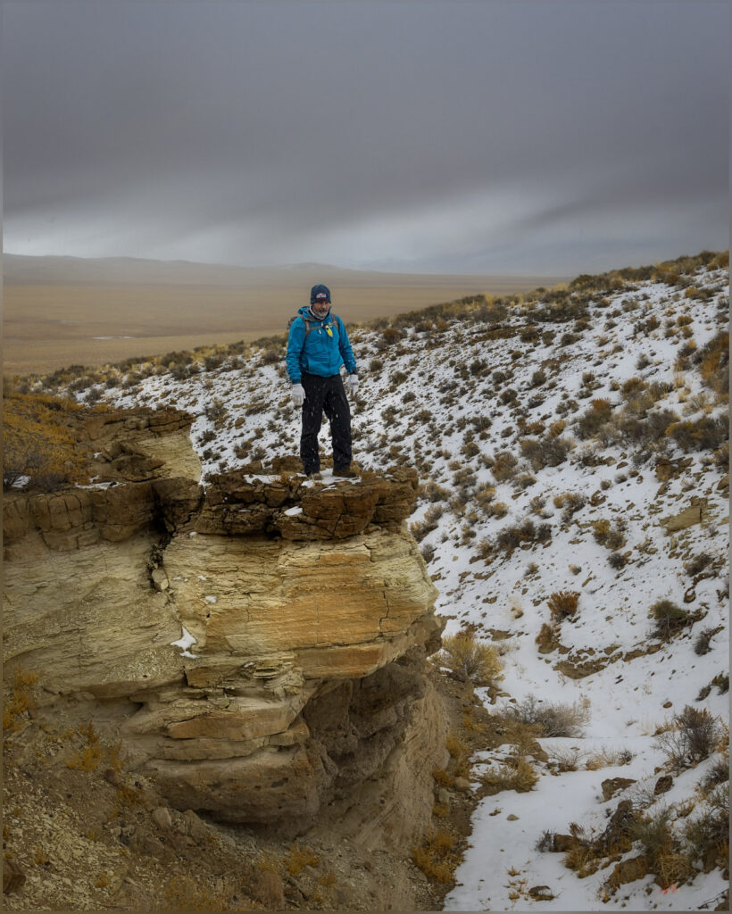
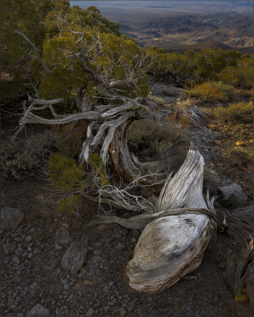
A lonely cabin sits among trees just off the road, and it is here that I decide to leave the graded track to find my way among Juniper woodland and patchy snow. Although it has been incredibly warm for late February, a few snow squalls had rolled through in the past couple of days. Snow covers north-facing slopes where the sun cannot reach on even the warmest days. I climb away from an inset floodplain of Dunlap Canyon to find dry ridges on volcanic tuff. The Juniper are widely spaced; vegetation density drops as we approach the transition to Mojave Desert communities not too far south of the Pilot Mountains. The route steepens so I contour among the few trees and sparse sagebrush before heading directly to the north ridge that extends from the main summit. Scant and twisted Juniper greet me at the ridge, artifacts of the arid wind that binds them to the distance as the valleys drop to either side.

Edge grove. Lower summit ridge in the Pilot Mountains, Great Basin Desert, NV, USA

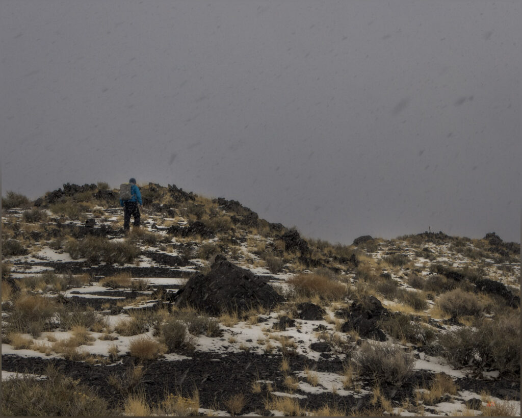
Turning south, I avoid a false summit by crossing crunchy snow, cutting solid steps on the steep slope. It is at the southern end of the snow that I find the road from Telephone Canyon, which I can see tracing into deep, dark, and snow-filled canyon far below. It looks very interesting but would have been a very long, slow approach in late winter.

Shards. Snow remnants in the Pilot Mountains, Great Basin Desert, NV, USA

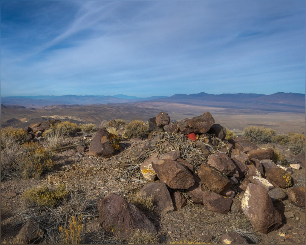
I reach an expanse of 360-degree views on the summit, but the highpoint is otherwise unimpressive. Buildings and towers crowd machine-cut platforms, and a low hum of electronics (or cooling for the electronics) pervades the calm. The sun is setting beyond Boundary Peak and the White Mountains to my west, and Earth’s shadow rises opposite. I put on another layer, but do not linger long. It is going to be dark soon, and I have left my headlamp in the truck. Time is of the essence.

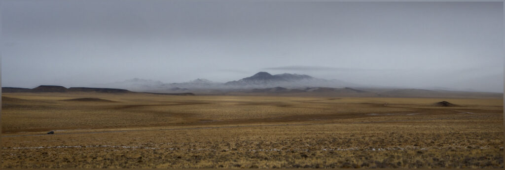
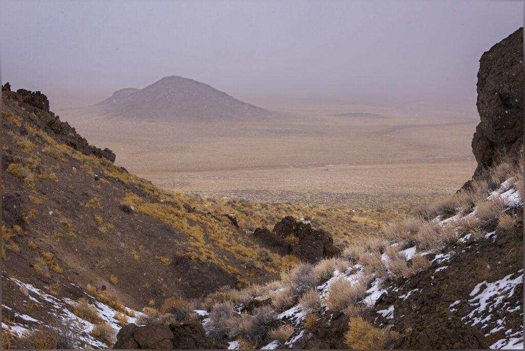
Mountains beyond. South of Pilot Peak in the Pilot Mountains, Great Basin Desert, NV, USA

Steep-cut switchbacks wind among mining prospects on the eastern front of Pilot Peak. I can follow these, cutting through occasional snow, until I find a descending ridge that leads me into the dark of Dunlap Canyon. The dirt of the road is just visible in the last gasp of blue hour. Imaginary sounds in the Juniper at road’s edge keeps me attentive; I am curious what the Mountain Lion – the one I never see – thinks of this wandering figure in the canyon bottom. Not worth the effort, I hope. Nevertheless, the adrenaline jumps every now and then, as my thoughts wander.

I never feel any real danger in the back country, I am cautious typically. My technical climbing days are over, so I pick routes of relative ease. The chances of encountering a predator interested in me are low. I have yet to see a Cougar, the one large animal still missing from my list of Great Basin critters. It is good, however, to know they are out there, keeping it wild and keeping us thinking about them. The wild things help me to feel alive, my senses present. I hope someday to share a moment with a large cat, as I have with song dogs, Bighorn Sheep, Pronghorn, and the birds of night and day.

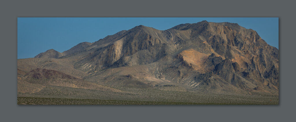
Against the grain. Outcrops of the Pilot Mountains, Great Basin Desert, NV, USA

Pilot Peak was a good loop. By chance, and some practice, I chose unbroken ridges and fitting slopes. I had the pleasure of evening light on the summit, and the tingling thrill of a canyon walk in the dark. I will view the towers often as I drive Highway 395, but I will also know what lies beyond the altered high point – the ridges and slopes where you can see and feel in the dark. And that brings us life.

Keep going.

Please respect the natural and cultural resources of our public lands.
#naturefirst #keepgoing

Nevada High Points #129 – Royston Hills

D. Craig Young · February 23, 2025 · 2 Comments

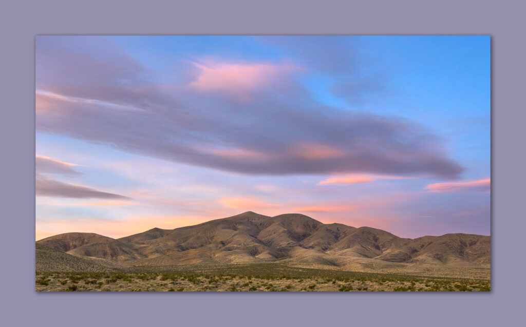
Rolling summit. High points can be subtle, Royston Hills, Great Basin Desert, NV, USA

Unnamed

6675 ft (2012 m) – 980 ft gain

2025.01.09


While I try to keep a regular schedule to get into Nevada’s Basin and Range every Second Friday, regardless of other fieldwork obligations, it is also good to combine an excursion with a visit to a fieldcrew working some project, somewhere. At the moment, we have archaeological survey crews working in the Broken Hills above Gabbs Valley, so my day begins there. It is nice to solve the puzzle of locating them in the open landscape of volcanic hills – an area my brother Darren and I visited a couple years ago. Darren is on a fieldcrew this rotation, and he gave me some approximate coordinates so that I could get close. I park within a mile of his coordinates and set out, finding the first crew as they work the lobes of an alluvial pediment east of the Broken Hills mine site. I then move north to find Darren and his crew in dendritic inset washes and pediment lobes in higher country.

Leaving the fieldcrews in the early afternoon – I am not currently on the ‘official’ rotation, so I let them continue their surveys and head south of Gabbs to access the western slopes of the Royston Hills. As I climb a good road away from Pole Line, heading for Dicalite Summit, a low pass between the Cedar Mountains and Royston Hills, I encounter large washouts from inset floods of past years; likely relict scars of the tropical moisture of Hurricane Hilary in August 2023, or something very similar. The roads are incised but passable, but I cannot find several of the mapped two-tracks that run parallel to the local drainage pattern; they are eroded away. I eventually turn down a wash, hoping to find a spot in the now-widened floodplain to set camp and begin my evening walk up the Royston Hills. The gravelly sands provide a good surface. There was once a two-track, mining road here somewhere, but I am now passing larger boulders and uprooted trees – a powerful flood coalesced recently in this drainage.

Active floodplains (Qa4 and Qa3) are inset into older, beveled fans or alluvial pediments (Qa2 and Qa1). These are bounded by older volcanic tuffs (Qp2 and Qp1) beveled as the younger fans formed. The inset wash of Qa4 formed in the past few years.

Cenozoic tuffs and ash deposits rise in light-colored pedestals in the interfluves and at the channel margins. The white outcrops might make good photo subjects in the morning, so I decide to camp in a flat section of gravelly floodplain. Things get quickly interesting as I turn around. A sudden undercarriage impact and spinning rear tire finds me perched precariously on one of the erratic alluvial boulders. While I missed sighting it, I did not miss getting hung up on it. I climb out to have a look and find that my front tires a basically in the air, one by several inches. Mild panic – I am well stuck.  I gather my thoughts and get my shovel out – this is the second time I have been stuck after visiting the Gabbs Valley Survey Project, and the only two times I have been stuck in many years.

Hills beyond. The southern end of the Shoshone Mountains beneath scudding clouds, Great Basin Desert, NV, USA (Map point #2)

The rig is fine; it simply rests on the boulder, like a jack-stand – I could do tire maintenance as I sit here. A closer inspection, however, reveals that the cavity exposed by the turned boulder could be enlarged. If I can get rear-axle traction, I may be able to push the rock into its own divot. Several minutes of shoveling creates good space into which the rock can fall. I lock the differentials and shift into low gear. I apply power slowly, and the truck moves forward, at once releasing pressure on the rock as it drops into the larger hole. I am free. I roll a few feet and shut it down; with fresh relief it is time to walk.

And just in time, because this is supposed to be a High Point story! As it happens, however, the Royston Hills provide a long, quiet wander with none of the small drama of my short overland drive. The drive had left me on the low, eastern slopes of the Cedar Mountains, with the geographic boundary between the ranges marked by a mature dendritic drainage that pushes basinward to the south. I can map several surfaces of the inset floodplain that cuts and isolates the bounding pediment lobes. The youngest floodplain may only be a few years old; it is now dry and likely only flows in significant storms.

Arid floodplain. An incised wash meanders through its floodplain on the way to Cirac Valley, Great Basin Desert, NV, USA (Map point #1)

I am soon climbing west-facing slopes of the Royston Hills, reaching tabular basalts above Miocene volcanic tuffs and minor rhyolite outcrops. The basalt forms a rugged cap below which talus forms stone stripes that drape across the underlying stratigraphy. The rounded summit is a broad, boulder-strewn tableland. It is one of many all-too-common summits where it is difficult to determine the actual high point. The mapped benchmark is not it. I use the level in my camera to compare a nearby hilltop to the marked point – points marked on maps do not signify the high point by default, but they provide an initial target when contour lines do not help. The sun sets as I traverse to the higher, similarly rounded hilltop.

Evening hills. The late-day sun leaves Cirac Valley, Great Basin Desert, NV, USA (Map point #3)

It is a good summit regardless of its lack of drama. The views are nice in all directions as Arc Dome rises to the north and the dispersed ranges surrounding the southern reaches of Big Smokey Valley wrinkle the skyline to the south. The views disappear quickly as twilight transitions to night. I pull out my headlamp and begin a slow descent through bouldery talus. After walking through a small group of cows, I begin the easy walk up the inset floodplains toward my campsite. Two green points blink my way and are gone just as quickly. They reappear on an elevated surface to my left, looking very much like a vehicle on one of the still-remaining tracks higher up. But as I turn my headlamp on and off, the eyes wink back in time. Does the coyote wonder what this single-eyed creature is? It turns away, lost in the night.

I reach the truck and set camp by moonlight. It feels cold, but there is no breeze. Dinner is simple, and I am feeling the good walk at the end of a long day, so I crawl into my tent for the night. I am hoping to explore the Cedar Mountains in the morning.

Arc Dome. Last light on High Point #82, Toiyabe Range, Great Basin Desert, NV, USA (Map point #2)

The wind had different thoughts, however. Having fallen asleep sometime around midnight, I was awakened with a start by flapping nylon of the windward vestibule. I had set shallow stakes into the sandy floodplain, holding the tent easily in the earlier calm, but now the wind had pulled its first anchor. I had not zipped the tent door in the nice calm, so the vestibule fabric joined me inside. Then, as I rolled over to rearrange things, a roiling gust collapsed the tent suddenly and completely, pulling all windward stakes, leaving me as the only weight and last anchor as the bundle of fabric flapped vigorously in the freshening gusts, with me uselessly inside. I scrambled and pulled at the fabric to stick my head out of the folds to find sideways snow streaking past in the moonlight. A low bank of clouds, backlit and soon to swallow the moon, scudded across the Cedar Mountains. I had to move carefully to keep the collapsed tent from ballooning down the wash. I was very cold, quickly.

Holding the tent like a disjointed flag, I pulled its maze of poles from the fabric, having decided I would pack up and drive to the opposite side of the Cedars. It was just after 3am, and I wanted to photograph and document this storm that had ripped my tent from the ground and jolted me from my sleep. I stuffed the loose gear into the backseat and loaded my various field boxes into the truck bed. Easy enough.

A gauze of dust and snow veiled the stream-cut road as I worked my way down-fan toward Pole Line. As I turned toward Gabbs Valley, I looked forward to photographing a sunrise behind this powerful little storm. My hopes were soon erased. The moon reappeared, and the more I looped around the Cedar Mountains, the more the storm dissipated. It was soon gone altogether – not a cloud in the sky. I grew sleepy as the excitement faded into another orange to blue morning. Disheartened, ,I simply turned toward home, happy with the windy little adventure after the peaceful walk in the Royston Hills. First, though, I needed some sleep to drive safely. I turned off Highway 50 on a large gravel and strandline berm west of Sand Mountain, laid out my sleeping bag on a coppice dune, and slept for a couple hours. Just another Second Friday exploring the amazing landscape of the Great Basin, even the simplest walk is an experience.

Keep going.

Please respect the natural and cultural resources of our public lands.
#naturefirst #keepgoing

Nevada High Points #128 – Slate Ridge

D. Craig Young · December 31, 2024 · 8 Comments

Desert walk. The Mount Duffee bajada, coalesced alluvial fans of Slate Ridge, Mojave Desert, NV, USA (Map point #1)

Mount Dunfee

7064 ft (2141 m) – 1647 ft gain

2024.11.13


I am on the road again. Having arrived home from northwestern Nevada only recently, I need to be in southern Nevada for some time in our Desert Branch office and a quick bit of fieldwork near Rogers Dry Lake in southeastern California. It is one end of the state to the other, and from the Great Basin Desert to the Mojave.  I enjoy the quick transitions, one ecology to another, Basin and Range to the Walker Lane tectonic silliness, and the travel day provides the opportunity to explore another high point without much of a detour. South of Goldfield, Nevada, I turn west at Lida Junction before heading into alluvial expanses below Slate Ridge.

This small, circular range is a tilted block of limestone and volcanic rocks, with actually very little slate, but for dispersed outcrops east of Mount Dunfee, the range high point. Not only is there little slate, Slate Ridge is not much of a ridge either. It has some fantastically dramatic outcrops and steep slopes, but it is really a complex jumble of hills and volcanic plateaus; however, from the historically minded town of Gold Point at its base, the western prominence of Slate Ridge is nicely imposing and ridge-like, if not slatey.

Welcome party. Joshua Trees on the fans of Dunfee Peak, Slate Ridge, Mojave Desert, NV, USA (Map point #2)
Map of the alluvial bajada along the western front of Slate Ridge and Mount Dunfee. Note the surface texture and general shapes of the oldest (Qa1) to the youngest (Qa4) individual alluvial fans and pediments.

Vague roads head toward various prospects visible on the slopes at the mountain front. I follow a maintained route before parking where a two-track intersects and provides a good start point. I have some wide bajada to cross before the steeper slopes begin. A bajada is a typically broad, mountain-front apron of coalesced alluvial fans, each emanating from its own canyon. Individual fans have their own source areas, with rock types in the fans matching the geology of their canyon sources generally. Because this region remains tectonically active, each tectonic jump or sheer along the mountain-front tilts the fan upward or moves the source canyon aside. The actions are quick, and the fans continue to build in the long quiet intervals in between – weathering and flashy floods cutting into and delivering sediment to the fans of the basin below. The lifted fans are isolated as gullies incise, and we can look at the degree of surface weathering and incision to place each fan and each tectonic change in time. The fan patterns are evident in aerial imagery, but there is nothing better than walking across the landforms themselves. It is why I visit these places.

Contacts. Beds and folds on the southwest fact of Dunfee Peak, Slate Ridge, Mojave Desert, NV, USA (Map point #3)

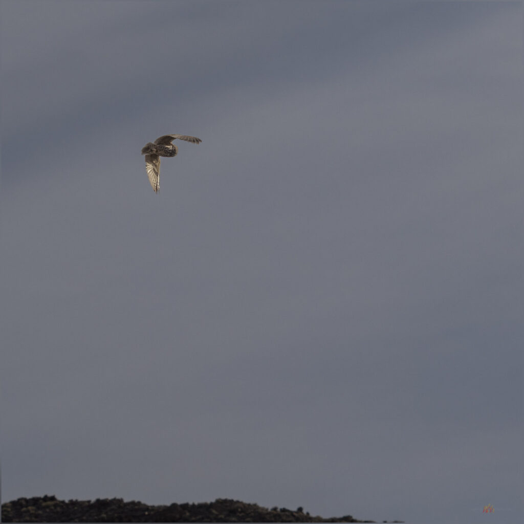
And, yes, there is the high point to reach. There are mining prospects where the fans intersect the mountain front, and the slope steepens into a nice climb. I soon notice circling raptors as I gain the ridge leading to the Mount Dunfee summit. There are several large birds, but one stands out, and its prominence does not go unnoticed by other birds who are doing their best to alter the larger bird’s slow, soaring path. The Golden Eagle merely shrugs at the swoops and dives of the Red-tailed Hawks; it looks as if the eagle is just passing through, veering close to the roosts of the juvenile hawks unknowingly. The Golden continues its straight-line glide path unperturbed.

Spotter. Red-tailed Hawk watches my approach to Dunfee Peak, Slate Ridge, Mojave Desert, NV, USA

I am soon on the summit of Mount Dunfee, a rounded dome among a scattering of cliffs. But something seems wrong. This is the named location of Mount Dunfee; I can, however, see a clearly higher summit to the northwest. It is, maybe, a half mile away, and one of the hawks is perched there. It is a sign!

Sentinel. A Red-tailed Hawk sits on the Mount Dunfee summit outcrop, I have to wait, Dunfee Peak, Slate Ridge, Mojave Desert, NV, USA (Map point #4)

It is not unusual to have a few summits of similar elevation in a summit cluster, especially among the smaller groups of hills or even along the high ridge of a prominent range. I am often, therefore, second-guessing the labels shown in map apps and other sources. I tend to trust the USGS topographic maps, but even these sometimes mark a named point that is not the high point. This seems to be the case along Slate Ridge. The hawk sensed my brief confusion and helped me out; it seems so, anyway.

The actual high point is more dramatic and precipitous than its rounded, illegitimate twin behind me. The hawk remained perched on the pinnacle until I got close. I hated to disturb it, but it had been watching every movement of my approach, so it was not startled or stressed. Its job done, I found the summit register, and I could enjoy the expansive views toward the Sierra and deep across the ranges of Nevada. There is just enough wind to lift the several hawks – the eagle is far away now – in various swirls and glides among the cliffs and canyons surrounding me. There are at least six raptors close by; maybe more, but I cannot turn quick enough to decide if I have counted that one or that other one, once or twice. A pleasure to watch for a while, nonetheless.

Hill space. Weather ridge top on the way to Dunfee Peak, Slate Ridge, Mojave Desert, NV, USA (Map point #5)

It is another wonderful day in a small, generally unknown group of hills in the midst of Nevada. I could digest the setting of the mountain-front alluvial bajada before reaching heights enjoyed by a kettle of raptors (yes, I looked up ‘kettle’).  The descent is easy, and I can soon continue my drive toward Las Vegas Valley and points beyond.

Serrated. Lichened outcrops on the ridge of Dunfee Peak, Slate Ridge, Mojave Desert, NV, USA. (Map point #6)

This might be my final high point of 2024. I made it to 13 this year, so far, and I am very happy and fortunate to be able to wrap so many summit excursions into my general travels. I hope for one a month, if only to keep the discipline of getting out, being curious, and learning.

Here’s to more high points in 2025. Thanks for coming along with me here at TrailOption; I look forward to hearing from you and, maybe, seeing you out there.

Keep going.

Please respect the natural and cultural resources of our public lands.
#naturefirst #keepgoing

Nevada High Points #127 — Painted Point Range

D. Craig Young · December 28, 2024 · Leave a Comment

Horst and graben. Beattys Butte beyond the Guano Rim, view into Oregon from Yellow Peak, Great Basin Desert, NV, USA

Yellow Peak

7171 ft (2186 m) – 1194 ft gain

2024.11.10


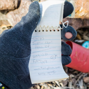
I stood here over 30 years ago, in the heat of a Nevada summer afternoon, visiting Lynn Nardella, a longtime archaeologist and sometime fire lookout. He was on fire-duty, while I was leading a university team doing archaeological survey on the Massacre Rim. Lynn would join us in a few days when we moved to a small excavation in High Rock Canyon, but on that day, he was watching the building monsoon clouds for lightning strikes. I was now standing, in scudding clouds and a piercing wind, at the same small building perched on the summit of the Painted Point Range, three decades later. This time, however, I had spent the morning walking here.

This week’s excursion focused on a geoarchaeological recce with some colleagues from the University of Nevada. Staying at the TD Ranch near Vya, Nevada, we had gouged around Macy Flat laying the foundation for a thesis project focusing on landforms, habitats, and archaeological sites of the Late Pleistocene and Early Holocene. It looks very promising. So, being in the area, I took off early on our home-bound travel day, for a walk to Yellow Peak – we had driven along its base several times over the past couple days.

Grey snag. A relic of the former Juniper woodland on the middle slopes of Yellow Peak, Great Basin Desert, NV, USA (Point #1)

Although it stands prominently at the northern apex of Massacre Rim, it is a relatively easy walk even if one avoids the road as I did. It is the third highest point within the Sheldon National Wildlife Refuge. I began along the access road where it switchbacks above Long Valley, near the refuge’s western boundary. After seemingly endless clear-sky walks in central Nevada, it was good to begin under low-hanging clouds and dark, imposing skies. I traced a route along some outcrops of volcanic tuffs with scraggly juniper trees. Although the refuge has done some woodland thinning in hopes of fire management, it is not as devastating as similar efforts I have observed elsewhere, and many snags seem to be left from the days of cutting limbs for fence posts. Snags can make interesting photographic subjects, but the common amputated limbs are unmistakable. An abandoned line of posts stands nearby, its barbed strands long removed; the posts standing tauntingly close to the trees, now dead, where they grew.

The ground is wet from recent snowmelt. Small patches of snow extend as white shadows from the base of trees and hide below stands of sagebrush and deeper grass. Spotting a coyote unaware of my presence, I duck beneath a juniper that will act as a perfect photo blind. In my quick excitement, I forget about the snow and my crunching boots alert the coyote to my presence, even though it’s quite distant. I am sad that I spooked it, but its run is lovely, and it soon disappears into the camouflage of the sagebrush background.

Not to wait. A Coyote takes the long way avoiding my wanderings on Yellow Peak, Great Basin Desert, NV, USA (Point #2)
Yellow Peak. The fire lookout awaits on the summit of Yellow Peak, Great Basin Desert, NV, USA (Point #3)

The cabin is an easy marker at the top of the hill. I approach a low rimrock below the summit and a small herd of deer, a buck and two does, peeks from a thicket of chokecherry and sagebrush nearby. The sun punches through to highlight the local slopes, leaving the sky dramatically dark in the distance, and I am buffeted by a steady wind. Cooling after the hike, I pull extra layers from my pack as I explore the platform of the lookout. I cannot find a summit register; maybe it’s in the building. Bracing against the wind or hiding behind the lookout, the view is the epitome of the basin and range province. Guano Rim leads out to Beattys Butte and the Massacre Rim runs to Coleman Rim and on to Hart Mountain. Some of the best of the Nevada-Oregon outback is visible from Yellow Peak. I understand why Lynn enjoyed his time up here.

The Lookout. The stout lookout, sealed for winter, on Yellow Peak, Great Basin Desert, NV, USA

I drop into a beautiful little drainage that curves around the ridge of my approach. I spend some time among aspens and juniper. The wildlife is quiet, only a few birds among the trees and a pair of distant ravens squawking at a red-tailed hawk. It is a nice walk out, surprising for its stands of Wild Rye along the narrow, inset floodplain. A good archaeologist once told me these stands mark locations where people paused to process grass seeds, allowing a few escaped seeds to colonize the landscape. It is, in fact, somewhat common to find grinding artifacts near these stands. No artifacts on my little transect through the floodplain, but I would not have been surprised.

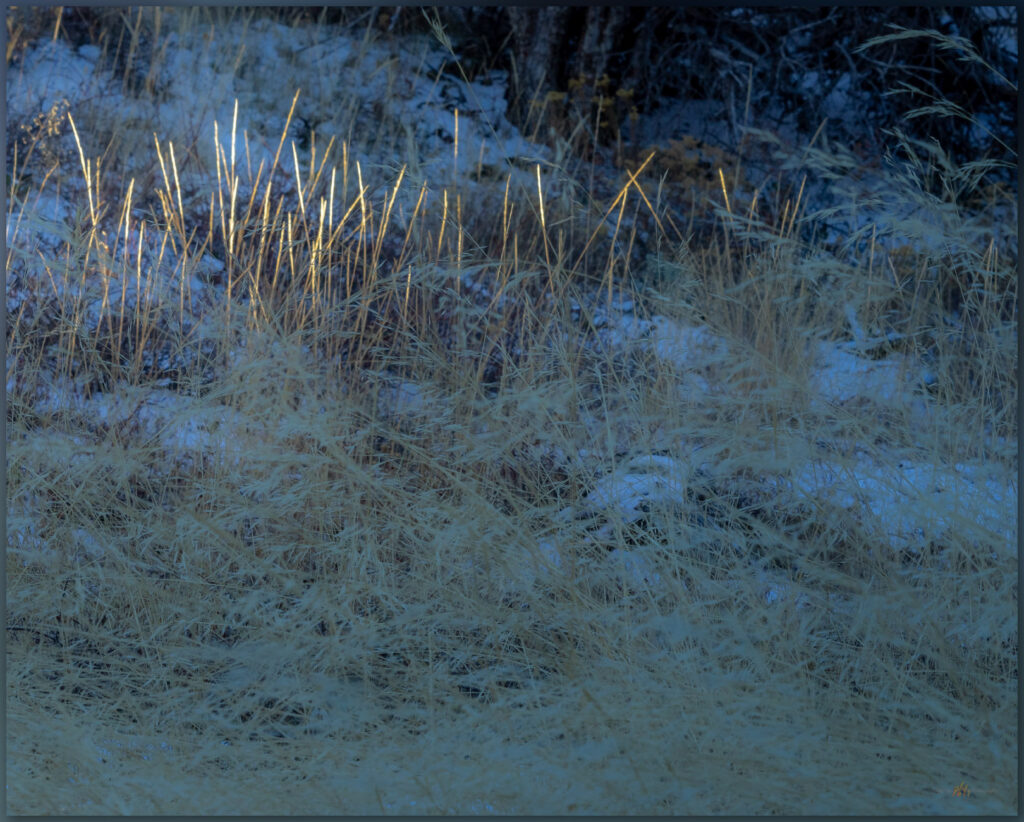
Riparian rye. Great Basin Wild Rye in a small inset drainage on the western slopes of Yellow Peak, Great Basin Desert, NV, USA (Point #4)

It is raining when I get back to the truck. Barely a shower, but I really like the change from the dry days of the summer and much fall. Yellow Peak stands behind me, another enjoyable hill in the sea of mountains that is Nevada. But now it is time to drive home. I will head south among the calderas of Cottonwood Creek and into the Black Rock Desert, a nice commute any time of year.

Keep going.

Quick look. A buck Mule Deer stops for quick, curious look below Yellow Peak, Great Basin Desert, NV, USA

Please respect the natural and cultural resources of our public lands.
#naturefirst #keepgoing

Nevada High Points #126 – Adobe Range

D. Craig Young · December 19, 2024 · Leave a Comment

Shadows of the Elko Hills. Late light brings out the topography of the Elko Hills and Ruby Mountains, low on pediment of the Adobe Range, Great Basin Desert, NV, USA

Peak 8135

8135 ft (2480 m) – 1750 ft gain

2024.10.22


This is a long outing, I am headed for fieldwork on the Old River Bed in the West Desert of Utah, and then on to visit my parents in Grand Junction, Colorado. But first, I cannot pass up a chance to check out a Nevada high point along the way. The Adobe Range rises north of Elko, Nevada, in a generally south-to-north-trending jumble of volcanic hills flanked by broad sedimentary pediments. The hills are not prominent in any dramatic sense, but I have worked several projects along their flanks without taking the opportunity to visit the range’s higher elevations. It was time to change that with an afternoon walk.

Inset wash. Cobble bedload in a dry wash of the Adobe Range, Great Basin Desert, NV, USA
Route map to Peak 8135, summit of the Adobe Range, Nevada

Originally deciding on Coal Mine Canyon as an east-side entry, but after squeezing through private property, I found a good road leading to some corrals well south of my target. It looked nice, with some fall color around high springs in an otherwise late-season, sagebrush landscape. Even where good roads lead higher, I always pick a spot that is minimally 1.5 miles from the summit, where I hope I can at least get 1500 feet of vertical gain — these ‘rules’ can be difficult in the smaller hills that have found their way onto my ‘list’ of named mountain ranges. In any case, high point excursions are about the experience and not the statistics — other than keeping the list going.

I decided to document this walk, basically a random choice, as a quiet video, experimenting with other ways of sharing the Nevada high point experience. I am not a skilled videographer by any stretch, but I thought this relatively easy walk might be a good chance to experiment with video scenes bringing the viewer along. I have included my effort here. I really want to focus on photos and maps, working to bring landforms to life to the best of my limited abilities, so I will be curious to hear what you think.

A small grove of cottonwoods and willows has held its color, but it is fading quickly. The slopes of the Adobe Range are wide open, with only a few cliffs and outcrops below the summit ridge. While the walk is a pleasure, the distant scenes of the Ruby Mountains, East Humboldt Range, and the headwaters of the Humboldt River in the Tuscarora Mountains, come along as added value. The skies are low with gossamer overcast. Concerned about the coming journey east, I wish I had more time. I am glad to work these into my fieldwork schedules, but these mountains deserve more attention. Here, I am surprised by small patches of snow, left by a recent storm, telling signs of the change of seasons. The walk feels good, and provides a nice break from the drive, but it is now time to head east and find a camp. The days are noticeably short, and I am in shadow throughout the short descent. I have miles to drive before I can rest for the night.

Last color. Aspens hold their color around a small spring and riparian area, Adobe Range, Great Basin Desert, NV, USA
Ruby view. The Ruby Mountain far beyond the outcrops of the Adobe Range, Great Basin Desert, NV, USA

The Adobes rise from an old landscape of eroded hills, so I do not encounter any young landforms of any map scale. The drainages are in erosional guillies leading to broad inset floodplains of Humboldt River tributaries, such as Coal Mine Canyon. The tributary drainages can hold young terraces preserving records of archaeological landscapes and recent change, but my route today was high above these. I focus on the views overlooking the tributary valleys before continuing my journey eastward.

Keep going.

Topo variation. The uplands of the Adobe Range. Cobble bedload in a dry wash of the Adobe Range, Great Basin Desert, NV, USA

Please respect the natural and cultural resources of our public lands.
#naturefirst #keepgoing

  • Page 1
  • Page 2
  • Page 3
  • Interim pages omitted …
  • Page 10
  • Go to Next Page »

Trail Option

Copyright © 2025 · Monochrome Pro on Genesis Framework · WordPress · Log in

  • Contact TrailOption
  • Substack
  • Waypoints Bibliography
  • Young Archives