• Skip to primary navigation
  • Skip to main content

Trail Option

A personal geography of landscape and place, art and geo-science.

  • Home
  • TrailOption Blog
  • WayPoints
  • Galleries
  • About
  • Contact TrailOption
  • Subscribe!
  • Show Search
Hide Search

LightOpt

Luther Pass: Success of ‘Fourth Friday’

D. Craig Young · January 30, 2020 · Leave a Comment

As I mentioned in my previous post, after months of futile attempts, I have resolved for 2020 to stick to a pattern of ‘second’ and ‘fourth’ Fridays. Second Friday is an outback or travel excursion combining field studies and photography, while Fourth Friday brings in a weekend of focused local photography. I am not sure how this will work out in the long run, but I have started well so far. The Clayton-Ione weekend provided an excellent bout of gouging around volcanoes and arroyos, while this past weekend – Fourth Friday – produced a combination of experience and photography that resulted in some of my best photographic work. I hope you think so too.

January weather has been relatively calm in the Sierra; in fact, our snowpack is currently shrinking after a series of good December storms. Yet, the forecast for Fourth Friday hinted at a quick-passing, early-morning snowstorm at higher elevations. I loaded up early, a little after 4AM, heading for Luther Pass and Grass Lake. I am on Hwy 89 regularly and often gaze into the glacially carved basin of Grass Lake, where pines grow in fingers of glacial outwash that extend into a wetland basin. Aspen groves punctuate the surrounding pine forest. I have often visualized photographs at Luther Pass, either of a small grove of pines isolated in the wetland against a dark forest backdrop or of a stand of fiery-fall aspens rising among the forest at the wetland shore. When I thought of Friday’s possible storm, I immediately prepared for the former – I would snowshoe into the frozen, snow-buried wetland and work with the emotion of snow flurries or low-hung clouds. There were stars above my driveway, but I could see them fading toward the abrupt rise of the Carson Range. Even in the dark of pre-dawn, this meant clouds were blowing in.

The snowplows had carved some parking pull-outs along the stretch of highway at Luther Pass. I pulled in and sat in the dark. No snow fell as I shut down the headlights; my hopes in the forecast were similarly dimmed. Thinking the snow was simply late, I strapped on snowshoes, shouldered my pack, and headed into the snow-covered space of Grass Lake. My trees were there, and I set up my composition quickly as dawn approached. Just as quickly, I knew this was not going to work. Without the ambience of snow or clouds, I could not separate the foreground grove from the background forest. I waited.

The skies above were stormy with dramatic clouds dancing among the mountain peaks. The sunrise was fantastic, beaming through the small gap at the eastern (of course) end of the wetland perched above the canyon of the West Fork of the Carson River. I practiced some timelapse settings, but this was not the image I came for. My wait continued.

Finally, the sun broke through, spot-lighting the small grove, isolating it against the dark backdrop just as a snow squall broke over the distant forest. This was not what I visualized, but I was ready for it. The trees lit up warmly, like candles overwhelming the surrounding snow. It was good to be here. I like the image, but it lacked the satisfaction of my visualization.

Standing out. Waiting on the snow, the sunrise brought this momentary gift.

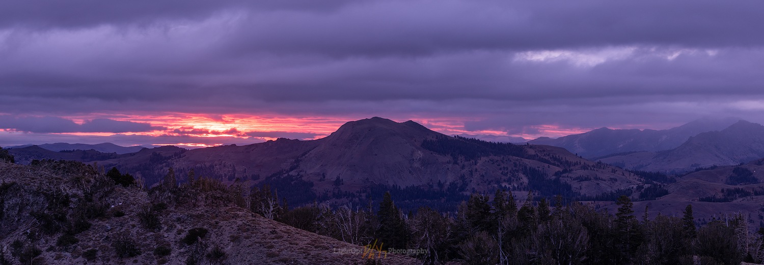
On Friday evening, after some time working and writing at home, having left my pack in the truck, I drove to the south end of Carson Valley where I climbed a set of hills to frame the expanse of Silver Peak and Raymond Peak, far south near Ebbets Pass. The clouds of the day still danced among the peaks, but the good light did not come. Still, I worked shots to continually develop the instinct of watching the land and using my equipment. Practice.

Luther Pass Collection

Although the weekend is about local practice, I decided that Saturday needed a journey to Mono Lake. Some of my friends from the 2018 Iceland trip are coming in February and I wanted to scout a bit of winter access to the tufa localities around the lake. I need not have worried; it has been warm enough to keep most of the paved and dirt roads clear. As a plus, the weather forecast called for a Sunday morning storm. Maybe its approach would award me with Sierra lenticulars or high clouds for a good Saturday sunset.

The South Tufa boardwalk was relatively crowded but, to my surprise, I was the only person only a mile west at the less developed Sand Tufa. I have wanted to photograph this tufa for a while, but a compelling composition is a definite challenge. It is an even greater challenge when the sky does not provide a backdrop. On the other hand, as the promised storm approached, having blocked all sunlight in the west, an amazing calm overwhelmed the lake.

Mono still. A vast serenity and the beauty of loneliness at Mono Lake.

This may be a greater reward than the drama of the near-iconic photography of tufa against a fiery sunset. The song dogs serenaded my walk on the placid shore. Nothing moved. I will be back for the icons later, but tonight this serenity is mine and mine alone.

I was home from Mono by 9PM. I am so very fortunate to have this as my ‘backyard’. I thought about the plan for Sunday morning. The coming storm seemed weak on radar, should I go back to Luther Pass? I made a promise to myself to focus on this weekend. Yes, I would.

Because I was keen on the working in the snow and still visualized the image I wanted to create, I realized I did not need sunrise. If the snow-bearing clouds arrived, I would have the natural diffusion I wanted throughout the early morning. I slept in a bit, but it was not too long before I was parked and donning snowshoes in the same pullout of two mornings ago. It was not snowing.

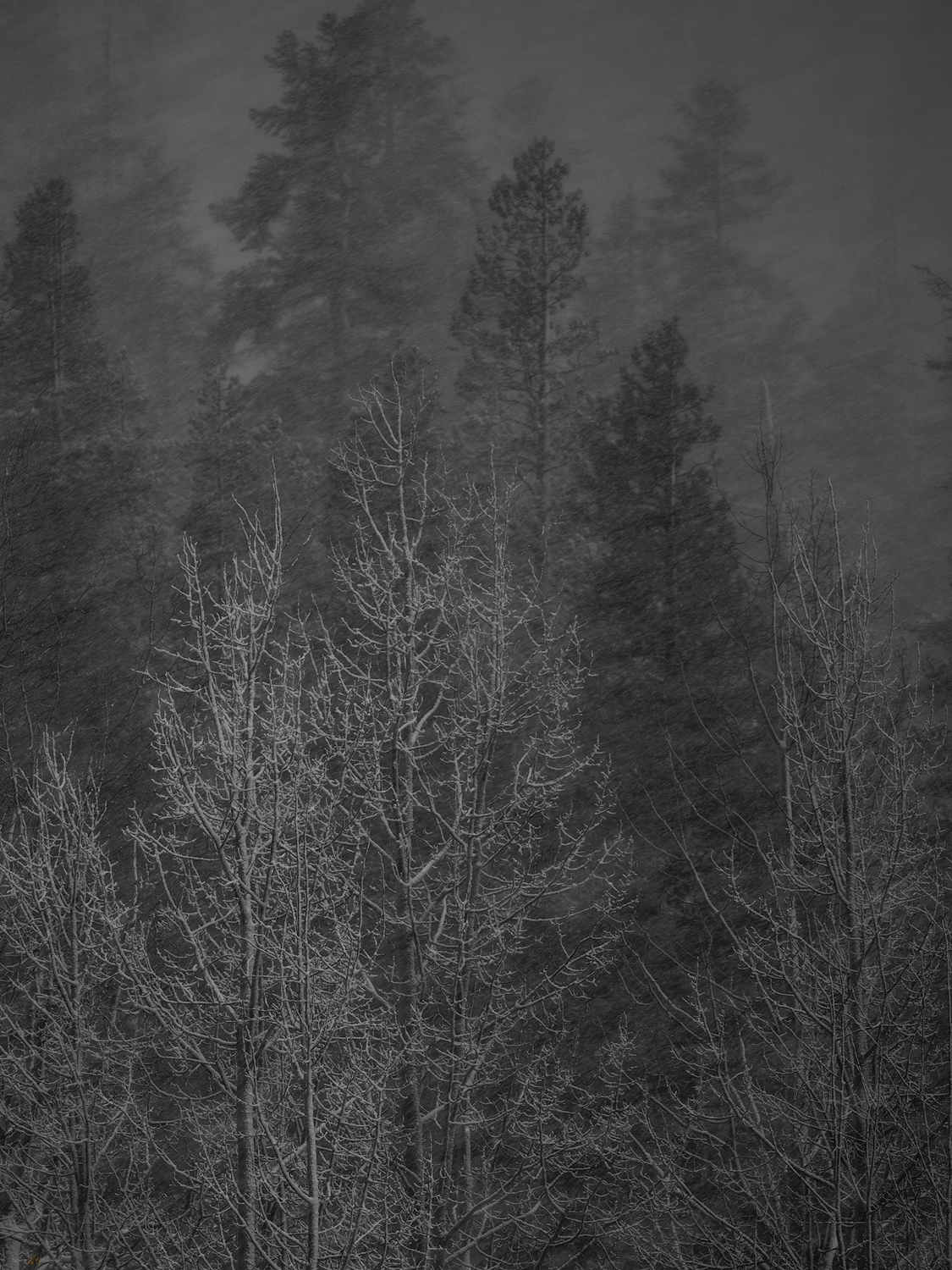
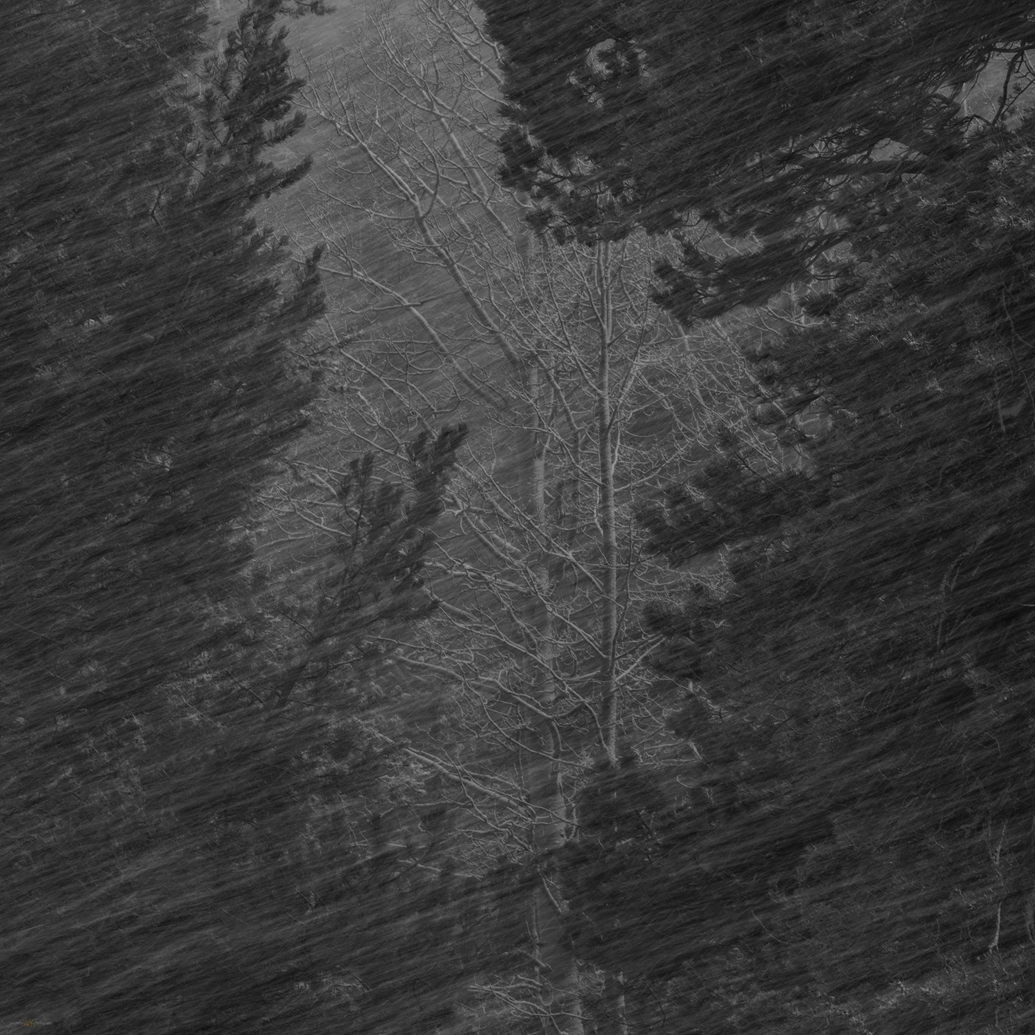
I dropped into the snowfield of Grass Lake and turned toward my target. A snow squall, like an expansive white sail, fell before me and a laugh sprung from my throat. Right on time. I could tell, however, that my little pine grove was fading into the snowstorm and its backdrop was too distant to meet my visualization. I continued on, heading toward a grove of leafless aspens I had spied in the autumn. Carefully crossing a creek, I climbed into a willow thicket and a new scene appeared before me. It was a version of my original hope, but it was framed within the forest rather than standing on its own. With framing and a compressed crop, I felt the image come alive. The snow was pounding and practically sideways in the wind.
Frontspace
Keyhole vision

From one spot, with only minor – but ultimately significant – movements, I created a pair of images that met completely the hopes of my visualization after months of driving across Luther Pass.

Luther Pass Collection

So, Fourth Friday. I kept to my plan and it paid off. Maybe it is a breakthrough. It feels like it might be. However, what is the most important thing I learned? I benefited from a string of days that include consistent focus and practice. Although I responsibly spent part of the days working with Des around StoneHeart, I made sure to keep focus, getting out for extended shoots and experiences each day. It is ultimately good to keep focused time set aside because I cannot photograph every day, or each week for that matter. I may not benefit from dramatic conditions when on a Second-Fourth schedule such as this. And yet, I will have my camera in hand with regularity and consistency; if I keep my eyes open and my feet moving, I bet it pays dividends. It did in January 2020.
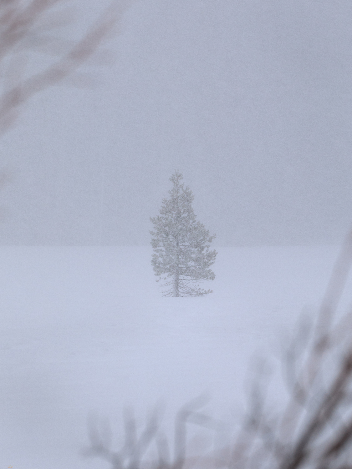
One in the wind

Keep going.

Please respect the natural and cultural resources of our public lands.
#naturefirst #keepgoing

The Crater to Ione, NV: The resolution of ‘Second Friday’

D. Craig Young · January 13, 2020 · 2 Comments

It is a new year, 2020. I thought of doing a retrospective of last year’s favorite journeys and images. “My 12 Best Photos”, calendar-like (to follow a theme), or something similar. A look back, however, reveals several gaps in my photography journey. Those gaps opened as my vocational world (not too mention much of our national and global community experience) encountered turbulence. I turned to field studies and photography as escapes – I had many good field sessions, but they were escapes, nonetheless. Not escapes from the management attention that my business requires, but escapes as relief and rejuvenation. So, leaving the turbulence behind and motivated by it, I am looking forward to a new year and another trip around the sun.

What were the gaps? I had one new blog post in 2019 and I basically avoided sharing either images or field observations on social media. The latter does not bother me all that much, the pitfalls of social media are best avoided. The former is a strange conundrum.  I very much enjoy the blog medium. I spent considerable time with new formats and published several blogs based on journeys that took place in previous years; I still have a few drafts in the works. I kept thinking I would catch up eventually. Still, that is ‘looking back’; this is about looking forward.

Clayton – Ione Collection

Friends, family, and colleagues know me as a scheduler. I keep a detailed calendar charting my day and keeping time for the various things I consider significant. Do I stick to it?  Some days or weeks are better than others; I have never, however, considered any calendar as legally or emotionally binding. Other than engagements or appointments I should not miss, it is generally aspirational. But it is very structured. When I do stick to it, there is pleasure and satisfaction there, and, as a result, when I realize a successful calendar, I find I get things done.

A given workday, for example, has ‘Prime’ tasks and ‘Focus’ tasks. During ‘prime-time’ I allow disturbances and it is about collaboration and teamwork; it usually takes up the mornings. I turn off phones and email during ‘focus-time’, picking a specific project for the day or week that needs or can benefit from undivided attention, typically several hours in the afternoon. Field work negates the schedule for a while. Hey, it is fieldwork, that is why I do this!

My wife and I have a pretty simple home life, and I am not one to separate ‘work’ from ‘play’. I can and do unplug, but I am fortunate (I think) that my interests intertwine, mostly to mutual benefit. Like the workday, evenings revolve around a few key, calendared activities. Mondays and Tuesdays are about geoarchaeological research, notes, or projects that don’t get time at the office. Thursdays are for photography – processing, printing, and study. Other days I let randomness have its way, and I do not berate myself if the occasional distraction rips the day from the calendar.

So, what is this about? This is something of a forward-looking resolution and promise to me – discipline and practice around growth in my photography and my geoarchaeological science. It is all about the weekends!

I will call them ‘Second Friday’ and ‘Fourth Friday’, calendared and planned weekends of each month. Second Friday marks a monthly field trip, getting out on the ground with emphasis on areas where I have research interest and where I can bring my photography to that setting and topic. I head out on a Friday with a geography in mind and camp through the weekend. I might make a basecamp, or I could ramble on a reconnaissance of roads and trails untraveled. Fourth Friday begins a local weekend focused on practicing my photographic skills. I might chase golden light in the mornings and evenings, forage for images on a quick daytrip, or simply hunker into intensive processing or printing sessions. I may break from the focus to see to chores, of course, but the weekend revolves around a photography theme or themes.

Will this work? We will see. With this blog post, it is January’s Second Friday and I am in Clayton Valley, east of Tonopah, NV.

The Crater.

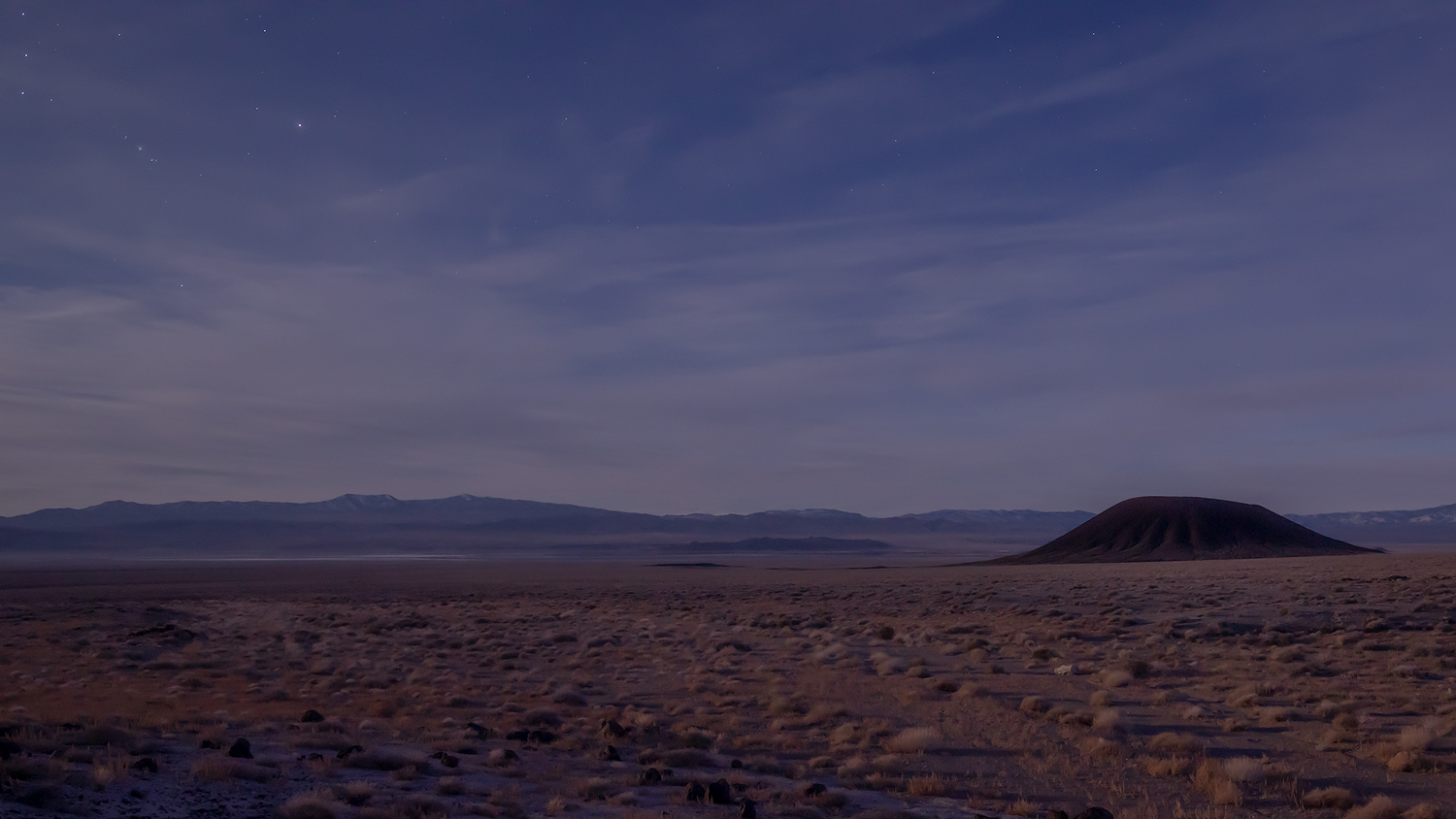
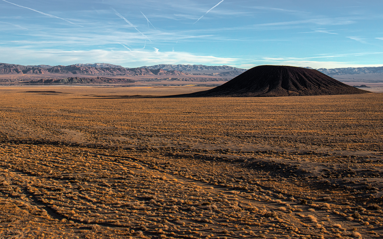
The Crater rises from the Pleistocene-age, coalesced alluvial fans that stream from the northeast margin of the Silver Peak Range. The fans engulf the volcano, but it rises in the classic composite cone, weakened only along its east side, where lavas poured into the valley, leaving black scoriated lobes paralleled the later flashy flows of the ever-reaching alluvial fans. Hwy 268 is one of the few remaining paved roads in Nevada that I have not explored, and while planning the field excursion The Crater is a highlight of my Google Earth flyby. This is where the weekend begins.

The Crater at Dusk, Clayton Valley.

The weather is perfect. There are rumors of a coming weak storm system, but the sky remains placid, the sun unduly warm for early January. I climb The Crater and explore its blown-out center; I continue southward to circum-navigate its perimeter. The walk is crispy on the young volcanic pumice and scree. Dust profiles on the cone’s south slopes, downwind of the Clayton Valley basin-bottom playa (today a focus of Lithium production), are fascinating. Fine-grained sediments always attract my attention.

Moonlight Crater, from the Monocline, Clayton Valley, NV.

I drive about a mile north with the approaching evening. Some basalt-capped badlands, called The Monocline, provide a stage for sunset and moonlight photography of the dark volcanic crater against the light-colored desert fans. It is the composition I visualized for the evening practice. The light is subdued, but I enjoy the quiet evening and the invitation of the full moon.

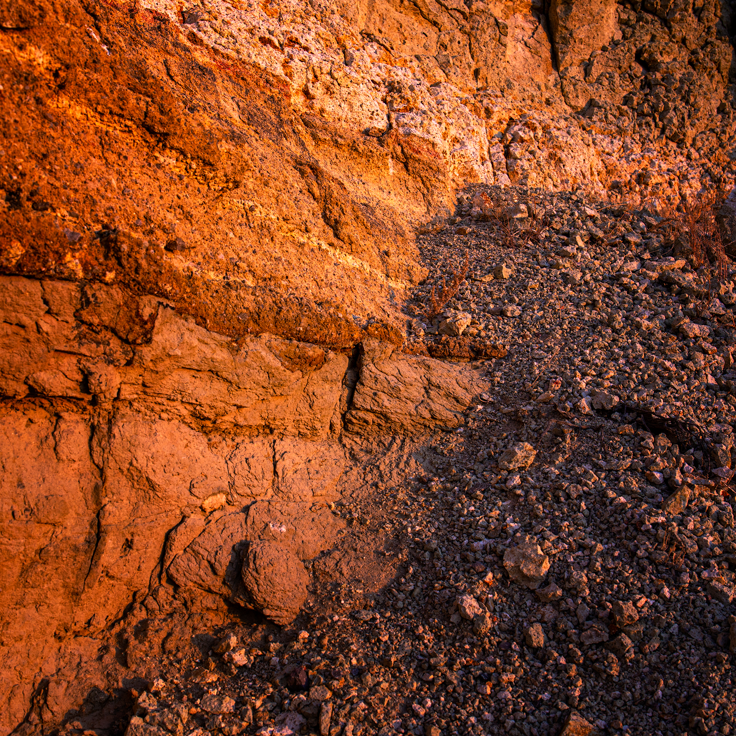
Tuffs in badlands of Black Canyon alluvial fans.

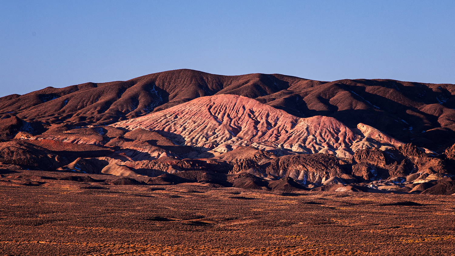
Camp is a non-descript wide spot at the intersection of cardinal two-track roads in the middle of the Black Canyon fan extending from the Silver Peaks. I am in the Big Smoky Valley drainage system now, but only a short distance north of the low pass to Clayton Valley. With the sunrise I detach the trailer and scurry in the ZR2 toward some badland outcrops far up the fan. The roads cut into the desert pavements and it is a short hike to Miocene badlands where ashflows and lakebeds encapsulate occasional pockets of petrified wood. Clear sky sunrise with few clouds. I am enthralled by the expanse of fans with inselberg islands of partially buried outcrops revealing remnant landscapes, but how to express the expanse and document the temporal incongruities through photography? I will return again and again.

Remnants. The volcanic outcrops of Black Canyon, Silver Peak Range, NV.

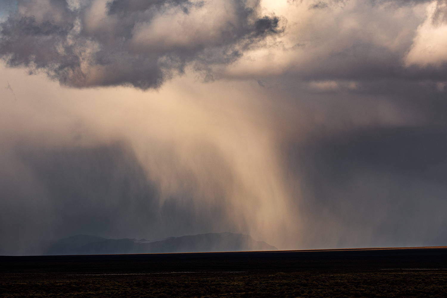
Circling toward Ione via the Gabbs Pole Line road, the forecasted squalls finally intersect the weekend. There is a bit of drama in the sky as I drop into quarry pits and arroyos to walk fine-grained profiles. There is temporal information in the sequence of ancient soils separating deep packages of gravelly Pleistocene alluvium and Holocene dust reworked into the basin as loessic alluvium. The Ione Wash arroyo is fantastic, a deep slice along the axis of this vast inland valley. I walk the profiles searching for fire histories, volcanic ash, and soil formation, hoping for an archaeological trace from the basin’s past.

Ione Valley Squalls.
Misty Mountain.

I camp by the roadside where I can photograph the squalls sailing through the Paradise and Shoshone ranges. Few flurries hit camp, but the evening is a pleasure, the trailer is warm, and I sleep well. The morning is clear but for some scudding clouds on the mountain tops. I tour homeward, joining traffic on Hwy 95 until skipping south at Yerington. I’m home in the early afternoon.

Last squall.

Clayton – Ione Collection

This is the pleasure of the weekend of Second Friday in all regards. I had some targets highlighted as little more than excuses to get into new landscapes where I could consider the natural setting and its process. I augmented my taste of dirt with the slow build of landscape photography, choosing a few scenes to maybe tell the story of the traveled stage. This is how planning, and a calendar, brings discipline that ultimately evolves into the pleasure of an outback journey and experience.

Keep going.

Dawn Squalls at Frog Lake

D. Craig Young · November 1, 2019 · 2 Comments

After endless days of blue skies, it looks like there is a change in the forecast. A generally dry cold front will roll through early Sunday morning, bringing strong winds and, more importantly, mid-level clouds and a slight chance of precipitation in the Sierra. After a couple unsuccessful, but fun, photo excursions among the fall colors of Hope Valley, I had to take advantage of the change in weather, getting up high to experience the brief storm.

Dawn Squalls Collection

So, I am on the road, heading up Highway 88 to Carson Pass, in the dark of Sunday morning. Frog Lake, on the Pacific Crest Trail, south of the highway trailhead, is an easy hike and, having been there scouting and photographing previously, it is a nice place to visit on short notice as conditions warrant. Ledges northeast of the small tarn overlook the length of Hope Valley and peer southward from Mokelumne Wilderness into the crags of Carson-Iceberg Wilderness; wide open compositions abound.

It was 20°F when I parked my rig at the trailhead. Wind gusts whipped at the doors as I reached for my pack and tripod, there was one car in the parking area. I dropped into the dark forest, enjoying the little adrenaline rush of a dark mountain trail seen only from the tunnel-like beam of a headlamp—waiting for the reflected eyes of critters, small and large, that watch my passage, as the limbs of the tallest trees shudder and crack in the wind. I cover my headlamp at intervals to soak in the darkness and watch the clouds moving with promise against the stars. Soon I am at Frog Lake, the dark water riffling in the wind. I am now exposed on the tarn’s shore as I move to the ledges above its northern margins. It is here that ancient glaciers scoured the rocks before dropping into Hope Valley far below. Today, the north wind scours the ledges in the opposite direction, blowing a squall’s few snow flurries through the cone of my headlamp, hints of snow’s hopeful return to the mountains.

As the light glows the clouds form overlapping bands extending to the eastern horizon. A lower cloudbank rolls over Freel Peak and Jobs Sister at the north end of Hope Valley. This is what I came for. And yet, the mid-level clouds are the bane of sunrise light; they block the horizon and flatten the view. Without illumination, the distant rolling cloud is almost invisible against the intersection of mountain and sky. In my mild disappointment, I realize my hands are painfully cold. I need to acclimatize or succumb to the endless need for handwarmers. I have some fancy gloves and liners, but something is not working.

Markleeville Peak at Sunrise. I did not plan a panorama in the field, but after reviewing images captured of slightly different compositions, I stitched this two-image panorama together to capture dawn’s window at Markleeville Peak. 0.5 sec, f/11, ISO 100; Canon 5Div, 100-400mm (100mm).

As I turn from the northward view, smiling at the pain in my hands—it is the feeling of mountain winter, I notice that the sunrise is aligned with a gap in the clouds much further southeast than I expected. I climb a few stepped ledges and tuck into a gap between boulders, out of the wind, sort of. The images of the red dawn were a challenge as my hands lost feeling. I want to focus on the image and enjoy its capture, but the wind at my hands, and whipping at my jacket and hood, reminds me that I am exposed at elevation, experiencing firsthand the change of weather. The images become secondary.

Misty mountains. This image, from the windswept ledges of Frog Lake, reminds us that winter is coming. 1 sec, f/11, ISO 100; Canon 5Div, 100-400mm (255mm).

I am, however, happy with their capture. The images reveal the dark morning squalls and the brief glow of a red sunrise. The sun was masked by the mid-level clouds but there was enough gap to alter the scene for a moment. I could see that this would be a moody image with a “Mordor” drama on the horizon. These scenes were not my first idea walking into Frog Lake, but I enjoyed watching the sky develop, once I was looking in the right direction.

Dawn Squalls Collection

I look forward to getting to know the Frog Lake ledges in all conditions. Let’s move toward winter here.

Keep going.

Palouse Photography: A Roadtrip

D. Craig Young · June 17, 2019 · 6 Comments

Although photo workshops can feel like a one-off experience, and often the expense makes it so, it is likely that you will develop a few long-lasting friendships and collaborations during the workshops you attend. And so it was that a group splintered from last year’s Iceland Workshop, and an excursion to the Palouse of eastern Washington gathered. I think Erno sparked the idea, and Jeremy committed to driving from the Midwest. Soon, Quinn and his son Corbin would fill out the team, meeting in Colfax, Washington, for a long weekend of light-chasing and storytelling. Although I typically prefer to photograph on my own, these guys are good landscape photographers and plain fun to travel with; no better way to practice and engage with the iconic wheatfields, buttes, and scablands of the Palouse.

I left StoneHeart after prepping the new field rig with camp gear (just in case) and a short week’s worth of supplies. The stout little Chevy is brand new and we, the truck and I, hit Highway 395 north for its maiden voyage. The weather promised some scattered storms all the way into northeastern Oregon, so I routed through Alturas, California, and Lakeview, Oregon, turning east toward Warner Valley, my haunt through the days of archaeological field schools and a geoarchaeological dissertation. Along with my girlfriend (still my life-long partner almost 30 years later), I spent countless evenings and rolls of Kodachrome 64 photographing sunsets from our camps. Any excuse for a visit.

Warner Valley, the selfie spot. I have a series from here starting in the 1990s.

I dropped off the back of Hart Mountain into some good storms on the dirt roads of Catlow Valley. The furtive skies chased me all the way through Malheur Wildlife Refuge and into the volcanic badlands of eastern Oregon. The day culminated as I went full storm-chaser along a rolling storm-front slashed with lightning and dust-curling winds. I got soaked and humiliated in a plowed field in western Idaho; so very fun.

Storms building at Poker Jim Ridge, Warner Valley, Oregon.

Day 1

After stopping for the night at the Frontier Motel in Cambridge, Idaho, I was ready to head into the Palouse and join the team at Colfax. I checked into the room I would share with Quinn and Corbin, but finding I was the first to arrive, I set off on a scouting mission. I had some ideas for some astrophotography, having run across mention of abandoned buildings here and there.

Ending up rather far to the west, I found a perfect (I hope) lonely building just off a dirt road near Lamont. It is quite far from the hotel, about an hour drive, but it seems accessible and oriented for Milky Way photography. I plotted a late-night visit.

I ended my day’s drive on Steptoe Butte. It is quiet in the afternoon, but it is easy to see why this becomes an iconic spot for photographing the waves of green and gold extending to all horizons below the stand-alone butte. There is a minimum of a dozen shots from Steptoe adorning the hallway walls in the Colfax hotel. It looks like I will soon have some of my own.

Palouse Collection

Erno and Jeremy planned on meeting me on Steptoe Butte for some sunset shots. Time enough to get a run in, so it’s downhill to the gates of the State Park. Thinking I would turn around at the gate to climb back, I soon noted a black Nissan barreling toward me. The occupants of the SUV kindly offered me a ride, so I climbed in, happily greeting my friends, last met in Iceland, as we drove back to the summit for an evening of photography. The sky gave it a bit of a go at sunset, but we spent much of our time working the rolling wheatfields for patterns revealed in the low-angle sun. The Palouse is where intimate landscapes become iconic.

First patterns. Getting the intimate perspective from Steptoe Butte.

Day 2

The early, pre-dawn morning finds us at a twin tree below Steptoe Butte. Because I tend not to look for local images prior to photographing an area that is new to me, I did not realize this isolated tree in a green field would be a local attraction; and yet, we arrived in the blue hour before dawn and were soon joined by several other photographers. I would not call it ‘crowded’, nice folks, but it seemed odd to be on a dirt road along some random field and have cars show up – I am quickly learning these things are not so random. Shooting into the rising sun is always a challenge. A few of us got low looking for the little orbs of dew on the young wheat. I wanted the sun within the split of the trees, though the mass of Steptoe in the background, due to the position of the rising sun in June, was a distraction I could not avoid.

Twin Tree Sunrise.

As the angle of the sun increased into the morning, we decided to head back to the Steptoe summit. Quinn and his son Corbin had arrived and because Steptoe is the local highlight, we had this landmark as an anchor and planned the rest of our day, and much of our visit, around its light. The forecast hinted at storms further south and we hoped maybe they would creep north. This encouraged us to indulge in a broad tour, hunting for colorful scenes and hoping for a thunderhead. We eventually crossed the Snake River and guessed that a turn up Alpowa Creek to gain access to Knotgrass Ridge would get us closer to the storms. We did not have any prior familiarity with these geographic names, just picking hopeful roads on the map.

Chasing squalls. Random roads in the highlands south of the Snake River.

I kept saying that the storms must be down in Oregon, well beyond our drive plans for the day, but the team remained hopeful. We were out of mobile signal so the radar clues we might normally get were not available. It did not matter, near Peola, WA, we hit the squalls – storms on the windshield are closer than they appear. It was a great tour, not a lot of photography, but we were getting the lay of the land. Sunset found us back at the twin trees to see what that might bring. The storm clouds had long subsided and a hazy sunset left us rather unmotivated. We should rest up for some astrophotography.

Is there a Milky Way here?

We would return to the ‘schoolhouse’ I had scouted near Lamont. I knew it would be at least an hour’s drive, but after leaving Colfax at about 10PM, the journey seemed to take forever. I know Erno and Jeremy, in the rig behind me, began to question the sanity of following me prophetically into the scablands. Quinn and Corbin had already had a very long day. The trip seemed short the previous morning, but everything was new then, and I clearly had lost track of time. Now my estimate seemed well short of reality, would it even be worth it? Does the Milky Way even rise over eastern Washington?

Palouse Collection

Finally, I stopped on a dusty road where my GPS showed my earlier plot, ‘house’. There was nothing, apparently, here in the dark. Nothing. The stars looked good and I promised the guys there was a building right over there, and there it appeared in our combined headlamp beams. This might work!

I had some low-level lighting we could use for the interior, but that meant getting inside the ramshackle wood structure. Quinn and I approached the windows, cautiously listening to the rustling wind and to the scratches of scurrying critters inside. I peered across a pane-less windowsill, shining my headlamp into the musty interior. Its narrow beam barely penetrated the darkness.

“Hey Quinn, this looks pretty good,” I said quietly as he came up behind me. “We should…”

A rush of ghostly feathers carrying a pair of large beasts swooped toward my lamp and out the window, I tumbled sprawling into the deep grass and thistles. Or, maybe I was in Quinn’s arms, having defied gravity at the explosion of ill-disturbed owls. The others only heard a youngster’s sharp squeal and then laughter.

“Ok, you go in first.” Quinn started and I followed, stepping over woodrat collections that blocked our path. We got lighting hints from the gallery of Erno, Jeremy, and Corbin, but it would take some back and forth to get the shots we came for.

Owl School. The experience often outdoes the imagery.

In the end, we had a great time, spending a couple hours beneath the Milky Way and growing accustomed to hanging out in the dark of the school to get the lighting set. We were careful to maintain our respect for the property, leaving things just as we found them during our brief visit. Thanks to the owls for letting us use their roost for a while, sorry for the silly disturbance. I hope the team still thinks it was worthwhile.

Palouse Collection

Day 3

We skipped any sunrise shoot, following the late night and early morning return. In the meanwhile, I gouged around the scablands and loess plains of the western Palouse, the pleasure of exploring.

Quinn and Corbin on the trails of Palouse Falls. Watch your step boys.

Our goal for the day became Palouse Falls, another local icon. We spent the late afternoon hiking its trails; it was nice to experience the powerful falls surrounded by columnar basalt buttressing volcanic tablelands. After all my time in the sagebrush steppe of the dry Great Basin Desert, I found it mildly unsettling to observe the constant spill of so much water and power but still be surrounded by sagebrush and volcanic rimrocks. The Humboldt and Truckee rivers, nearer home, might look the same, I imagine, if they encountered a resistant cliff and dropped a few hundred feet. It does not seem possible, but on it roars.

Beyond the falls. I’m not sure if this image ‘works’, but it captures the long wait, lost in thought, above the falls.

I waited for several hours at cliff’s edge in hopes of engaging the falls with the Milky Way arc. I wanted more practice at blending the blue hour landscape with a starry night scene. I need a lot more practice, and the falls, deep in the gorge, do not hold any lasting light. Clouds partially blocked the galaxy core, but I often like a few clouds in my night images. I find that clouds add something unique to an otherwise constant, from our humble perspective, Milky Way.

Day 4

Jeremy letting it in.
Our mobile barrista.

Our final morning shoot was, I believe, our most productive of the trip. Jeremy had scouted some locations yesterday and we left the gravitational pull of Steptoe Butte for a while. Rambling among wind turbines, rolling wheatfields, and abandoned homesteads, we took our time with sunrise, enjoying Jeremy’s hand-ground beans as we brewed coffee on the tailgate. We met Quinn and Corbin later in the morning among the wind turbines; they had camped at the falls.

Erno, sunrise turbines done, processed, posted. What ya’ll been doing?
Wind flower. A blended composite, after watching the turbines for hours.

Palouse Collection

Rolling east. This is the image I had visualized as my creative goal for the Palouse landscape. A favorite from the trip.

We would return to the heights of the butte for our final evening, and the light rewarded us. I think I got the hang of the rolling fields today. First in the morning capturing layers of color toward the horizon, and then, second, from the vantage point of Steptoe. I have several that I like but it is the icon of the Whitman granary that stands out to me.  If only because, every day on this trip, I walked past a very similar—exact? – image outside the hotel room I shared with Quinn and Corbin. Why not have a local icon to remember the great four days among good friends.

Wheatfield icon. Although I walked past this image in the hotel hallway many times, it indeed captures the essence of the Palouse.
Palouse Crew 2019

Day 5

A long day for a nice, thoughtful drive home. Would I return to the Palouse for photography? I enjoy a few of my images, but it is not the kind of area that captures my imagination. I loved the falls, not to capture images of the towering cascade, but its power engaged me, and I particularly enjoyed the patterns of columnar volcanic outcrops (here and everywhere). I would go back on the hunt for summer thunderstorms. I am happy for the journey and the great visit with the team, but the rolling fields are best left on their own. The patterns of the Palouse are wonderful, whether in the good hands of local farmers or on the walls of a hotel. I belong in the desert.

Creviced flow.

Palouse Collection

I bet you’ll enjoy checking out the Istagram feeds of the team; certainly some Palouse highlights there.

Erno @ernogyphoto

Jeremy @jrleder

Quinn @qjkventurephotography

Frog Lake Recon, Carson Pass, CA

D. Craig Young · August 12, 2018 · 4 Comments

The smoke had cleared a bit at StoneHeart, so it was time to see how things were at the altitude of Carson Pass. I did not expect a compelling golden-hour sky this morning, but I have been wanting a spot that would provide some scenic backdrops, with relatively quick access from home. A place I could get to know and then hike into quickly when conditions present themselves. Frog Lake, less than a half-mile south of the Pacific Crest Trail trailhead at Carson Lake, is a good candidate. I was out the door at 4:30 AM for the hour drive and even shorter hike.

Frog Lake Collection

Access to the Winnemucca Lake trail, traversing below Round Top Mountain, is very easy. The trail was quiet and the light growing. A few clouds beyond the smoke made for a pretty sunrise, but the lake was my focus. I circumnavigated the small, mirror-like pool. Frog Lake is perfect. I now have a location for any dramatic storm days or seductive sunsets. There are expansive scenes to the north — Hope Valley to Freel Peak, and south — Round Top and its eastern ridge. Frog Lake could be a prominent mirror or frothy foreground. I can’t wait to give it a chance.

Reflections and fractures. A focus-stacked image looking north across Frog Lake, Carson Pass, CA. 1/80 sec, f/9, ISO 100, 24mm.

But I can’t walk away without a couple images. I focused on developing some foreground interest with the lake reflecting some of the sparse pines and snags at the lake margin and found a textured boulder with some prominent contrasting fractures. This provided some subtle leading lines and patterns against the stillness of the lake and loneliness of the haggard trees. Today’s images are focus-stacked and blended in Photoshop to emphasize the foreground texture.

Fractured snag. The tree is not only reflected in the water, the foreground boulder mirrors the pine. I used the same boulder as foreground in both images, but I found the change in perspective produced a very different foreground weight. This image is focus-stacked and I have removed some distracting, bright-white bird-stains from the rock. 1/100 sec, f/11, ISO 100; Canon 5DmIV, 17-40 mm f/4L.

Frog Lake Collection

I look forward to returning to the possibilities and easy-access of Frog Lake. The access this morning was so simple that I was soon fly-fishing along the West Fork of the Carson River in Hope Valley below the pass. A nice combo for the morning.

Keep going.

  • « Go to Previous Page
  • Page 1
  • Interim pages omitted …
  • Page 4
  • Page 5
  • Page 6
  • Page 7
  • Page 8
  • Interim pages omitted …
  • Page 10
  • Go to Next Page »

Trail Option

Copyright © 2026 · Monochrome Pro on Genesis Framework · WordPress · Log in

  • Contact TrailOption
  • Substack
  • Waypoints Bibliography
  • Young Archives