• Skip to primary navigation
  • Skip to main content

Trail Option

A personal geography of landscape and place, art and geo-science.

  • Home
  • TrailOption Blog
  • WayPoints
  • Galleries
  • About
  • Contact TrailOption
  • Subscribe!
  • Show Search
Hide Search

Nevada

Landscape Photography: Late Snow and Last Light on the Black Rock Playa, Nevada

D. Craig Young · February 27, 2021 · 1 Comment

I spent the day, having started well before sunrise, on an overland obsidian recce focused on the geomorphology and distribution of the Majuba and Seven Troughs toolstone sources. A series of dramatic snow squalls cut that effort short just as I reached the ‘High Road’ from Sulphur to Gerlach. However, as I broke out of the western margin of the storm, I could see a blanket of new snow across the dark space of the playa of the Black Rock Desert.

The playa is typically a dry, dusty basin — most experience this place in the summer and fall, with the denizens of Burning Man transforming the space annually (though the playa got a break in 2020). Snow is not typically in the playa experience. But as I dropped past Cholona, a white blanket spread before me and a long horizontal crack at the sky-horizon promised a show. I ditched the truck and climbed into the hills below Pahsupp Peak. I would wait and be ready.
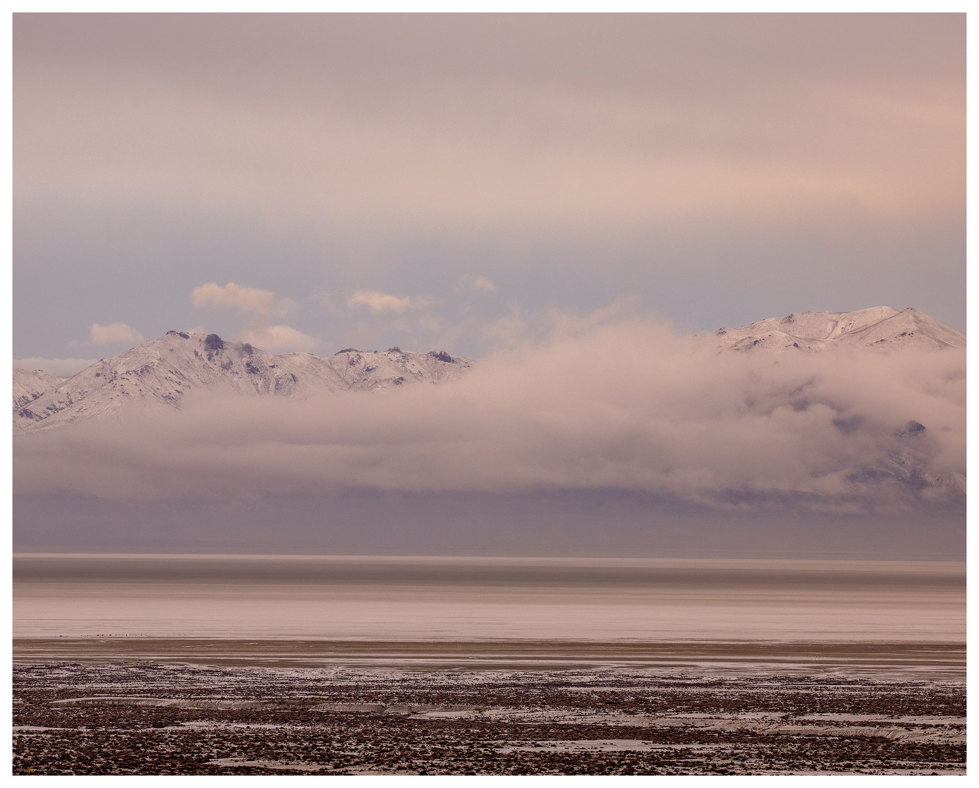
Calico snow. The playa in its atypical blanket of white below the breaking storm.

Late Snow Collection

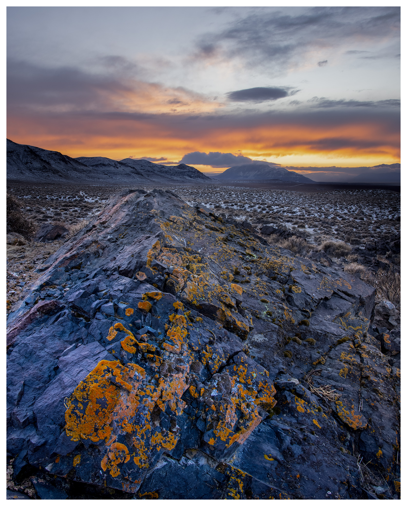
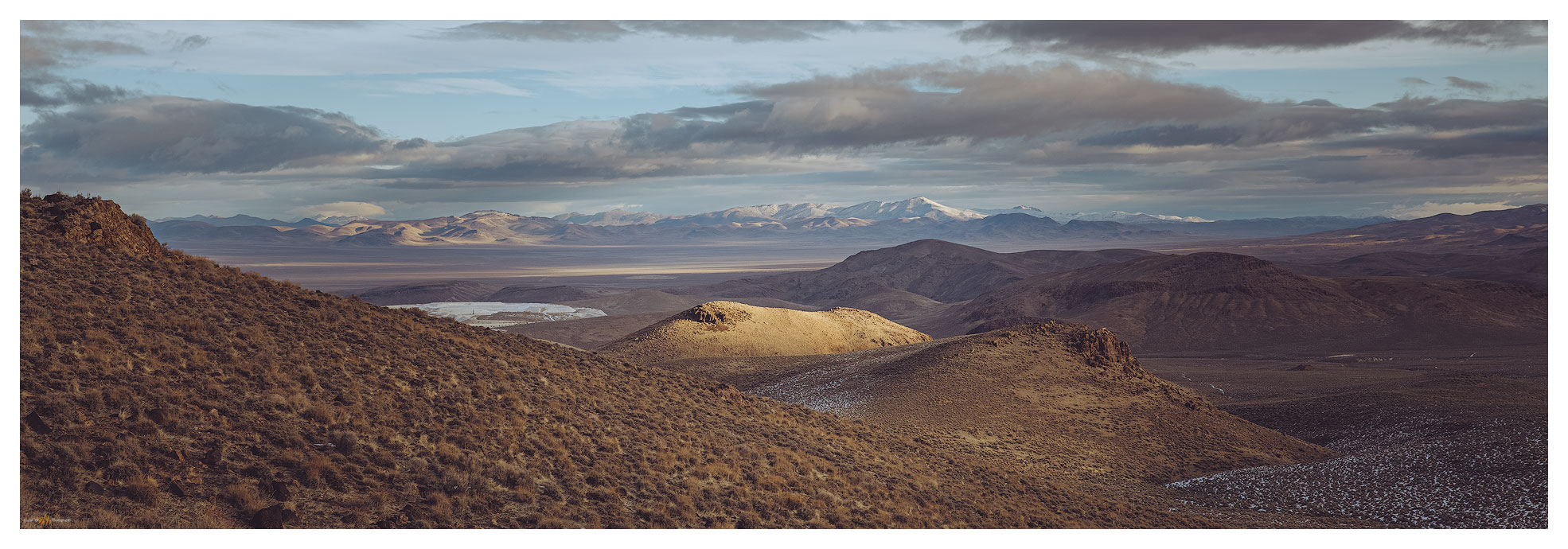
Traversing a series of alluvial gullies cut into lacustrine sediment of pluvial Lake Lahontan, I worked my way to a set of rocky outcrops highlighted by orange lichen dampened by the recent snow. From these rocks I could play with a variety of compositions in all directions.

I kept telling myself to go slow, pick a composition and work with the light that was building as the sun began to peak from the horizon on its way to evening. However, the receding squalls behind me — to the east — continued a shadow-play of cloud shapes and snow-fall curtains. While I concentrated on the light show in the west, I did turn for the occasional image in the darkening clouds — sometimes the two interacted and rewarded me with fantastic opportunities. This perspective called for a wide-view. Other times, I just watched in the moment. It was a special evening.
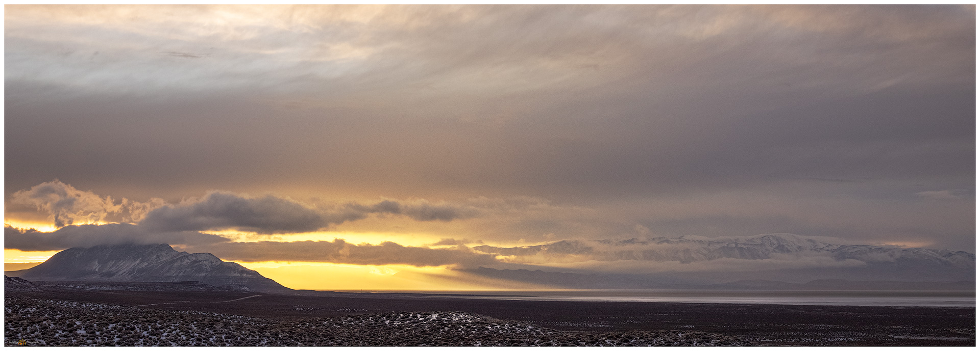

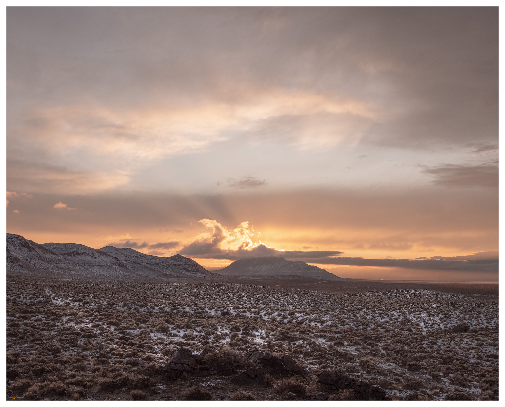
Black Rock Playa at Trego. As the storm receded it allowed the sunset to spread into the Black Rock Playa. (Please click for full view).
Passing snow. Dramatic mammatus clouds as the storm moves out of the Calico Mountains. (Please click for full view).
Two track to Trego. Traces in the snow hint at the old roads above the playa margin, it also makes a subtle pattern through the image.
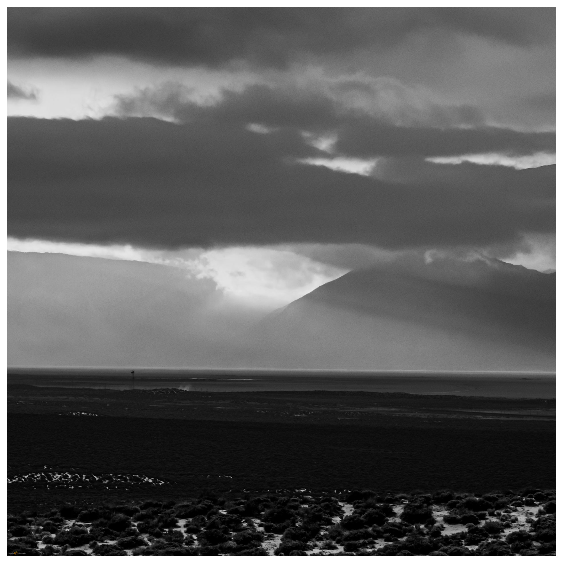
Shadows of Trego. An experiment in black and white; I am happy with the compressed view of the sunset and the break in the Granite Range. The steam of hot springs rise in the mid-ground.
Last Light at Trego. The requisite near-far rock-to-sky scene. Not at all subtle, but this was the feeling at the close of a wonderful day.

Late Snow Collection

A long drive home remained, but everything about the day contributed to a perfect overland excursion. From obsidian maps to playa snow to the requisite afterglow, I count this among the special ones.

Keep going.

Please respect the natural and cultural resources of our public lands.

#naturefirst #keepgoing

Nevada High Points #77: Desert Creek Mountains

D. Craig Young · February 26, 2021 · 1 Comment

Desert Creek Peak

8969 ft (2734 m); Gain 2740 ft

2021.01.17

With the post-holiday, pandemic surge still upon us, Darren and I continue to focus on target High Points in relative close proximity to home. The Desert Creek Mountains are basically a northern extension of the Sweetwater Mountains, but the local ranges and hills take on some isolated character. These relatively low mountain groups are cloaked in pinyon woodland where thick stands and downfall makes cross-country travel difficult. There are rarely trails in these brushy hills — I have been turned back on a few occasions because route-finding can take time. We would not be turned back on Desert Creek Peak, though we had a few moments of straight-on bushwhacking.

Desert Creek Peak Gallery

The road up Desert Creek is well-traveled and it seems a longer drive than I remember — Desna and I were in here to climb the Wellington Hills in 2004 (Christmas Eve, it was, 17 years ago). Darren and I, here in January 2021, navigate the rig through a couple creek crossings and then are stopped cold, literally, by the ice-choked creek. No need to be overly adventurous, we are here to walk, so we stash the truck and set out.

Frozen approach. The road turned cold, deep in the shade of Desert Creek.

Beyond the frozen crossing, most of the road was dry and snow was hit and miss on north-facing slopes. Crossing directly below the summit, only a mile away, but almost 3000 feet above us, we chose the southern ridge to begin the steep hike.

Desert Creek Peak. We hiked the right-hand, pinyon-covered ridge to approach the summit from the south.

The weather was perfect for this outing, sunny and calm. We worked our way through pinyon, taking snow patches and frosty gullies to avoid heavy stands but otherwise following game trails in switchbacks among the pines.

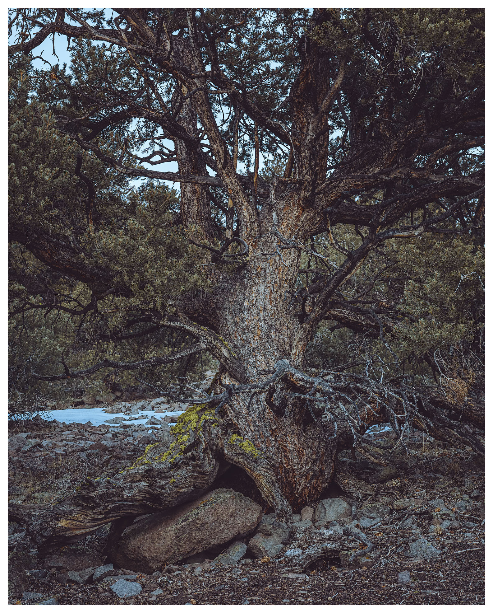
An old one. Pinyon of the local ranges is rarely more than a century old, though trees that survived the logging of the gold and silver days, can still be found.
Into the sun. Darren pushing through the pinyon on the western slopes of Desert Creek Peak.

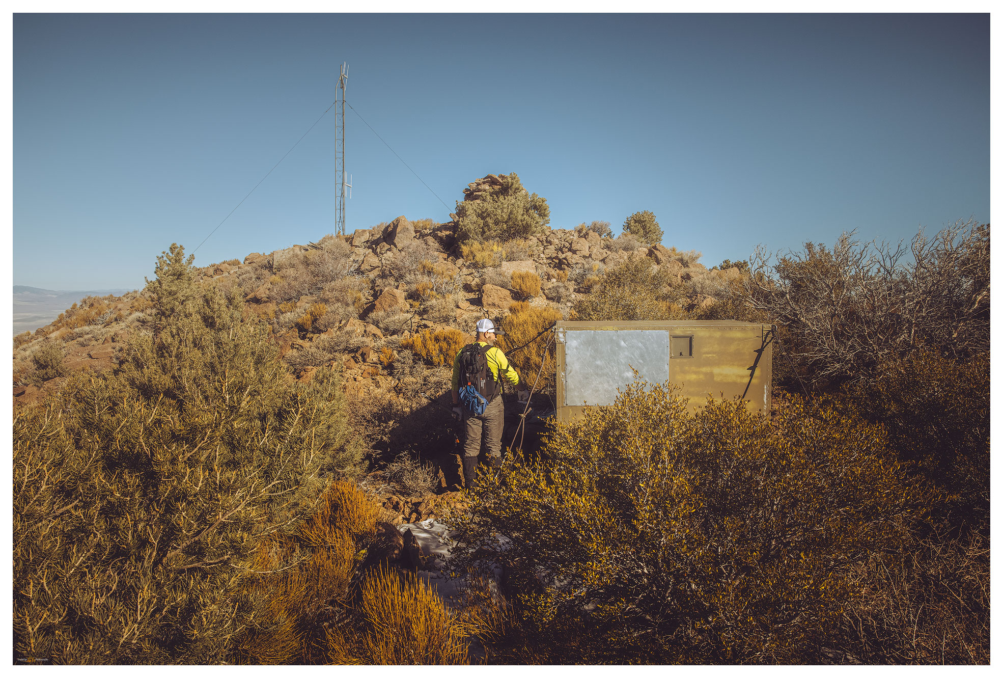
In a steady hour of climbing through the woodland, we eventually made the summit ridge, following a series of rocky steps with scattered young pinyon and bitterbrush. An antennae and the large rock cairn marked the summit just shy of 9000 feet in altitude. An amazing blue and very calm sky met us, and we soaked in the sun.

Summit things. Battery storage for the 1960s repeater or receiver — maybe a game-tracking station?

Steep descents of trail-less slopes pound the quads and, I could be sure, these would echo for a few days afterward. Desert Creek Peak is prominent from southern Smith Valley, and what it lacks in adventure, it makes up for in views of Sierra and the Sweetwaters. Mount Grant and the Pine Grove Hills rest under the sun to the east. It is nice to fill in this gap on the map with #77, every step worthwhile.

It is also nice that we are home in the early afternoon. Bonus points: stopping at Rosie’s in Wellington to bring home dinner!

Click on image for larger view.
Summit view. Antelope Valley and Silver King area of the Sierra to the west.

Desert Creek Peak Gallery

Keep going.

Nevada High Points #76: Montezuma Range and Clayton Dunes Overland

D. Craig Young · February 22, 2021 · 7 Comments

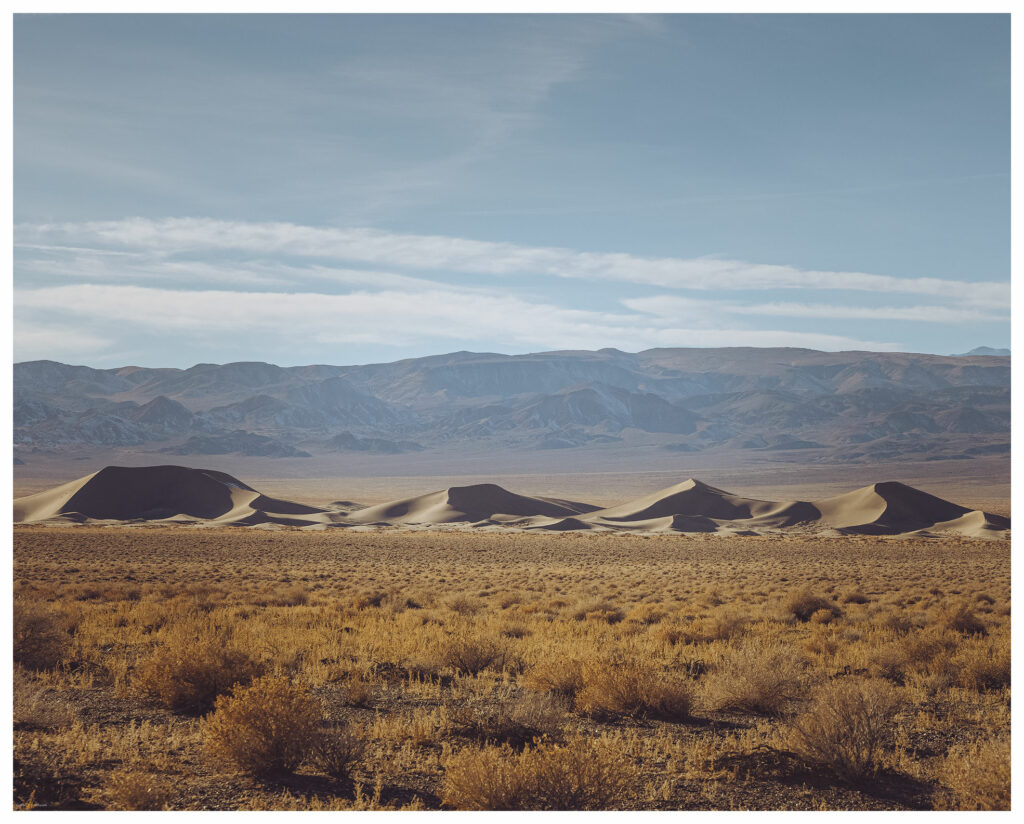
Clayton Dunes.

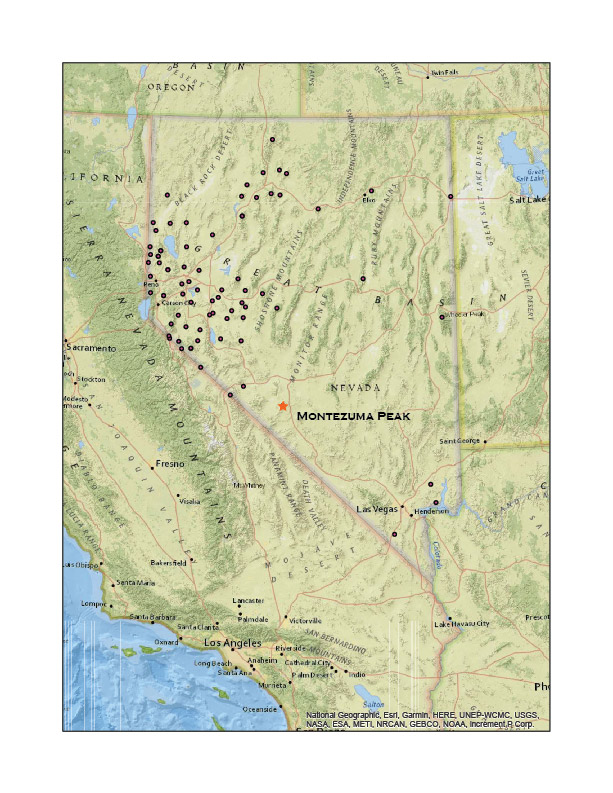
Montezuma Peak

8373 ft (2552 m); Gain 1624 ft

2021.01.09

It was time for the initial ‘Second Friday’ excursion in 2021. Snow squalls had come and gone during the week, so our plan was to head south into the southern Great Basin so that the daytime temperatures would be somewhat warm and snow might be less in the higher elevations. Darren and I chose Montezuma Peak for our target, and I picked the dunes of Clayton Valley for our two-night camp.

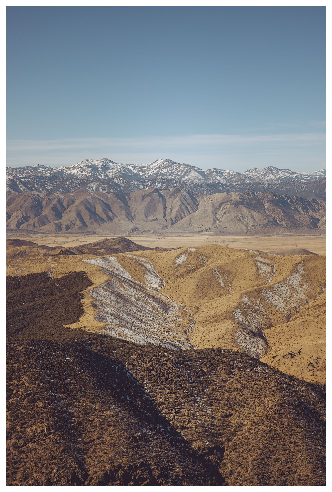
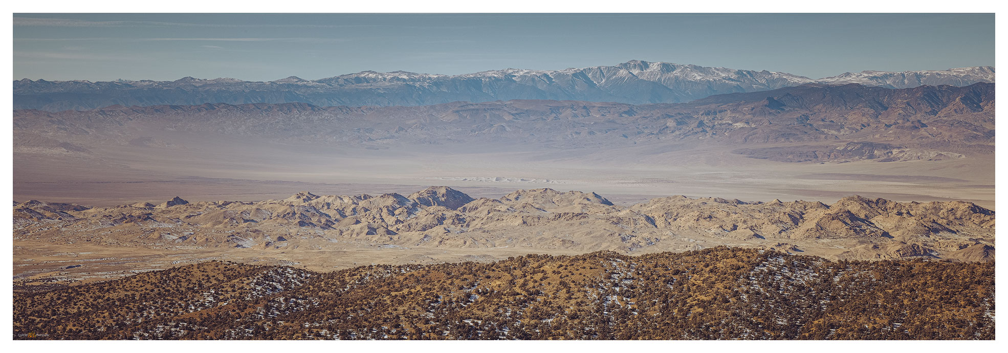
Clayton Valley. View from Montezuma Peak with Clayton Dunes, Silver Peak Range, and the White Mountains in the distance.

I met Darren in Carson City late on Friday morning. With a stop for fuel and a few supplies, we were soon on the straightaways of Highway 95 heading toward Tonopah, Nevada. We turn south toward Silver Peak, dropping past ‘The Crater’ and into Clayton Valley. I camped in Clayton Valley on my first Second Friday excursion in January of last year — in the before times. At the time, I had made the dunes a future destination and worthy of a look.

Clayton Dunes Collection

We arrived at the dunes at sunset. Rising prominently about a mile from the road, the dunes have no maintained access and off-road vehicle activity appears to be quiet in the winter. A sandy (obviously) two-track leads into the dune’s east side; however, I was not sure the truck and trailer would make it — a meter-deep arroyo had taken over portions of the track and small dunes rolled across others. We ditched the trailer by the turn-out and explored the two-track with the truck. It was fine and sandy. Returned for the trailer and set camp as the darkness closed in.

Winds were forecast, but at dinner we commented on the calmness and its relative warmth. A coyote sang in the distance. Watching the stars and mapping out the lights on the distant side of the valley, we noticed the lights of the evaporation ponds dimming and disappearing. The pinpricks of streetlights at Silver Peak were bright against the mountains. Slowly they, too, vanished.

We sat perplexed until a quick gust of wind rattled the table and an empty beer can. The smell of the night changed. Another gust. Dust storm!

The silt engulfed us reflecting a fog of headlamp and not much else. The vanishing lights explained. We hunkered in momentarily and then thought we should make the most of this. Let’s climb the dunes. We worked our way in our silt halos watching white-outs of sand blast from dune crests — the dunes migrating under our feet.

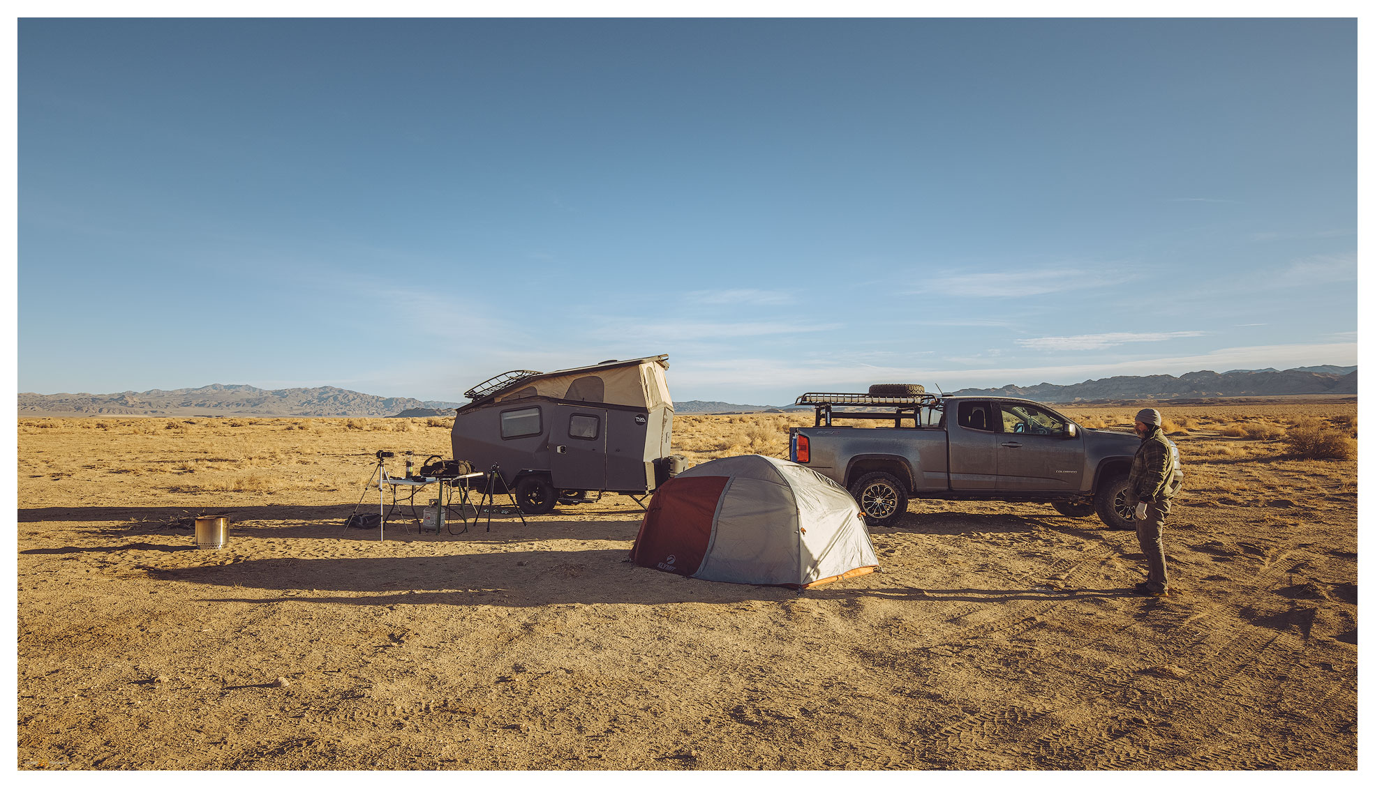
Clayton Camp. My Taxa Cricket with Darren’s tent; our common overland camp configuration.

The morning was bright, a low cloud at the horizon evaporating at sunrise. We waited for golden light on the dune, but the uplands to the east were calling. The road to Montezuma, a historic-era mining town, is well-maintained and its upper reaches access private property and modern infrastructure, but respecting the properties is easily done.

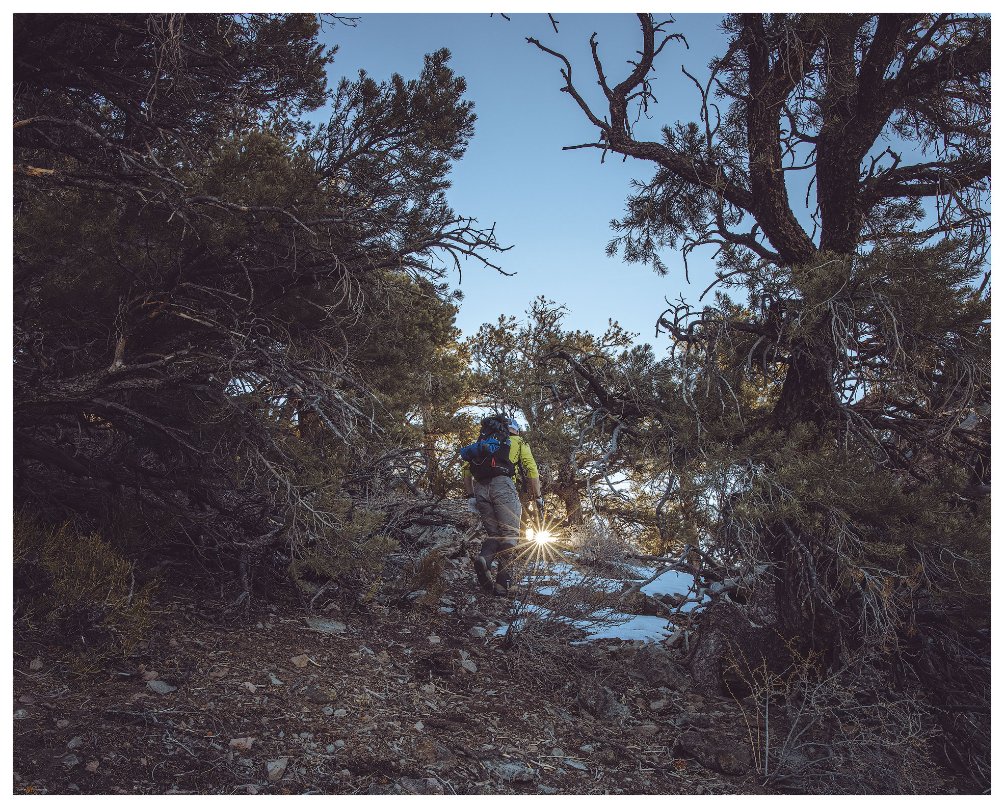
A so-called ‘pack trail’, variously marked on different maps, led to a pass that crests at the northeast ridge of Montezuma Peak. It is a simple, enjoyable hike from there. Snow patches were not deep even though we approached on north-facing slopes.

Montezuma Peak Collection

Montezuma approach. Leaving the pack trail we enjoy rock cross-country hike toward the rounded summit.
Toward Mud Lake. Summit view to the northeast toward the playa of Mud Lake.
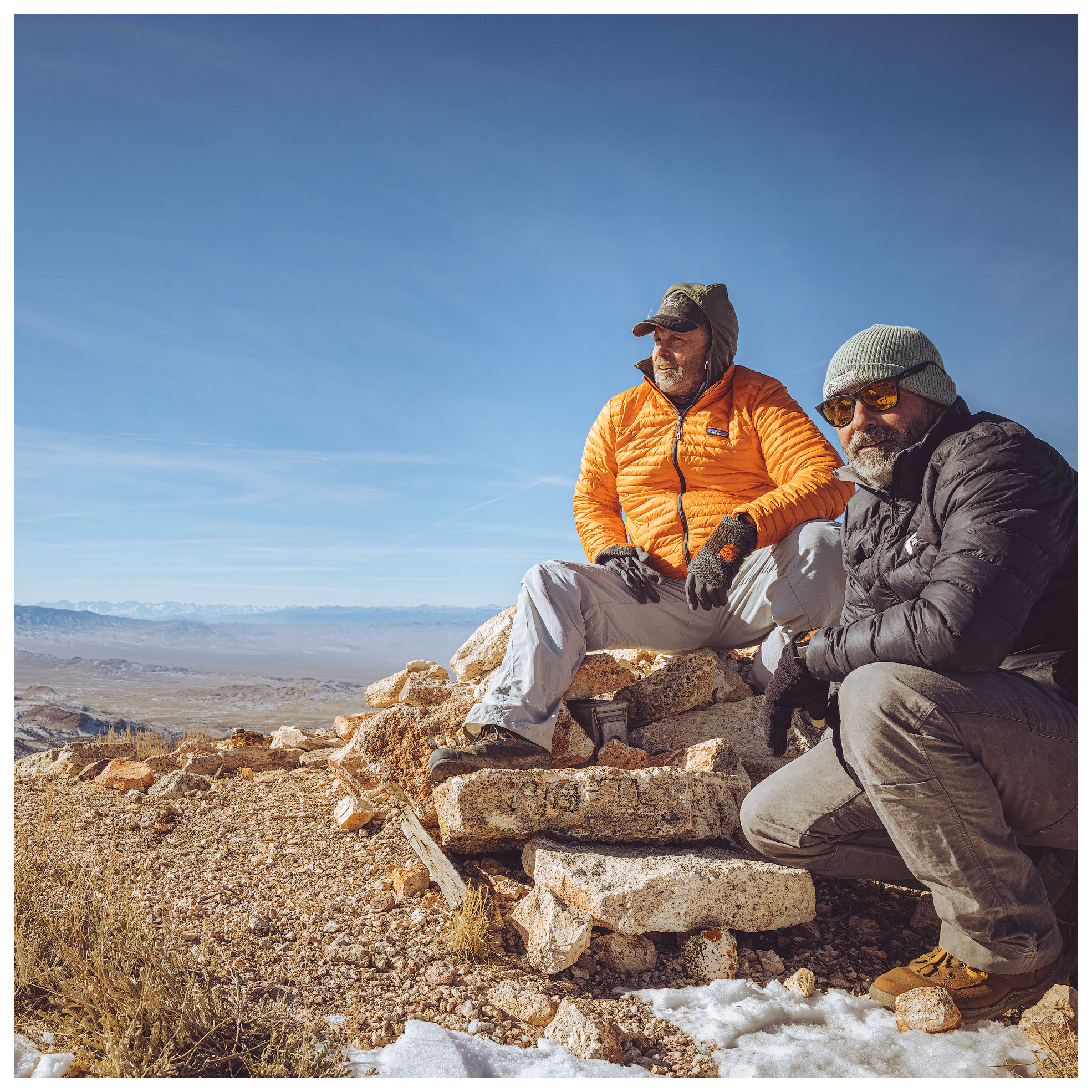
Summit moment. The night’s wind brought the day’s cold — we did not linger.

Back at in the dunes we wandered, following animal tracks and composing photographs for the promising sunset. I also wanted to get the know the dunescape so we could catch the early light and the great shadow play of mid-morning sun angles on the curving dunes. I tried a few things but the cold was coming hard and fast. We prepared for dinner noticing that any liquid that hit the table froze immediately. Our hands numbed if we moved anywhere away from the stove. I turned on the trailer heater so we could lounge inside, but we kept to star-gazing and the pleasure of our well-contained campfire. It is something of a challenge to stay up in the winter-darkness, so we were relieved that the time passed quickly among our conversations about future trips, natural history, photography, and video ideas. And likely a myriad other things.

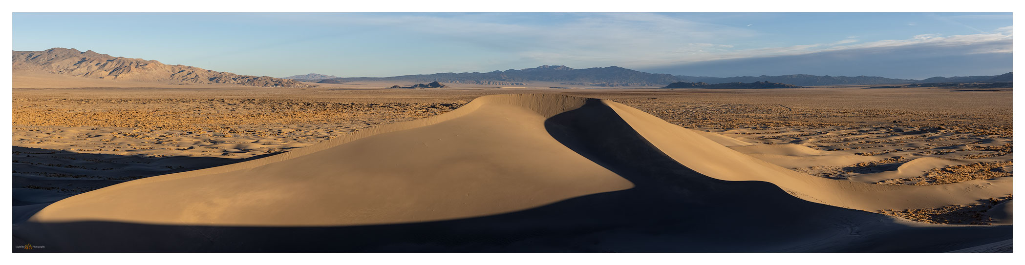
Clayton Dunes. Basin alluvium arranged by wind the basin bottomlands.

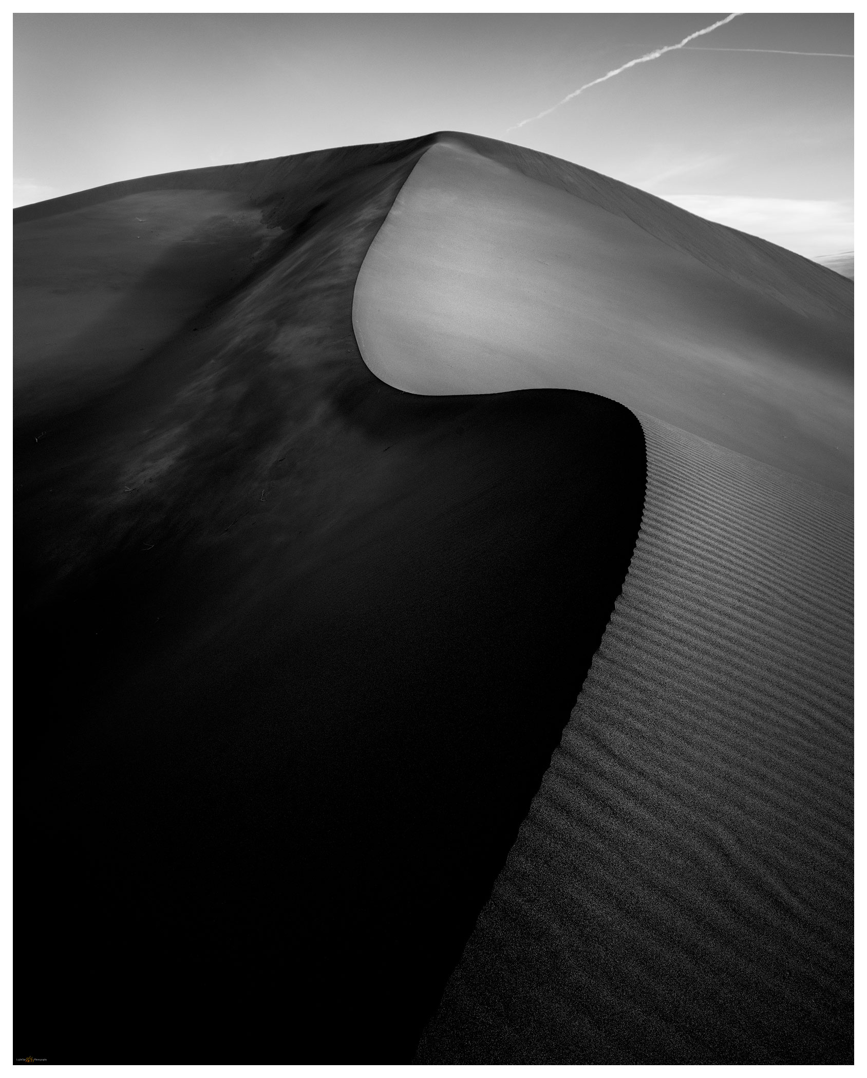
Because the evening shoot in the dunes did not materialize, I wanted hoped for success in the morning. I climbed the dune well before dawn, it was dramatically cold (in camp, our five gallon water jug was a solid block). The simple star dune in the midst of the dunefield provide the S-curve I wanted. I could have a play with first light against the dark of the dune shadow. The shadow area held a frost, giving it some highlights reflecting the sky, something I had not seen on a dune previously — of course, I’m not often on a dune in single-digit (F) temperatures. It was very satisfying, and I warmed quickly with my success.

Frosted dune. Feeling the mood of the dune at first light (three-image focus stack).

Darren was hiking his own quadrant of the dune but soon joined me for a few long moments enjoying the quiet, expansive views. This first overland of 2021 had worked out nicely; we had a fast peak and some slow time in the dunes. We had the excitement of the dust storm and the calm of the refreshed, trackless dune on the cold morning. It was, however, time to head home and plan our next overland/photo excursion.

Clayton Dunes Collection

North dune. A five-image pano from the dune apex, looking north across Clayton Valley.

Keep going.

Please respect the natural and cultural resources of our public lands.

#naturefirst #keepgoing

Nevada High Points #75: Trinity Range

D. Craig Young · February 21, 2021 · 1 Comment

Trinity Peak

7337 ft (2235 m); Gain 2005 ft

2021.01.03

I have a long-held goal, contrived in the early 1990s, of climbing the high points of Nevada’s named ranges. I have known a few who claim to have achieved the feat, and I do not doubt their success. Although I doubt I’ll reach the goal of every highpoint summit, the goal has always been motivation (or, an excuse) to get into the Nevada outback and experience places I might not visit otherwise.

My successes have been limited lately, but it is time to ‘re’-turn in the direction of Nevada summits, those obvious and the many obscure. Maybe this is a resolution for the New Year, and 2021 is probably a good time for a reset. Besides, the outback is the muse to my photography-geoarchaeology-trail running pursuits that form most days. Although the goal may be unobtainable — I have catalogued 352 named ranges, mountains, and stand-alone hills, and several rest behind military fences, it gets us into the landscape where the interplay of art and science is always at-hand. And, it is just plain fun; let’s keep going…

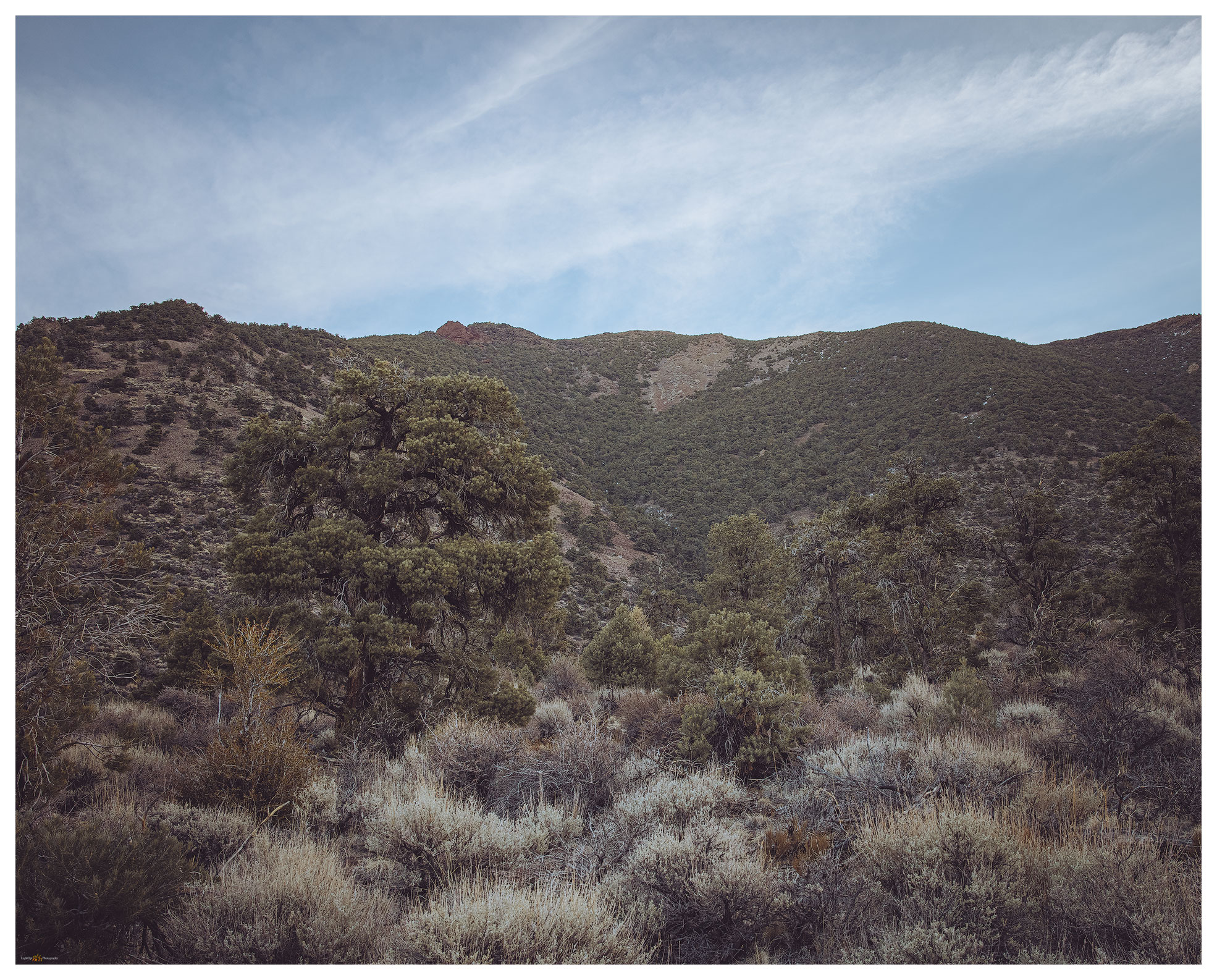
Trinity approach.

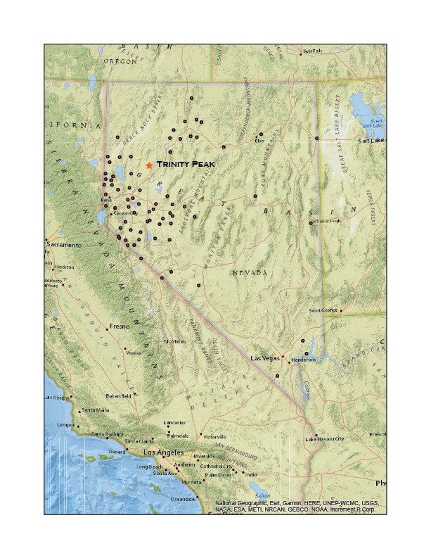
A break in the weather called for a summit day, choosing an unclimbed range within, say, a three-hour drive of StoneHeart. Trinity Peak is the high point of a volcanic range rising in generally rolling hills west of the Humboldt River. Ragged Top has some interesting craggy outcrops, but it stands a couple hundred feet lower at the southern end of the range.

We left the interstate at Lovelock, turning west on the Hwy 399 toward Trinity Pass and the Eagle Picher Mine at Seven Troughs Road. Clouds hung low over the range but it looked a good morning for a walk. The two-tracks away from the main road were slick and slimey; it was warm enough to melt but cold enough to maintain a general snowcover. I immediately realized my gaiters were still packed at home. The snow was not at all deep, but occasional steps would bring a good batch of snow and mud over the boot-tops.

Trinity Peak Collection

We climbed easily across lower slopes, intersecting drainages and then turning higher to get a snowless ridge or outcrop. We did not rush; the temperature was perfect and there was practically no wind. One of those good days in the Nevada outback.

The Trinity Range is a north-south-trending range — like most in Nevada’s Basin and Range province — that bounds the expansive Granite Springs Valley to the west and drops to broad fans and the Humboldt River to the east. It is the western most range in a cluster of small mountains and hills in the ‘Blue Wing Triangle’ south of the Black Rock Desert, east of Pyramid Lake, and north and east of the Humboldt River, where vast dry basins are cut by often steeply faulted hills. There are few springs or other water sources. Pronghorn are common, as are soaring raptors.

Today, however, it is quiet and only a few of the little brown birds accompany us. We hit one false summit at about mile two. From this outcrop the summit rose from a boulder-strewn tableland. Yellow and orange lichen decorated the way.

Trinity ridge leading from a false summit outcrop.

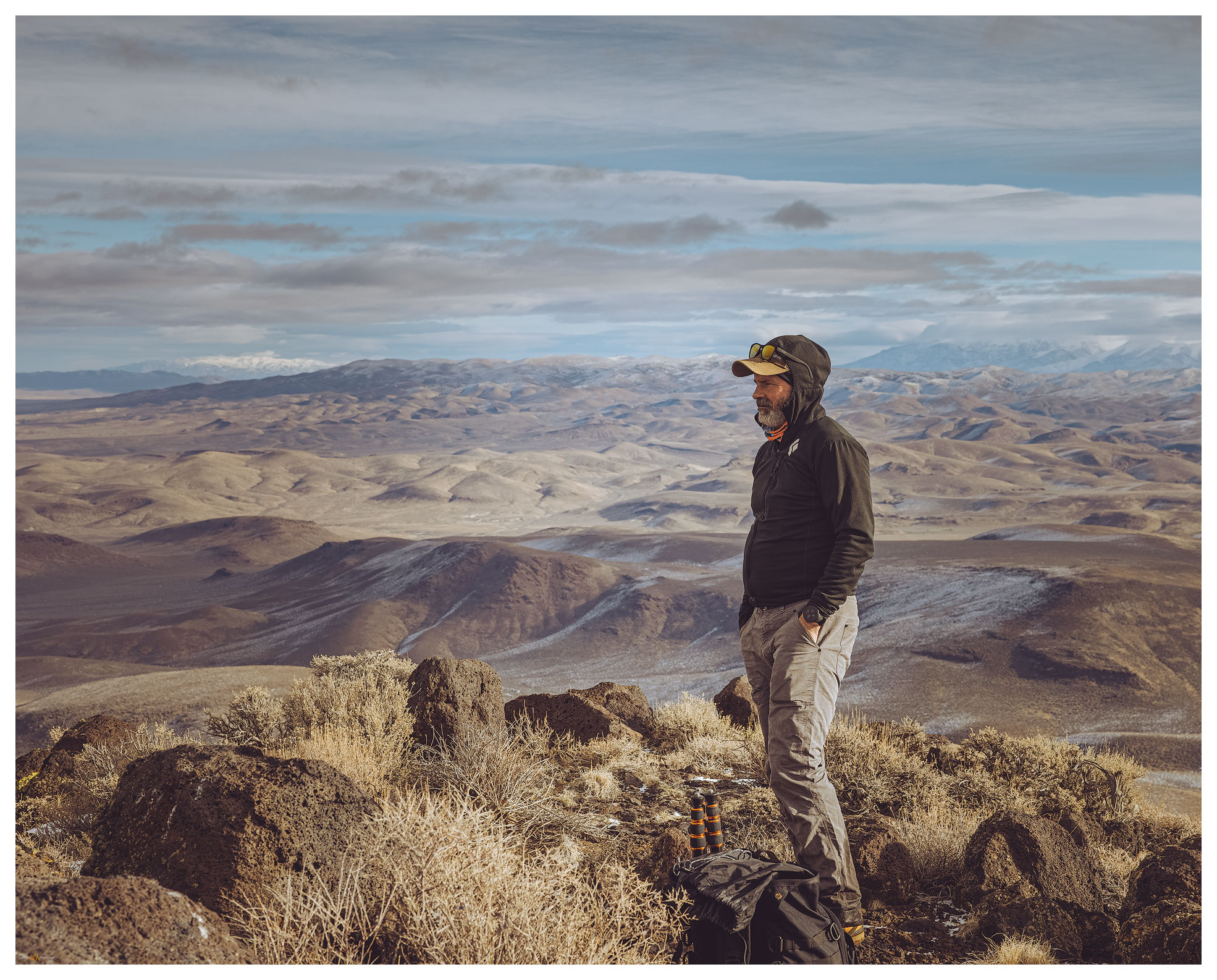
We skirted the snow fields to keep our feet dry and enjoyed the casual walk. Our paths split to explore minor outcrops below the summit. Darren was on top first, noting the typical survey lathes and guy-wires from historic-era mapping efforts. A brass cap marked a prominent boulder.

Darren on Trinity summit. A good time to not hurry.
Summit register, nicely not a popular stop.

We planned future excursions into the ‘Blue Wing Triangle’. This is an easy day trip and better overland excursion area where six or seven additional highpoints remain on my list. Winter excursions remain possible and it is an all-season area in general, although watching for the swift changes of any winter storm is critical. Public lands grazing is most common activity in the ‘triangle’ but encountering others is relatively rare.

Granite Springs below. West view from summit ridge of Trinity Peak, overlooking Granite Springs Valley to the Shawave Mountains under low clouds.
Toward Majuba. Sun strike on foothills of middle Trinity Range, on approach to Trinity Peak, north over Sage Valley toward Majuba Mountains.

Please remember to tread lightly and respect the resources and beauty of your public lands. Respect private lands, leave the gates as you find them. Pack it out. Nature First,

Trinity Peak Collection

A good start to 2021 and perfect for an easy Sunday morning adventure. We have plenty to look forward to. Maybe I can put a dent in the long list of high points yet to explore, one at a time, step after step.

Keep going.

Please respect the natural and cultural resources of our public lands.
#naturefirst #keepgoing

Obsidian Traces: Mapping Majuba

D. Craig Young · February 7, 2021 · 1 Comment

Patterned Ground Video Series #3

Obsidian, a form of volcanic glass, is a key constituent of traditional toolkits — and the detritus of tool manufacture — found in archaeological sites throughout the Great Basin of western North America. It was preferred, in many ways, because of its absolutely sharp edges and the relative ease with which tools and edges can be created. Skilled toolmakers can create complex, almost artistic, hunting technology, while even the most unskilled user can fracture a piece of obsidian to create a utilitarian cutting edge, if need be.

In the volcanic rocks of the Basin and Range geologic province, obsidian is relatively common and can be found in prominent glassy outcrops or as cobbles and gravels spread across the landscape. Its utility to traditional foragers needing a reliable toolkit and the availability of obsidian as raw material result in its common presence in archaeological sites — sometimes it is the only material present to indicate the passing of people through the Great Basin past.

Recce route at Poker Brown Wash in the region of Majuba and Seven Troughs obsidian sources.

What kind of stories can obsidian tell archaeologists? Formed during volcanic eruptions, each obsidian has a unique geochemical signature. The obsidian from Volcano #1 can be easily distinguished from the obsidian of Volcano #2. If we find obsidian from Volcano #1 in our site, we know that people visited Volcano #1 to get toolstone or that they traded with people who had visited Volcano #1. We can think similar things if we find artifacts or waste material made of obsidian from Volcano #2. If Volcano #1 is far away from our study-site, we can surmise that either people or obsidian trade items moved a long way. Maybe obsidian from Volcano #1 is common in older parts of the site, while obsidian from Volcano #2 is only from more recent deposits; it becomes clear then that the movement of people, raw material, and artifacts changed over time — maybe it was different people or maybe access to Volcano #1 was cut off by new inhabitants around that obsidian, so the villagers began to rely on Volcano #2. Any way you look at it (or argue about it), there is a lot of potential information in obsidian artifacts. But to fully realize that potential, we also need to know about the volcanoes!

Where were the original eruptions? Is the obsidian localized or is it spread over vast areas? Many obsidians erupted millions of years ago; in the meantime, mountain-building earthquakes and eroding rains and rivers have erased the original volcanoes, but yet the obsidian can still be found. If we are going to ask questions of the obsidian at archaeological sites, we need to know the natural distribution of obsidian raw material created by past volcanic events.

I have been searching the Patterned Ground of ancient obsidian nodules to help my archaeological colleagues create better maps relating archaeological sites and their artifacts to the raw material of obsidian toolstone. We know many of the ‘primary’ locations (i.e., a few spots on a map), but the forces that rearrange the volcanic remnants of the Great Basin landscape leave many unknowns — many sources are not spots, they are vast blobs, often tens, even 100s of miles across. Sometimes a single geochemical source — obsidian from the same eruption — is separated by mountain ranges with little or no obsidian in between. In Obsidian Traces, I continue to search for clues in the patterns of the obsidian landscape of the Great Basin.

  • « Go to Previous Page
  • Page 1
  • Interim pages omitted …
  • Page 12
  • Page 13
  • Page 14
  • Page 15
  • Page 16
  • Go to Next Page »

Trail Option

Copyright © 2026 · Monochrome Pro on Genesis Framework · WordPress · Log in

  • Contact TrailOption
  • Substack
  • Waypoints Bibliography
  • Young Archives