• Skip to primary navigation
  • Skip to main content

Trail Option

A personal geography of landscape and place, art and geo-science.

  • Home
  • TrailOption Blog
  • WayPoints
  • Galleries
  • About
  • Contact TrailOption
  • Subscribe!
  • Show Search
Hide Search

Mojave Desert

Nevada High Points #98 – Gold Mountain

D. Craig Young · March 12, 2022 · 1 Comment

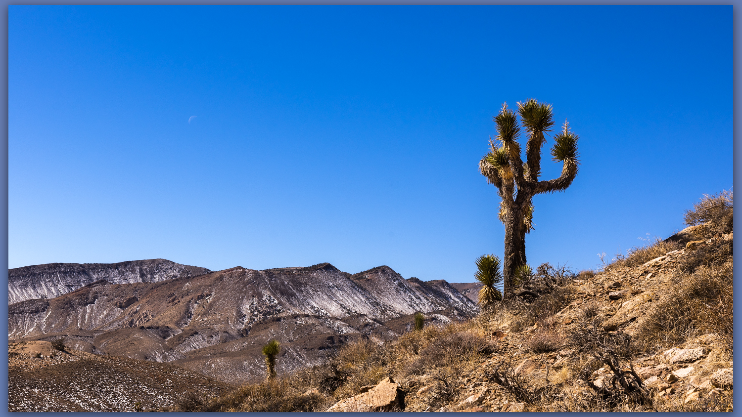
A Joshua. Westward from slopes of Gold Mountain, Mojave Desert, NV, USA

Gold Mountain

8152 ft (2485 m) – 2300 ft gain

2022.02.25

Gold Mountain Collection

It was finally time to get back to a desert high point – my string of monthly highpoints having been broken by a wonderful trip to Patagonia and Atacama Desert in Chile (stories and images coming soon).

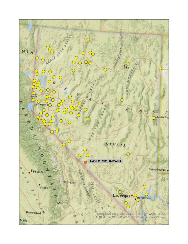
Although we have not had good precipitation in 2022, a couple slider storms have left dustings in the high country and access can be an undesired, muddy adventure as early runoff continues. With this in mind, Darren and I ventured southward into the Mojave to find the south-facing slopes of Gold Mountain above Bonnie Claire Flat. It is a long but easy drive through Tonopah and Goldfield before turning west toward Scotty’s Castle and the former northern, paved entrance to Death Valley National Park – the road remains closed where, several years ago, the headward drainage of an alluvial fan reclaimed the highway near the castle grounds. It makes for a quiet section of highway along Bonnie Claire between Gold Mountain and the Grapevine Mountains.
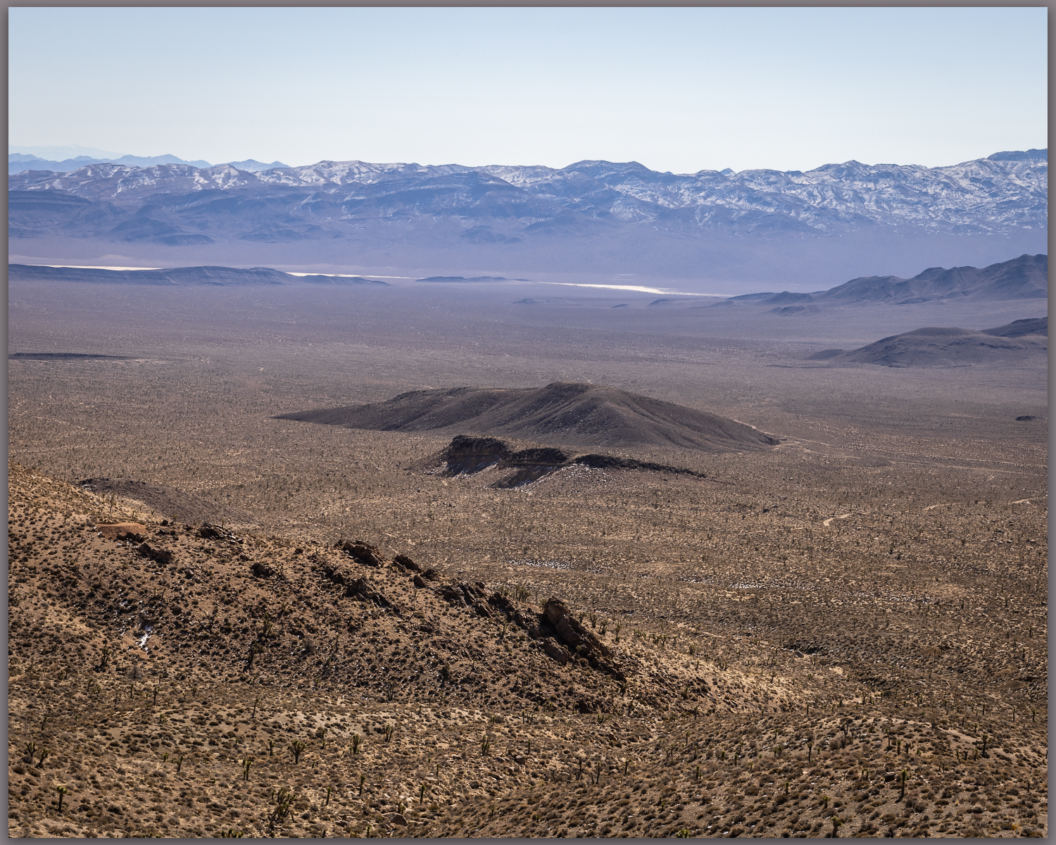
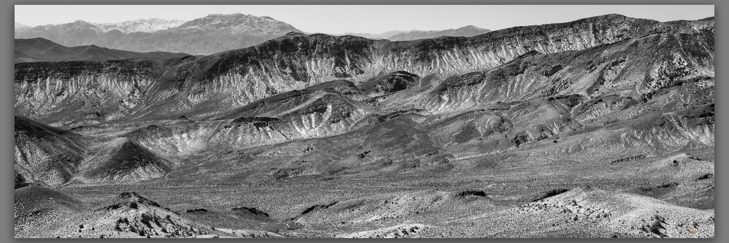
Bonnie Claire Flat. Southern slopes of Gold Mountain, Mojave Desert, NV, USA
Bonnie Claire distance. Southeast toward Obsidian Butte, Mojave Desert, NV, USA
Bonnie Claire Flat. Southern slopes of Gold Mountain, Mojave Desert, NV, USA

We turn northward up the fan, encountering traces of Bonnie Claire Airfield before tracing our way to some mining prospects at the toe of the mountain front. There is a cool breeze as we head out, but we are soon warm as we gain elevation. On a moderate slope we walk up loose, dusty scree with Joshua trees scattered among granitic boulders. Prospects dot the hillsides where seams of hydro-altered rocks and occasional volcanic dikes run through their host outcrops; these intrepid miners chased riches promised by the historic strikes of nearby districts, and who could pass up “Gold Mountain”?
Snow remains. North slopes hold fading winter moisure, Mojave Desert, NV, USA

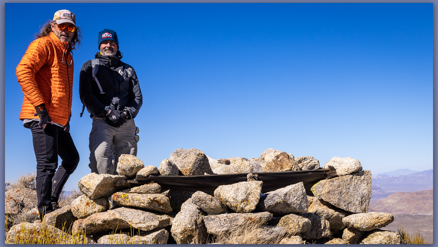
The scattered Joshua trees give way, with elevation, to a pinyon woodland where a few Pinyon Jays call out – I fail to see the talkative birds, however.  Darren reaches a small cornice which preserves the recent snowy turbidity of recent storms; the small wave climbs from the ridgeline but we step over and through to reach the rocky slope of the summit outcrop. A square cairn protrudes from the summit where we can look westward to the Sierran Crest and eastward into the Basin and Range. It is a simple but very worthwhile summit, as is most often the case in the smaller isolated ranges throughout Nevada.
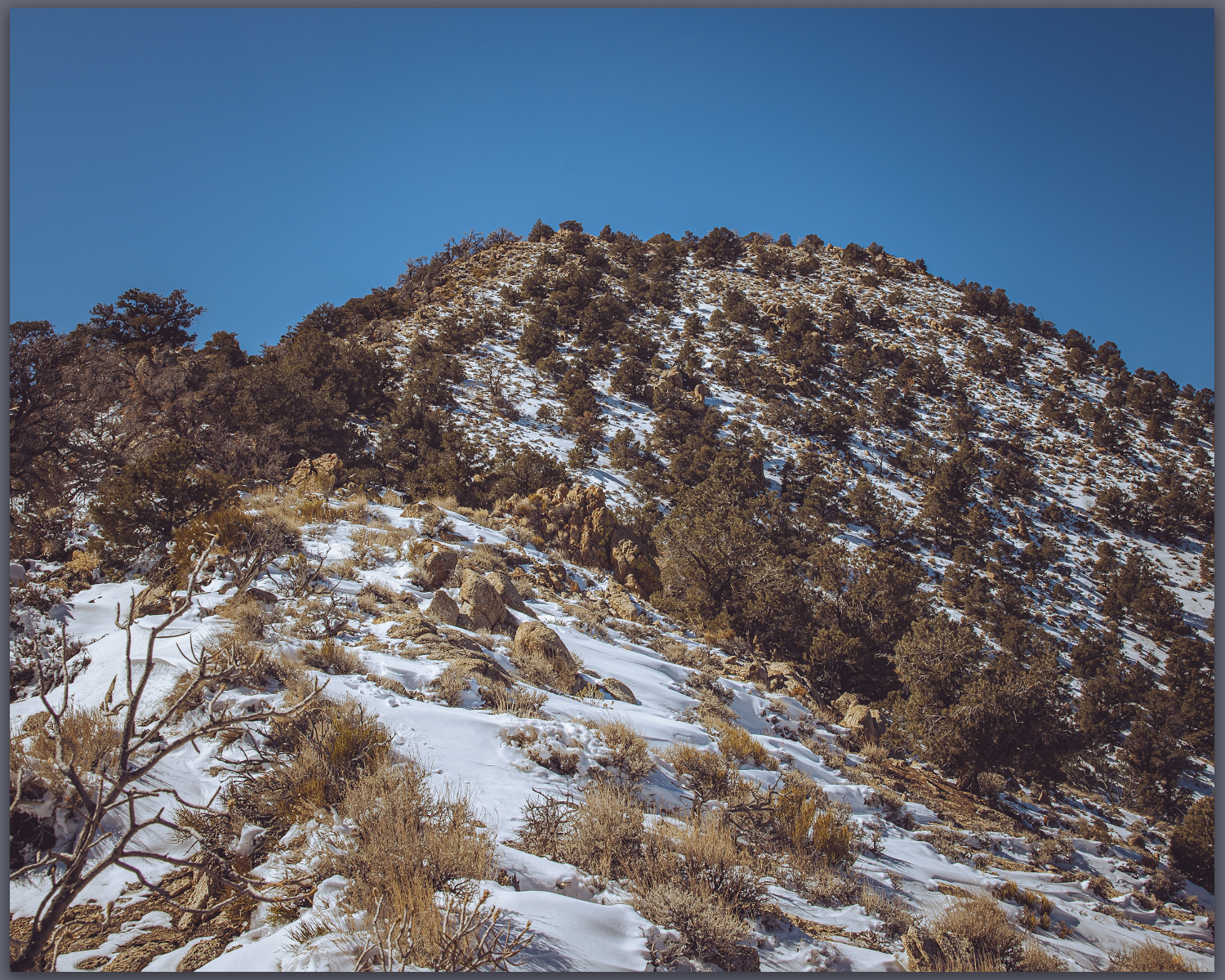
Gold summit ridge. Pinyon woodland near the summit of Gold Mountain, Mojave Desert, NV, USA
Summit time. The brothers at the summit cairn of Gold Mountain, Mojave Desert, NV, USA
Gold Mountain. The summit rises above Joshua tree canyons, Gold Mountain, Mojave Desert, NV, USA

Gold Canyon Collection

We drop southward to look for one of the larger prospects among a dense pinyon grove. Our descent takes us too far west, a bouldery outcrop and sandy canyon drawing us downward.  I am not, however, overly fascinated by the old mines, so we take the descent following game trails toward the fans that feed into Bonnie Clair. We are quickly back to the truck where we marvel at the afternoon warmth. It is time to return to the chill of the northern valleys and we head homeward. A good day for a high point outing, taking advantage of windshield time to catch up with my brother and feel the warmth of a winter day at the edge of Death Valley. 

Keep going.

Please respect the natural and cultural resources of our public lands.

#naturefirst #keepgoing

Nevada High Points #94 – Bird Spring Range

D. Craig Young · December 4, 2021 · Leave a Comment

False glitter. The lights of Las Vegas, Bird Spring Mountains, Mojave Desert, USA

Peak 5695

5695 ft (1736 m) – 1050 gain

2021.10.15

Peak 5965 – Bird Spring Range Photo Collection

Thankfully, my time in Vegas was about over. Leaving the conference hotel in the early evening, I worked my way south toward Jean, Nevada, eventually turning west toward Goodsprings. I hit the flaggy cobble-strewn track cut into the carbonate fans at the western slopes of the Bird Spring Range; the track parallels a dendritic dry wash draining the southern end of the Spring Mountains, of which the Bird Springs are a southeastern extension. The road, incised by consistent travel, cuts through a rocky plan of Joshua Trees and creosote. A smoother, less-used track heads into a broad swale in the northeastern portion of the range. I do not want to drive too far, as it looks like tracks head toward the summit ridge, so I find a turn out and settle into an evening walk.

Bird Spring approach. An easy evening walk to the high point of the Bird Spring Range, Mojave Desert, USA
Cactus light. The sharp ends catch the last light of the evening, Bird Spring Range, Mojave Desert, USA

The light feels harsh until the sun is on the brink of the horizon, golden hour rushes past in mere minutes. I am, however, excited by the walk into nightfall, making way steadily up a useless vehicle trail. A few outcrops of gritty limestone punctuate the trail, where a bright waning moon is diligently chasing the sun. The upper steps of flaggy limestone are steep, and it seems the vehicles have forced their way to a rounded summit plateau. It is a dead-end drive, but I guess the lights of Las Vegas are the draw – and a cheap way to climb a mountain. Happy I am alone this evening.

Into the dark. Night settles in as I approach the steep summit trail, Bird Spring Range, Mojave Desert, USA

I find the summit cairn of Peak 5695, high point of the Bird Spring Range. Earth’s shadow has rocketed past, and the Vegas glitter shows its fleeting beauty – it does look fancy and promising from this height and distance. I am glad to have followed my previous morning outings with an evening one.

Summit register #94

Peak 5965 – Bird Spring Range Collection

The descent is slow in the cone of the headlamp light, ball-bearing gravel rolling on limestone steps. A Joshua Tree, with a reaching arm, startles me as it pops into the peripheral light, anthropomorphic brush at my shoulder. I laugh out loud, only to shiver at the sudden creepiness. But as things flatten in the canyon bottom, I enjoy the last of the moonlight.

It has been a good week of walks in the hills of southern Nevada’s Mojave Desert. I will admit, however, that the peak-bagging spree has begun to lose its magic. I needed the escape from the urbanity of Vegas, but the series of small peaks – though high points of named ranges – has felt hurried. I look forward to slowing down and moving further east on my future visits this far south.

Keep going.

Please respect the natural and cultural resources of our public lands.

#naturefirst #keepgoing

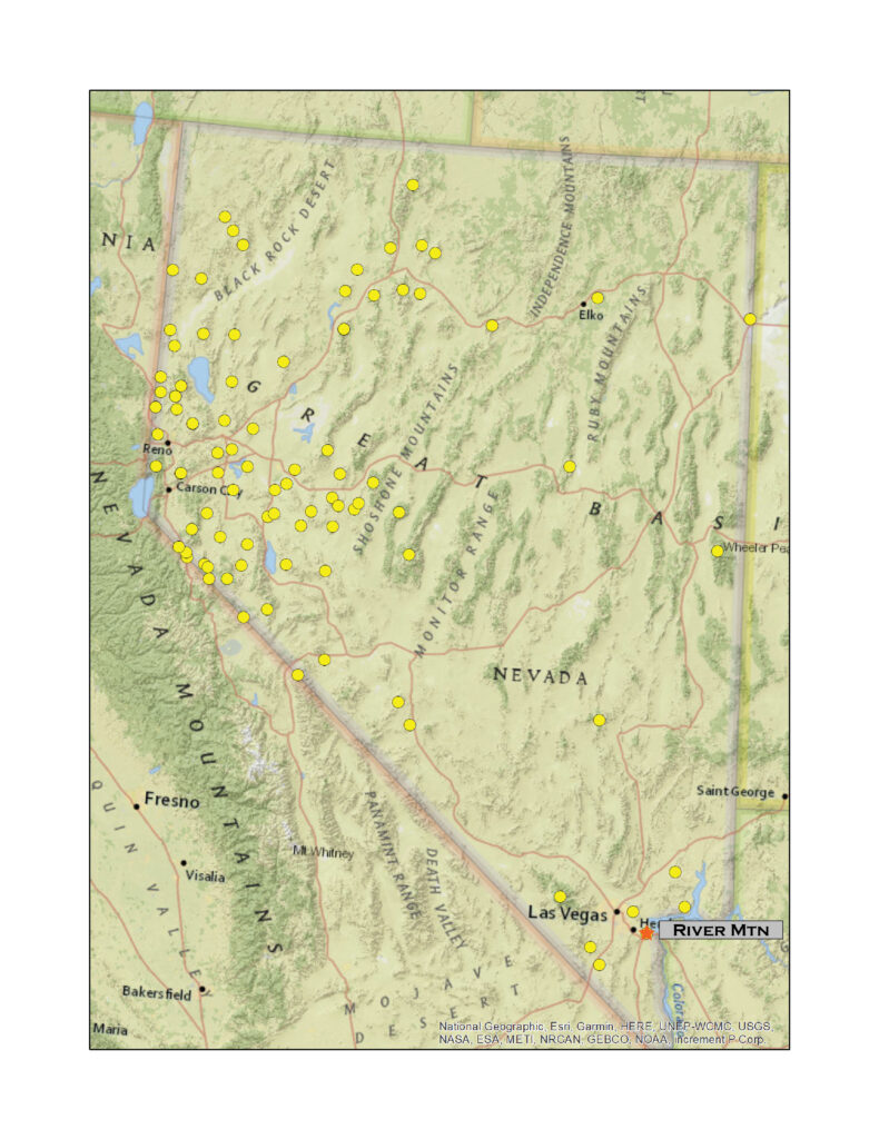
Nevada High Points #93 – River Mountains

D. Craig Young · December 1, 2021 · Leave a Comment

River Mountain

3789 ft (1155 m) – 1013 ft gain

2021.10.13

Away from hotel early, going for two days in a row. If I must hang around Vegas for the week, I can focus on a few highpoints in some of the smaller local ranges. Continuing east of the city, I shift southward from the Frenchman Mountains to the River Mountains above Boulder City and Lake Mead. I drive into Boulder City before sunrise and find the trailheads of Bootleg Canyon, a local mountain-bike mecca.

HP #93 Collection

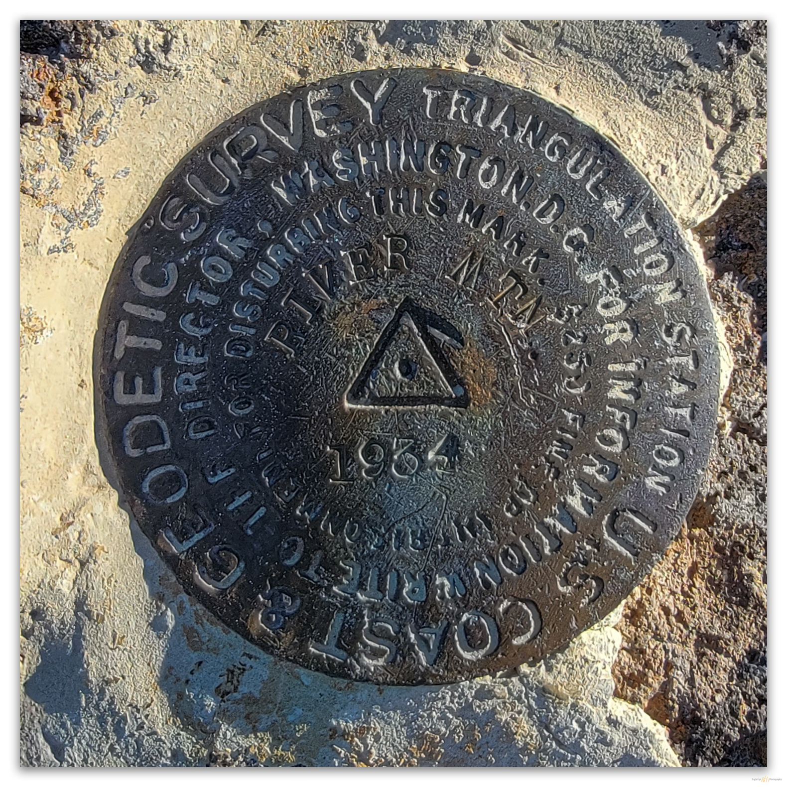
A summit marker on the rocks of River Mountain, Mojave Desert, USA

Film takes time, and processing Velvia is a bit of rough, and not so welcome, chemistry, or so I have come to realize. When will the 35mm slides return from the lab?  It has a been almost two months since I summited River Mountain and shared time with the ram. How will the photos turn out?  I’ll update the post with a few scans of the images, good or bad, as soon as they arrive.


I drive up-canyon a short distance and find a good parking area out of the way of any bikers that might show later. Starting out on one of the signed single-tracks, I soon abandon the trail to traverse the broad alluvial fan with several dendritic, inset gullies, eventually finding an access road that runs below a twin set of power lines. The crackle of Vegas punctuates the quiet morning as the endless hunger of paradise draws from the dammed river. The lines cut the pass between the River Mountain highpoint and the prominent scarp of Black Mountain to the south. I must get out from under the line, so I turn north to go direct up volcanic slopes – easily the steepest slope I have been on in a while. There is no trail. I step among the puzzled boulders of talus aprons and colluvial cones below two sets of outcrops before gaining the summit ridge. Easy rock-hopping winds north to a small summit cairn and some benchmarks. The summit has good views of the lake and a landscape of solar facilities to the south – both scars of our quest for power, clean as it might be.

My mountain walks remain a mix of exploration, simple and personal, and documentary photography.  While I am happy with many of the images I create on these walks, I do not think I am investing the amount of time or getting myself into positions with subject that tell the story of the mountain range and its setting. This goal is practically ignored on these pre-workday scrambles; I am basically just peak-bagging.  But today I decided to limit myself to film, working with my 40-year-old Canon AE-1 and Velvia 100. It feels good in my hand, like so many days in the mountains and deserts of my past.

Back to the future. The Canon AE-1, 35mm Velvia 100 on this summit day, but we will have to wait a bit for processing.

Once at the summit, I drop down along the standard trail – the summit register is a rather elaborate ammo-can, it is a popular destination. This will mean intersecting the powerline road again, but that will have to do. As this unfortunate thought burrowed into my head, I heard rock fall and talus crunching and scittering; then silence. Then again, and again. Tracing the sound back to the slopes just behind me, I finally notice a solo bighorn ram climbing easily to the col I just left. He is fabulous. As I’m dropping along the standard trail, I hear talus crunches somewhere nearby. Waiting for a short while, they repeat. I then notice a solo bighorn ram climbing to cross my recent track. He’s fabulous.

Only moments ago, before leaving the summit, I had changed to a 70-200mm lens hoping for a wildlife encounter. I had been thinking possible a desert tortoise or a pair of ravens, not a large, majestic ram. I have learned since that the River Mountains have a large, introduced population of desert bighorns, but, still, it felt a wonderful surprise at the moment. I practically burned the whole roll of 36 exposures on this guy. I hope I am getting the focus correct, this well-used lens is new to me. I’m shooting f/8 and typically around 1/125 or 1/250 of a second. Usually too slow for wildlife, but I am completely novice at working wildlife with analog film stock and camera. On digital I could jack up the ISO and get a high shutter speed, but film is not as flexible and requires talent to get results. Probably could have opened things up a bit, but I only have another stop or so with this lens. I am typically using one stop down to account for the bright sky, at least I think that is what I am reading from the camera. If the camera suggests F8, I set to F8 but then adjust shutter speed to have camera show F5.6 on the meter. I think it is telling me I am shooting one stop too fast/dark, this being my goal. We will see. I hope it they are not under exposed. The ram moves deliberately from the col to the ridge and then disappears. Even if I botched the photographs, the walk provided a few special moments with the wonderful animal.

HP #93 Collection

After dropping along the rough access road, I reverse my trajectory across the alluvial fans. Hoping to intersect a roadrunner or other interesting birds, I find nothing but quiet under blue morning sky. A good walk to begin another workday on the road.

Keep going.

Please respect the natural and cultural resources of our public lands.

#naturefirst #keepgoing

Nevada High Points #92 – Frenchman Range

D. Craig Young · November 9, 2021 · 2 Comments

Sunrise Mountain. The skyward tilt of the limestone rocks of Sunrise Mountain guarding the northern end of the Frenchman Range, Mojave Desert, USA

Frenchman Mountain

4052 ft (1235 m) – 2400 ft gain

2021.11.12

I slept much better in Kyle Canyon the other night. The past two nights, however, have been strange. I have a room at the Flamingo in Las Vegas; it is a perfectly fine room with a nice view, but I feel trapped. Although I have a conference to attend later in the week, and work to do at our local office, I need to get out early and get back in the air.

I am in Vegas for the week, so I plan to take advantage and get beyond the urban interface to summit a few of the local, small high points, a couple of which are visible from my 24th-story window. But, before I can see any mountains on the eastern horizon, I am driving into the dark of the early morning and into a sheeting rain squall on the Lake Mead highway. Frenchman Mountain, the high point of the range of the same name, is the goal for this morning’s walk. It is a mountain I have looked at every time I am in Las Vegas Valley, and I stared at it for much of the time I spent in my hotel room yesterday – I am no fan of the casino and with the pandemic in its delta phase, and who knows what that is, I am not spending much time in the public masses of the casino floor.

The rain let up as dawn approached. Behind the rain, a brisk wind poured from the north, ripping at my jacket as I left the trailhead. The hike to the summit is rather uninteresting, and I kind of wish I would have found the faint trail that climbs from the west, but in the dark of a quick morning, the road to the summit towers makes sense. It is a road, however, that seems to go straight up. The hike stirs the soreness that echoes from the Charleston Peak effort a few days ago, but it fades as I gain elevation.

HP #92 Collection

Frenchman Summit. Communication towers at the high point of the Frenchman Mountains, Frenchman Range, Mojave Desert, USA

The road folds in ever-climbing switchbacks into the cleft of the canyon and views are only to the north. I am soon at the first pass; a false summit that might be disappointing if I did not expect it. I knew I would lose a lot of elevation after this pass before climbing the second steep grade to the summit. It came as no surprise. I would later see two groups that arriving at this point and, looking down the steep drop before the track’s ultimate rise, and probably influenced by the buffeting wind concentrated at the pass, would seem to utter, “forget it”, and turn back, descending to the trailhead.

The uninteresting ascent, descent, and ascent-again is well worth it. Thinly bedded, brown to white sandstone, limestone, and dolomite protrude in crenelated skins, tilted razors peeling away against the sky. Cactus, creosote, and blackbrush cling to the steep, parched slopes.

Seafloor reckoning. Tilted beds of limestone and dolomite form the dramatic crest along the summit of Frenchman Mountain, Frenchman Range, Mojave Desert, USA

A misstep on the summit ridge could mean a deadly tumble in the washes thousands of feet below. It is surprising and exhilaratingly steep. I wander the summit straddling the ridge, the summit towers obscuring the natural setting and sitting in two clusters along the ridge. But these dramatic mountain rises above one of the most unnatural settings there is: Las Vegas blankets the valley below the peak, a sparkling mundanity of straight-line streets leading to the false opulence of the strip. (Is that too much? It is how I feel this morning because I am expected back down there).

The hike back to the trailhead is quick and windy. I meet the parties that re-think their outing at the first, false summit. I encourage them onward, but soon notice they are following me down.

Back on the 24th floor of the casino, I see Frenchman rising on the valley’s eastern skyline. It will greet the sun early tomorrow morning (and many days after, of course), but I will look at it a differently than I have in the past. It was a good to roam its summit and a great way to escape the valley, chasing the squalls into the early light. If I look to the south, I can see the River Mountains, I think I will do this again tomorrow.

Early snow on Charleston. Snow remains from the squalls of our summit day on Charleston Peak in the distance, Spring Mountains, Mojave Desert, USA

HP #92 Collection

Keep going.

Please respect the natural and cultural resources of our public lands.

#naturefirst #keepgoing

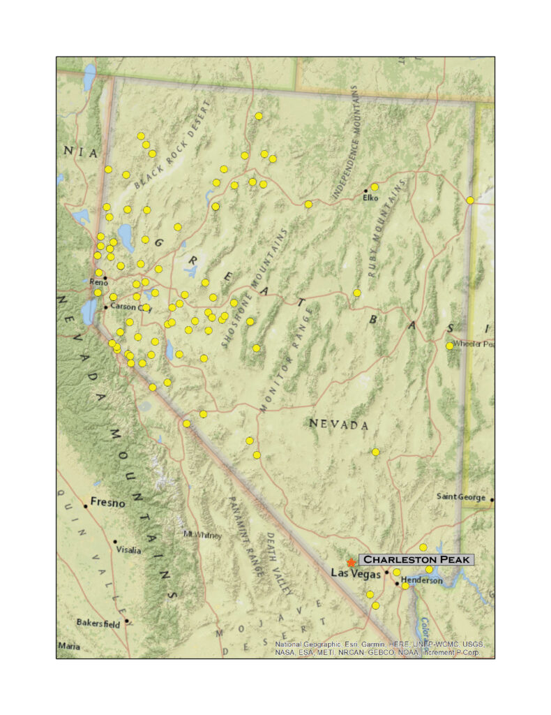
Nevada High Points #91 – Spring Mountains

D. Craig Young · November 7, 2021 · Leave a Comment

Time hoarders. Bristlecone pine – another day in the element where they are and have been. Spring Mountains, Mojave Desert, USA.

Charleston Peak

11,918 ft (3633 m) – 5300 ft gain

2021.11.09

We have not been on a big hill for a few months. The smaller, hidden gems are a pleasure, but nothing beats some elevation gain and ultimate altitude. I had a work week in southern Nevada, so we decided that for Second Friday we would climb Charleston Peak, high point of the Spring Mountains and a nice prominent summit in the midst of the Mojave Desert. Darren would fly home on Sunday, after which I was sentenced to a week on the strip. But I will deal with that later, tonight I am on the edge of the Mount Charleston Wilderness.

HP #91 Collection

A simple camp on a tributary wash at Kyle Canyon, Spring Mountains.

Camped in Kyle Canyon – bagged a USFS spot for a couple nights – I am up in the dark at 5.30 to prep coffee and breakfast, fuel for the day; Darren soon pops out of his tent to join me. We had set up our packs last night, and they were slightly heavier than usual. The day held an unsettled forecast so that meant a few more layers to take along – and I had my camera and a couple lenses, always good to be prepared even if it was a nice, promising morning. So, all things ready, we made a quick drive to the trailhead, where several cars were already in the lot – a small pack of trail runners heads north, they might have an adventurous day.

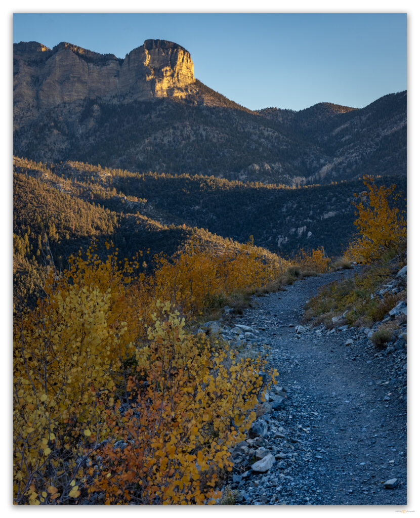
Guarding the summit. Charleston Peak rises above its eastern limestone escarpment, Spring Mountains, Mojave Desert, USA

The typical route to Charleston Peak is known as the ‘South Loop’, although it is often done as an out-and-back. That is our plan given the day’s forecast. Although I am curious about alternative routes – the ‘North Loop’, also not a loop, stands out – there is a rather massive limestone wall that rises for a thousand feet or so, forming an abrupt and defensive eastern escarpment. And yet, there must be some interesting and challenging routes in there somewhere. Those kinds of challenges are behind me now.

Trail at sunrise. The first switchbacks at first sun, Spring Mountains, Mojave Desert, USA
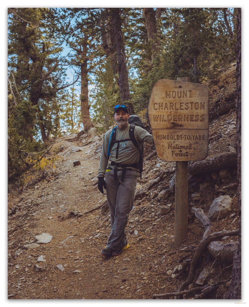
The good boundary. Entering the Mount Charleston Wilderness on the north slope of Griffith Mountain, Spring Mountains, Mojave Desert, USA

We begin the South Loop below Cathedral Rock and are soon in the slow switchbacks that ascend the gullies that cut the north face of Griffith Peak, a southern pinnacle on the long ridge connecting Griffith and Charleston. The route is basically forested switchbacks, one after another, leading unendingly, it seems, to the long (~4 miles) ridge that then climbs gradually for the remainder of the walk to the high point. It is a splendid trail. We have traversed riparian woodlands leading to stands of ponderosa pine transitioning to lodgepole, fir, and, eventually, bristlecone – wonderfully diverse above the desert.

Under the storm. The last sun before the storm, streaming through a canyon below Griffith Peak, Spring Mountains, Mojave Desert, USA

At the ridge, we begin to encounter rime ice, clinging as windvanes to leeward sides of tree branches and blades of grass – the wispy strands of ice reach several inches in length. Although calm now, it is obvious that yesterday (last night?) it was windy and cold, with just the right amount of moisture to form the wonderful crystals. The ethereal ice highlights the skeletal remains of once healthy pines consumed by the Carpenter 1 fire of 2013. We would walk in the fire scar for the first half of the summit ridge.

Frozen in place. Rime ice traces a red thistle on the South Loop, Charleston Peak, Spring Mountains, Mojave Desert, USA
Lime and frost. Playful patterns in the windy rime ice huddled against a limestone outcrop, Spring Mountains, Mojave Desert, USA

A small summit hiking team, all women from Los Angeles and, formerly, Costa Rica, catches us as we paused to relish the fog that swirls on the western wind churning along the ridge. At our meet-up, they ask if we are doing the North Loop on the descent and given that Darren and I had started a discussion about our descent route while switchbacking through the forest, I immediately confirmed that we would indeed be heading north after the summit. It would be a good, if quick, decision.

Trail fog. Costa Rican summit team, our partners for the day, work steadily up the south loop trail, Spring Mountains, Mojave Desert, USA

The fog became definitive cloud and pellety graupel pecked at our shirts and packs. The climbing kept us warm, but the moisture crept in. It was windy now too, but the trail guided us easily even as we needed to be strident in the building wind. We soon found, just below the summit, the wreck of the 1955 CIA plane. It is a few large fragments of the fuselage and landing gear (and certainly other bits) strewn among east-sloping talus. It seems that it only just missed clearing the ridge, but, flying east, it crashed into the western slope and tumbled terribly over the ridge. Apparently disoriented in a storm, the plane went down, and none survived their secret commute to Groom Lake (Area 51) deep in the Nevada desert.

We regain the trail, turning into the wind on the northwest slopes; it is snowing steadily and brashly now. Finally, the radio towers of the rounded summit came into view, but we were otherwise clouded-in – there was no view in any direction. Should we wait? Would it be a short time until a little clearing revealed a desert panorama far below? Who knows? One thing was sure; the wind chill was crisp, and the moisture of our climb made the cold cling to us, like the rime ice building on the summit towers. We donned our down jackets and set off into the wind-driven squall scouring the giant Z switchbacks on the peak’s eastern face. The Costa Rican party summited just behind us.

A summit squall. Darren checks the weather on the summit of Charleston Peak, Spring Mountains, Mojave Desert, USA

The North Loop has, just below the summit, a very different character than the South Loop. Its switchbacks are exposed, and filled with recent hard-packed snow, the narrow trail is almost serious, especially with the blowing snow and fog adding a bit of drama. I am immediately glad we came this way. There are stories in the ‘summit’ blog sites implying that the North Loop is not worth doing because it lacks interest. How wrong that is! After the few exposed switchbacks, we begin a long traverse, passing the Devils Thumb on our way to the upper reach of Trail Canyon. And we soon get exceptional views of the summit behind and just above us – yes, the summit is clear now. There are mountain views you simply do not get on the South Loop. The trail remains above 11,000 feet for several miles, skirting rock walls and pulpited hoodoos. I would not have wanted to miss this; if we can miss something that we do not know about.

The clearing. The clouds break as we descend the east face of Charleston Peak, Spring Mountains, Mojave Desert, USA
A grove of ledges. The light follows our descent as we traverse the ledges below the Devils Thumb, Spring Mountains, Mojave Desert, USA
Ending the loop. Darren enjoying the scenes of the North Loop below Charleston Peak, Spring Mountains, Mojave Desert, USA

I was beginning to feel the long day as we approached Trail Canyon junction, almost 16 miles into our walk. Autumn colors peeking from the evergreen forest replaced the fog and snow show. The warm color in the raking light of the evening made the descent a pleasure. The Costa Ricans had joined us for most of the afternoon, and it was clear I was lagging more than these steady walkers. We talked of other peaks of late and climbs of the future.

Kyle Canyon. The post-storm light plays with the autumn colors of Kyle Canyon, Spring Mountains, Mojave Desert, USA

Pavement appeared abruptly at the wilderness boundary, the bottom of Trail Canyon. This meant that we had a road-walk for the last mile, but this was fine; it gave us time to review the day and bask in the true pleasure of unexpected alpine walking adventure. It might have been the best day I have had on a mountain – completely unexpected in such proximity to the desiccated oddity of Las Vegas.

Charleston Peak. The high point of the Spring Mountains rises above southern Nevada, Spring Mountains, Mojave Desert, USA

On the truck’s tailgate, we toasted our unique day on this great mountain tailgate, and then a couple from Connecticut, whom we had met as they headed south on the high switchbacks of the North Loop, came out of the forest below Cathedral Rock. They looked due for a finish and a rest, so we offered them a ride to the Trail Canyon parking area. I was happy to do this until they said they had had a clear summit after our warning of snow and windy fog. But that is how it goes, and, of course, this news failed to diminish our pleasure of a perfect day.

HP #91 Collection

Even freeze-dried spaghetti tastes special after a day like this. Refueled and cherishing the echoes in our legs, we sat by the fire and marveled at our good fortune. Then slept very well.

Keep going.

Giving way. Spring Mountains, Mojave Desert, USA

Please respect the natural and cultural resources of our public lands.

#naturefirst #keepgoing

  • « Go to Previous Page
  • Page 1
  • Page 2
  • Page 3
  • Go to Next Page »

Trail Option

Copyright © 2026 · Monochrome Pro on Genesis Framework · WordPress · Log in

  • Contact TrailOption
  • Substack
  • Waypoints Bibliography
  • Young Archives