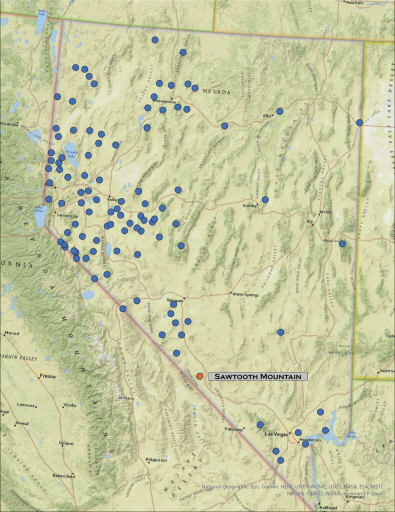
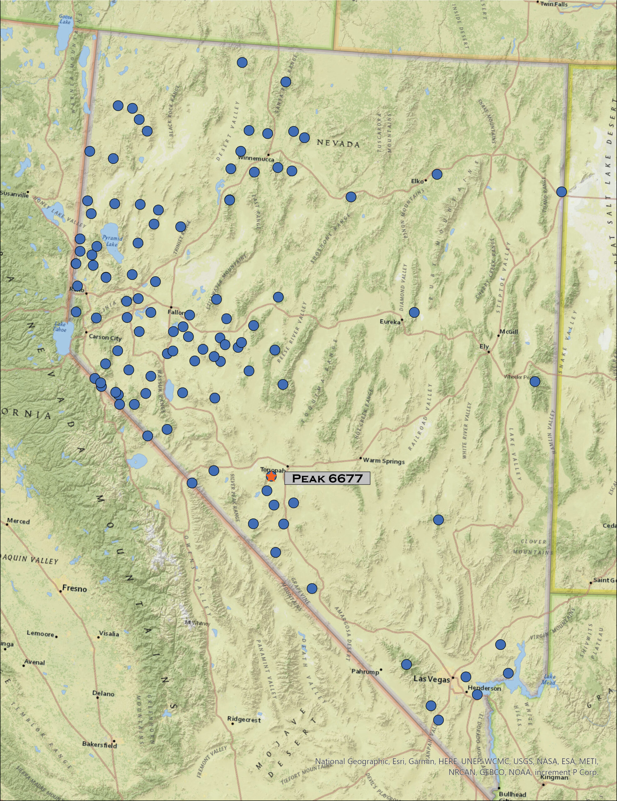
The winter snows seem endless, the foothills of the Carson Range releasing the cold moisture from the lake effect that streams out of the Tahoe Basin. The Sierra snowpack is trending toward record depths, and we benefit from the overflow that has been prevalent this season. It does not look to be letting up as the atmospheric rivers remain productive. It means, however, that I must head farther south to find dry ground to explore. So, I am out early on Sunday morning – still a Second Friday weekend – and headed toward Tonopah where dirt will lead me into the General Thomas Hills, an easy-day outing.
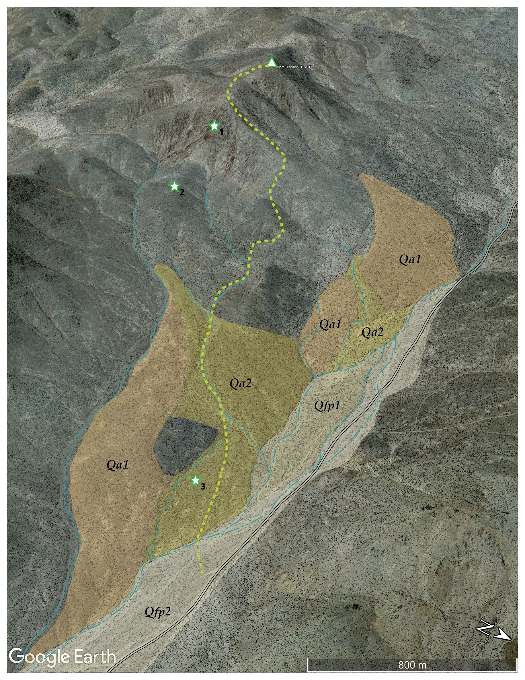
I have lately developed a mindset, once I begin walking, that the summit is the ‘only’ goal, moving up and down with basically that purpose, hoping only secondarily that some photo opportunities might present themselves. Over the next few posts, realigning the experience and communication, I hope to introduce an emphasis on the physical geography of routes I take to reach each highpoint. Photography will remain a key component of each excursion, but I will also focus on describing the landforms I encounter, mapping and describing how and when they might have formed. You will find a new map with each post highlighting the Quaternary (2.2 million years and younger) landforms along with a few other features-of-interest to add to the story (hopefully). I do not do rocks; other than a few recent lavas from relatively isolated volcanic centers, there are not many rock-forming processes in the ‘recent’ past. I am fascinated by the natural weathering that changes rock to sediment and the processes that rearrange that sediment to form landscapes. We will be looking at alluvial fans, dunes, floodplains, and lakes – those extinct and, sadly, those becoming so – among other things, and, hopefully, making some informed guesses at how environment and process, past and present, influenced their arrangement. My hope is to develop, over time, a dictionary of Quaternary landforms for the Great Basin, adding detail to the vast ‘yellow’ space on most geological maps. This starts, of course, with a walk – camera at the ready – to get our feet and eyes onto the landforms.
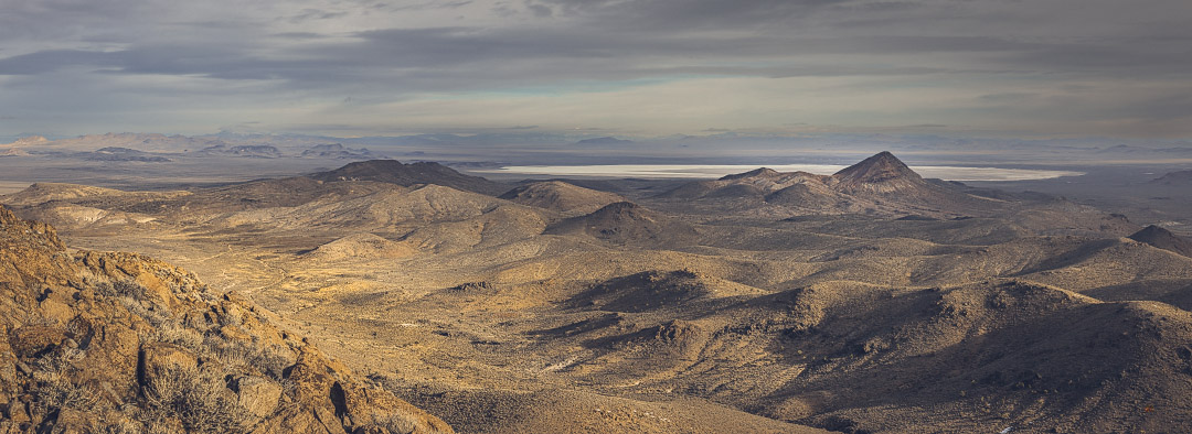
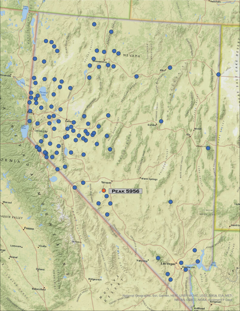
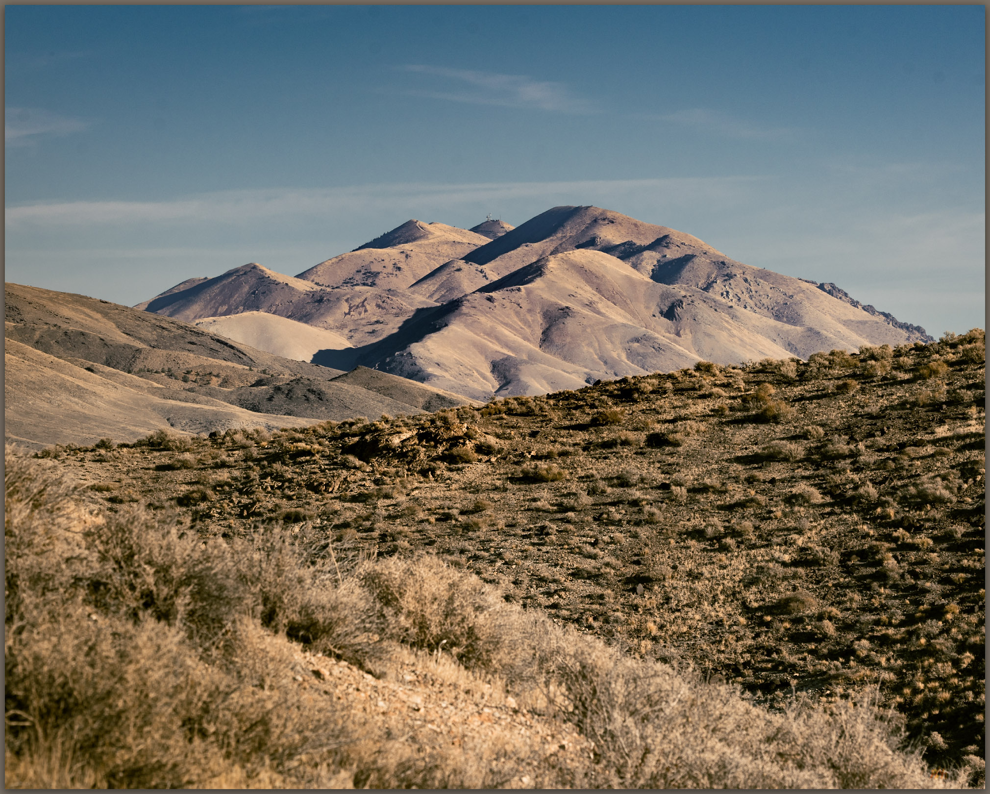
The General Thomas Hills rise west of Montezuma Valley with its vast alluvial basin floor leading toward the modern playa of Alkali Lake. The hills are not prominent, but they are separated from nearby (and higher) ranges of the Weepah Hills and Lone Mountain by the broad trench of Paymaster Canyon – we will get those soon. Looking back, we were here a month ago to explore the highpoint of Paymaster Ridge to the south.
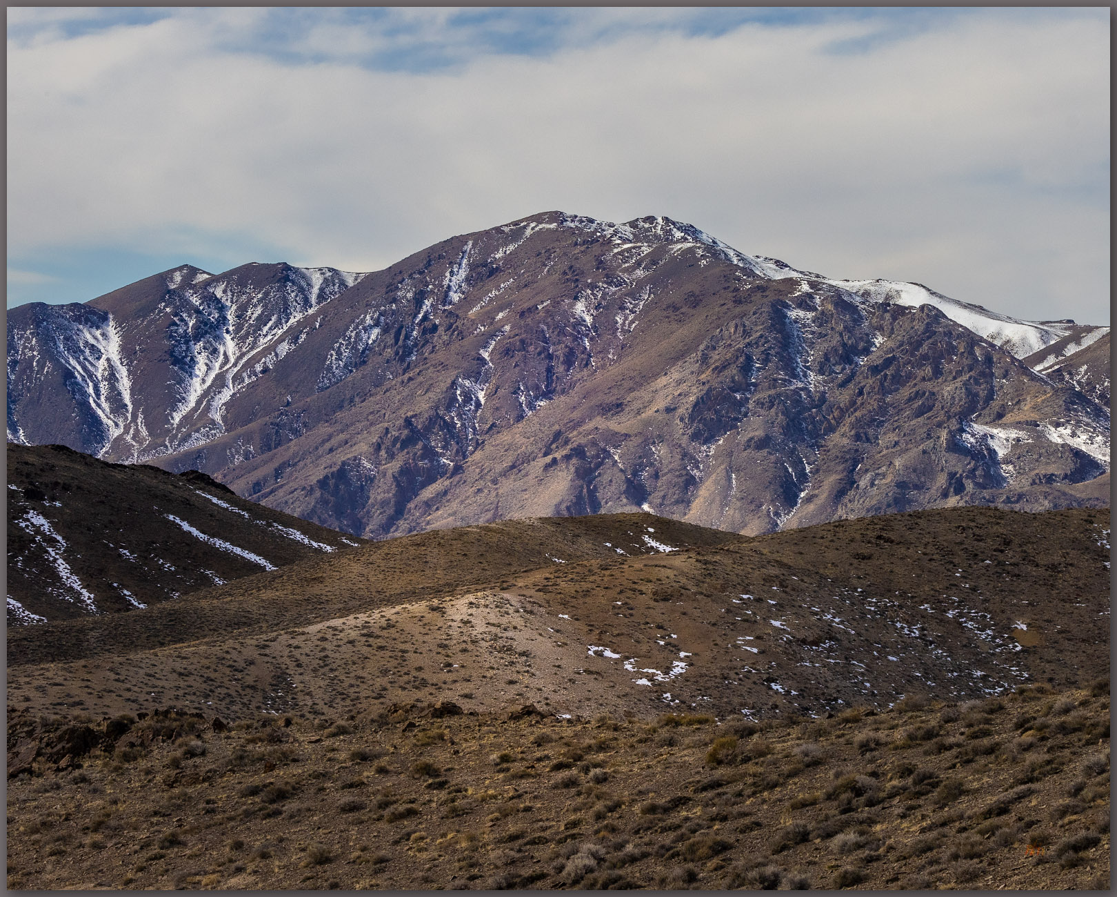
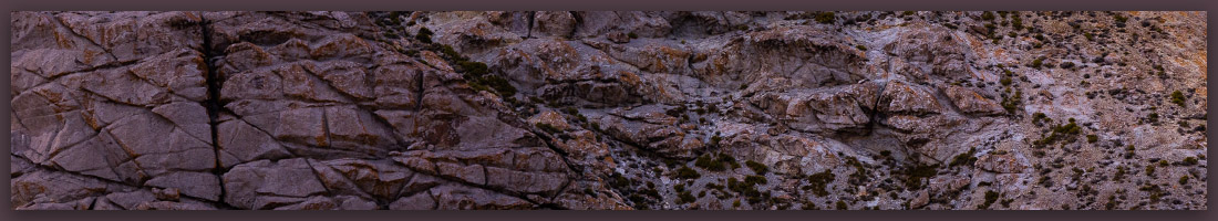
While the uplift that formed the hills occurred relatively recently, the rocks we traverse are very old. I park along the Paymaster Canyon Road to look up at easy rolling hills with talus and low rimrock outcrops of intrusive Triassic or Jurassic rocks, easily over 100 million years old. When these rocks were deeply buried, deep movements pushed and folded even older rocks over the top of the Triassic rocks, creating a thrust fault. These Cambrian rocks (>400 million years old!) outcrop close to the summit, referring to a regional geological map (as I have said, I am not so good with rocks), so we walk back in time as we walk up the hills.
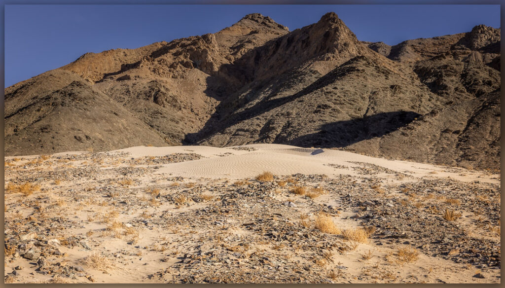
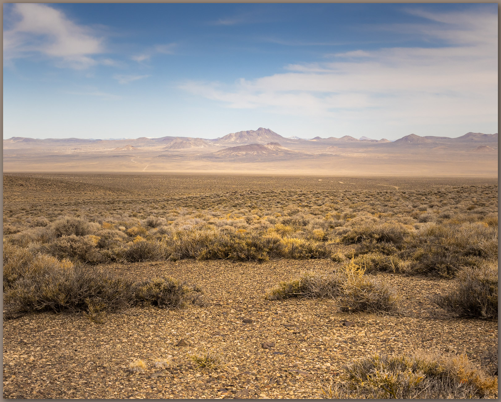
This time travel is true across any basin floor throughout the Great Basin. The young landforms are at the valley bottom or forming skirts and aprons at the valley margins, the outcrops of the mountains and hills reveal the old stuff. Here, just off the Paymaster Canyon Road, I walk into an active wash – dry most of the time – that cuts at the ends of relict alluvial fans forming the base of the General Thomas Hills. The wash (Qfp2) shows braided channels formed in flashy storm events when all drainage below Paymaster Pass focuses here; the road follows the drainage and clearly requires common maintenance to prevent it from capturing too much streamflow.
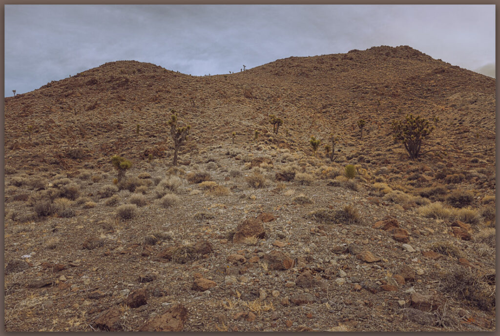
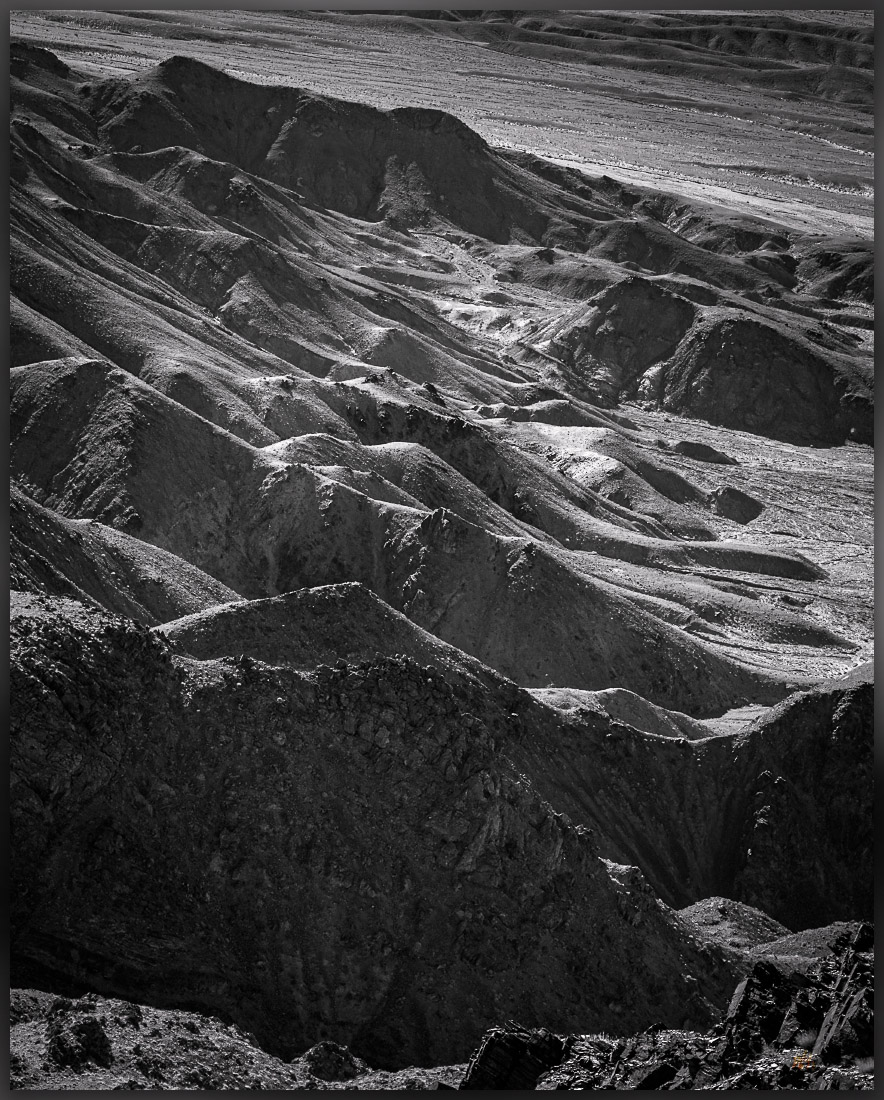
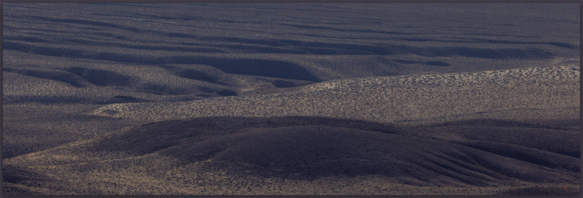
Above a low terrace riser, I walk onto the younger (Qal2) of two sets of dissected alluvial fans that emanate from gullies and rills cutting into hillslopes above. As extensional faulting lifts the older rocks to form the hillslopes, weathering and gravity take over; the hills shed sediment toward the basin floor. Driven by water and pulled by gravity the sediments debouch from the confinement of narrow gullies to spread in conical fans that bend even further basinward. When water is the dominant transport mechanism the sediment is called alluvium, so these conical landforms are alluvial fans. We are, however, in the middle of the desert – actually, the intersection of the Great Basin and Mojave deserts; there is not much water here. What water does come, it comes in high-energy pulses, but with so little input, the formation of these fans, as you might imagine, takes time.
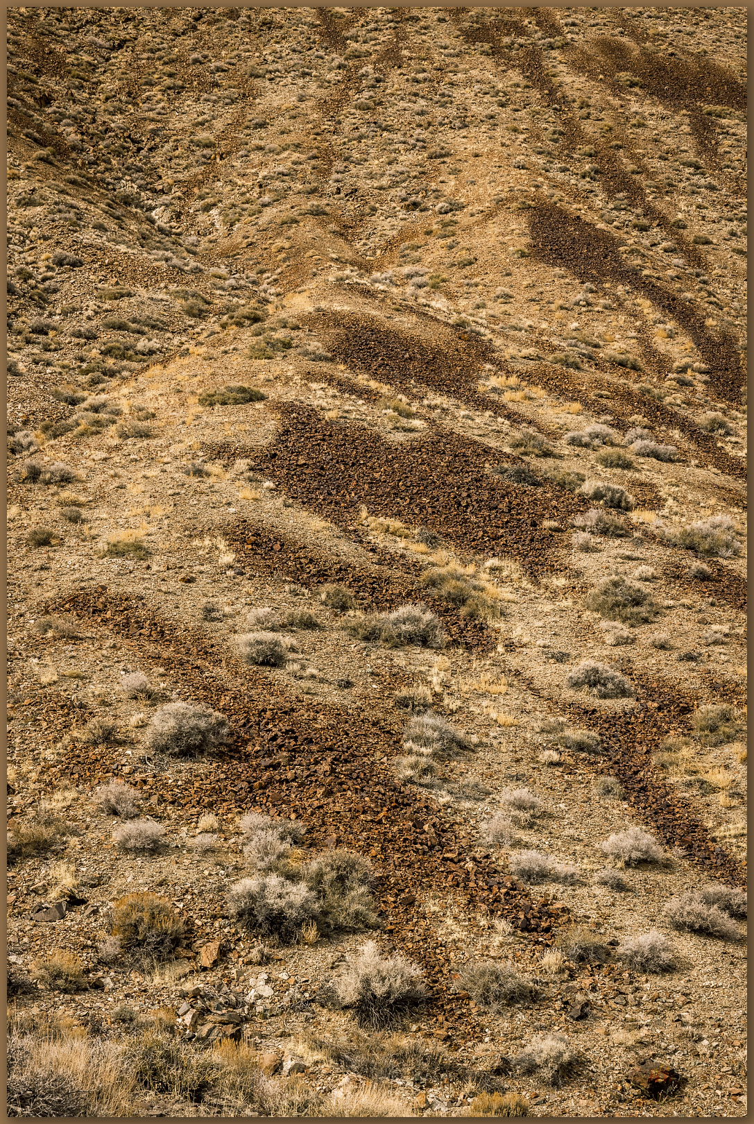
The fan surfaces show patterns of sheetflow with small gullies and sudden debris flows, but they are mostly capped by an intricate pattern of well-sorted (about the same size) gravel. The surfaces have had time to ‘get organized’ so we can guess that these have been stable for several thousand years, at least. As I continue across the Qal2 surface, I see that the fan I am walking on cuts along the base of similar landforms to either side. This is a clear cross-cutting relationship, where the flows of one fan ate into another. We know, therefore, that the fan I am on is younger than the fan(s) it cuts into. The Qal2 is younger than the Qal1. How much younger? We do not know at this point, we would have to take a much closer look using more precise measures, but cross-cutting relationships give us a start. The fans are generally similar, so they might not be separated by more than a few thousand years, if that.
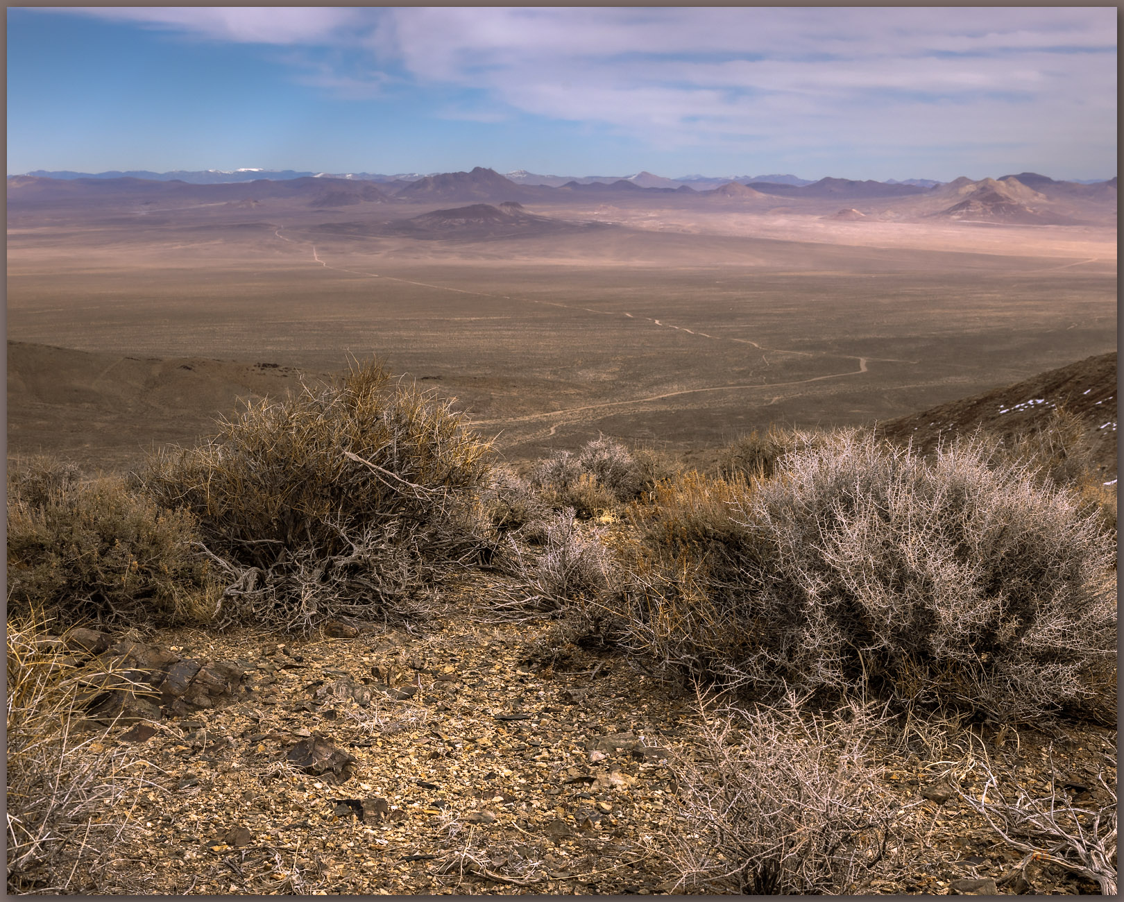
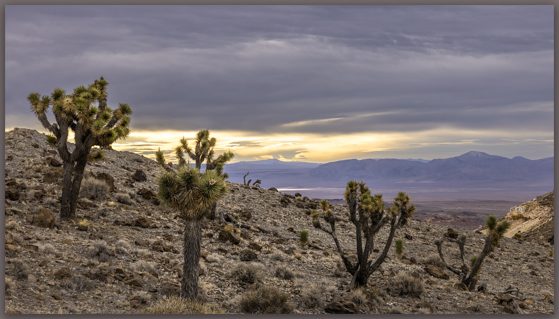
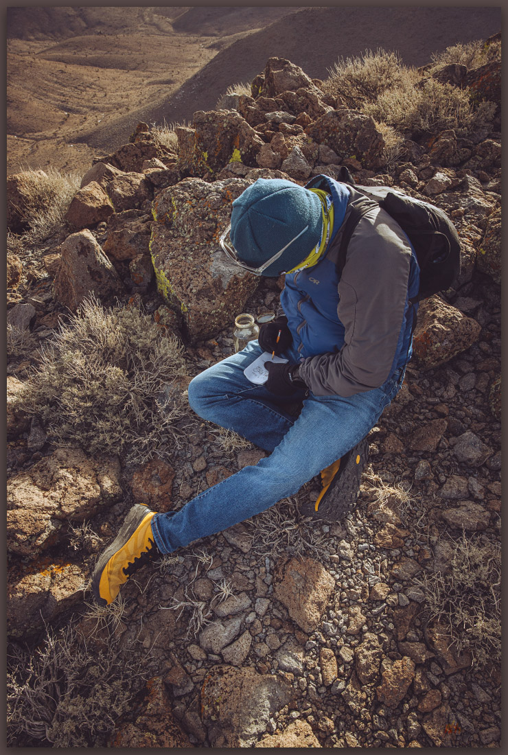
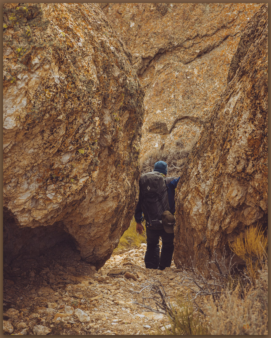
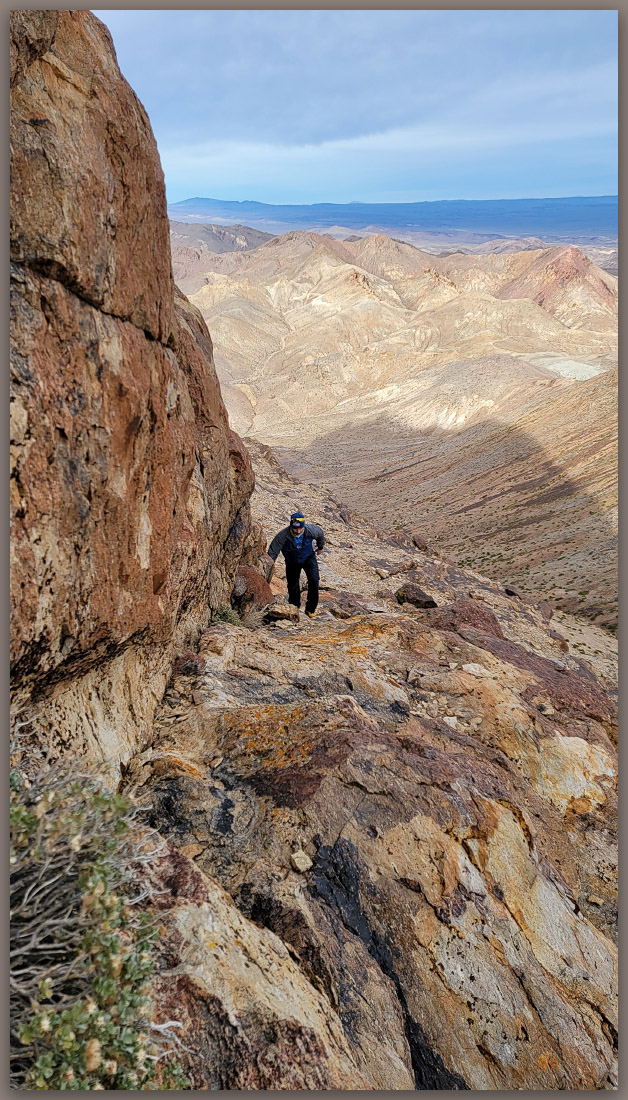
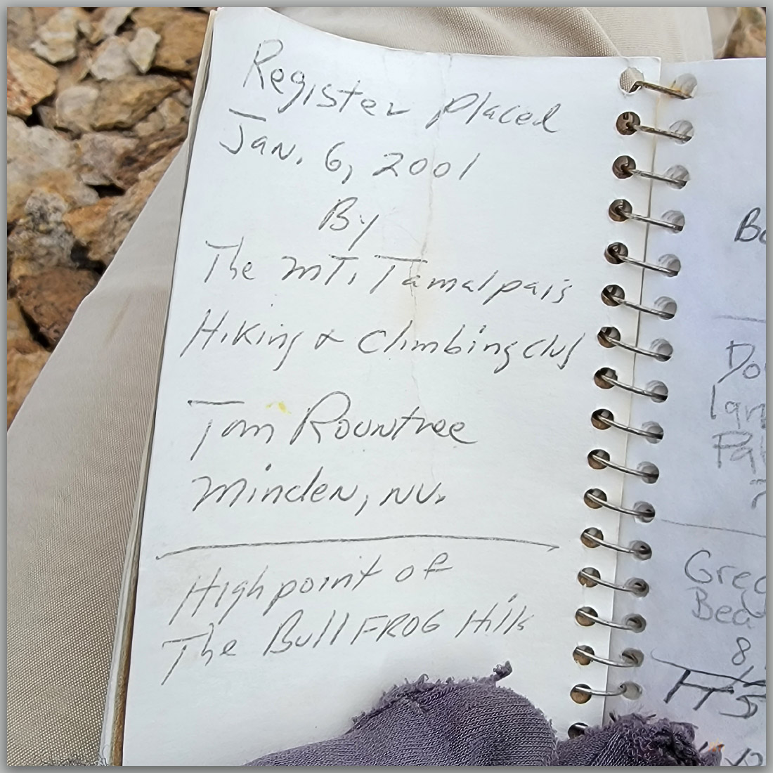
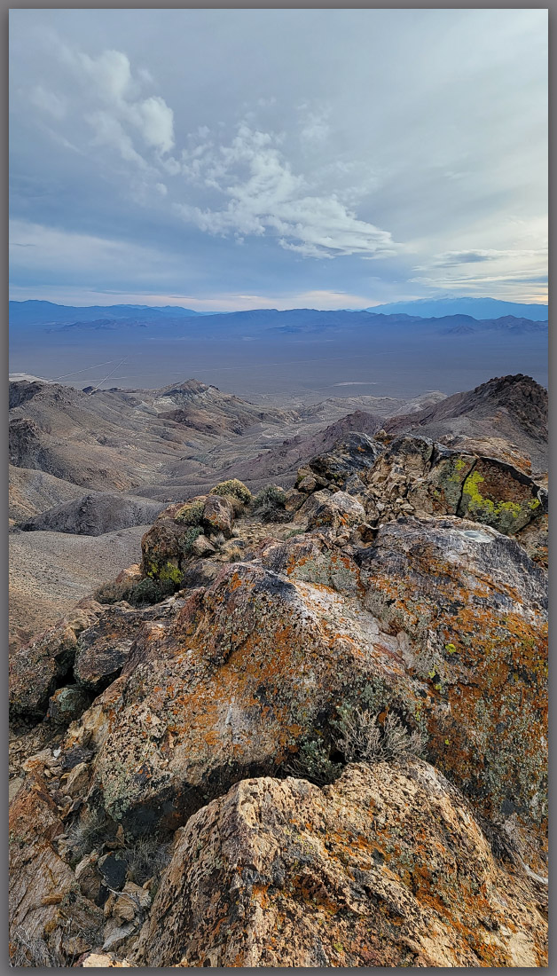
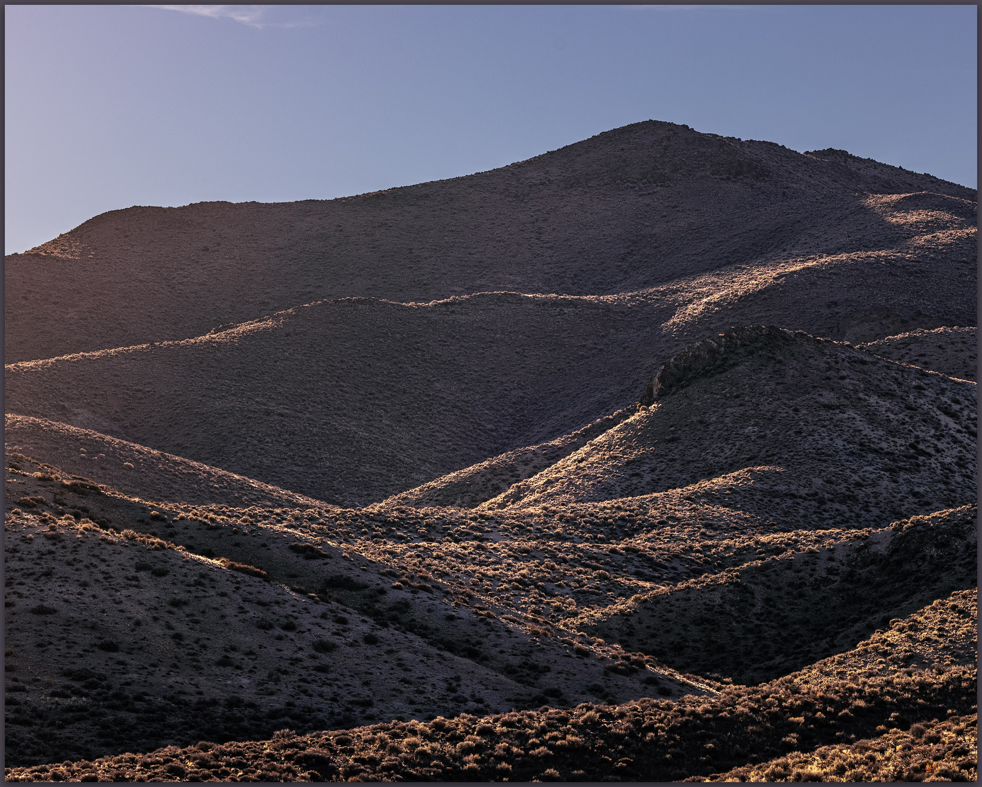
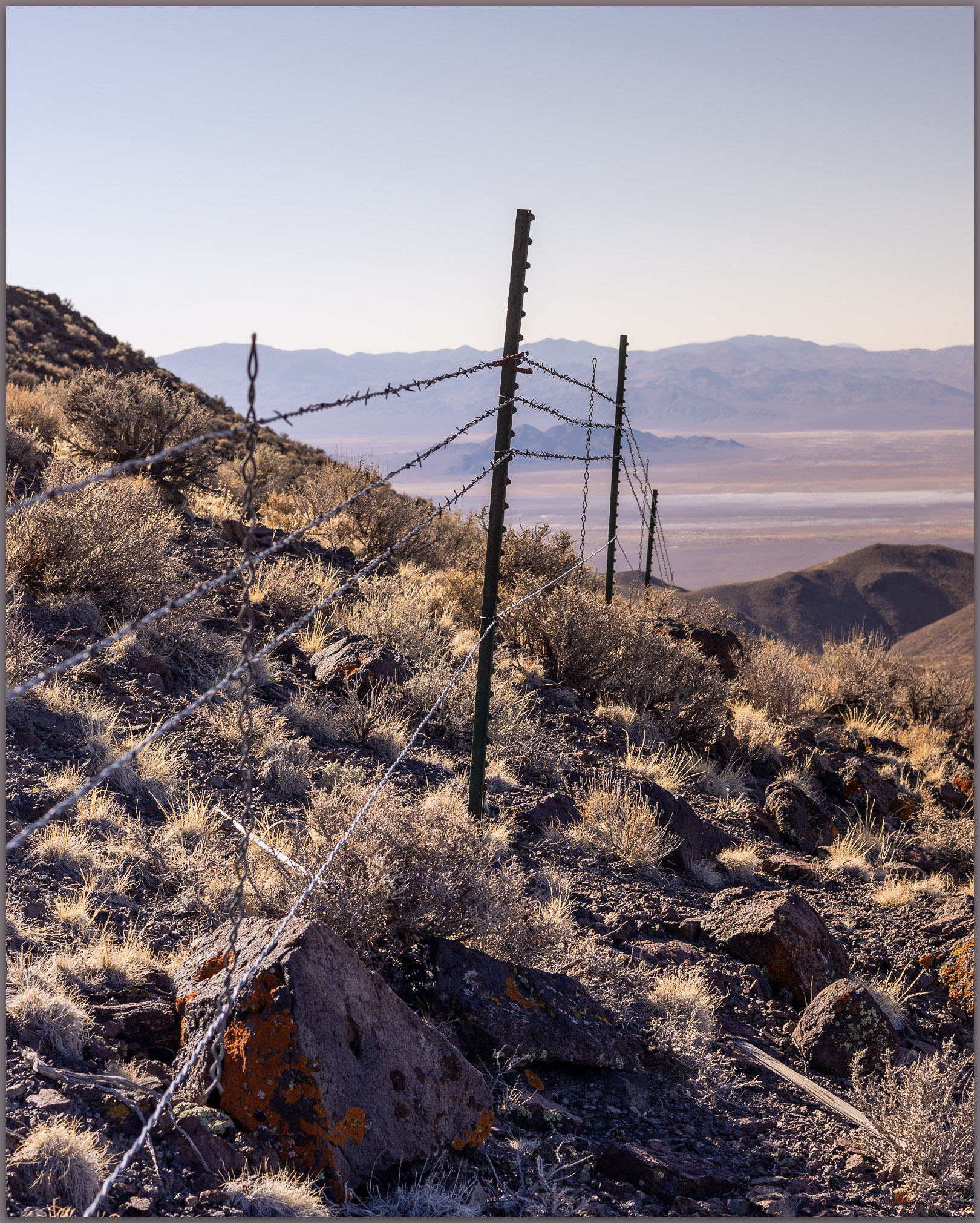
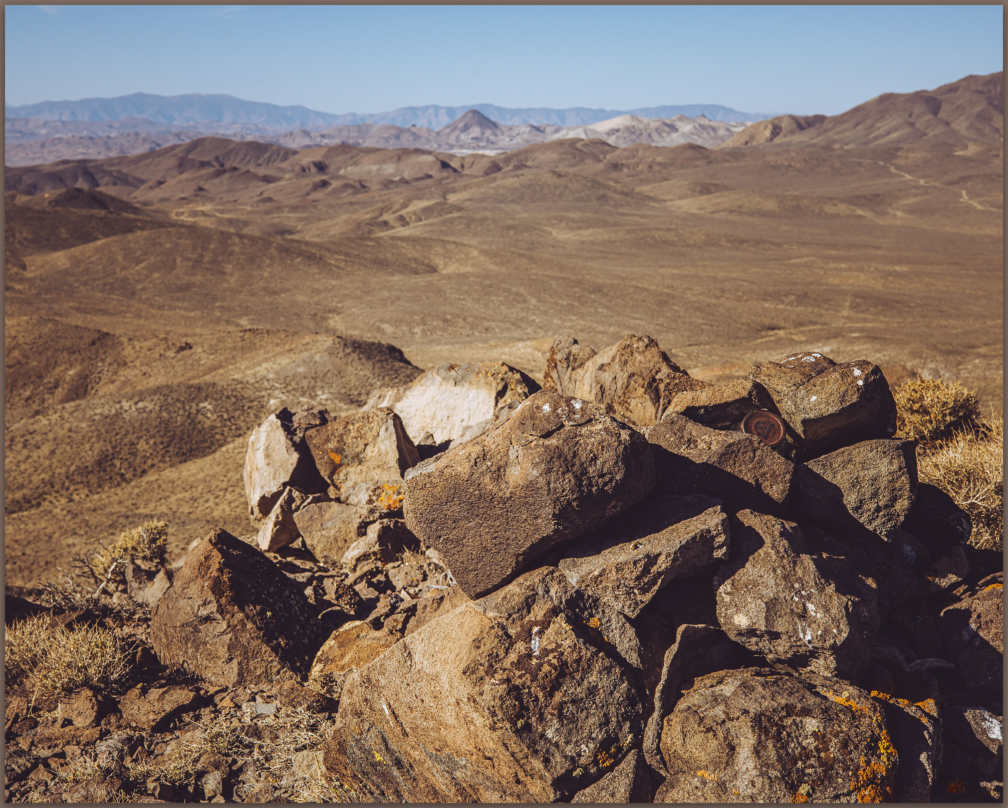
The wind picks up as I transition from alluvial fans to bedrock slopes that steepen noticeably. Pulling on my windbreaker, I pass a deep abandoned mine adit cut into the top of the alluvial fan. Exploratory mining, especially historic-era activities, often focus on the fan transition to quickly get to the potential ore of the mountain front without too much overburden. Above the adit, gravity takes over as the driving force moving sediment, with water becoming secondary. The sediment comes in large clasts now too. This is colluvium, sediment arranged by gravity into talus cones, aprons, and stripes. I also encounter steps as low rimrocks form ridges of resistant rocks. It is easy-going to the summit ridge, and the highpoint rolls out in a relatively level tableland making it a bit of a puzzle finding which little rock cluster hides the summit register. The wind is now piercing and cold; although the views are nice, I will not linger.
General Thomas Image Collection
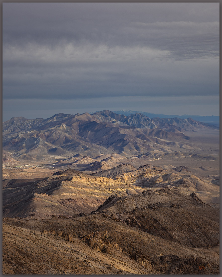
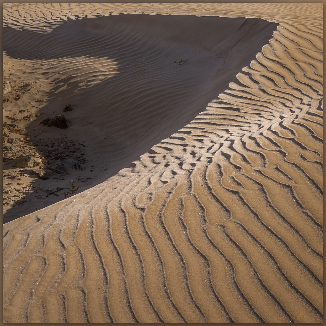
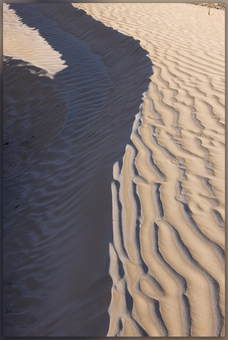
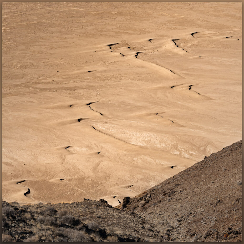
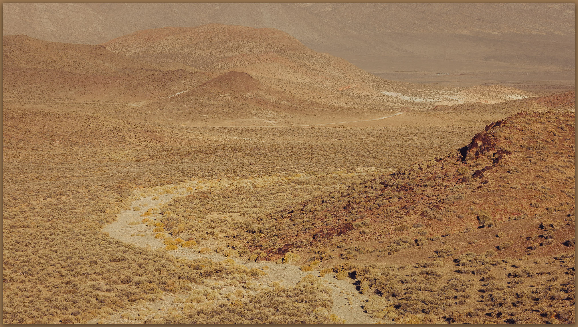
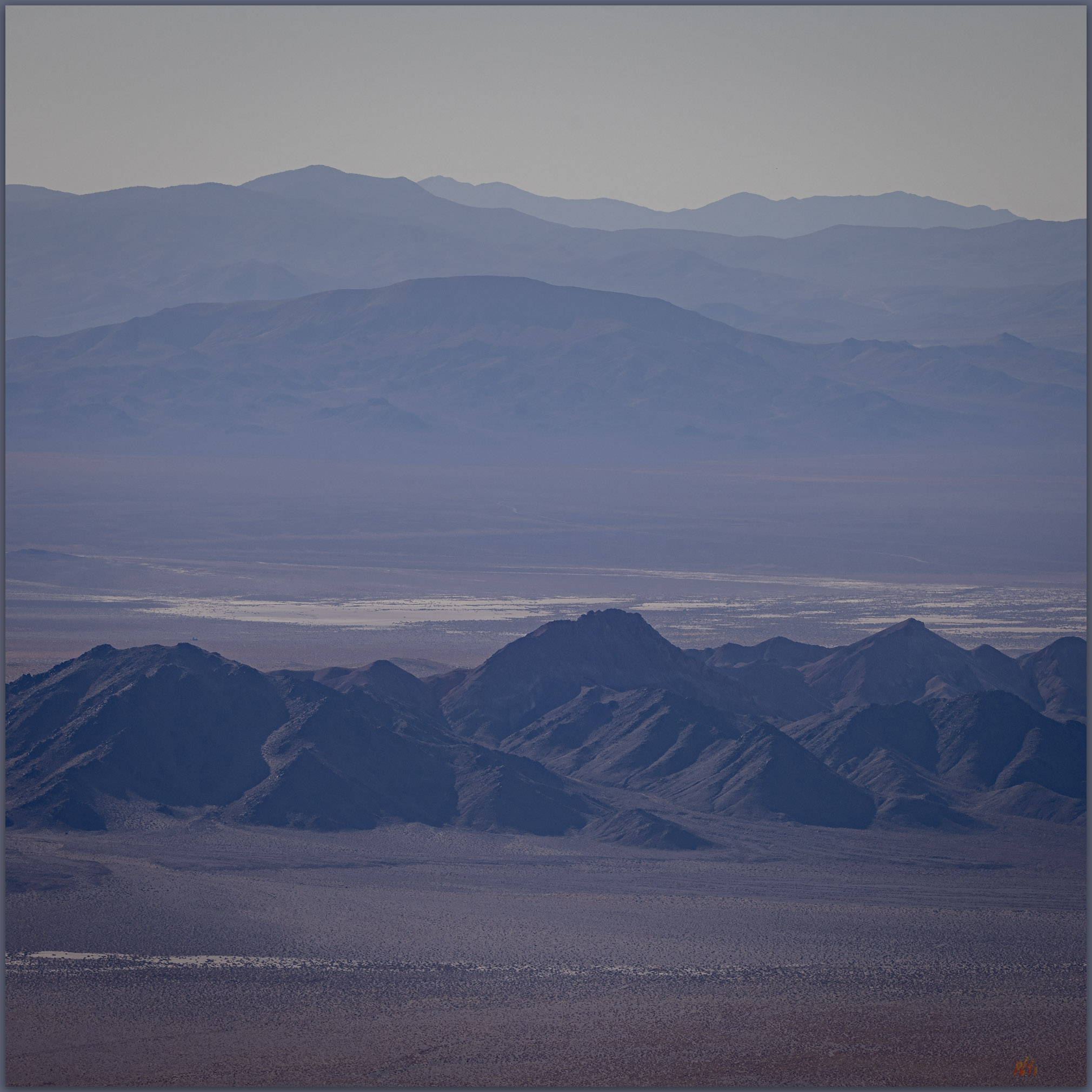
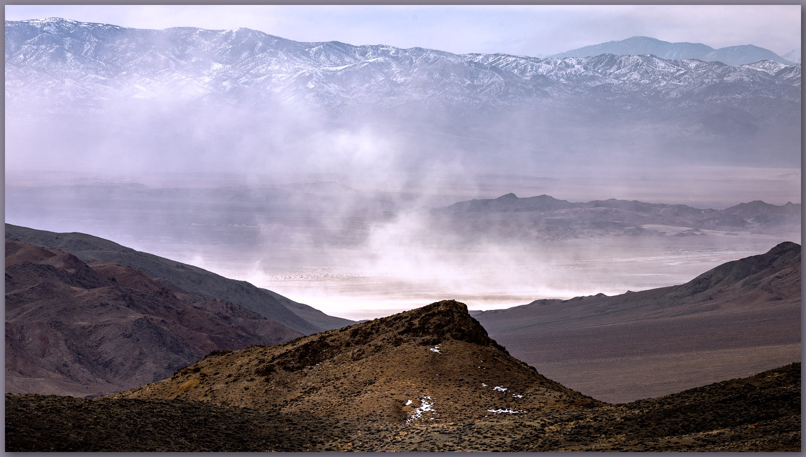
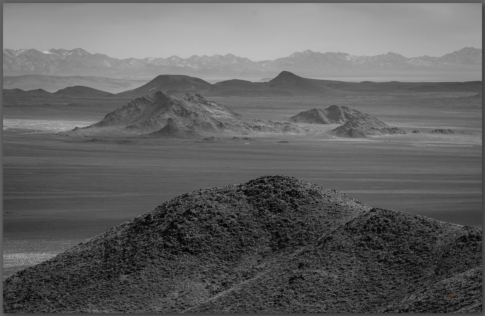
Dust rises from Clayton Valley to the southwest, where dunes race in two directions. Today, after the storm, they are likely moving south (the dust sure is!); before the storms the prevailing winds drive them north. The mosaic of evaporative mines on the basin floor adds to the airborne sediment load. These are aeolian processes, wind-driven rearrangement, where gravity is once again secondary. Water is important too, but we will visit that another time – the dunes and desert loess of Clayton Valley are distant, and I have some driving to do. It is time to head down, retreating through time, from the ancient bedrock, through the fans of yesterday, and the sandy washes of today.
We have a lot to learn from the smallest of hills. I hope you enjoyed our journey – and renewed focus – through a few of the landforms of the General Thomas Hills; I clearly did not take enough photographs today. The cold wind reminds me that I have snow to return to, and, likely, a driveway to shovel.
Keep going.