Headlights seem to be brighter. It is four o’clock in the morning and Highway 50 stretches out in front of me. Oddly, for a Sunday, there are several other vehicles on the road, and as I turn onto the Ramsey Cutoff, there are several cars bearing down on me, their headlights firing into the dark. Not much I can do, already certain these are the new standards and not high beams – it’s not a new thing, but for some reason it stands out in the ‘traffic’ of a dark morning, when I usually see very few other travelers.
I am dropping around the north end of the Wassuk Range, curving from Smith Valley to follow the Walker River to its terminal basin at Walker Lake, a remnant of the once vast Lake Lahontan. As the sky lightens, I can look ahead to see a long alignment of Venus, Mercury, and Mars fading quickly into the morning. There are distant clouds, low on the southern horizon, but the morning light will quickly shift to the blue sky of day – I cannot seem to time my excursions with the dramatic skies that teasingly greet each office day.
The highway quiets as I climb out of Walker Lake – this is often where the highway gets a bit busier; not today – working my way south along the Garfield Hills and then to the small enclaves of Luning and Mina. The sun is breaking above the Pilot Mountains as I pass from the Rhodes Salt Marsh to the Coaldale Marshes, now mostly broad, dry playas with local springs, relics of former oases. The Monte Cristo Range rises to the east, colorful outcrops of volcanic tuffs in the early light. I leave the highway after finding a gravel road, crispy with frost, leading north across a broad fan emanating from the low foothills at the range’s southern margin. The road has graded berms except where it drops to trace along soft washes where new sand and gravel of spring-time floods form the roadbed. It is an easy drive, except for the moments when I am heading directly into the early sun – always at a winding turn or some narrow obstacle. I am, however, soon at my planned starting point. The summit plateau of Cristo VABM rising above, about two miles distant.
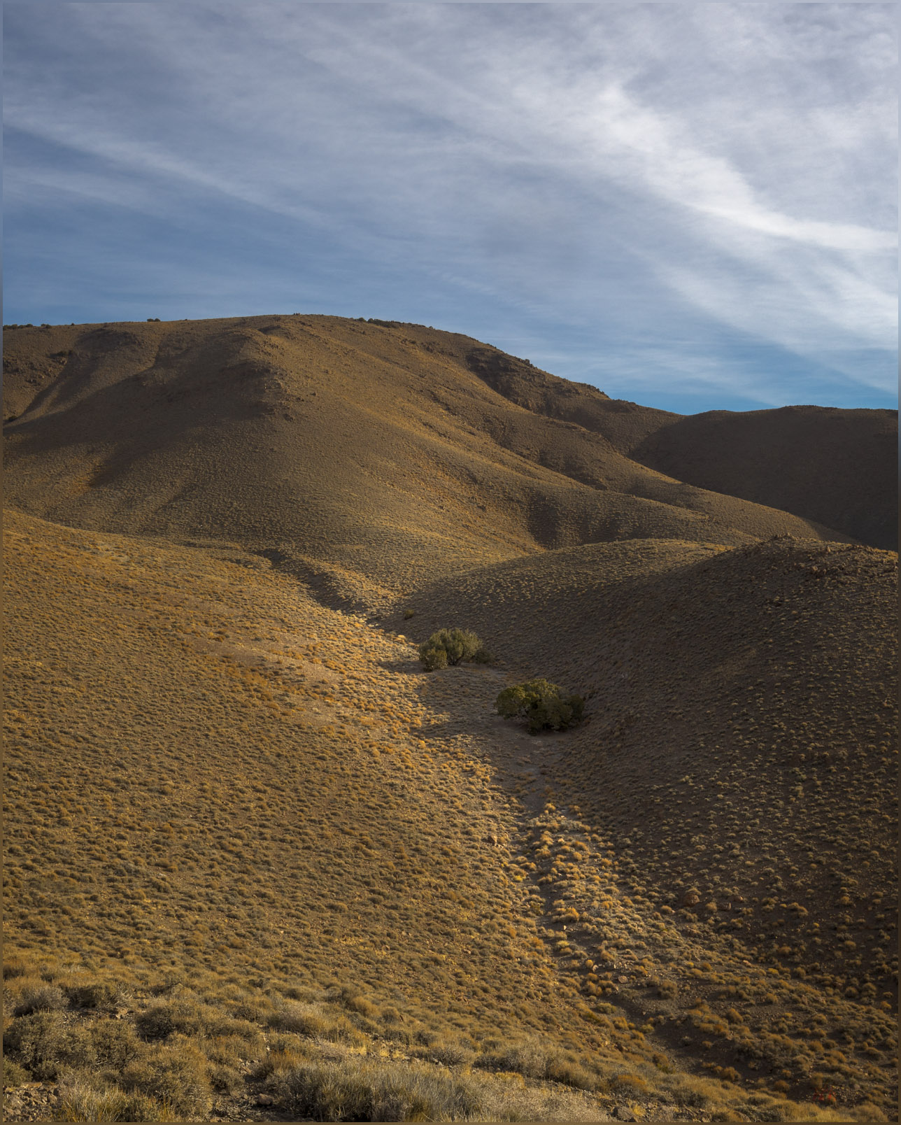
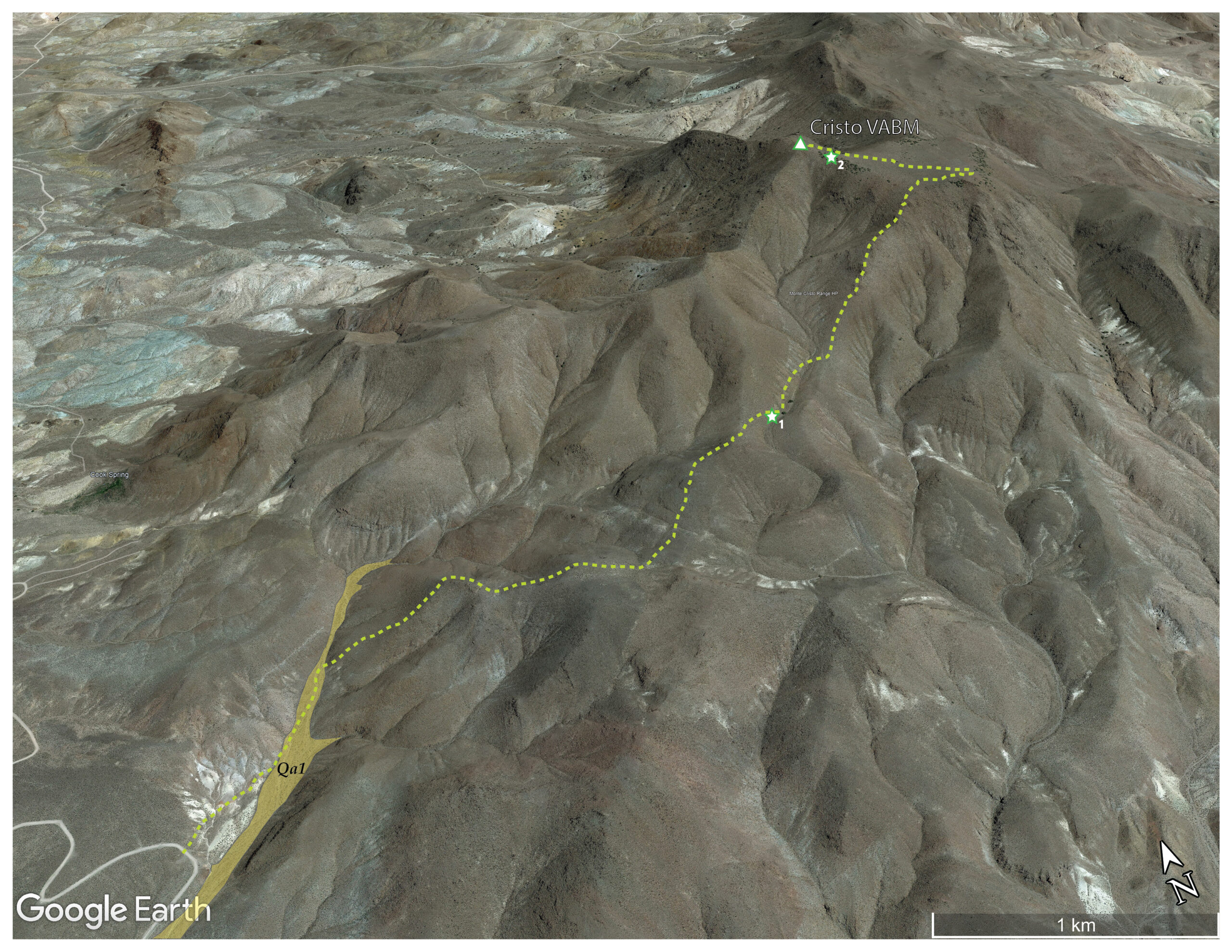
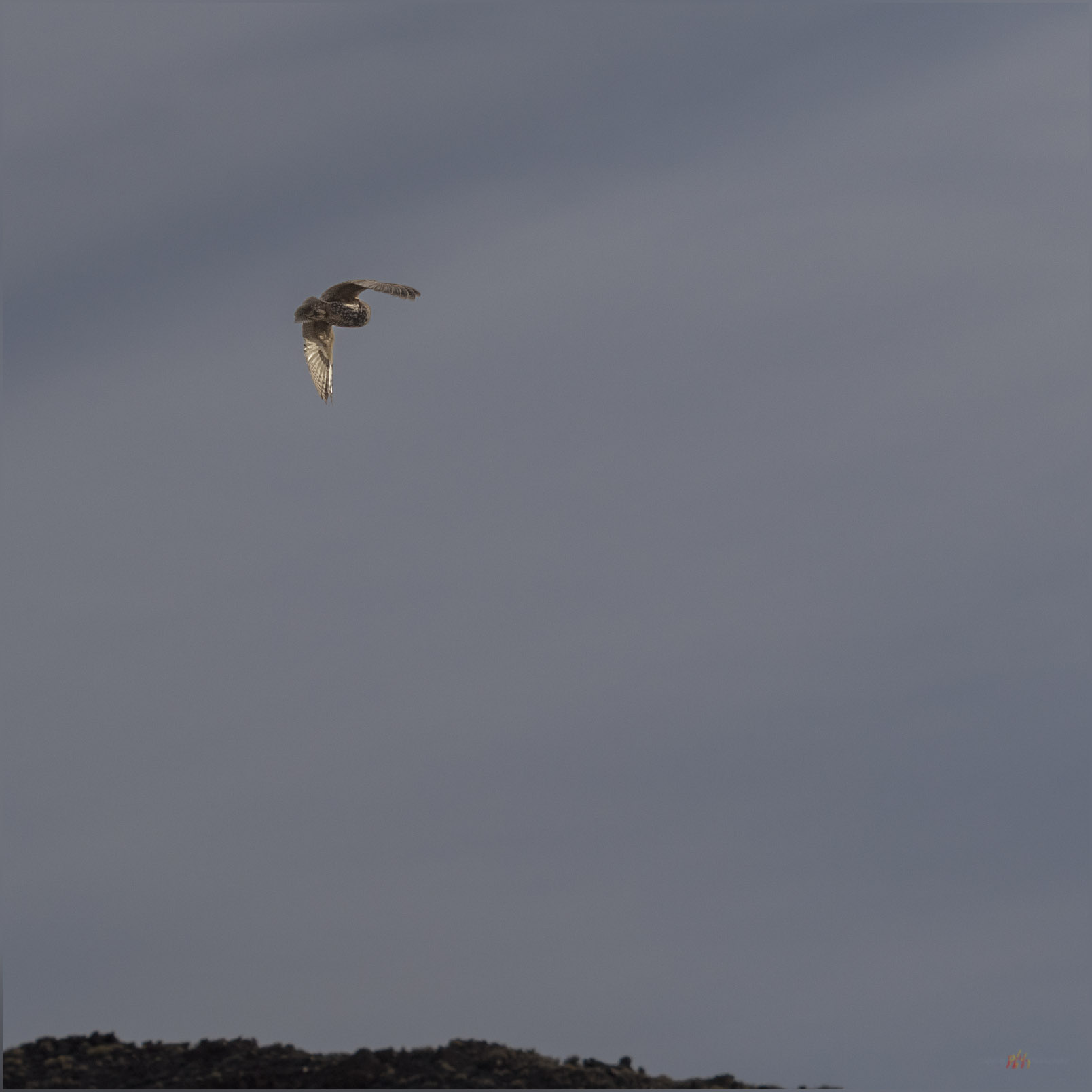
It is an easy hike up a narrow floodplain, the only mappable landform of recent formation and age (Qa1; <25,000 years or so) that I traverse today, then onto some moderately steep slopes. An intervening gully harbors a pair of juniper trees that catch my eye. I try to work some photos of them, moving in to look at the shapes among the low branches and gnarled bark, but sadly I flush a pair of Short-eared Owls from their daytime roosts. They are wonderful to see, but I do not wish to disturb them, and I hope they can settle back as I depart upwards. I only catch a glimpse as they swoop quietly away and over the adjacent ridge.
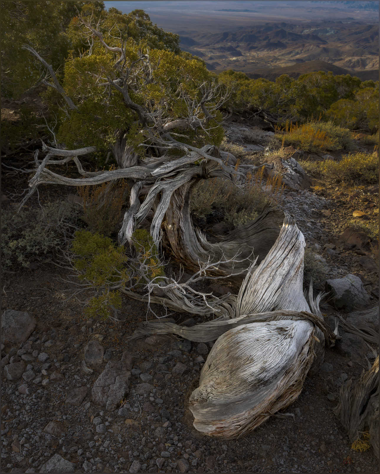
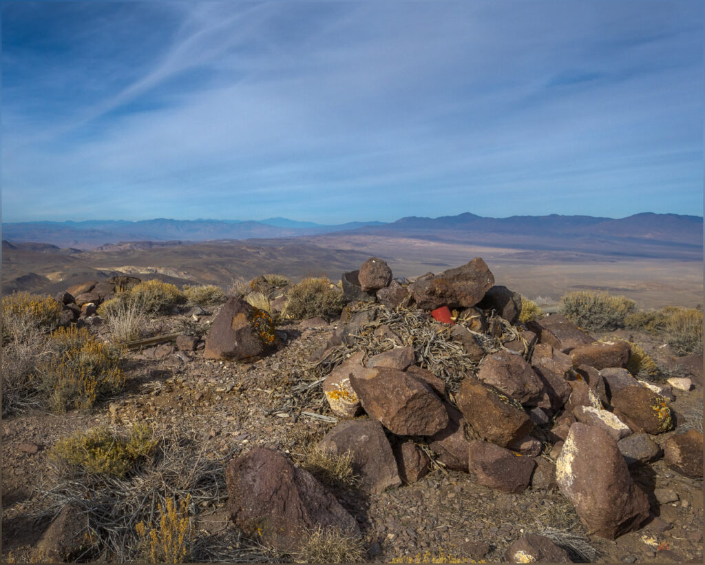
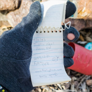
Approaching the summit plateau, I stop to check my map; is the Cristo VABM at the north or south end of the generally flat-looking landform above me. When I look up, there is a bighorn sheep, visible as only the curl of his horns and an inquisitive nod, and then he is gone. I follow as quietly as possible, ignoring the actual highpoint as I look among the small juniper bunches and surrounding boulders, checking each slope below where he had clearly retreated. But he blends in and away, and I never catch another glimpse. A hopeful and enjoyable half hour, with my camera ready, I eventually make my way to the summit cairn, working through the ragged but hardy pygmy woodland of weathered Utah Juniper to the exposed summit cairn and register.
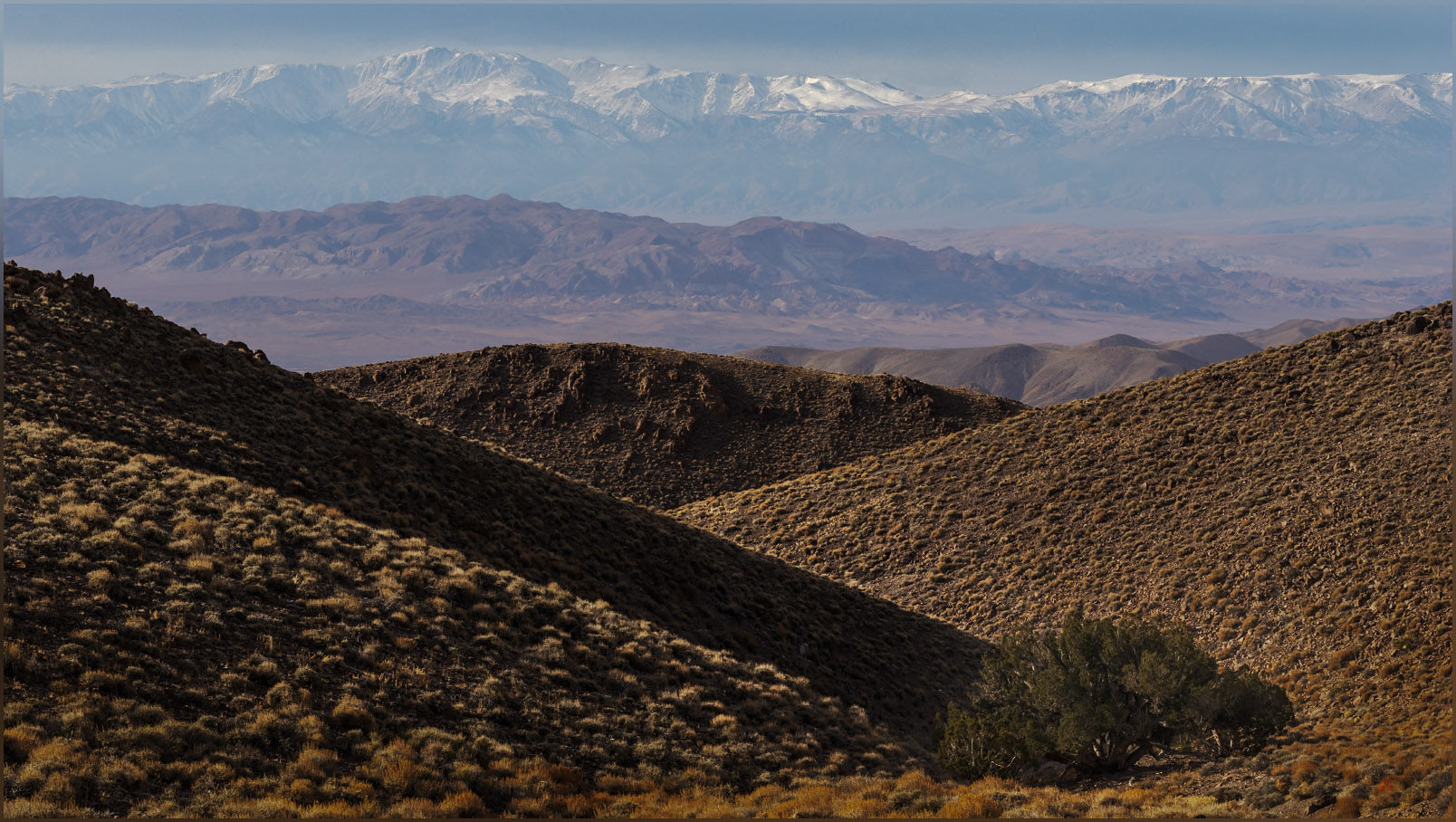
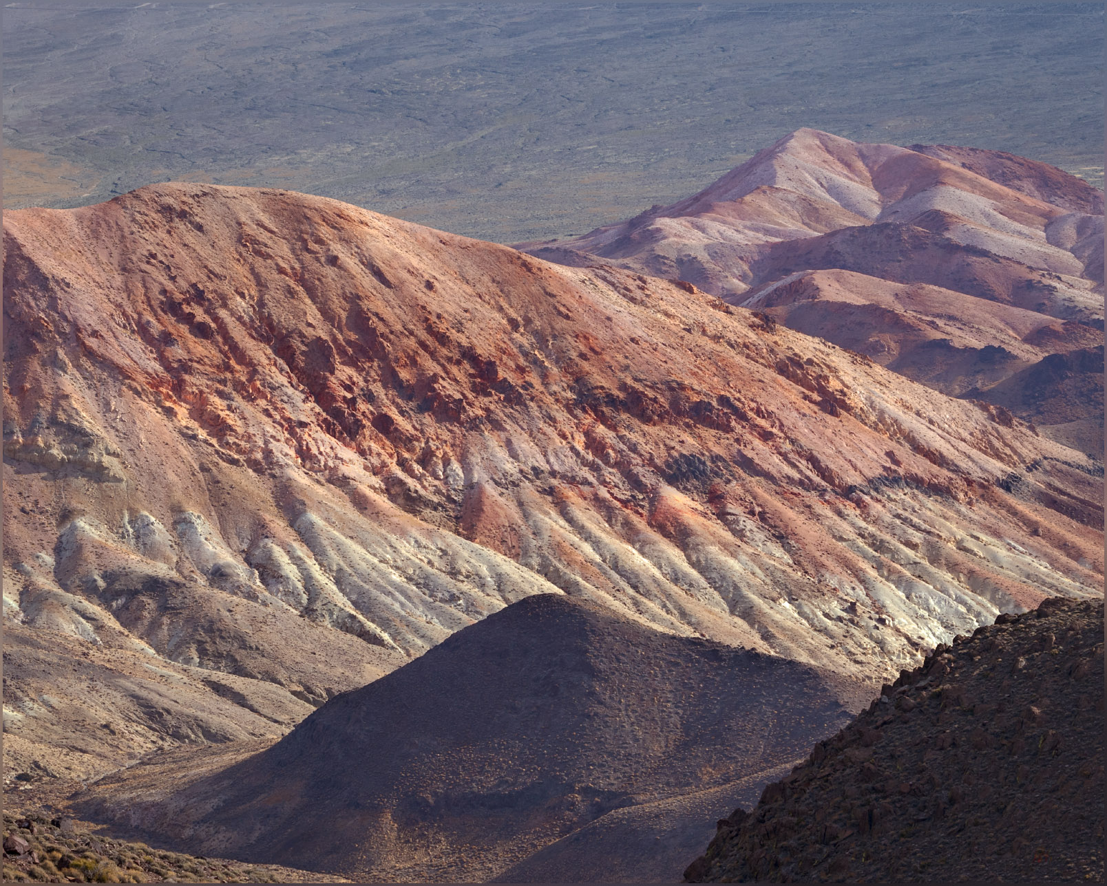
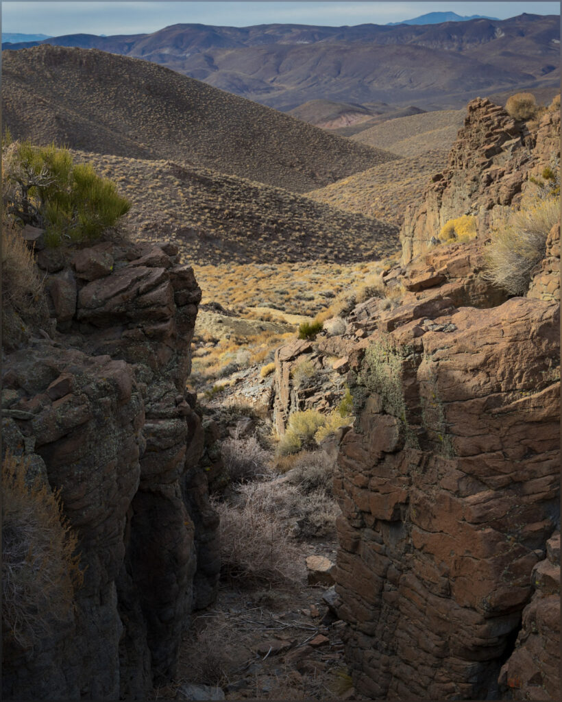
The summit views are the typical splendor; something that is never lost on me. The White Mountains of California on the western horizon, their northern tip sticking into Nevada as the pinnacle of Boundary Peak. Desert mountains surround me, some I have visited while others remain targets for future excursions. I can look down on the historic location of Gilbert with its few mining relics dotted among myriad tracks and trails – and a misplaced, modern trailer or something.
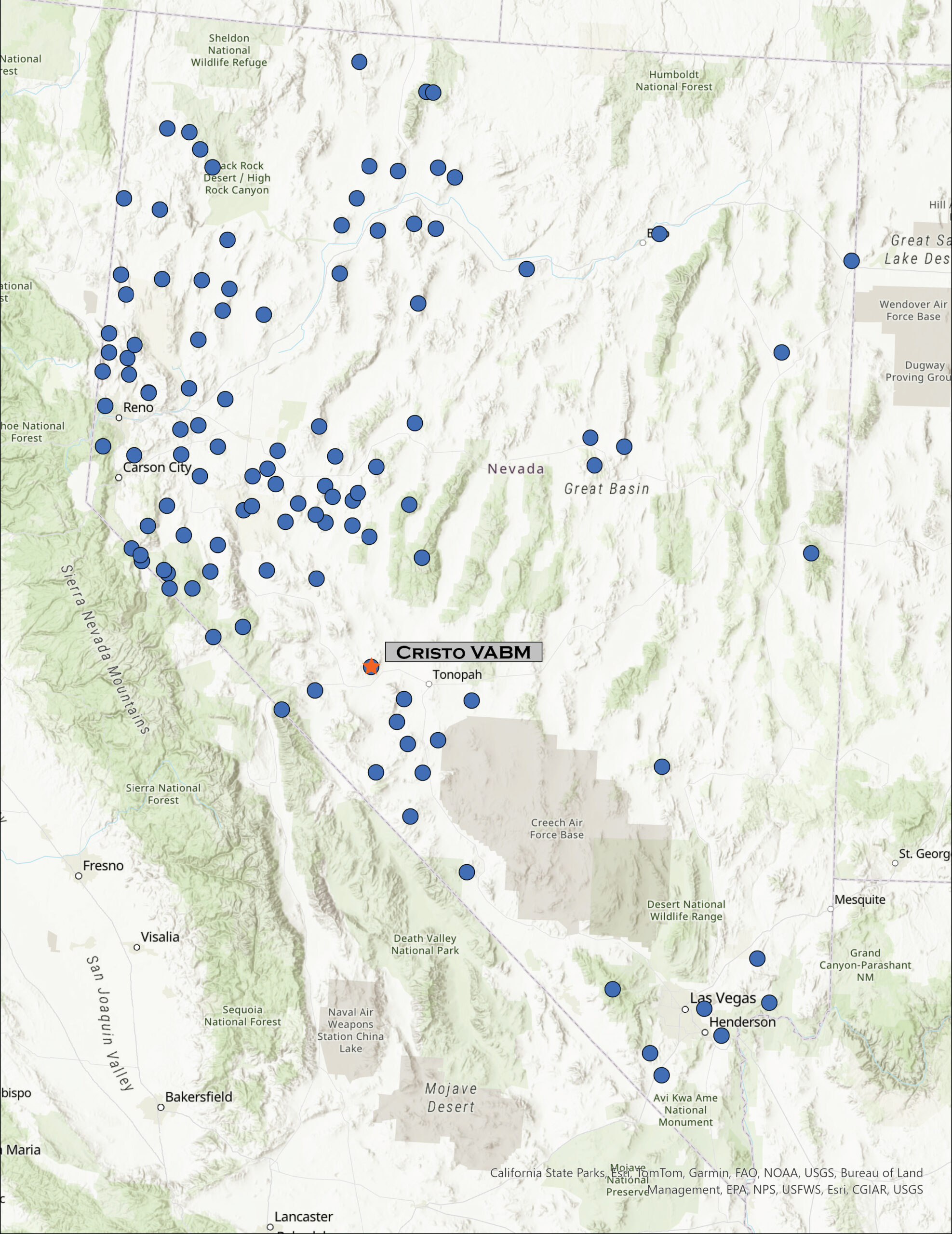
It is the last day of 2023. I managed to visit ten highpoints this year, not the one-a-month I plan for, but still a fortunate series of excursions, maps, images, and stories. The mountains and hills, large and small, continue to amaze and attract me. I cannot explain the traffic of the early morning, but it was an easy escape, on some dirt and a game-trail, to the quiet of the mountains to close out the year. My apologies to the owls, whom I disturbed from their rest. I will remember to approach softly next time; I should assume an isolated stand would hold an otherwise safe roost. Pardon my interruption — it is the same restful quiet I seek in the desert enclaves of unnamed canyons and their tributaries.
Keep going.
Please respect the natural and cultural resources of our public lands.
Leave a Reply