• Skip to primary navigation
  • Skip to main content

Trail Option

A personal geography of landscape and place, art and geo-science.

  • Home
  • TrailOption Blog
  • WayPoints
  • Galleries
  • About
  • Contact TrailOption
  • Subscribe!
  • Show Search
Hide Search

Ranges and Routes

Nevada High Points #101 – Slumbering Hills

D. Craig Young · June 1, 2022 · 4 Comments

Waking the giants. A granitic pluton emerges from the Slumbering Hills, Great Basin Desert, NV

Unnamed

6531 ft — 1991 m (1593 ft gain)

2022.05.18

Slumbering Images Collection


Slumbering Hills (2018). Great Basin Desert, NV, USA

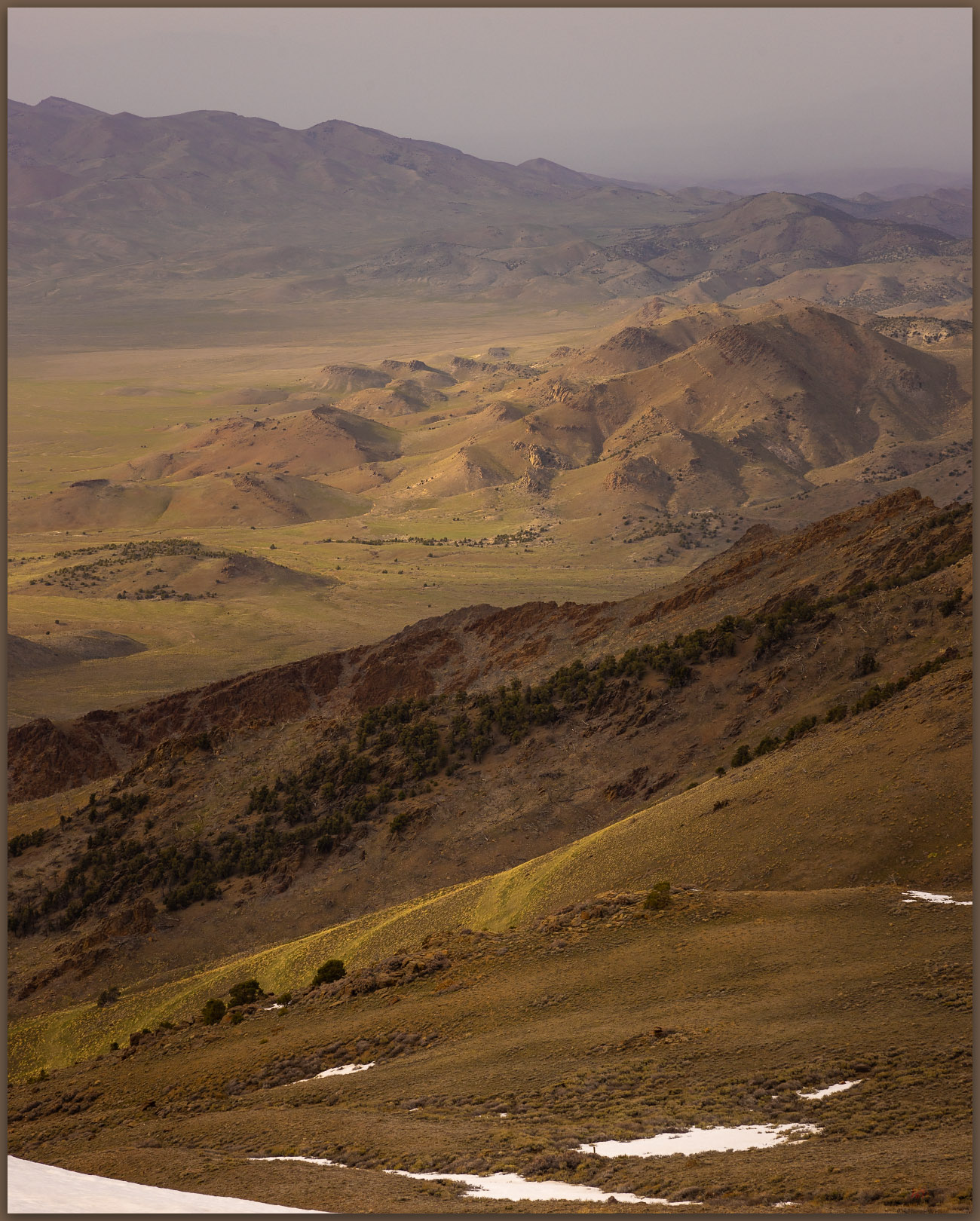
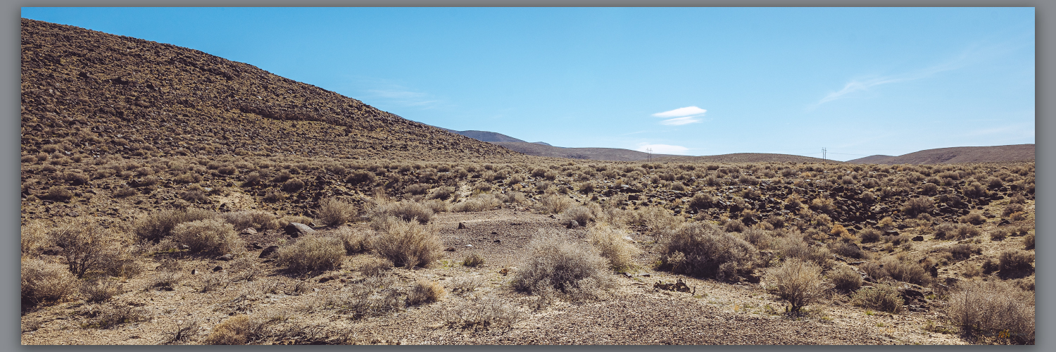
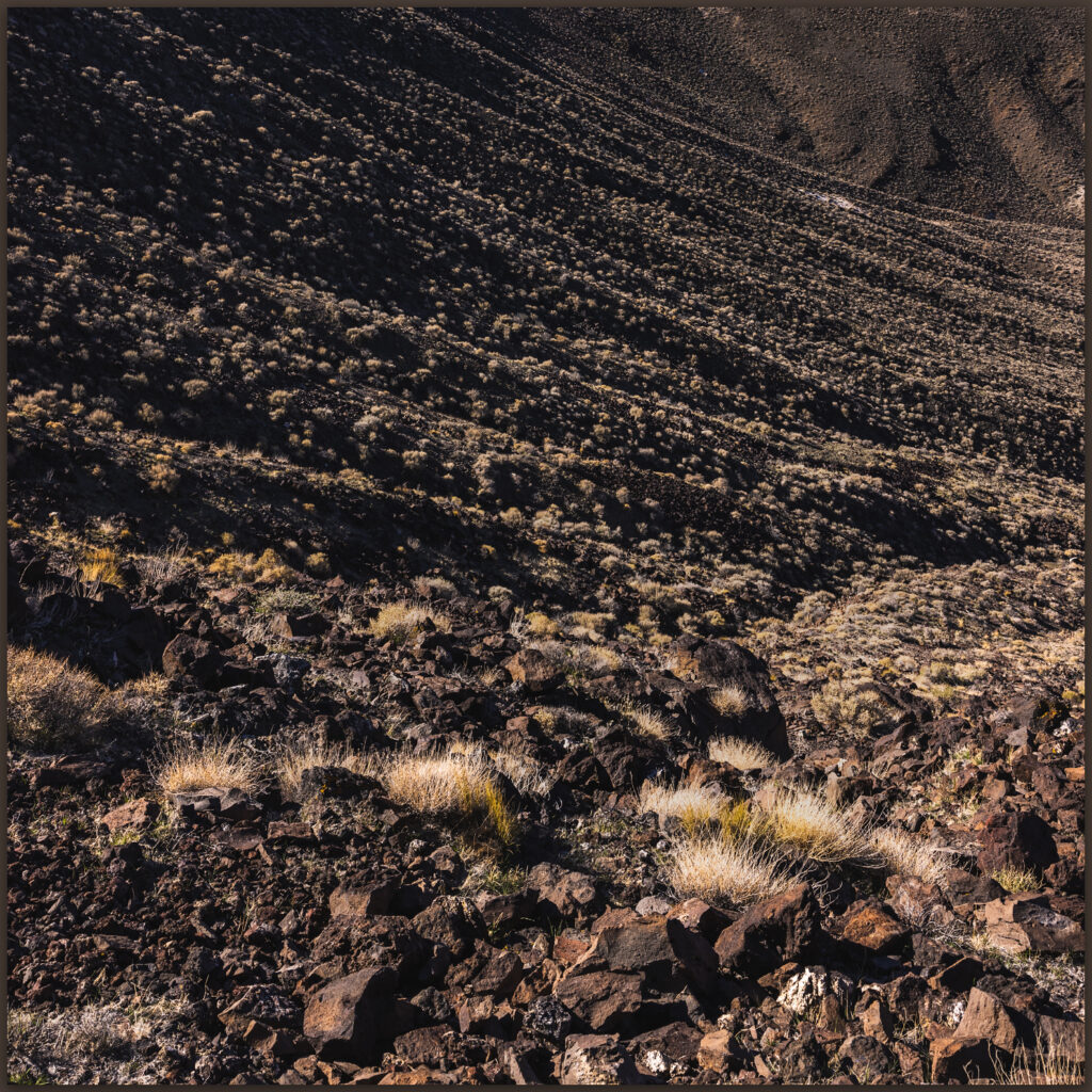
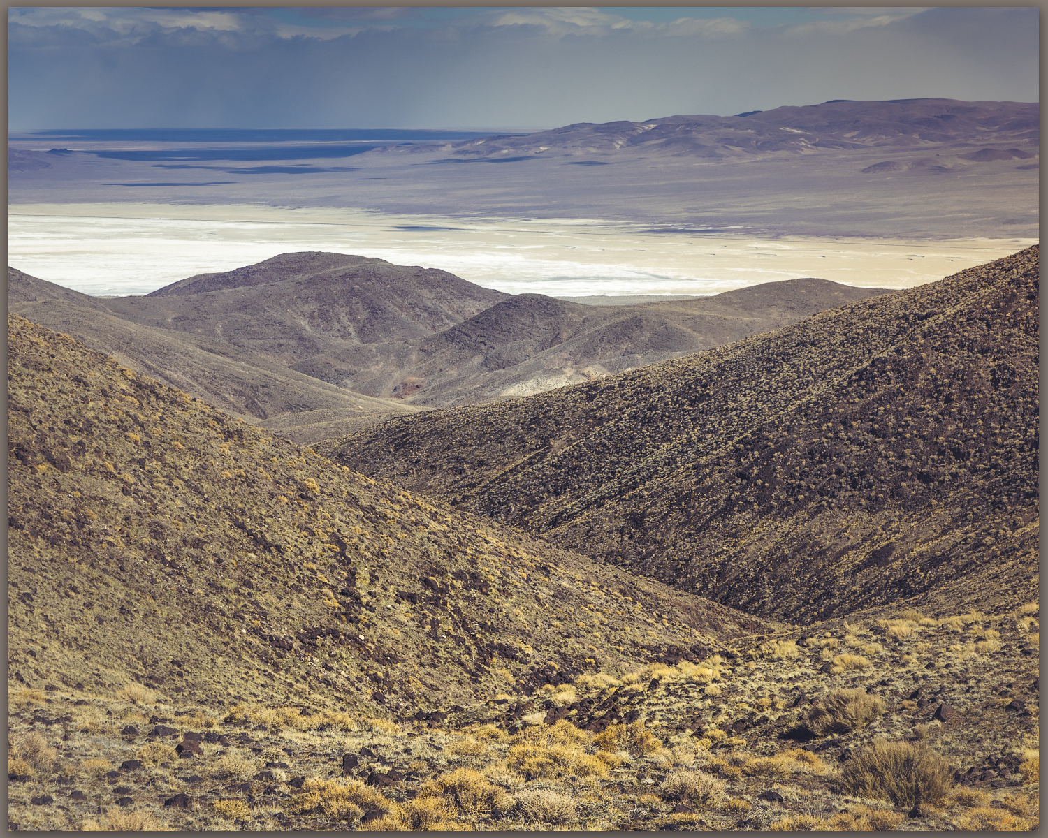
There is something in the Slumbering Hills. The unnamed high point is below 7000 feet in elevation and there are few riparian areas, only scattered springs, and absolutely no trees. Cheat grass and desiccated plants of sagebrush and saltbush communities show the struggles of fire and scabby recovery; mining pits and piles pock the numerous roads and tracks that traverse the range. It seems unappealing and easily unassuming from the highways where one glimpses higher, snow-capped mountains that rise in the distance, drawing sightlines to obviously higher horizons. And yet, the late evening light of each day turns a brief trick of alchemy as golden hour sets magic at play. Some of my favorite Great Basin imagery comes from these magical hills. Appropriately, the hills’ magic would trick me in other ways too.

Silver State playa. A small playa at the intersection of lacustrine remnants and the distal fans of Silver State Valley, Great Basin Desert, NV
Silent perch. A raptor waits among the rocks, Slumbering Hills, Great Basin Desert, NV

For the past several months I have been working nearby, studying the paleogeography of obsidian and its use in the northern Great Basin, and this provided the opportunity to hike into the Slumbering Hills. Obsidian is absent from this range, but I wanted to get closer to the photographic magic I had experienced several years ago and, of course, find my way to the range’s high point. With this in mind, I left camp one afternoon with Joe Burfield, a collaborator on my current project, working our way into Humboldt Canyon below Awakening Peak. We climbed grassy slopes to gain an east-facing ridge, finding a barking pronghorn antelope as we approached the rocky outcrop of the summit. The climb was a pleasure that later turned to surprise as, downloading my images and checking my high point catalog, I realized that Awakening was not the apex of the range. It was the obvious summit in my early photo, and I had fixated on it, forgetting to check my catalog — I had led us to the wrong summit! Not the third time I have made this mistake. No worries, it simply meant another walk with Joe.

Sleeping green. The grasses of spring begin their fade to summer, Desert Valley, Great Basin Desert, NV

This time we traversed the base of the hills to a point further south, leaving the old site of Daveytown and following a sandy two-track to Pickhandle Pass. As we drove, we climbed into a garden of granitic knobs and outcrops, each a puzzling, bulbous crag or an impossible set of balancing boulders hosting little kingdoms of a ruling raptor or raven. Take Owens Valley’s Alabama Hills, bury it in alluvium, and lift it into the sky; it is something like that. We pointed and laughed at the surprising formations that kept popping into view. I had camped here year’s ago, approaching from the west, so I remembered the ridge-line two-track leading south from Pickhandle Pass. We parked somewhere near my old tent site, looking forward to a three-mile wander among the granite hoodoos to the range’s true, though unnamed, high point (I was sure this time).

An ancient delta. Distant sand dunes mark a former delta of the Humboldt River below Blue Mountain in southern Desert Valley, Great Basin Desert, NV
Heading home. A ground contrail below the Jackson Mountains, Desert Valley, Great Basin Desert, NV

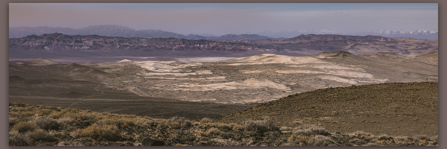
Vast sand dunes ramp along the southern margin of the range; wind-driven remnants of an ancient course of the Humboldt River, from a time when it veered into Desert Valley to join the Quinn River, probably some time in the Late Pleistocene. Today, the wind was carrying loads of fine-grained desert loess from the playas of the Black Rock Desert and beyond – this is the magic dust that imbues the Slumbering Hills with its golden hour personality. It did not disappoint.

A quick glance. A pronghorn antelope near the summit of the Slumbering Hills, Great Basin Desert, NV
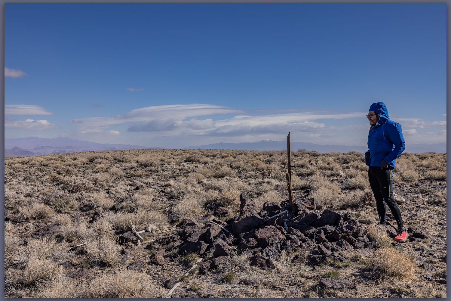
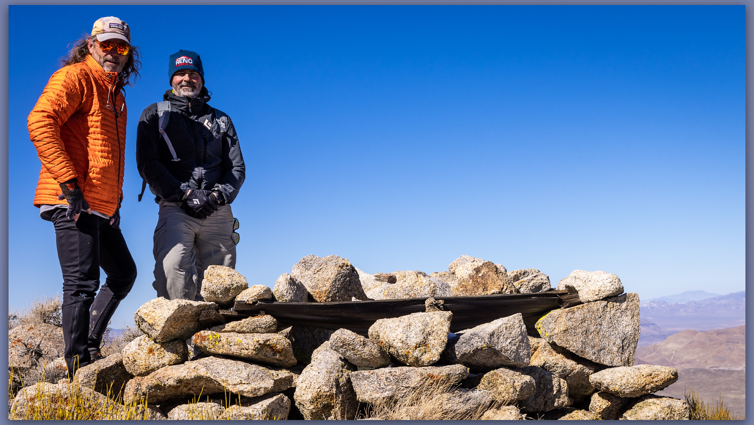
Summit cairn. The high point of the Slumbering Hills, Great Basin Desert, NV
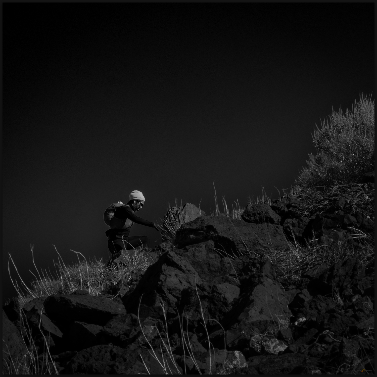
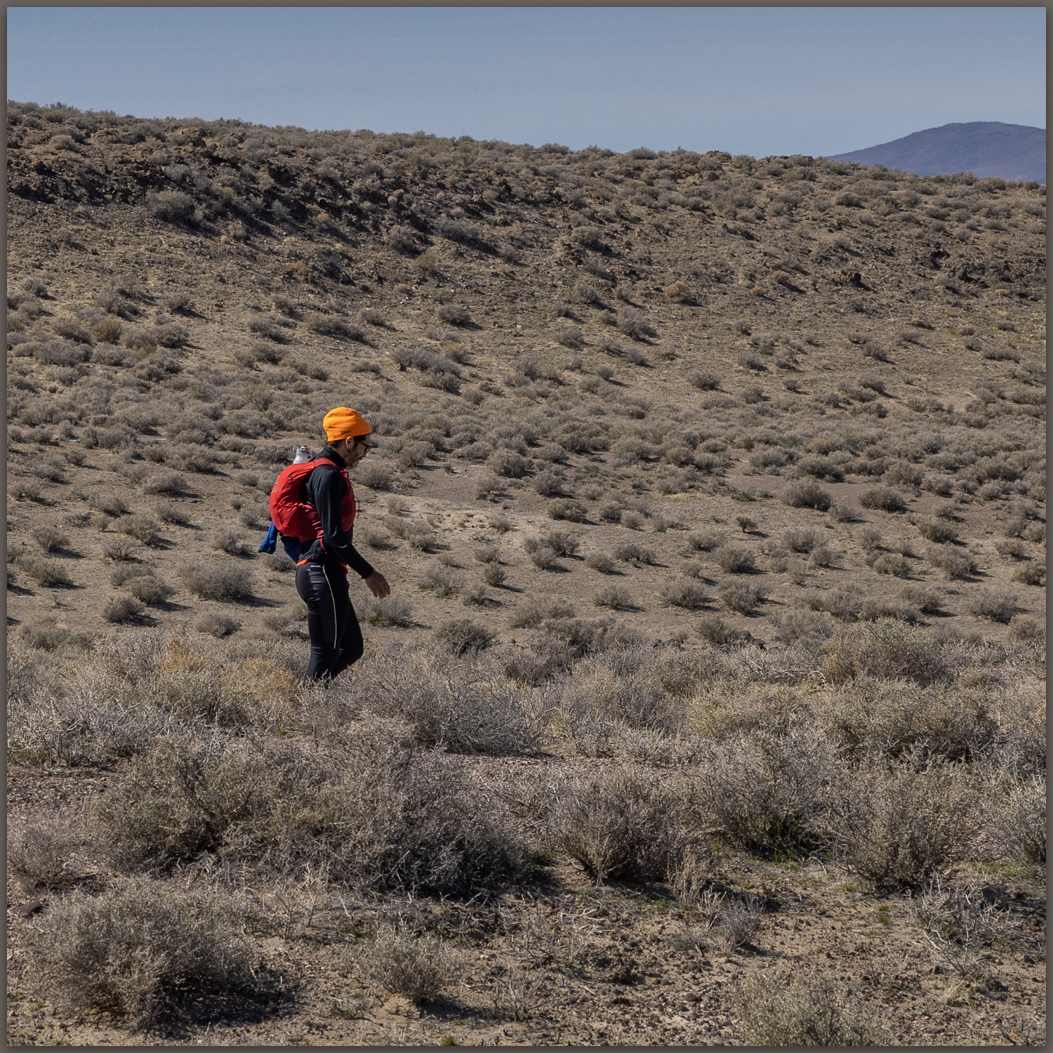
Joe. Making our way into the evening below the summit of the Slumbering Hills, Great Basin Desert, NV

After a brief visit with a pronghorn antelope, yet again grazing below the summit, we climbed into the golden light of the summit, a cairn and register confirming that I had navigated correctly. The sun was setting as we paused for a time, bracing in the wind but warmed by the beautiful glow of the last light. We could look several miles north to see Awakening, where we had been only a few evenings earlier. Our descent would be in twilight, venturing into night. Joe’s headlamp eventually found the rig in the dark grass of the two-track. Our drive’s conversation would inevitably turn to the pleasure of having ventured into this bedraggled little range twice, not disappointed and by no measure a waste of time. We would roll into our camp near Orovada just prior to midnight, a worthy day of magical light.

Slumbering Images Collection

Lenticulars and dust. The wind operates high and low above Silver State Valley, Great Basin Desert, NV

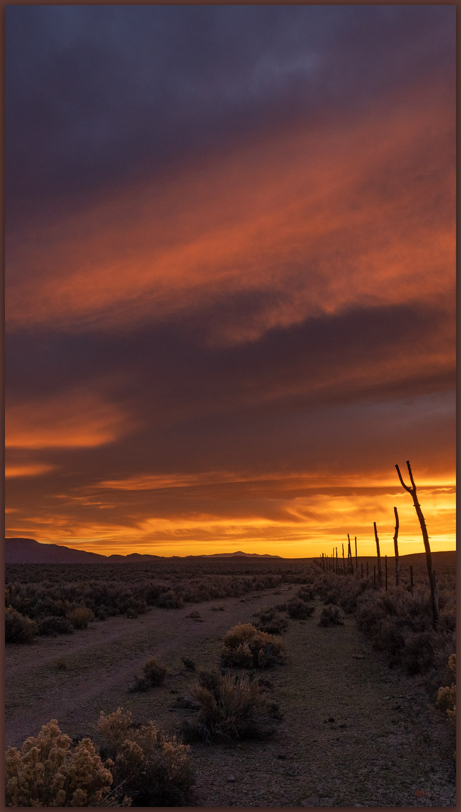
My last few high point excursions – even the one that did not count – have been evening walks. While I enjoy the challenge of photography and will seek out a trail at all times of day, the golden hour of a Great Basin evening, with dust, straggling clouds, and wispy virga – the aborted promise of moisture – among the contrast and saturation of low-angle light, is the epitome of a day’s completion. I have often known summer heat to abate or winter storms to break with the fading light, as the energy of the day wanes and the sun’s last rays scrape the topography to pile shadows into canyons and stack highlights among outcrops and ridge lines. This is the time to wander and see; when the experience of the Great Basin is at once, and almost daily, sublime. The walk out can be dark, but the memories light the way.

Keep going.
Nevada High Points #100 – New Pass Range

D. Craig Young · April 26, 2022 · 1 Comment

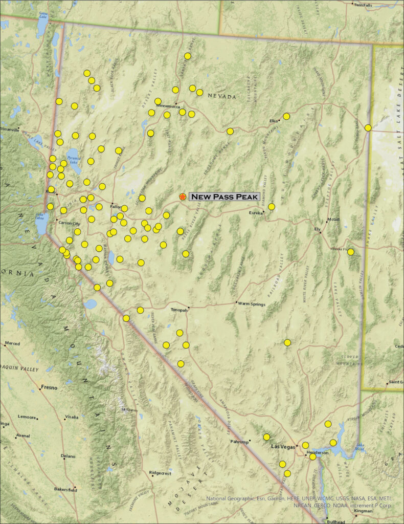
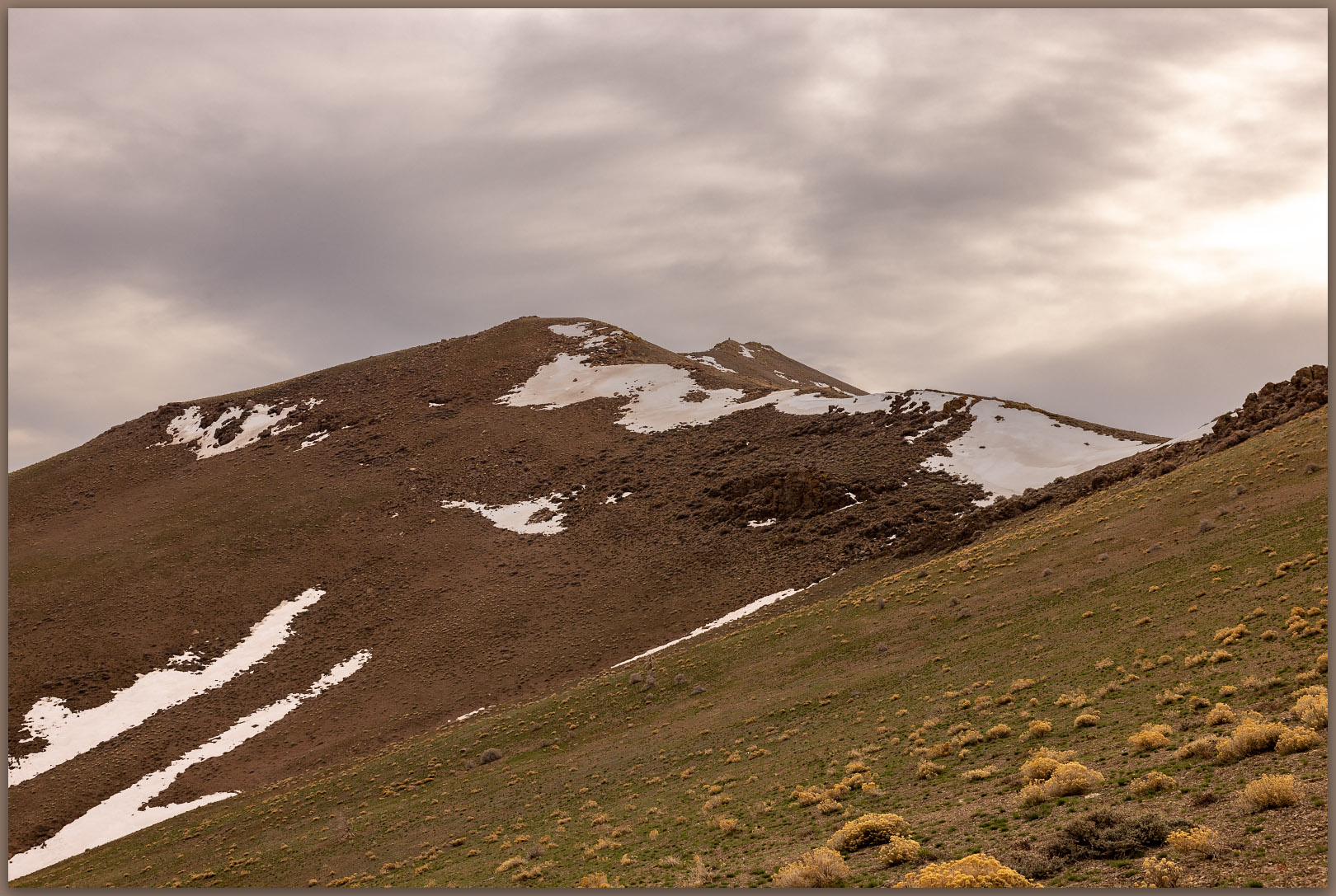
New Pass Peak. The north slopes and upper reaches of Gilbert Canyon, New Pass Range, Great Basin Desert, Nevada

New Pass Peak

9002 ft (2744 m) — 2901 ft gain

2022.04.08

New Pass Peak Collection

Big, round numbers are cool, and here I am at High Point #100. It is simply a step on the journey, but it is also a great measure of motivation and experience in getting here. I started this quest in 1995 visiting high points in earnest for a couple years until, some would say, bigger responsibilities got in the way. But like the 100-mile ultraruns I have completed, the long experience takes time and consists of many unique steps on many different trails. It is the process that matters. I am happy that the earnestness has returned, and I have reached the century mark – New Pass Peak, west of Austin (Nevada, of course).

I chose New Pass because the approach would be relatively straight-forward and due to an upcoming travel schedule, I did not have a full weekend. I also liked it because I see the peak commonly while traveling Highway 50, and I would have a common visual reminder of #100 as I travel across the state. As usual, Darren agreed to join the experience; we would get at least one camp night in.

We set camp on a small outcrop at the edge of the dry lakebed (playa) of Edwards Creek Valley. I have a geologic fascination with dust, so the silt dunes and fine-grained alluvium of valley bottoms are always interesting; I would have occasion to regret that interest later today. With my little camp trailer and Darren’s tent stashed in the valley, we began a driving traverse of the mountain front where the New Pass Range rises abruptly to the east. The road took us along the fire-barren alluvial fans and relict pediments, revealing a general absence of roads or tracks on mountain’s western front. Exploring further north we dropped into Antelope Valley (one of many Antelope Valleys) and explored its high basin with way too many parched wild horse herds. The fires and horses have had a significant adverse impact in this dry and ever-drier basin.

Skeletal pines. The bones of fire on the eastern slopes of New Pass Peak, New Pass Range, Great Basin Desert, Nevada

Our round-about tour led us in full circle to the old New Pass Mine Road where we thought we could start our three-mile (one-way) walk along a south-to-north ridgeline. We were met, however, by private property and cable gates that turned us away. At first disappointed, we felt encouraged when we finally found the roads leading along Gilbert Creek – learning that this is the route to access the communications facilities on the summit. We parked well down-canyon and started up a steep slope to intersect our original ridge route. Skeletal pinyon snags circled small groves that somehow survived the latest fire. Will the surviving groves be enough to seed the pinyon’s return?

New Pass approach. Circuitous ridge-walk toward the high point, New Pass Range, Great Basin Desert, Nevada
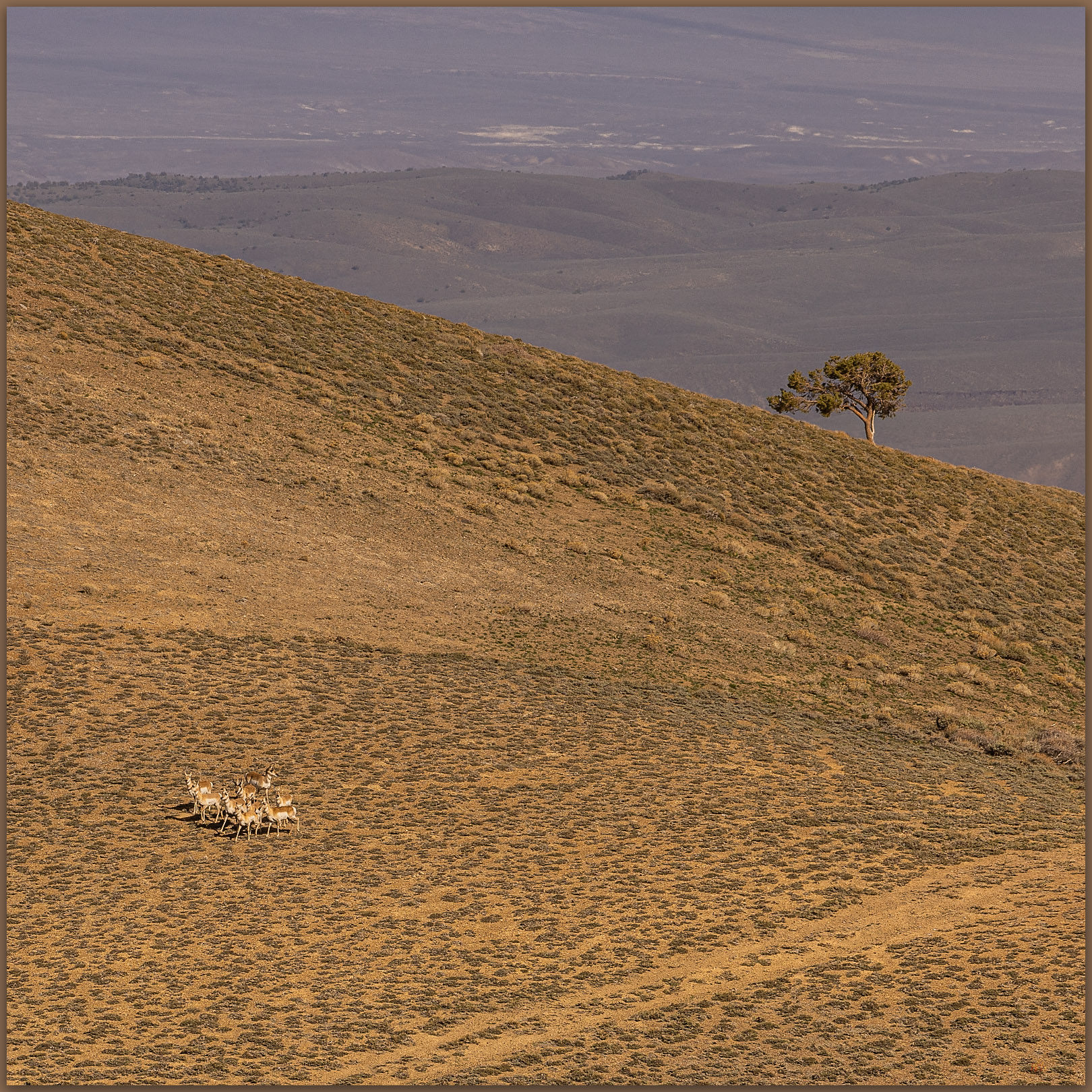
Followers. Pronghorn on the trail behind us, New Pass Range, Great Basin Desert, Nevada

Pronghorn find us near the ridgeline.  We only notice them when looking back on our route, and there they are, standing in the saddle we had passed through only moments ago. Not sure where they came from, but they watched us curiously and similarly as we kept moving away.

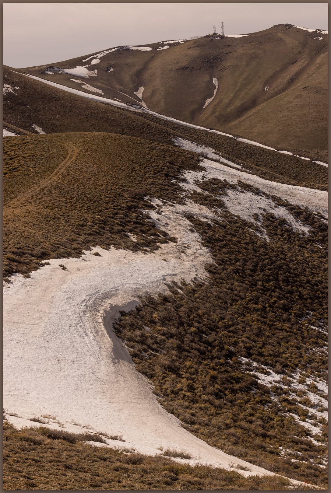
It was now windy, the skies smudged with dust from distant dry lakes and playas. We pushed through a few patches of snow to gain the final summit where the communication overwhelmed small patches of snow and glowered from the hilltop. It was nice that the actual highpoint was isolated a bit to the north, peaking at a rocky outcrop that overlooked the facilities and everything else. We tucked into the outcrop to sign the few scraps of paper that made up the register – if we scurried out from the rocks, the wind blasted our jackets into a noisy frenzy. We could see that Edwards Creek Valley was embroiling a dust storm of its own, and, somewhere in that cloud, our camp (or its remnants) was set. Sometimes dust is a bit too interesting and present.

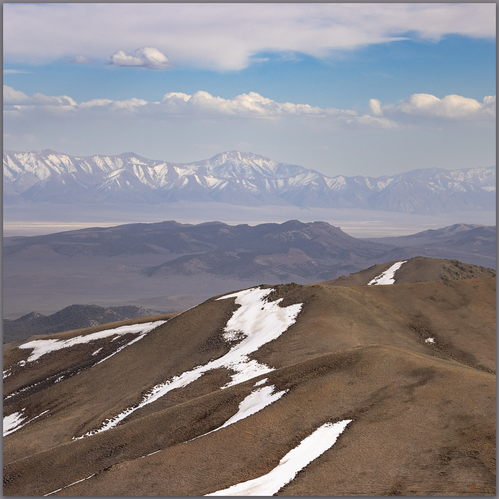
Toiyabe distance. Bunker Hill, high point of Lander County, Toiyabe Range, Great Basin Desert, Nevada
Hints of spring. Green hillsides in the dusty breeze of Edwards Creek Valley and New Pass Range, Great Basin Desert, Nevada
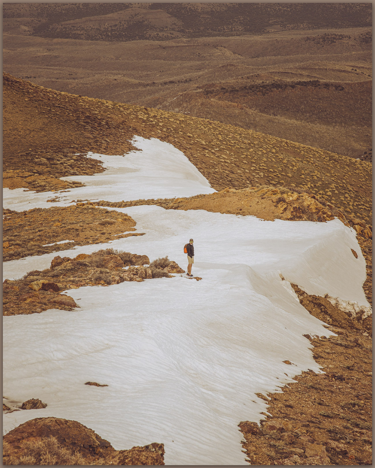
Snow patches. Darren exploring the descent from New Pass Peak, New Pass Range, Great Basin Desert, Nevada
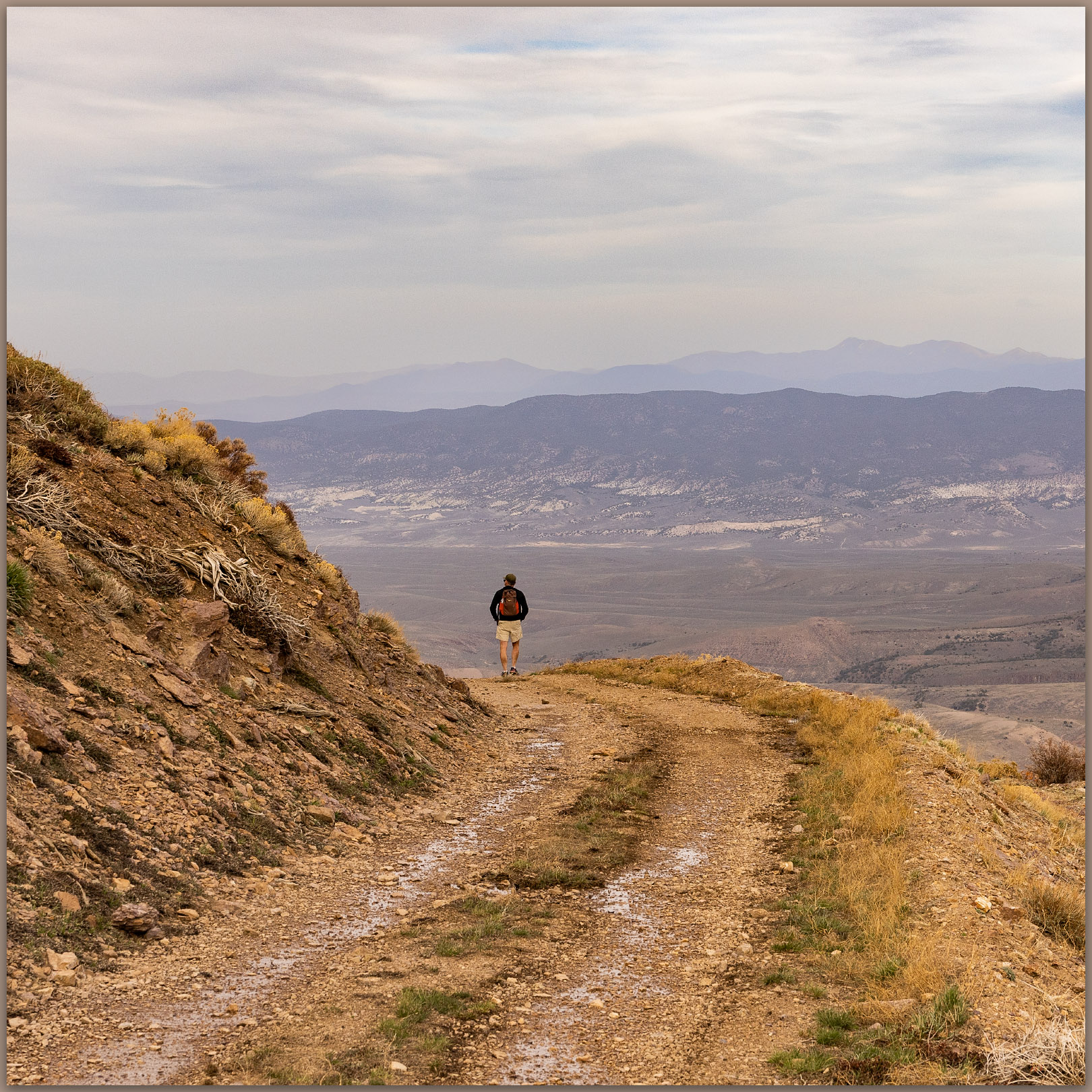
Two-track descent. Darren wanders the road into the upper reaches of Gilbert Canyon, New Pass Range, Great Basin Desert, Nevada

Never mind the gusts, the summit was splendid. Good views of the Toiyabe Range and Shoshone Mountains, along with some colors of the late afternoon working through the storm clouds and whirlwinds. The conditions calmed as we dropped onto the road into Gilbert Canyon where it soon became clear that we might have left the summit a bit early. It took about an hour to get back to the truck but in that time the sun reached the cloud gap at the horizon and shed glorious light on our area of central Nevada. At first, we raced the light on our return drive, hoping to catch a golden hour scene to photograph, but we settled quickly on the simple enjoyment of our warmly lit drive. We slowed considerably to take in the wonderful transition to night.

Closing tracks. Ending the day, leading toward camp, New Pass Range, Great Basin Desert, Nevada

Our camp was a mess. Darren’s tent had clammed into a single dimension but was otherwise in its original location. The wind had calmed after powder-coating everything in sight – an amount, if measurable, would likely have been in the tons per acre for this one event. Dust influx occurs in those kinds of amounts, year after year, throughout the Great Basin. It is awesome (and dusty).

Click here for New Pass Peak Collection

Our skottle dinner provided special celebration. Darren had joined me on #100, a few days before my 58th birthday. Good times. The wind would return in the night, turning cold and occasionally waking us enough to witness new dust clouds blurring the Milky Way and the last of the winter constellations.

In the morning we scouted future access routes into the Clan Alpine Mountains where Mount Augusta awaits. We will get there soon. Of course, we have only 217 yet to go.

Keep going.

Please respect the natural and cultural resources of our public lands.

#naturefirst #keepgoing

Nevada High Points #99 – Cocoon Mountains

D. Craig Young · March 19, 2022 · 3 Comments

Shoreline features. Intersection of strandlines and the pavement of lacustrine badlands, remnants of pluvial Lake Lahontan on the lower slopes of the Cocoon Mountains, Great Basin Desert, NV, USA

Alkali VABM

6104 feet (1860 meters) – 2700 feet gain

2022.03.13

The forecast promised wind, and the day delivered. Although we drove into early morning darkness, an eastern glow of dusty skies preceded with the coming sun. Robert, my son-in-law, joined me on this one-day journey to the Cocoon Mountains, pushed by a trailing wind.

Rills. Colluvial ramps below the scarp of Cocoon Mountains, Great Basin Desert, NV, USA

The Cocoons are low volcanic hills rising south of Eight Mile Flat in the Salt Wells Basin, east of Carson Lake and southwest of the Carson Sink. Strandline shores of pluvial Lake Lahontan ring the mountains, their rocks remnant of the eruptive landscape founded in Middle Cenozoic tuffs and lavas. Sands of the Walker and Carson river deltas, once stored as beaches and bars, climb the hillslopes, filling canyons with standing waves of fine-grained sediment. I have watched this small, obscure range pass my windshield many times as I skirt the dune of Sand Mountain on Highway 50, east and west across Nevada. Now, beyond the dust of the sink, Robert and I turn south into lunette dunes of the Turupah Flat, at the sill of Salt Wells Basin, pushing along a rocky road around the foot of the Bunejug Mountains to reach the sandy foot slopes of the Cocoons. The road soon dug into the sand of lake-margin dunes; locking into four-wheel drive we moved easily onward – maybe fifteen miles beyond pavement.

A sandy track led to a water tank; we parked and walked into the soft slopes of sharp shadscale and saltbush, bleached bones marking the hard finish of a few cattle – some coyotes and ravens probably scavenged sustenance, dispersing the skeletal splinters into the brush. Winding our way along stranded shorelines, we traverse onto bouldery slopes and into sand-filled canyons. It is an easy walk, nothing for excitement but a few surviving cows, and the wind at our backs pushing us upward. A moderate volcanic escarpment marks the western front of the flat-topped mountain where a few wispy clouds play in the wind and blue sky – the wind-driven dust is ripping in long streams behind us to the west, trailing into the Walker River corridor and blocking any long views toward home.

Hiking through. Robert on the western slopes of the Cocoon Mountains, Great Basin Desert, NV, USA

Choosing a sun-marked line leading from a small, outcropping hill to a crease in the mountain-front, we take to steep stepping-stones of roll-prone boulders and scree. A chill has come to the wind, which has also strengthened noisily. The sweat of the climb turns to quick cold, and we dig in our light packs for warmer layers. Snow sits in alcoves along our last easy push to a summit tableland. But where is the top?

Alkali marker. The summit map station, labeled ‘Alkali’, Cocoon Mountains, Great Basin Desert, NV, USA

The common topographic marker of lathe and guy-wires protruding above a summit cairn marks ‘Alkali’, the USGS mark at 6,104 feet. Alkali was the goal, but the low undulations of the expansive, rocky flat give me pause. We are above the last topo line (always the goal!), but what little bump is highest. The Alkali mark lacks a register, not surprising on what many might consider an unattractive summit. We wander the tableland, eyeing the Alkali mark from various candidate bumps (there is a 6012’ mark highlighted on some maps), but we settle on Alkali – hitting every other undulation just in case!

Winding out. Canyon above Eightmile Flat, Cocoon Mountains, Great Basin Desert, NV, USA
Aeolian motion. Dunes of the Blow Sand Mountains from the summit of Cocoon Mountains, Great Basin Desert, NV, USA

The views are great; the winds are greater. Gusts buffet us, knocking me down at one point as I fumbled distractedly in my pack for a different lens. The falling dunes of the Blow Sand Mountains (a military-restricted summit) illustrate the movement of sand from the Walker River drainage to the Carson basin, where ripples of lunettes in Salt Wells Basin lead to the seif dune of Sand Mountain, which today is climbing the Stillwaters to fall into Dixie Valley. I am reminded that desert dunes have their origin in water – streams are the genetic conveyors of silt and sand; they are parents of dunes, their children seduced to far-flung adventures by consanguine wind.

Walking out. Robert on sandy lower slopes of the Cocoon Mountains, Great Basin Desert, NV, USA

Cocoon Image Collection

Tired of the wind-blown stance at the top of the Cocoons, we drop into protected canyons after traversing a northwestern ridge back to the powerline track we crossed earlier. Once constant gusts subsided with each step toward the valley-margin sands. Robert and I kicked along the sandy slopes talking of former trail-running adventures and those to come. Soon our out-bound footprints appeared among the scattered bones along spoked paths that led to the dry tanks; here, our truck waited, a friendly beer drawn from the dregs of the cooler. A good morning walk, once again.

Keep going.

Please respect the natural and cultural resources of our public lands.

#naturefirst #keepgoing

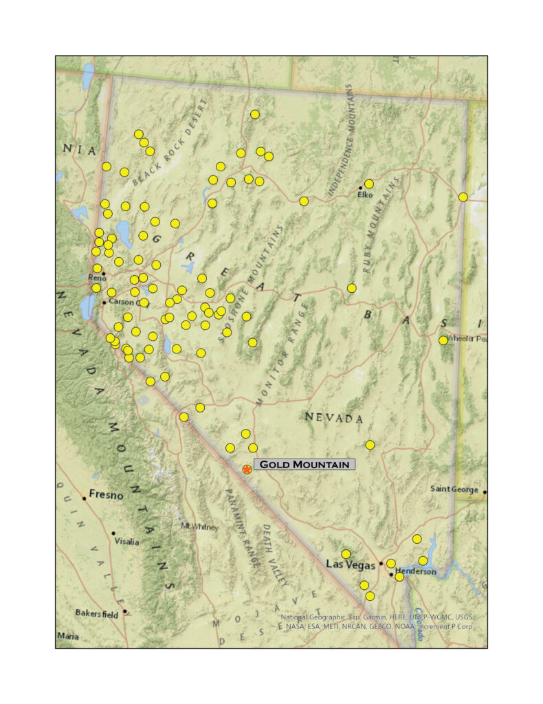
Nevada High Points #98 – Gold Mountain

D. Craig Young · March 12, 2022 · 1 Comment

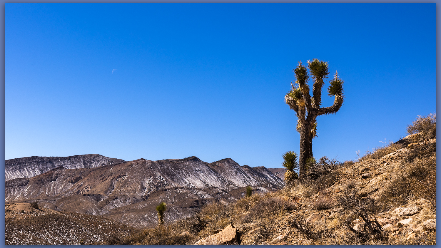
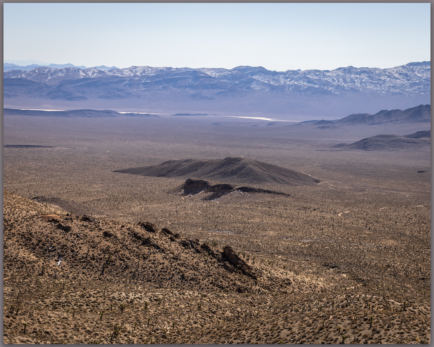
A Joshua. Westward from slopes of Gold Mountain, Mojave Desert, NV, USA

Gold Mountain

8152 ft (2485 m) – 2300 ft gain

2022.02.25

Gold Mountain Collection

It was finally time to get back to a desert high point – my string of monthly highpoints having been broken by a wonderful trip to Patagonia and Atacama Desert in Chile (stories and images coming soon).

Although we have not had good precipitation in 2022, a couple slider storms have left dustings in the high country and access can be an undesired, muddy adventure as early runoff continues. With this in mind, Darren and I ventured southward into the Mojave to find the south-facing slopes of Gold Mountain above Bonnie Claire Flat. It is a long but easy drive through Tonopah and Goldfield before turning west toward Scotty’s Castle and the former northern, paved entrance to Death Valley National Park – the road remains closed where, several years ago, the headward drainage of an alluvial fan reclaimed the highway near the castle grounds. It makes for a quiet section of highway along Bonnie Claire between Gold Mountain and the Grapevine Mountains.

Bonnie Claire Flat. Southern slopes of Gold Mountain, Mojave Desert, NV, USA
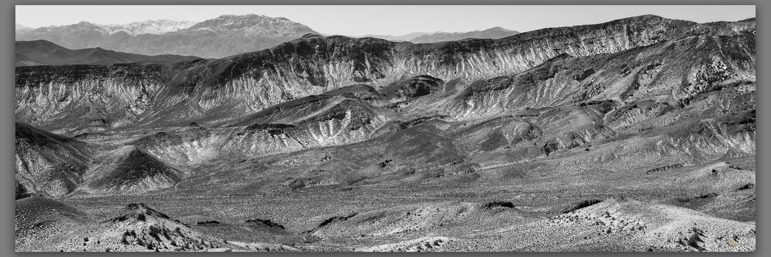
Bonnie Claire distance. Southeast toward Obsidian Butte, Mojave Desert, NV, USA
Bonnie Claire Flat. Southern slopes of Gold Mountain, Mojave Desert, NV, USA

We turn northward up the fan, encountering traces of Bonnie Claire Airfield before tracing our way to some mining prospects at the toe of the mountain front. There is a cool breeze as we head out, but we are soon warm as we gain elevation. On a moderate slope we walk up loose, dusty scree with Joshua trees scattered among granitic boulders. Prospects dot the hillsides where seams of hydro-altered rocks and occasional volcanic dikes run through their host outcrops; these intrepid miners chased riches promised by the historic strikes of nearby districts, and who could pass up “Gold Mountain”?

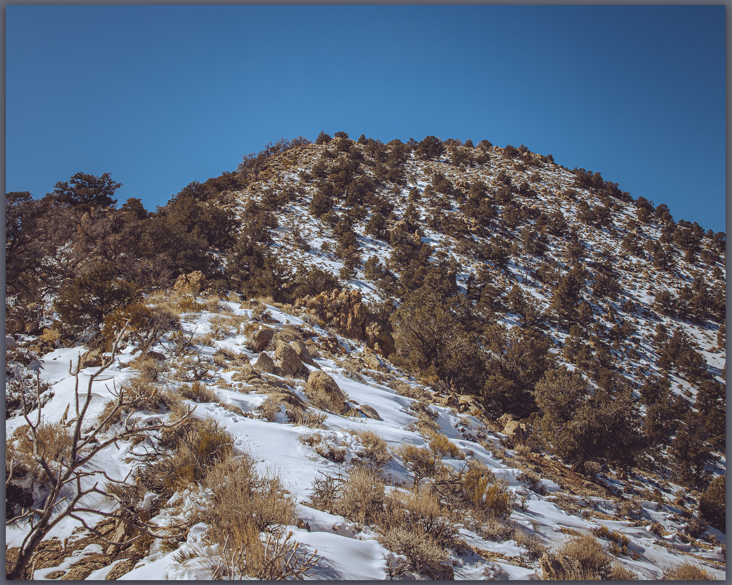
Snow remains. North slopes hold fading winter moisure, Mojave Desert, NV, USA

The scattered Joshua trees give way, with elevation, to a pinyon woodland where a few Pinyon Jays call out – I fail to see the talkative birds, however.  Darren reaches a small cornice which preserves the recent snowy turbidity of recent storms; the small wave climbs from the ridgeline but we step over and through to reach the rocky slope of the summit outcrop. A square cairn protrudes from the summit where we can look westward to the Sierran Crest and eastward into the Basin and Range. It is a simple but very worthwhile summit, as is most often the case in the smaller isolated ranges throughout Nevada.

Gold summit ridge. Pinyon woodland near the summit of Gold Mountain, Mojave Desert, NV, USA
Summit time. The brothers at the summit cairn of Gold Mountain, Mojave Desert, NV, USA
Gold Mountain. The summit rises above Joshua tree canyons, Gold Mountain, Mojave Desert, NV, USA

Gold Canyon Collection

We drop southward to look for one of the larger prospects among a dense pinyon grove. Our descent takes us too far west, a bouldery outcrop and sandy canyon drawing us downward.  I am not, however, overly fascinated by the old mines, so we take the descent following game trails toward the fans that feed into Bonnie Clair. We are quickly back to the truck where we marvel at the afternoon warmth. It is time to return to the chill of the northern valleys and we head homeward. A good day for a high point outing, taking advantage of windshield time to catch up with my brother and feel the warmth of a winter day at the edge of Death Valley. 

Keep going.

Please respect the natural and cultural resources of our public lands.

#naturefirst #keepgoing

Nevada High Points #97 – Paradise Range

D. Craig Young · January 5, 2022 · Leave a Comment

The mists of the basin on the clear, Sand Mountain, Great Basin Desert, NV, USA

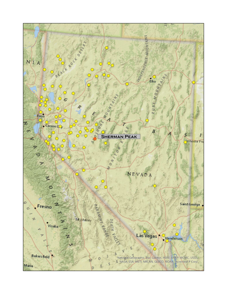
Sherman Peak

8957 ft (2639 m) – 2464 ft gain

2021.12.19

Sherman Peak – Paradise Range Collection

Winter’s coming, and the first snows have arrived. Although it snowed a little at StoneHeart in Carson Valley, I had watched the storms reorganize over the central Great Basin. How much would there be in the Paradise Range near Gabbs, Nevada? Well, a lot more than I thought.

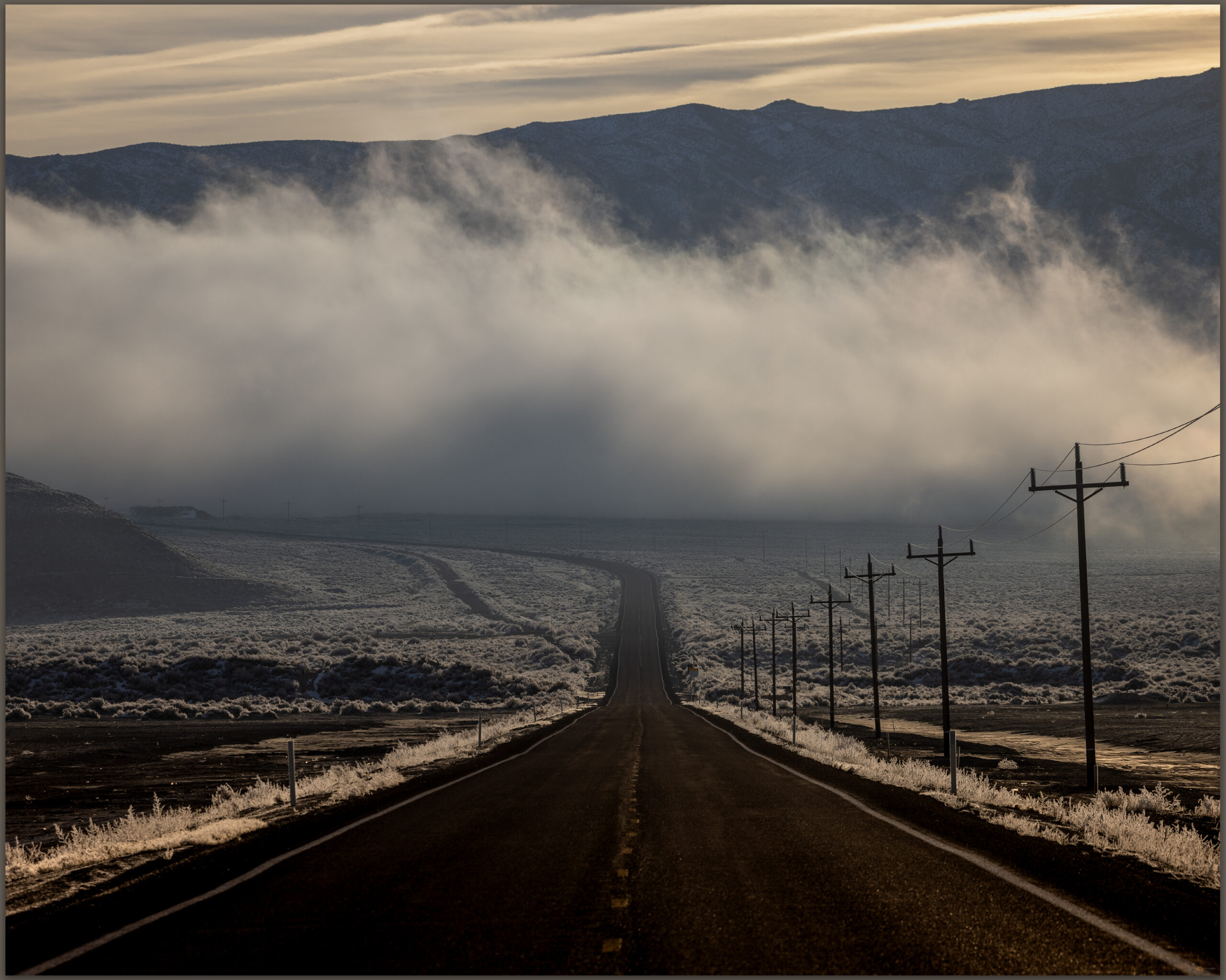
The long way. The loneliest road lives up to its name in the early morning, Sand Mountain, Great Basin Desert, NV, USA

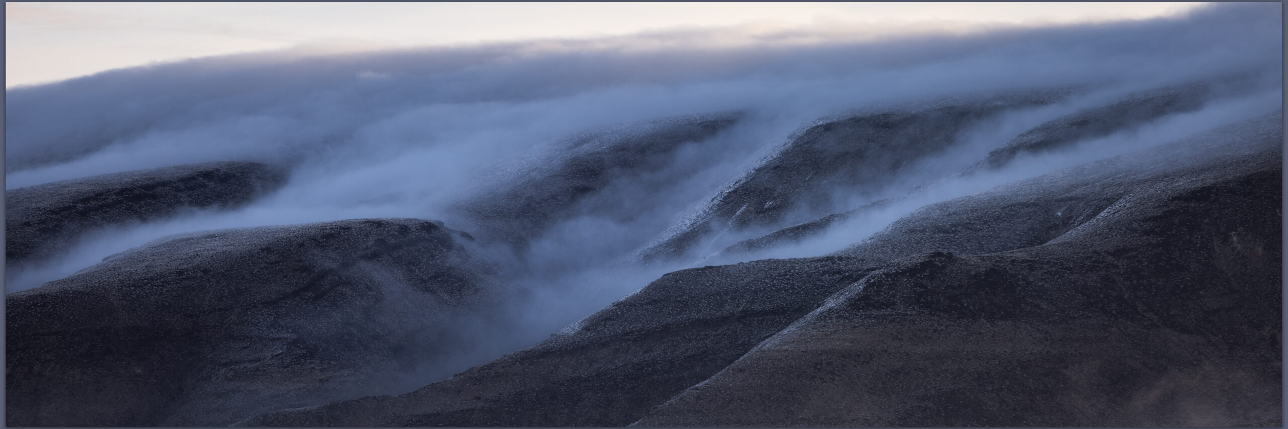
Darren and I hit Highway 50 in the pre-dawn, fog hanging low along the Carson River. At Sand Mountain the low clouds receded up mountainsides, with misty dollops scudding along the dune and its nearby hills. We were closed in at Labou Flat and Dixie Valley – nothing but the black line of the highway leading onward.

Blue skies in Gabbs Valley. Turning toward Ichthyosaur State Park, we climbed between growing snowbanks into the Paradise Range. No off-road travel today, so we parked in a crunch of deep snow, creeping in four-low just to get inches off the plowed pavement. The sun burned and bounced off the white landscape. When we stepped into the snow-bound two-track, it reached just below our knees. We were headed toward south-facing slopes of Sherman Peak, it would have to thin out.

Sherman Peak rises to the left, Paradise Range, Great Basin Desert, NV, USA
Snow approach. Finding more snow than anticipated, we worked slowly toward Sherman Peak, Paradise Range, Great Basin Desert, NV, USA

No it would not. We traversed and traversed; the snow was deeper and deeper. I had not picked a long route and figured it would be just under three miles to the high point, that takes a couple hours typically. This was dragging on as we worked away along a contour that took us on to north-facing, waist-deep drifts in a skeletal forest of snags and blow-downs. I thought about turning back; we are in the shortest days of winter solstice and time could turn against us. It was not dangerous, only more than we had psyched up for. We kept at it, of course.

Summit time. A well-earned moment on Sherman Peak, Paradise Range, Great Basin Desert, NV, USA
Darren finds the register in the typical summit cairn, Paradise Range, Great Basin Desert, NV, USA

The summit was a relieved reward where we turned into a newly biting wind and felt the chill of recent excursion, the heat of effort evaporating quickly. We did not linger. But our first steps downward found us stumbling and falling from snow-buried boulders, missing the next footfall we thought would be there. Repeatedly. When we got into stride we descended quickly; until we hit the deep snow of the rolling, forested slopes of the last two miles. We slogged, boots heavy with wet snow and accumulated ice. Happily at the truck, we were glad for the effort and impressed by the conditions that Paradise had thrown at us – even if our sweat had come in the relatively warmth of the solstice sun.

I realized after that I had not taken many photographs. At first humbled by the stark blue skies and bright white snow, I soon forgot the camera altogether as we focused on breaking trail. The views from the summit of Sherman Peak are exception, seeing a distance Sierra skyline, valley beyond valley, and the bulge of the plateaued ranges of the central Great Basin. It was dressed for winter, ready for the days to come.

Sherman Peak – Paradise Range Collection

Please respect the natural and cultural resources of our public lands. #naturefirst #keepgoing

  • « Go to Previous Page
  • Page 1
  • Interim pages omitted …
  • Page 5
  • Page 6
  • Page 7
  • Page 8
  • Page 9
  • Interim pages omitted …
  • Page 12
  • Go to Next Page »

Trail Option

Copyright © 2026 · Monochrome Pro on Genesis Framework · WordPress · Log in

  • Contact TrailOption
  • Substack
  • Waypoints Bibliography
  • Young Archives