
Alkali VABM
6104 feet (1860 meters) – 2700 feet gain
2022.03.13
The forecast promised wind, and the day delivered. Although we drove into early morning darkness, an eastern glow of dusty skies preceded with the coming sun. Robert, my son-in-law, joined me on this one-day journey to the Cocoon Mountains, pushed by a trailing wind.
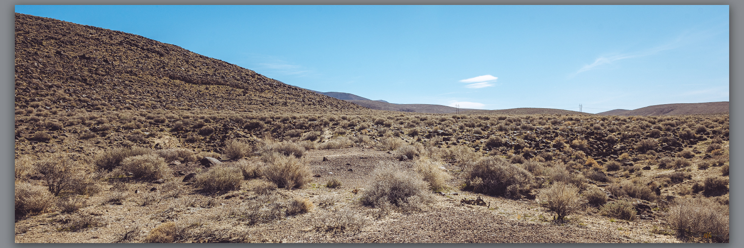
The Cocoons are low volcanic hills rising south of Eight Mile Flat in the Salt Wells Basin, east of Carson Lake and southwest of the Carson Sink. Strandline shores of pluvial Lake Lahontan ring the mountains, their rocks remnant of the eruptive landscape founded in Middle Cenozoic tuffs and lavas. Sands of the Walker and Carson river deltas, once stored as beaches and bars, climb the hillslopes, filling canyons with standing waves of fine-grained sediment. I have watched this small, obscure range pass my windshield many times as I skirt the dune of Sand Mountain on Highway 50, east and west across Nevada. Now, beyond the dust of the sink, Robert and I turn south into lunette dunes of the Turupah Flat, at the sill of Salt Wells Basin, pushing along a rocky road around the foot of the Bunejug Mountains to reach the sandy foot slopes of the Cocoons. The road soon dug into the sand of lake-margin dunes; locking into four-wheel drive we moved easily onward – maybe fifteen miles beyond pavement.
A sandy track led to a water tank; we parked and walked into the soft slopes of sharp shadscale and saltbush, bleached bones marking the hard finish of a few cattle – some coyotes and ravens probably scavenged sustenance, dispersing the skeletal splinters into the brush. Winding our way along stranded shorelines, we traverse onto bouldery slopes and into sand-filled canyons. It is an easy walk, nothing for excitement but a few surviving cows, and the wind at our backs pushing us upward. A moderate volcanic escarpment marks the western front of the flat-topped mountain where a few wispy clouds play in the wind and blue sky – the wind-driven dust is ripping in long streams behind us to the west, trailing into the Walker River corridor and blocking any long views toward home.
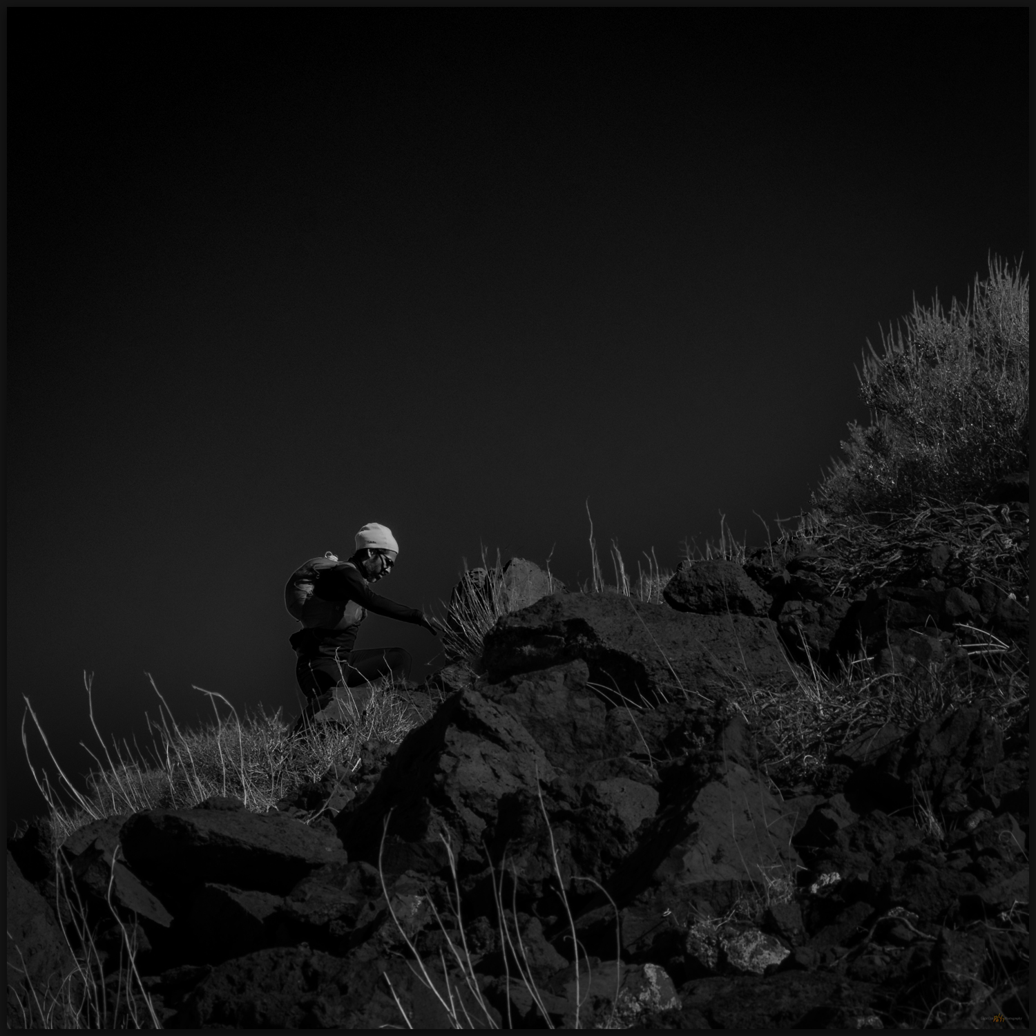
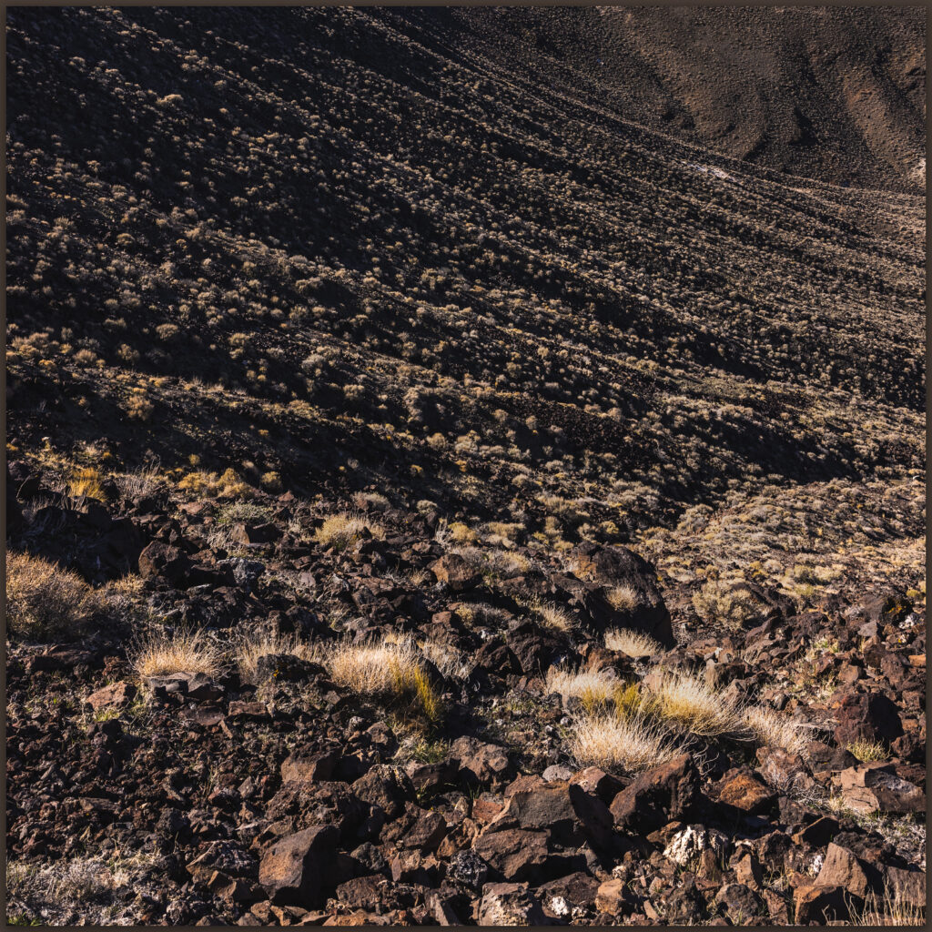
Choosing a sun-marked line leading from a small, outcropping hill to a crease in the mountain-front, we take to steep stepping-stones of roll-prone boulders and scree. A chill has come to the wind, which has also strengthened noisily. The sweat of the climb turns to quick cold, and we dig in our light packs for warmer layers. Snow sits in alcoves along our last easy push to a summit tableland. But where is the top?
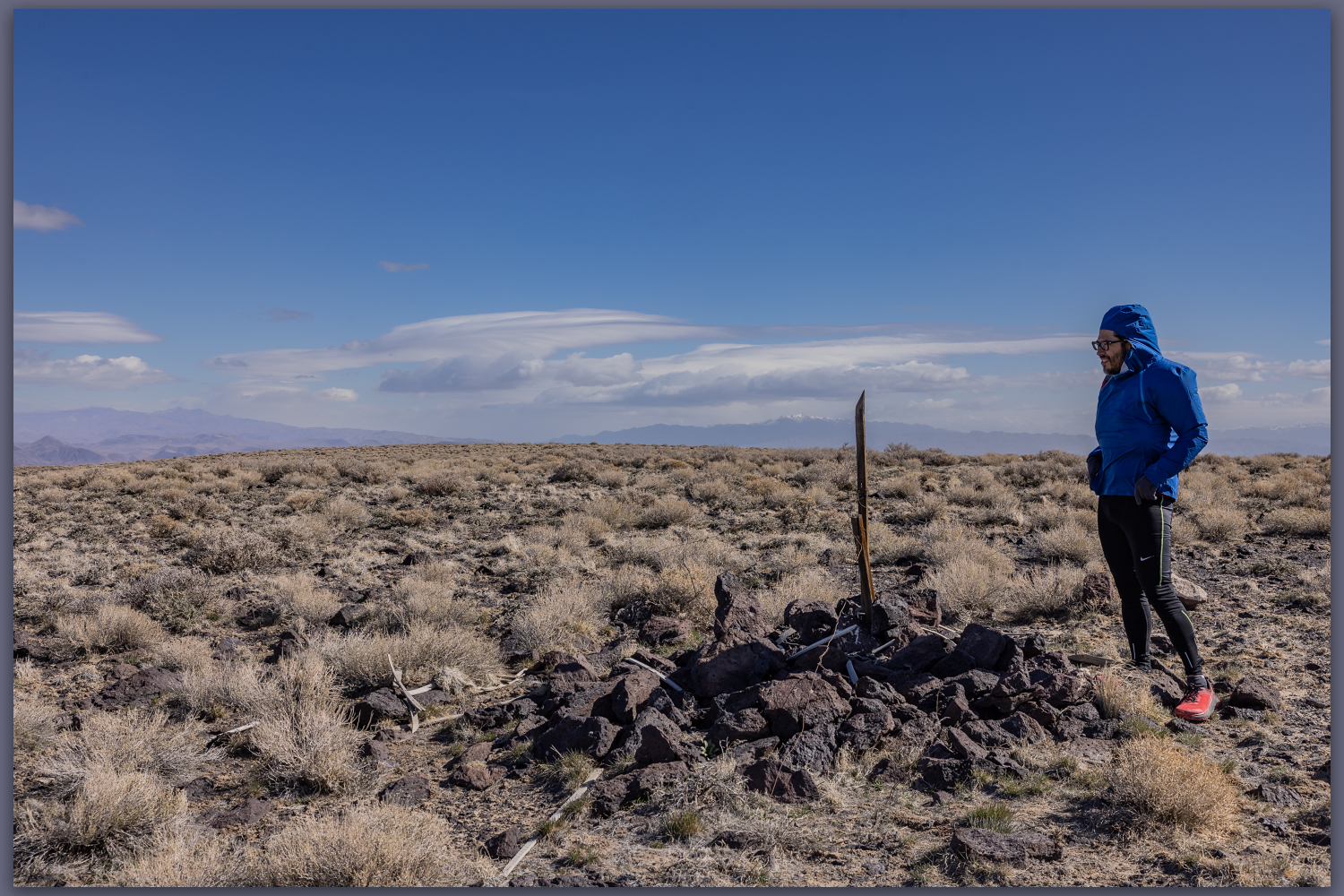
The common topographic marker of lathe and guy-wires protruding above a summit cairn marks ‘Alkali’, the USGS mark at 6,104 feet. Alkali was the goal, but the low undulations of the expansive, rocky flat give me pause. We are above the last topo line (always the goal!), but what little bump is highest. The Alkali mark lacks a register, not surprising on what many might consider an unattractive summit. We wander the tableland, eyeing the Alkali mark from various candidate bumps (there is a 6012’ mark highlighted on some maps), but we settle on Alkali – hitting every other undulation just in case!
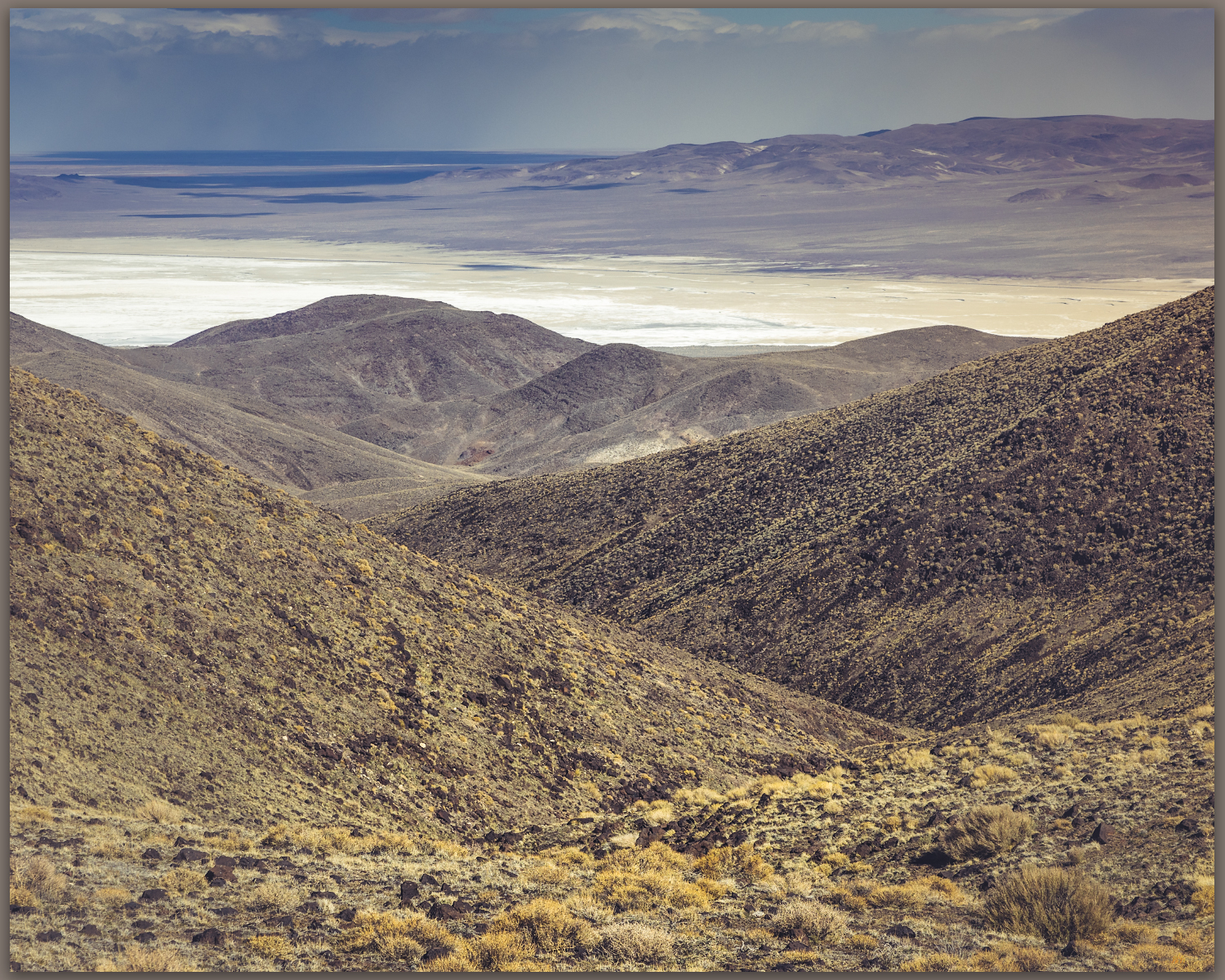
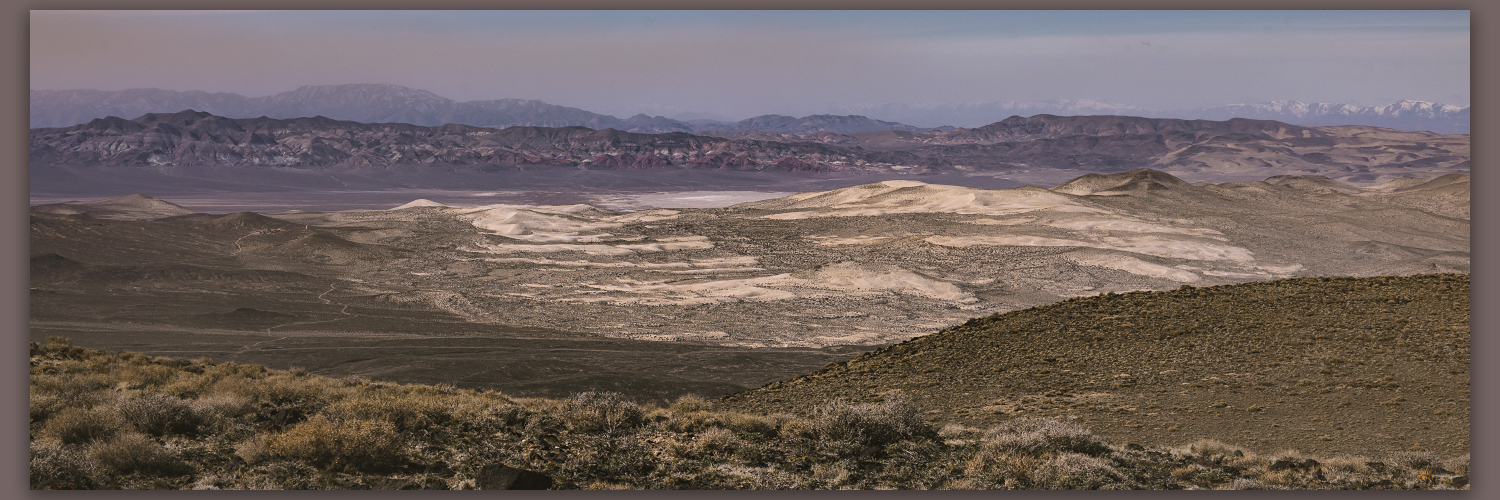
The views are great; the winds are greater. Gusts buffet us, knocking me down at one point as I fumbled distractedly in my pack for a different lens. The falling dunes of the Blow Sand Mountains (a military-restricted summit) illustrate the movement of sand from the Walker River drainage to the Carson basin, where ripples of lunettes in Salt Wells Basin lead to the seif dune of Sand Mountain, which today is climbing the Stillwaters to fall into Dixie Valley. I am reminded that desert dunes have their origin in water – streams are the genetic conveyors of silt and sand; they are parents of dunes, their children seduced to far-flung adventures by consanguine wind.
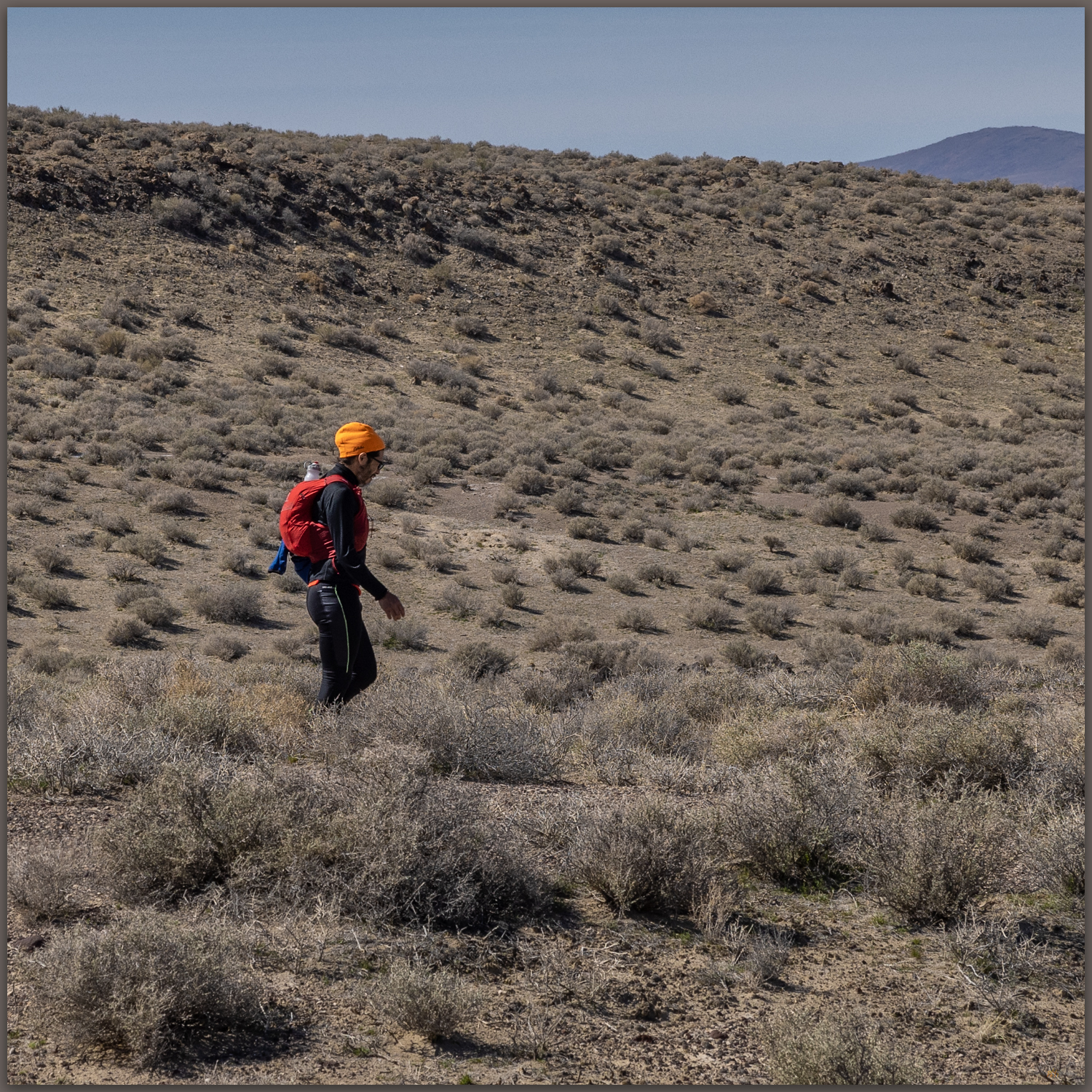
Tired of the wind-blown stance at the top of the Cocoons, we drop into protected canyons after traversing a northwestern ridge back to the powerline track we crossed earlier. Once constant gusts subsided with each step toward the valley-margin sands. Robert and I kicked along the sandy slopes talking of former trail-running adventures and those to come. Soon our out-bound footprints appeared among the scattered bones along spoked paths that led to the dry tanks; here, our truck waited, a friendly beer drawn from the dregs of the cooler. A good morning walk, once again.
Keep going.
Please respect the natural and cultural resources of our public lands.
Band meet-n-greets, beers and beaches: the best.
Thanks for coming along!
Wonderful views. Thanks for posting