• Skip to primary navigation
  • Skip to main content

Trail Option

A personal geography of landscape and place, art and geo-science.

  • Home
  • TrailOption Blog
  • About
  • Contact TrailOption
  • Subscribe!
  • Lost Journals
  • Show Search
Hide Search

California

Saline Valley Salt Tram – Inyo Mountains, CA

D. Craig Young · January 3, 2022 · 7 Comments

Moving over mountains. The remnant superstructure of the Salt Tram Summit Station above Saline Valley, Inyo Mountains, CA, USA

In early November, a few colleagues and I traversed the challenging 4×4 trail that skirts the ridge line of the Inyo Mountains, from Cerro Gordo high above Owens Lake, to the remaining historic-era structures of the Saline Valley Salt Tram. Although subject of a heroic restoration project several years ago, the summit structure remains exposed to the elements, of course, but it is also exposed to the rigors of heavy visitation. While most visitors are impressed by the remains and awed by the effort required in its construction, vandalism, whether purposeful or simply irresponsible, is an on-going concern. Our task was to map the summit structures using three-dimensional photographic tools with imagery obtained by drone. After the adventurous but grueling drive, we set up camp and prepared for some early morning flights. I am not an authorized drone operator, so I spent much of the time exploring the ruins and photographing from the ground.

Saline Valley Salt Tram Collection

Out of Saline. A tram stanchion above Saline Valley, Inyo Mountains, CA, USA
Salt feed. The summit station feeds Owens Valley to the west, Inyo Mountains, CA, USA
Salt intake. The receiving end of the summit tram station above Saline Valley, Inyo Mountains, CA, USA
Cable guide. Superstructure in the summit tram station, Inyo Mountains, CA, USA
Joinery. Hardware and wood in the salt tram summit station, Inyo Mountains, CA, USA
Mapping tools. Photo transects by drone, documenting the summit station, Inyo Mountains, CA, USA

The tram transported salt from Saline Valley over the ridgeline of the Inyo Mountains and down to Swansea at the shore of Owens Lake. Dozens of stanchions in various states of preservation mark the route from one side of the mountains to the other; the stanchions, leading to and from the summit station, supported and guided cables and their swinging carts; they can still be traced today across the distance. It is an amazing story of engineering and effort, for a relatively short-lived operation.

Saline Valley Salt Tram Collection

I am not typically interested in photographing structures, but these stoked an interest, especially given the uninteresting light and weather on the perfectly blue-sky, fall days we experienced on our little project expedition. I would have better luck during the changing weather once I was back in the valley bottom – I was headed back to the landforms of the Olancha and Cartago margins of Owen Lake at the foot of the eastern Sierra.

Keep going.

Please respect the natural and cultural resources of our public lands.

#naturefirst #keepgoing

Fall Color: A Rainy Evening in Hope Valley

D. Craig Young · December 15, 2021 · Leave a Comment

Aspen mosaic. Autumn’s passing in Hope Valley, Carson Range, USA

Finally, rain. I spent the last week in the Mojave Desert, gouging around Las Vegas Valley, walking several ranges, and spending too much time in a casino conference center. I cannot complain about returning to in-person gatherings with colleagues and friends, but I still felt I needed the solace of Hope Valley among the first storm clouds of the fall. I had missed the peak colors, it seems, but the aspens and willows of Hope saved something for me.

Holding still. A lone aspen at the edge of the grove, fall colors in Hope Valley, CA, USA.

I found, however, that a darkness had settled in and the compositions, to my eye, today, were few. I worked among the trees and hiked between scattered groves of color. Two images stood out and I was happy to get the simple shots as the light faded further.

Fall Colors – Hope Valley Collection

As I walked, I reflected on the week and month as the pandemic appeared to fade. Our meetings had been an apparent success and I wondered if I could dare feel some relief (Omicron variant was still in our future). In my hand my camera fired, with the settings of a relatively slow shutter speed. The view on the screen was a blur, reminding me of the potential creativity of Intentional Camera Movement (ICM). I began to play and started to see things unexpected; things that seemed to relate to my daring sense of relief and recovery. Certainly not to everyone’s taste, but I like the creation in the moment when abstraction meets emotion, even when it is simple and personal.

Recovering. Hope Valley, Carson Range, USA
At the edges. Hope Valley, Carson Range, USA
Is there an after? Hope Valley, Carson Range, USA

Fall Colors – Hope Valley Collection

Please respect the natural and cultural resources of our public lands. #naturefirst #keepgoing

Landscape Photography: Snow Recce in Antelope Valley CA

D. Craig Young · March 4, 2021 · 1 Comment

Snow filled the valleys of the western Great Basin at the end of January, when lake-effect squalls, energized as they traversed Lake Tahoe, cycled through the valleys southeast of the lake. We approached two feet of coverage at St0neHeart, with deep drifts along fence lines and out-buildings. So early on a Sunday morning, I decided to chase the light while the snow was still fresh and deep in the fields and foothills of Antelope Valley, across the state line but not far from home.

There had been rumors of fog in the forecast, but the the pre-dawn sky was clear. As I traversed the ranch roads that crisscrossed the ranchlands of the valley bottom, little motivated me to leave the warmth of the truck, it was 18F (-8C) along the Walker River. Cattle barely noticed me, refusing to lift their heads from their early-morning feed.

I ventured into the pinyon hills of public land on the valley’s east side, but the deep snow and bunchy trees turned me back. As I regained the truck, I noticed a heron gliding along an irrigation ditch banked in snow and willows. It disappeared on wide wings, seeming to drop into the snow. I eventually found the bird patiently watching riffles in the flowing water, a slight bit of turbulence at a confluence of ditches. It made sense that any morning meal would have to pass this now-dangerous intersection with a great blue heron (Ardea herodias) in waiting.

Waiting. A Great Blue Heron patient in the cold.

I too waited. The heron never moved. I finally crept slowly away. Full disclosure: I never left my truck — resting my long lens in the window and sharing time with one of my favorite birds.

Antelope Valley Collection

I had basically given up for the morning and turned for home. I had the one image of the heron (or, at least, I would get one from the several I’d captured) and was happy with that. But from the highway I saw strange patterns, starting with perfect circles on the ice of Topaz Lake — still frozen at its southern shore. I’m still not sure how they form, but the simple pattern turned me around and I found a pullout above the steep drop to the lake.

Topaz spots. Abstractions in the ephemeral ice of Topaz Lake.
Connection. Some patterns are too cool to explain.

I was happy to have stopped to check the patterns. For a popular lake typically overrun with boats of all kinds, I have had some very good, quiet images from its shores. And it can be very nice that it usually presents these things as one passes on Highway 395.

Further north I caught sight of a string of mule deer (Odocoileus hemionus) moving slowly in their beaten trail. Bounding occasionally to clear obstacles I could not see. It was the spacing that caught my eye. It’s a wide image, so give it a click and get the full view (note: you can do this with all images at Trail Option, usually).

Leading line. A well-spaced group of mule deer on slopes of the eastern Sierra.

Antelope Valley Collection

Some times short trips, with few expectations, give the best results — all within 30 miles of home.

Keep going.

Please respect the natural and cultural resources of our public lands.

#naturefirst #keepgoing

A glow that had to last — Death Valley, Part 3

D. Craig Young · October 12, 2020 · 9 Comments

It was time for a shower. Climbing out of Death Valley, we arrived at Lone Pine, California, in the late morning, seeking refreshment and food. The hotel was not crowded so we checked in easily, cleaned up, and wandered across the street for BBQ. It was not that we ate poorly in Death Valley, we just needed to fuel up for our last outings – an evening and early morning in the Alabama Hills. Lone Pine felt strange. I had worked here for extended periods last year, and I had typically camped in my trailer. Now I was a tourist staying in town and making excursions to the Hills; the role had been switched.
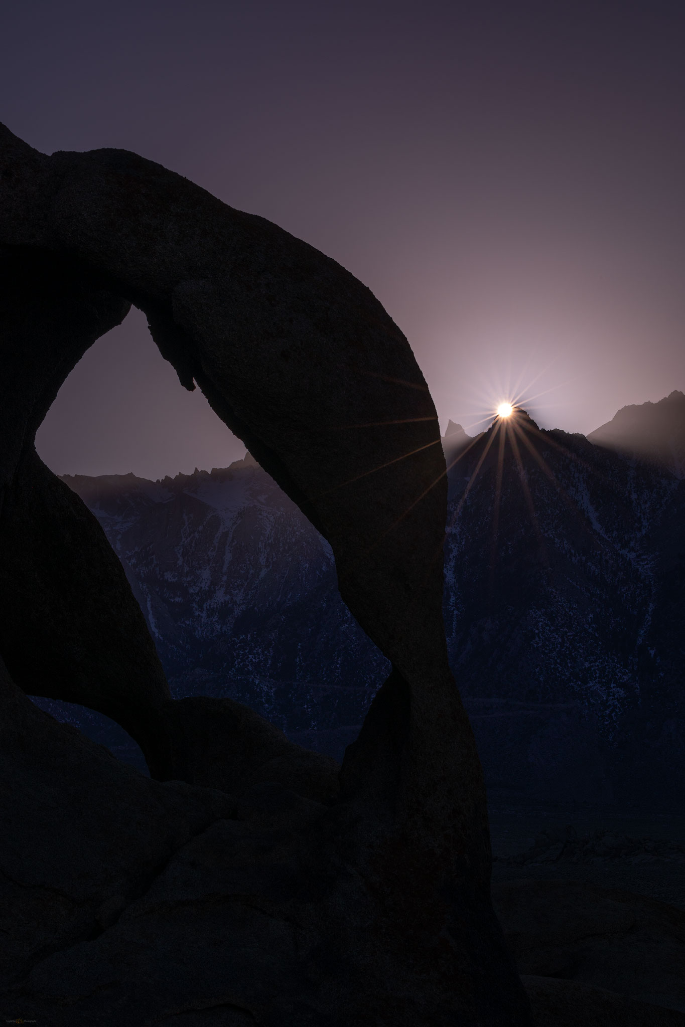
Cyclops arch, sunset on Whitney, Alabama Hills
Cyclops rays. Scouting the arches and an experimental wait to catch the last light of the blue day.

The evening was clear with blue skies settling toward a sudden sunset. Heading toward the portal road, Randy and I grabbed a late coffee and ice cream to go. But the first curve disengaged me from my vanilla, and it dropped surprisingly in my lap (sorry about the any spot I missed Randy!) – one should not juggle espresso and a cone when chasing light. We headed north toward the ‘boot’ and the ‘cyclops’, meeting up with the team as we hiked in. With the sharp and abrupt light, and with the forecast suggesting potential for an interesting morning with storm clouds over the Sierra, we used this as a scout. Our trip would culminate in the morning.

Death Valley Collection

Quinn, Randy, and I met in the parking lot well before sunrise. We wanted to check the Milky Way potential at the ‘cyclops’. It is always a highlight of early morning walking in the star-lit desert, waiting for the granitic outcrops to loom in the light of headlamp. A distant owl warns of our approach. In the darkness of the hills the Milky Way is clear as it settles in a broad arch above the eastern horizon. The promised clouds are evident in dark patches masking stars as they tear away from the mountain front. Some may curse clouds in an astro-shot, but I have always liked any well-placed clouds especially if they simply add glow to a few of the brighter stars or provide depth and scale to the otherwise dark landscape – I am a minimal light-painter. We did, however, light the arch’s interior and committed to working on galactic images until the sun turn our attention to the Whitney massive beginning its glow in the west. The storm was at almost the perfect position, rolling over the summits with a misty gauze below the dark density of water-bearing clouds.
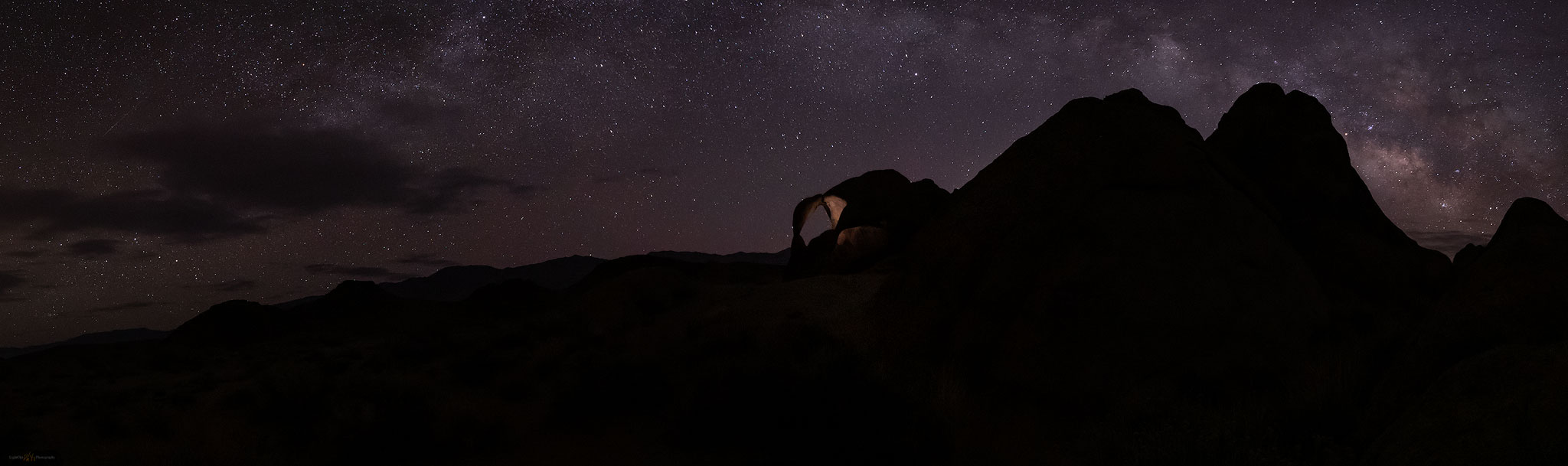
astrophotography at Cyclops Arch, Alabama Hills, California
Cyclops way. Patches of a coming storm approach the Milky Way arch over the Cyclops.
Alpen glow on Lone Pine Peak, Sierra Nevada, Alabama Hills, California
First light. First sun hits Lone Pine Peak overlooking the Alabama Hills. A scene I had not witnessed during the previous summer and fall camping below the peak.
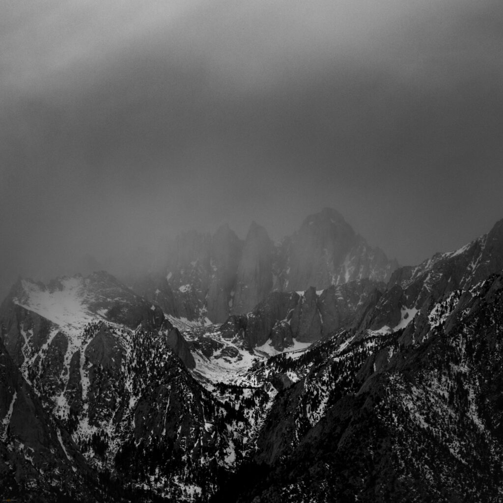
Black and white image of Mount Whitney in the coming, late winter storm
Whitney incoming. Turning a long lens on the shroud of storm clouds on Mount Whitney.

We could tell it would not last long. The gift of alpenglow was fleeting but I think we made the most of it. I had one of my most relaxed mornings of our trip, feeling in-the-zone. I reached for long and close images of Lone Pine Peak and the needles of the Whitney summit ridge before backing away for a wide, multi-image panorama of the Range of Light. Its name written in the first cast of dawn. Our trip came to a close.
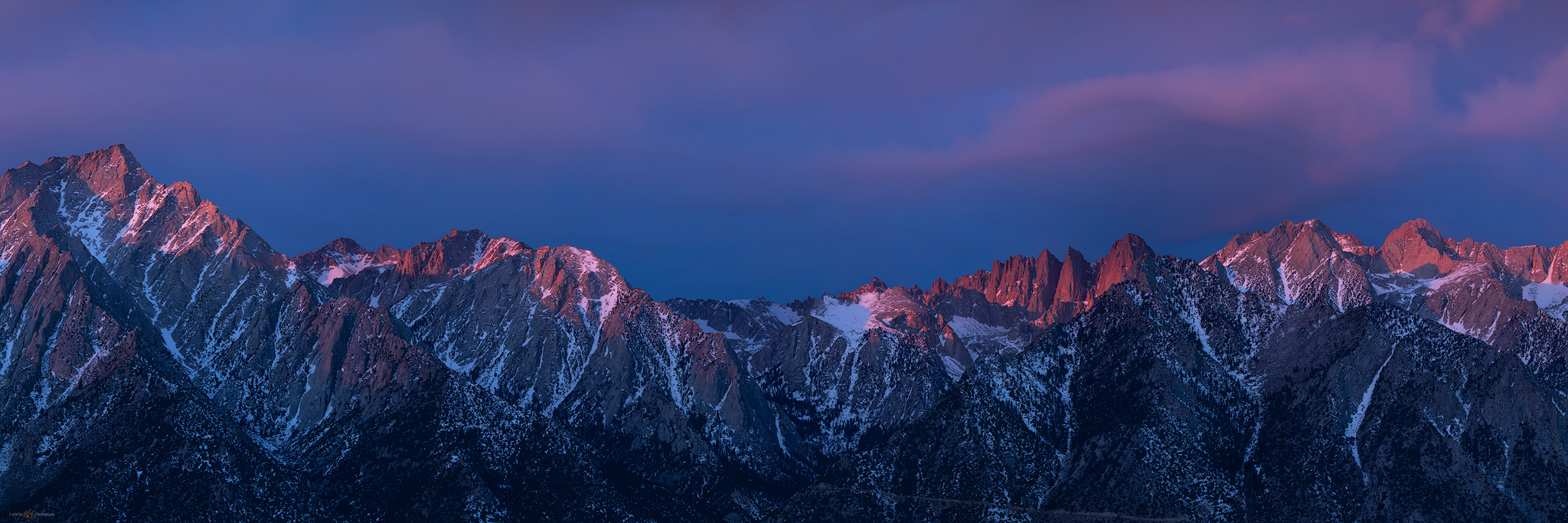
Panorama of the Sierra Nevada at Mount Whitney, Alabama Hills, California
The glow that had to last — Range of Light, California

Death Valley Collection

I write this many months and a pandemic or two later. Little did we know as we parted, separately leaving Lone Pine in the late morning, that much of our freedom to roam would fade as the mountains disappeared behind the storm clouds, replaced by seemingly intractable problems brought about by a polarized, dystopian loss of trust and community. We had these few days that we could look back on – the days when we could wander. These few photos, and the memories of comradery, remind me that, with care and effort, our wandering will return. As the landscape and its emotions teach us, let us not take it for granted.

Keep going.

Please respect the natural and cultural resources of our public lands.

#naturefirst #keepgoing

  • « Go to Previous Page
  • Page 1
  • Page 2

Trail Option

Copyright © 2026 · Monochrome Pro on Genesis Framework · WordPress · Log in

  • Contact TrailOption
  • Substack
  • Waypoints Bibliography
  • Young Archives