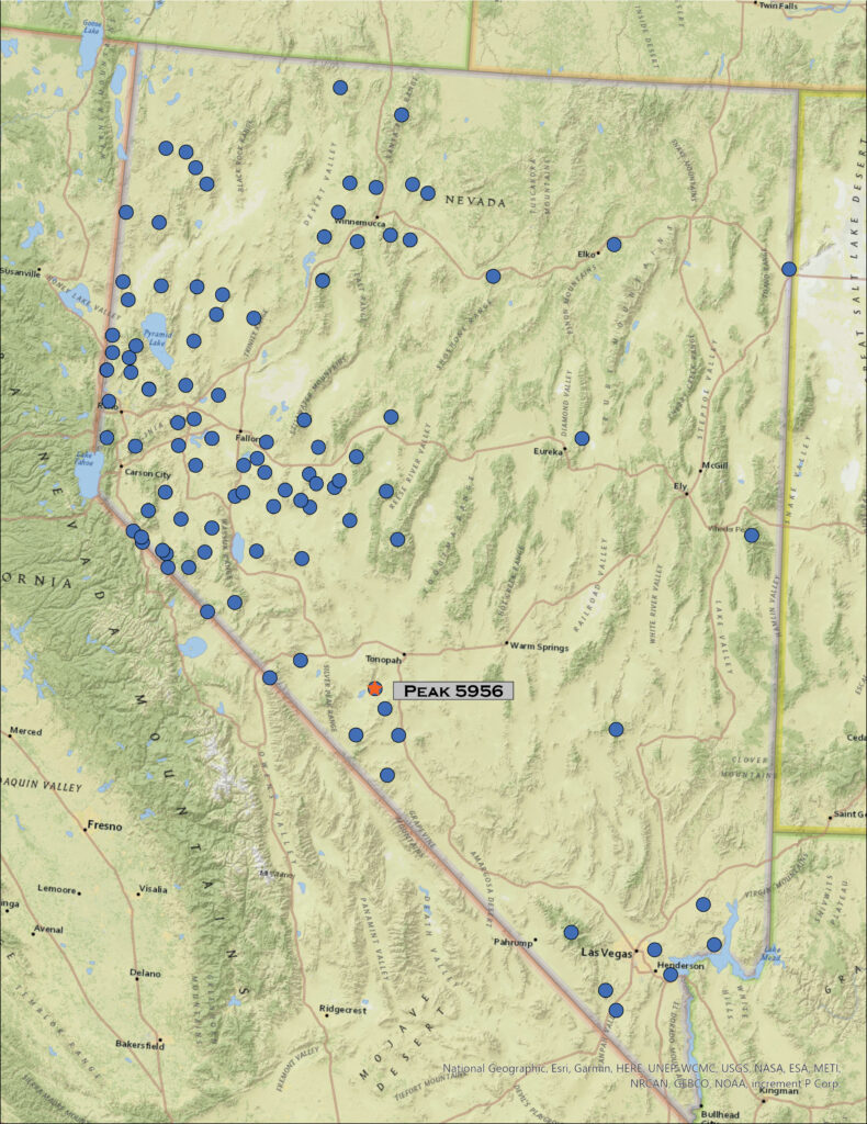
We missed a month – the move is complete, finally – but are in the Great Basin outback for December. It is another small set of hills as we head to Clayton Valley, a good winter excursion, to explore Paymaster Ridge. There is a cluster of named ranges here. In some ways the ranges are arbitrary; difficult to tell whether the named divisions are based on geologic structure, topographic prominence, or simply cartographic creativity. Paymaster is separated from the General Thomas Hills by a low pass, a topographic feature that is really a partially dissected, alluvium-choked valley forming a gap in the faulting that brings both sets of hills to some prominence. To the west, the Weepah Hills and Lone Mountain loom over these small hills, attracting our attention to future excursions.
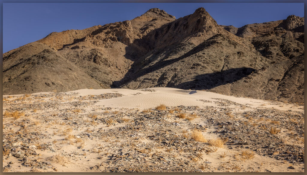
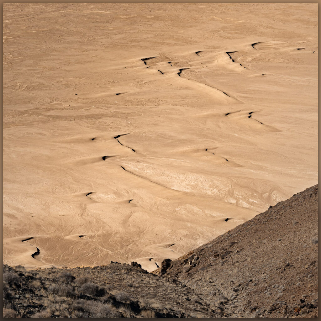
Darren and I traverse the evaporative mines of Clayton Valley along the Silver Peak Road. This road leaves US 95 just north of Goldfield and rejoins it near Coaldale, or vice versa, and is an interesting ‘long-cut’ when traveling between Las Vegas and Carson City. Although the segment through the valley bottom is improved dirt – and unattractive unless you like mining berms, the bounding hills and ranges, along with eye-catching volcanoes, make it an interesting change from the expanse of Tonopah (you will be skipping the services of Tonopah, so plan accordingly, but it is a nice change once in a while). We turn north along the western front of Paymaster Ridge, heading north toward Twin Springs and Pearl Hot Springs, the latter of which I had planned as our start point. This semi-improved track soon turns adventurous as a series of linear dunes, anchored on the topographic change that the road provides, block any quick progress. We roll over several but then encounter some coalesced dunes and sheets and decide to park and get walking – no need for intrepid driving today. I would have liked to visit the springs, but today’s goal is upward to the east.
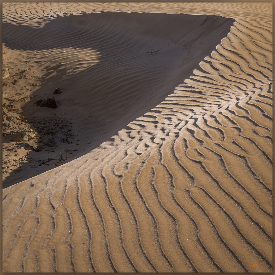
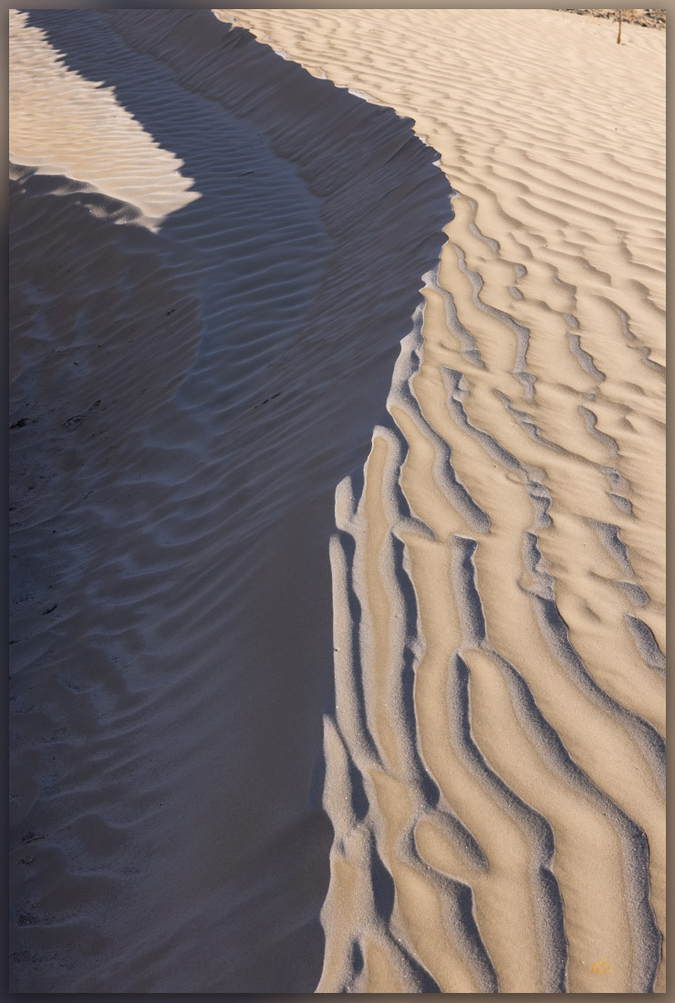
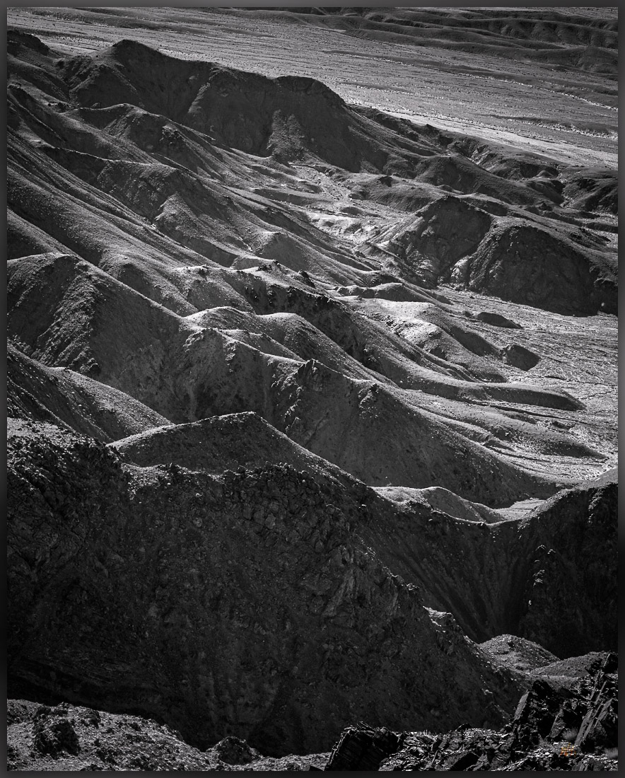
We hike to a nice dune that has settled on the undulating topography of debris flows and rock levees that emanate from an unnamed canyon. The rippled dune is crystalline in the early light with only the tracks of a kangaroo rat as evidence of life in this dry habitat. Past the dune we enter some fabulous, vertical canyons with blind turns, chockstones, and a few dry falls. The occasional summer storm must be exciting in here. No sign of water today, and yet we are surrounded by its evidence. We pick a northeast-trending opening and gain elevation quickly, weaving among outcrops, steps, and talus-filled gullies. We are soon a faulted plateau following burro tracks toward the broad hilltop that is the highpoint of Paymaster Ridge – also known as Joes Peak.
A small cairn marks the summit. Alkali Lake, the least imaginative and over-used, however accurate, placename in the Great Basin, dominates the basin of Montezuma Valley as it stretches toward Tonopah. The White Mountains to the west are aptly named, at least once the seasonal snows come to the western Great Basin. Boundary Peak, the highest summit in Nevada, sits lost at the northern tip of the Whites – home of the ancient bristlecone pines. Here on Paymaster, however, there are only scattered shadscale shrubs among the platy shale outcrops with juniper woodlands colonizing the Weepah Hills and Lone Mountain to the north.
It is another blazingly clear day. I need to think differently if I am going to move beyond simple documentary photography in the stark and arid landscape we inhabit on these highpoint excursions. So, three related goals for future highpoints: 1) slow down – I am out here for the experience, so being overly summit-driven impedes creativity and learning; 2) get to highpoints earlier or later in the day, stop hoping for skies to get interesting and use the morning and evening light when it is often (subjectively) at its best; and, 3) while the expansive vistas are seductive and certainly have a dramatic, often stark, beauty, look for the small details that make each walk unique. These are not mutually exclusive, they are all generally tied to slowing down. I have noticed an obvious connection to better imagery when I camp near my chosen route, even if the route results in a fairly brief outing to the actual highpoint. I should try an occasional bivouac as part of an excursion, immersing myself in the changes the overnight brings. This might also provide opportunities for gathering and presenting other media types (planning required); so I will add that as a fourth goal. Yes, my goal for 2023 will be to slow down and reap the creative and mindful benefit of engaging deeply in the basins and ranges that are Nevada.
We trace our track back into the canyons, dodging a few dry falls where steep knickpoints make for tricky downclimbing. It is early afternoon, and the temperature has not broken through the freezing mark but with no wind, the day is a pleasure. The truck sits on the sandy fan where we drop our light packs and look back at our route, now lost in the overlapping, creased stratigraphy of the west face of Paymaster Ridge. We will begin to consider our new goals as we hit the highway for our drive home.
Keep going.
Leave a Reply