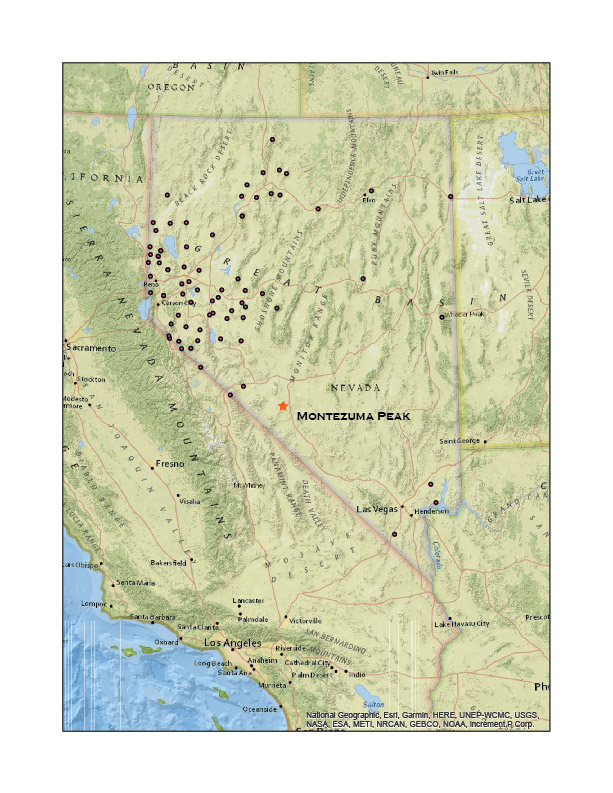
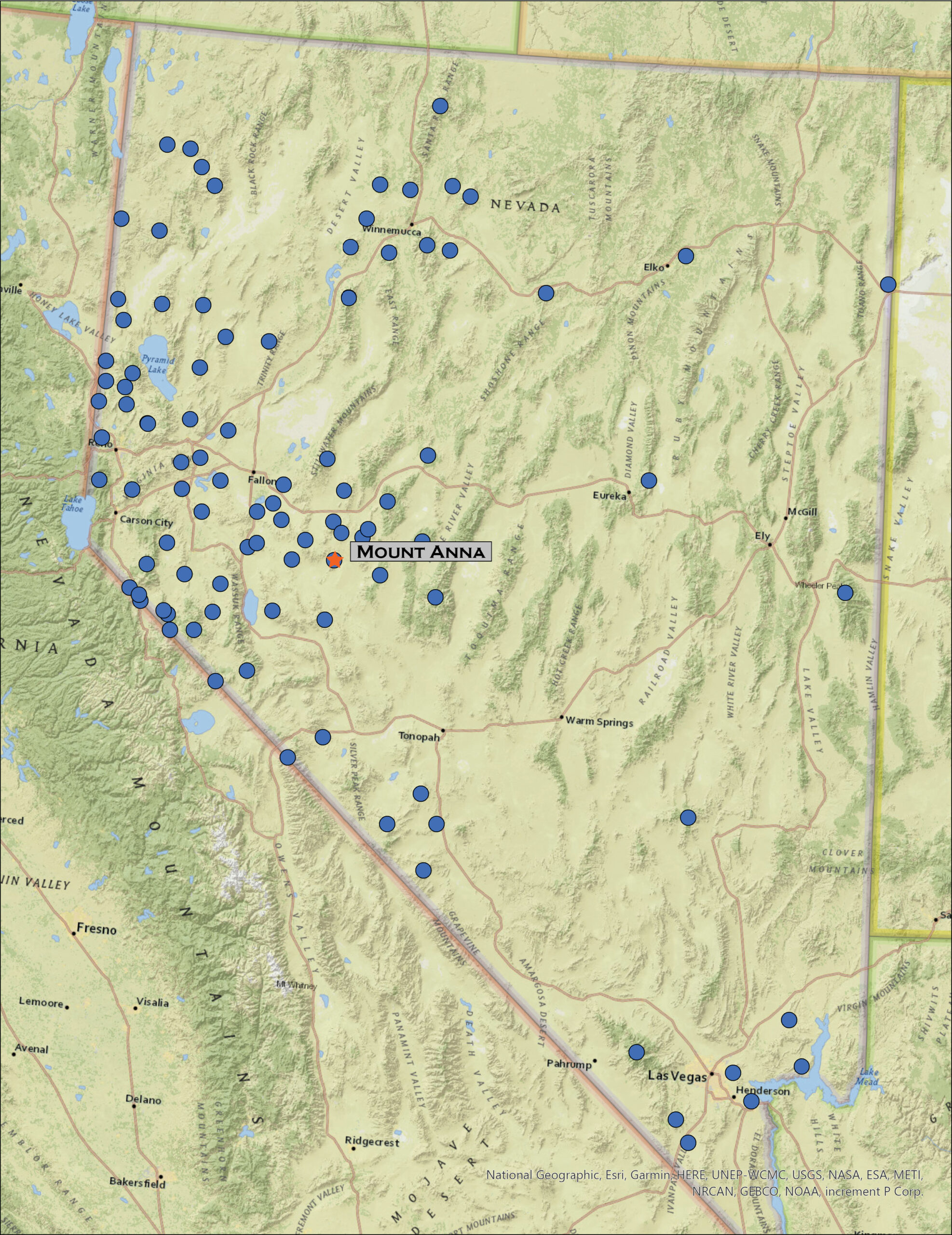
• Skip to primary navigation
  • Skip to main content

Trail Option

A personal geography of landscape and place, art and geo-science.

  • Home
  • About
  • Contact TrailOption
  • Subscribe!
  • Lost Journals
  • Show Search
Hide Search

Overland

Nevada High Points #79: Monte Cristo Mountains and Gabbs Valley Overland

D. Craig Young · March 7, 2021 · 6 Comments

Approaching Mount Anna.

Mount Anna

6908 ft (2106 m); 1755 ft gain

2021.02.12

(edit 2022.07.06)


It is once again ‘Second Friday’, time for an overland. Darren and I hit Highway 50 in the late morning, expecting the forecasted wind to catch up with us later in the day. A storm was forecast but from the look of the clear skies, it was somewhere to the northwest. Planning for the weather change, I had chosen Mount Anna in the Monte Cristo Mountains bounding northern Gabbs Valley as our target. Our goal this year is to explore the ranges across central Nevada and this is a rather easy start.

Cliffs over Gabbs Valley.

Mount Anna Collection

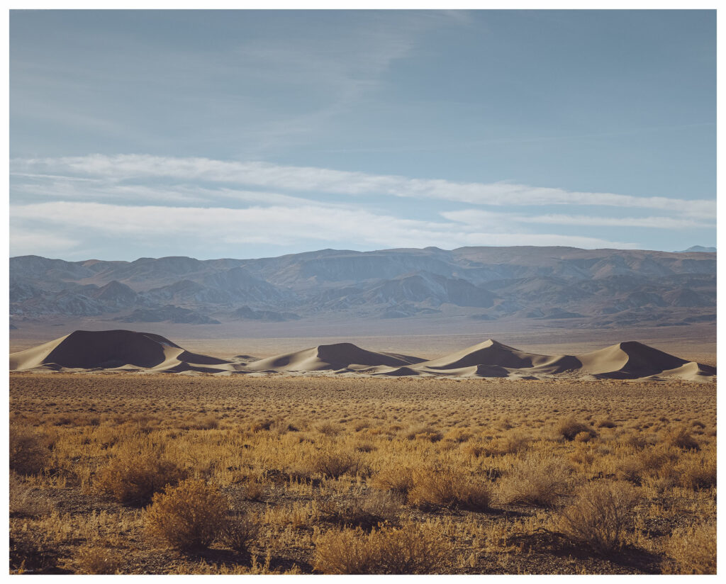
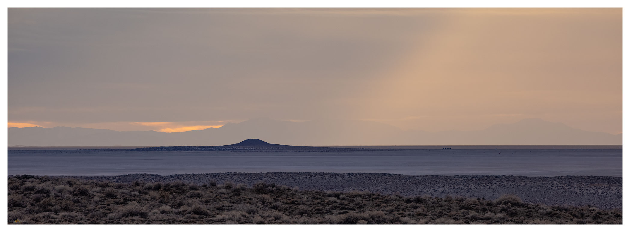
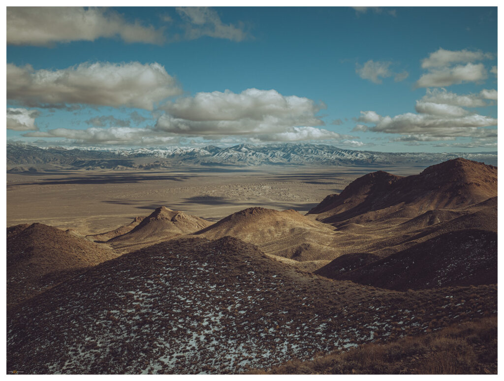
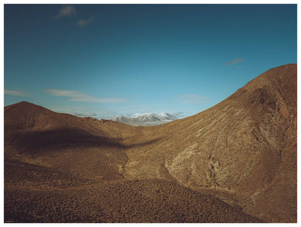
We turn south at Middlegate to traverse the low pass above Gabbs Wash and the valley expands before us. The Monte Cristos rise as a volcanic crease in the midst of Gabbs Valley, between Rawhide Flat and the hog-back of the Cobble Cuesta. It appears as a vast expanse of sagebrush and shadscale, but playas and washes connect to interesting features of incised hills and mountain fronts. We move up into the foothills to explore a possible camp in the vicinity of the historic-era Kaiser Mine.

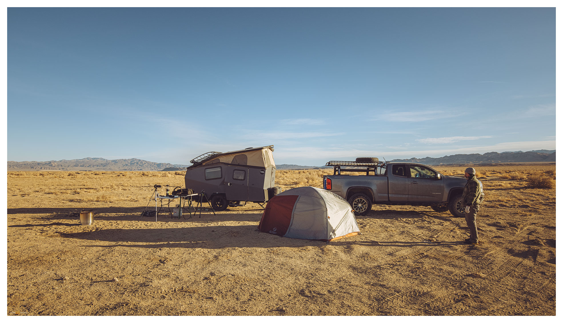
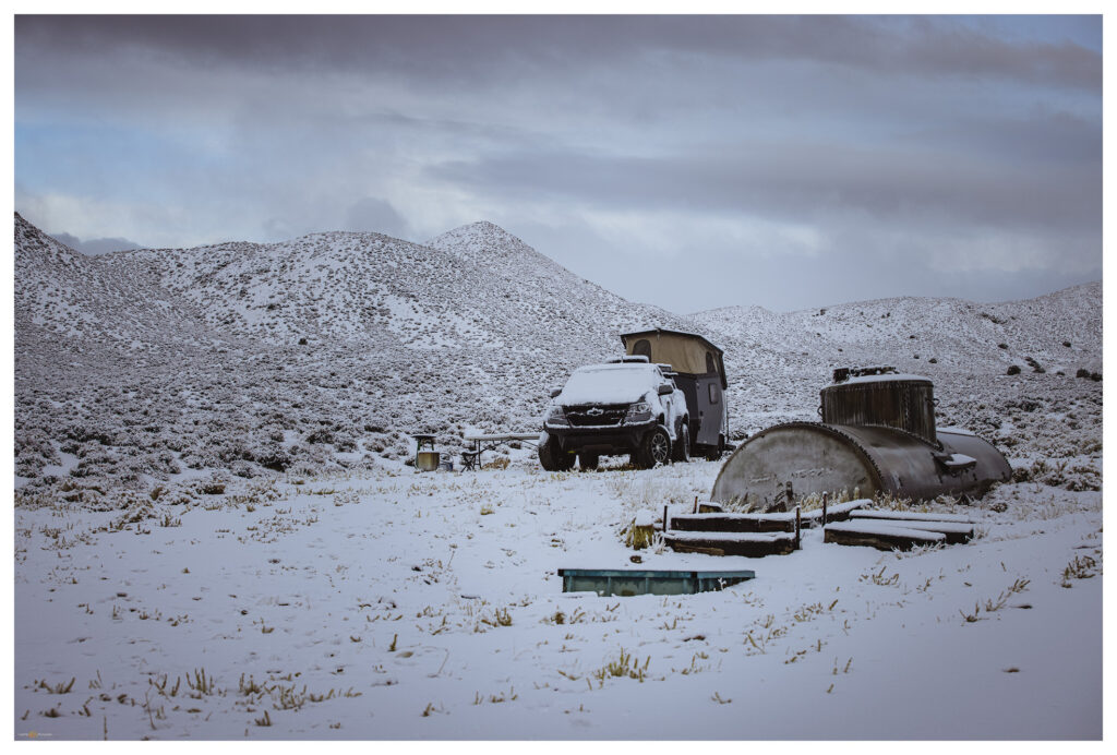
The ground remains saturated from recent snowmelt, forcing us to avoid mud gullies and soft spots at the road margins. We back out of the mine area to find some flat ground at a trough with an old rail tanker-car as a water tank. The trough holds good water, but there are no signs of recent use. We will only be here overnight and water is easy to come by this time of season so we aren’t in long-term conflict with any critters that might rely on this water source.

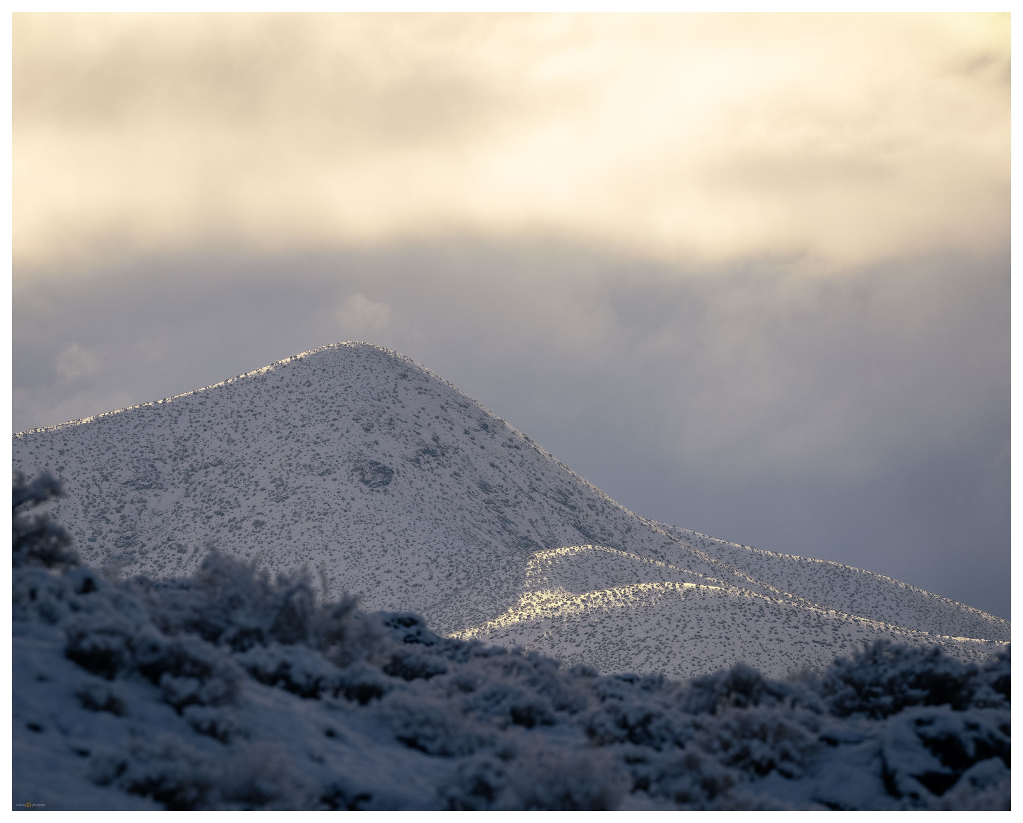
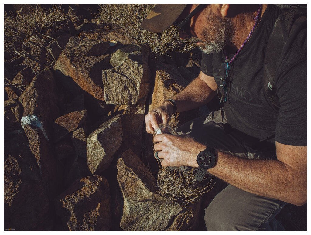
We set camp quickly and engage the truck to climb along two-tracks south of our camp at the Kaiser Mine road. A muddy two-track takes us to a start-point that is gives us a three-mile hike to the summit of Mount Anna. Our route contours generally along a prominent contact between uplifted volcanic flows and ashy tuffs. A light-colored, fine-grained deposits suggests the once inter-bedded mud of a caldera-filling lake. The ground is damp but we avoid the ‘gravity-dirt’ that clings to boots and inhibits progress.

Summit ridge to Mount Anna.

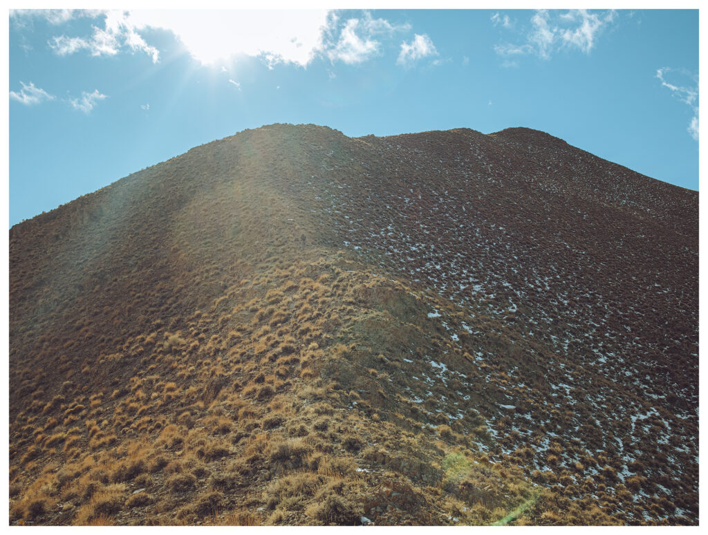
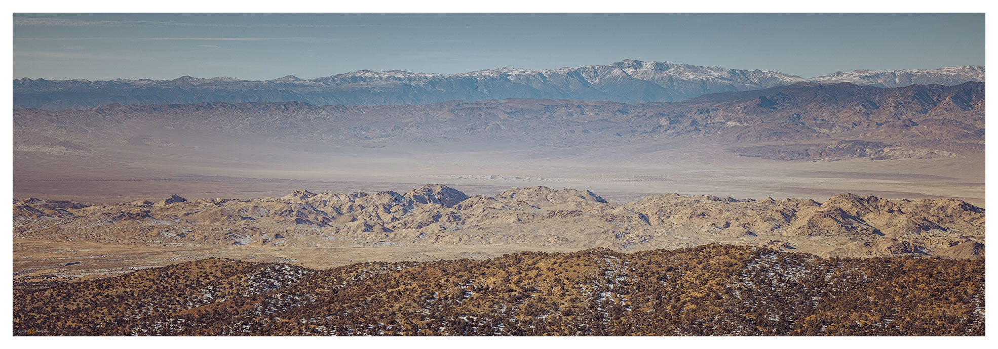
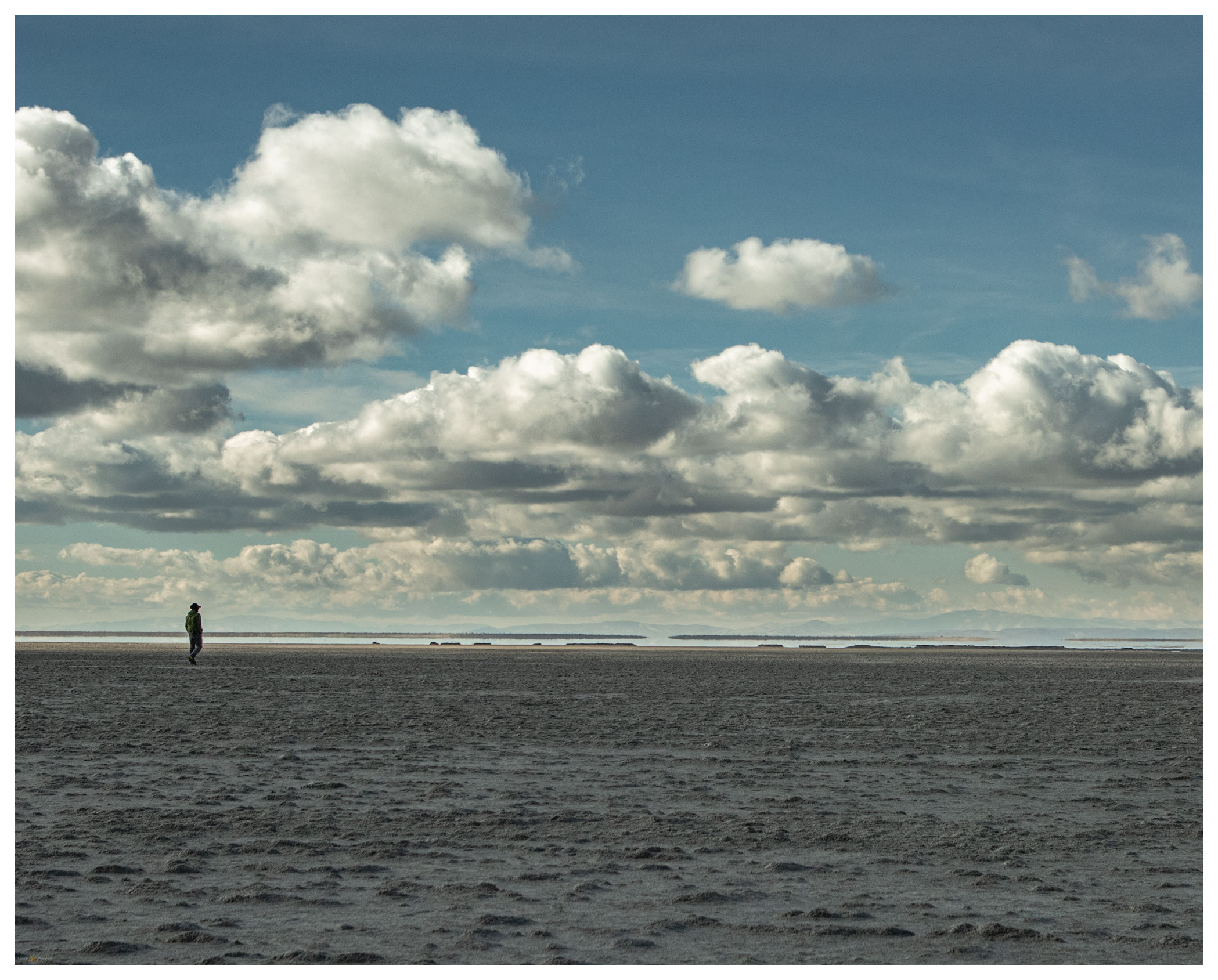
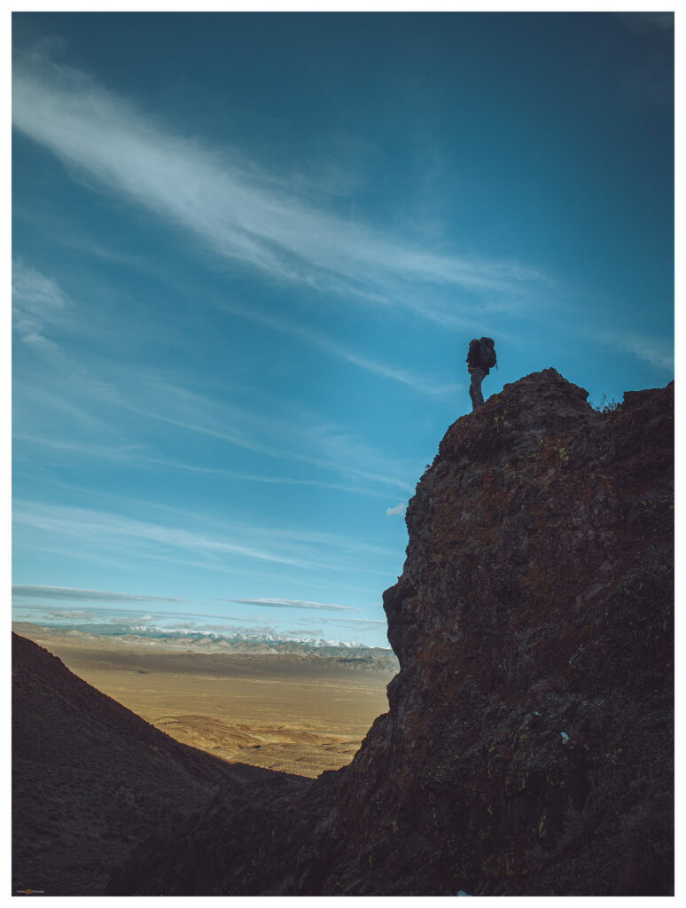
The sunny afternoon is perfect — calm and somewhat warm. We cover ground quickly to find some fantastic volcanic canyons and dry falls in the wash below the summit. Although we’ve walked a couple miles, we really haven’t gained any elevation and the mile or so of the final push is nicely steep, with great, expansive views to the east and south. Arc Dome rises in the Toiyabes, a goal for the very near future.

Gabbs Valley from Anna Ridge.
A modified summit. Darren arrives on the gravel pad at the summit.

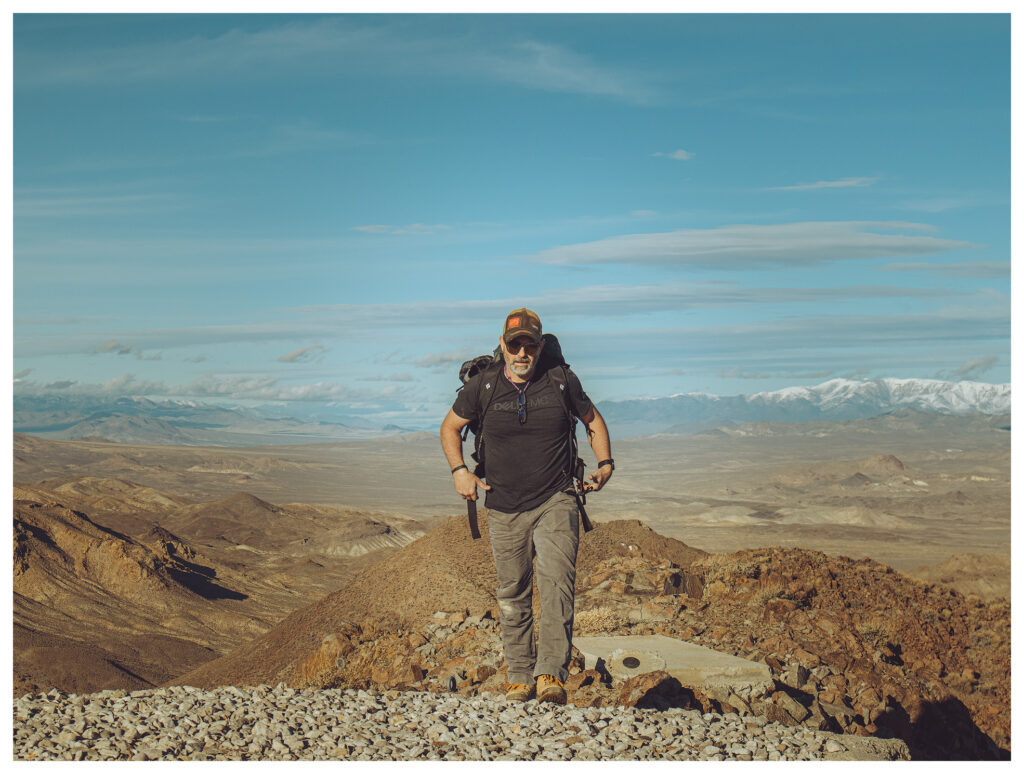
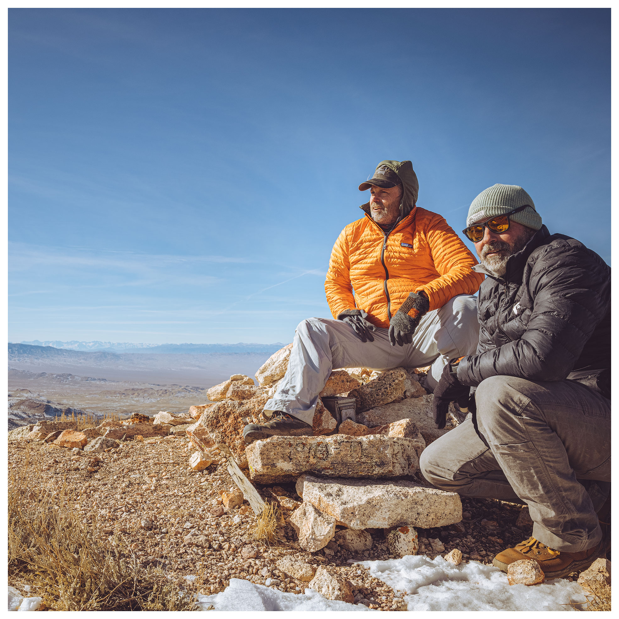
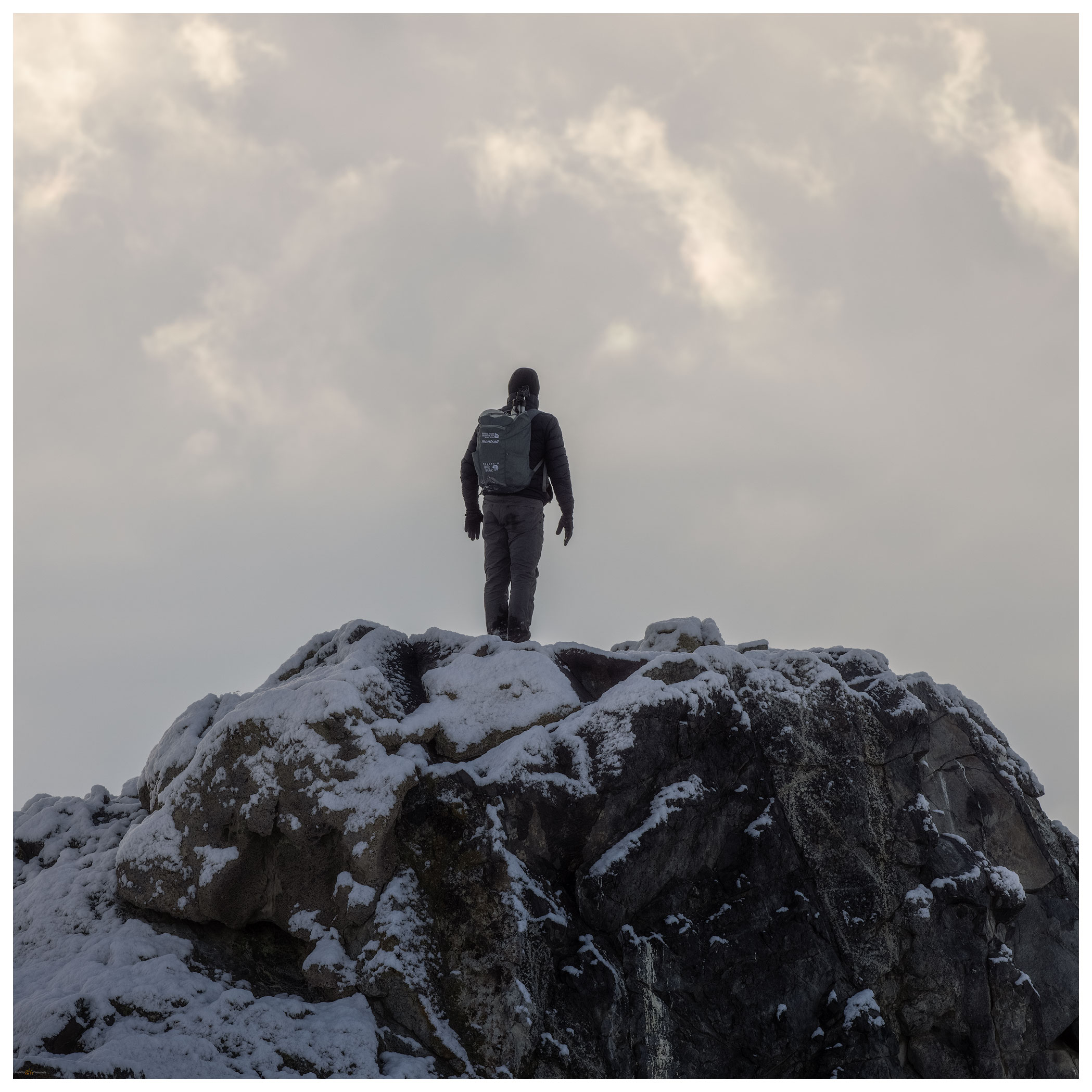
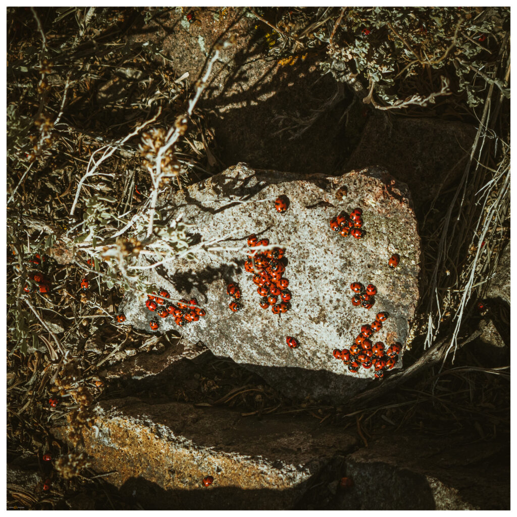
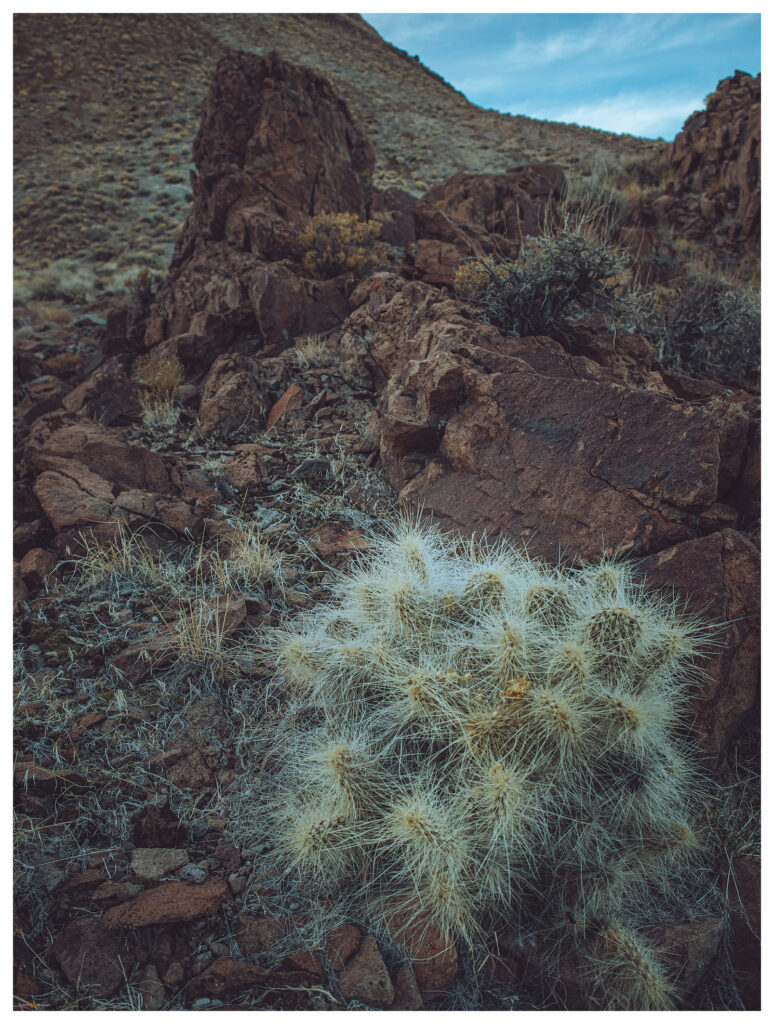
Darren reaches the summit to find well-constructed platforms of concrete and gravel. These are likely footings for military tracking stations or, possibly, for seismic measurements. There are no clues otherwise. I follow just behind him, suprised that the summit is altered but finding the views exceptional under still clear skies. And we are not alone. An aggregation of lady bugs (Hippodamia convergens), a relatively common sight on spring-time summits, brings the rocks and low sage of the summit outcrops colorfully alive. It takes some care to not step on the swarming orange beetle blobs.

Lady bug aggregation.
Summit register.
Fairview from Anna Ridge.
Waiting for the drying, cactus on slopes of Mount Anna.

We trek downward, retracing our cross-country routes and exploring the features of conglomerate washes and localized debris flows where linear levees of cobbles swarm along steep gullies and rills in the mountain side. We are back at camp after sunset.

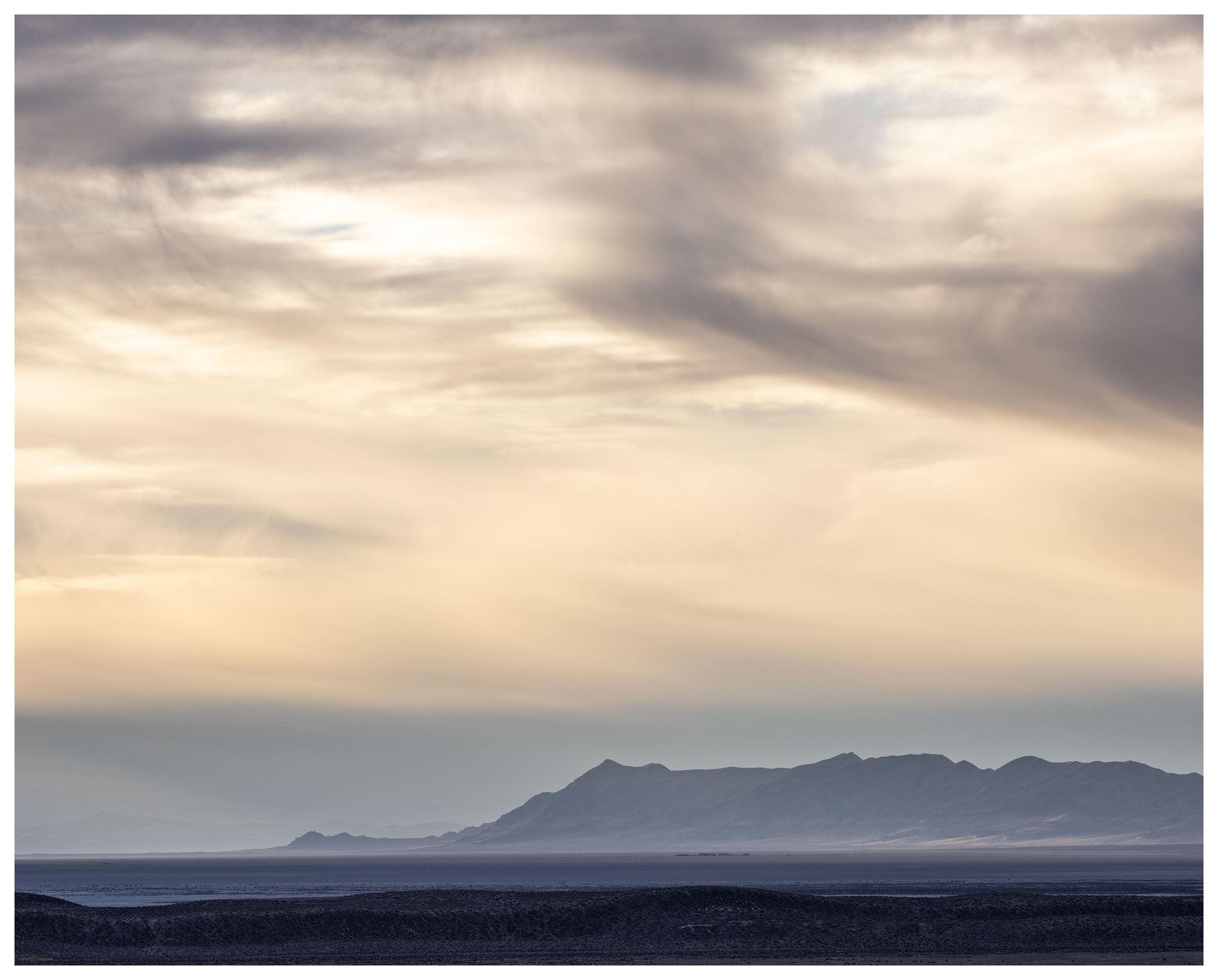
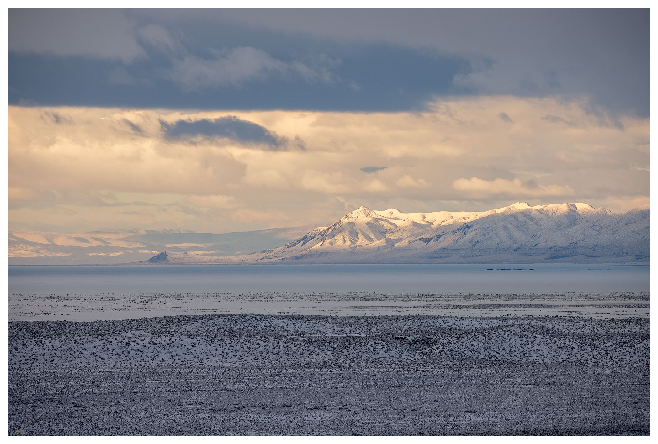
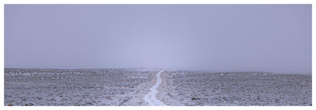
The night remains calm as we ponder our target for tomorrow — maybe the low set of hills on the opposite side of the valley. But the rain starts just after we climb in for the night, and soon the near silence of snow begins to transform our surroundings. The wind never came, but we wake to a blanket of snow with a cover of wispy fog. The damp brings a chill absent until we start packing up. Another climb is out of the question, but we can traverse to East Gate and explore the cleft of Buffalo Canyon. We descend the Kaiser road slowly, with truck and trailer giving easy traction in the fresh, wet snow. We eventually leave the snow cover momentarily at Middlegate but it returns with depth in the canyon above Eastgate.

Mount Anna Collection

Camp at the stock trough and railcar tank.
North into the fog.
Road home.

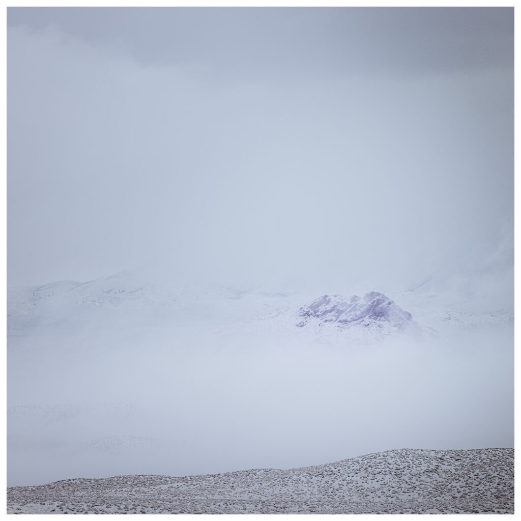
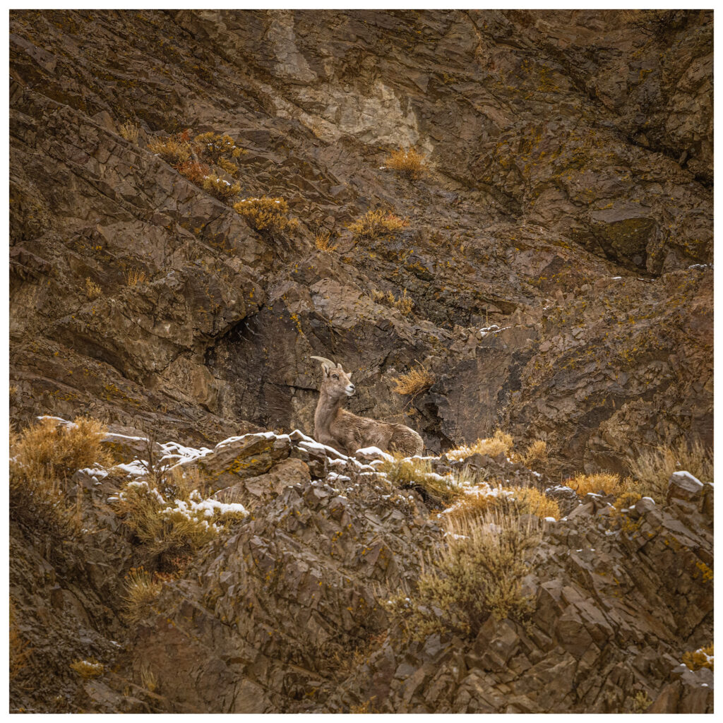
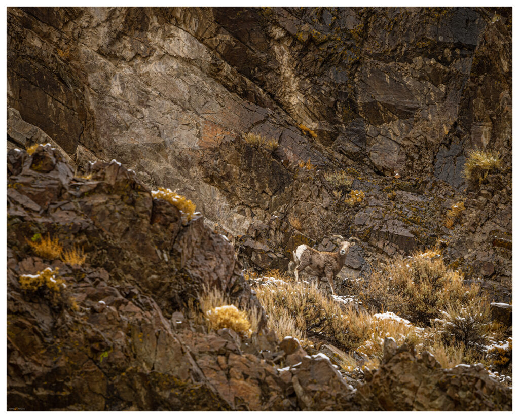
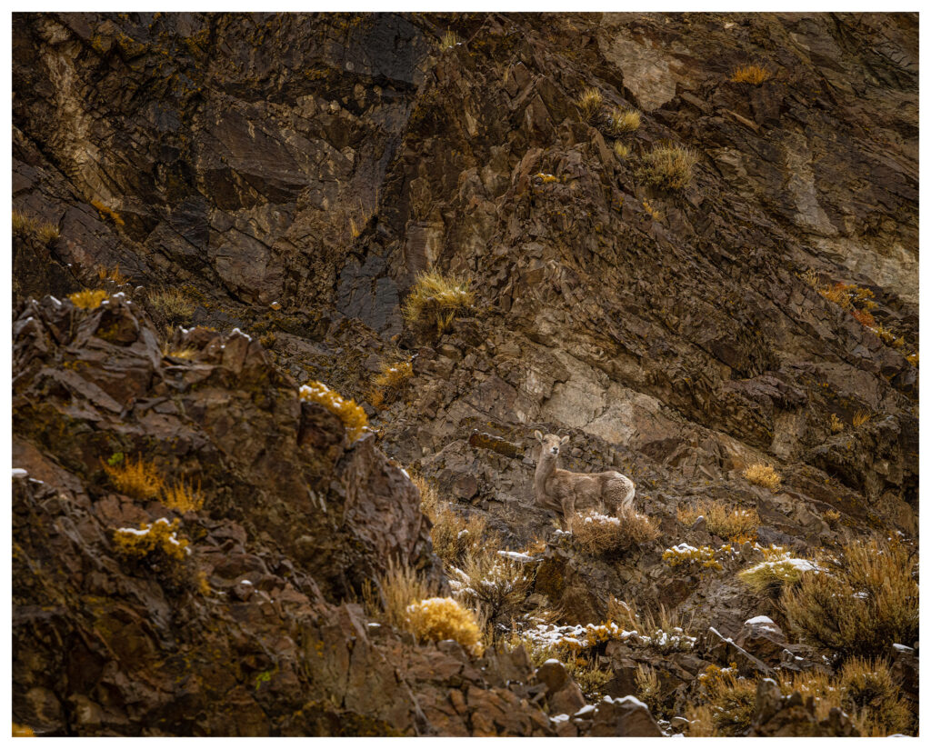
We venture in and Darren soon notices a group of bighorn sheep (Ovis canadensis) high on the cliffs of the canyon’s northern margin. These are a nice gift on a snowy morning. We watch the herd for a while and explore a series of waterfalls that only exist after a wet storm. The storm comes with a power that seems a purposeful attempt to make up for the calm of the previous night. At times we hit storm bursts that seem like summer storms, but their turbulent winds drive snow mixed with the usual dust and tumbleweeds.

Buffalo Canyon Wildlife Collection

Bighorn at Eastgate.
A season’s moisture at Eastgate on Buffalo Creek.

Mt Anna is not a prominent peak, but it gave us the gift of its textured slopes of volcanic rocks and badlands. It led us to a dramatic morning and a visit to the bighorn sheep of Eastgate. Even the small hills lead to big places.

Keep going.

Please respect the natural and cultural resources of our public lands. #naturefirst #keepgoing

Nevada High Points #76: Montezuma Range and Clayton Dunes Overland

D. Craig Young · February 22, 2021 · 7 Comments

Clayton Dunes.

Montezuma Peak

8373 ft (2552 m); Gain 1624 ft

2021.01.09

It was time for the initial ‘Second Friday’ excursion in 2021. Snow squalls had come and gone during the week, so our plan was to head south into the southern Great Basin so that the daytime temperatures would be somewhat warm and snow might be less in the higher elevations. Darren and I chose Montezuma Peak for our target, and I picked the dunes of Clayton Valley for our two-night camp.

Clayton Valley. View from Montezuma Peak with Clayton Dunes, Silver Peak Range, and the White Mountains in the distance.

I met Darren in Carson City late on Friday morning. With a stop for fuel and a few supplies, we were soon on the straightaways of Highway 95 heading toward Tonopah, Nevada. We turn south toward Silver Peak, dropping past ‘The Crater’ and into Clayton Valley. I camped in Clayton Valley on my first Second Friday excursion in January of last year — in the before times. At the time, I had made the dunes a future destination and worthy of a look.

Clayton Dunes Collection

We arrived at the dunes at sunset. Rising prominently about a mile from the road, the dunes have no maintained access and off-road vehicle activity appears to be quiet in the winter. A sandy (obviously) two-track leads into the dune’s east side; however, I was not sure the truck and trailer would make it — a meter-deep arroyo had taken over portions of the track and small dunes rolled across others. We ditched the trailer by the turn-out and explored the two-track with the truck. It was fine and sandy. Returned for the trailer and set camp as the darkness closed in.

Winds were forecast, but at dinner we commented on the calmness and its relative warmth. A coyote sang in the distance. Watching the stars and mapping out the lights on the distant side of the valley, we noticed the lights of the evaporation ponds dimming and disappearing. The pinpricks of streetlights at Silver Peak were bright against the mountains. Slowly they, too, vanished.

We sat perplexed until a quick gust of wind rattled the table and an empty beer can. The smell of the night changed. Another gust. Dust storm!

The silt engulfed us reflecting a fog of headlamp and not much else. The vanishing lights explained. We hunkered in momentarily and then thought we should make the most of this. Let’s climb the dunes. We worked our way in our silt halos watching white-outs of sand blast from dune crests — the dunes migrating under our feet.

Clayton Camp. My Taxa Cricket with Darren’s tent; our common overland camp configuration.

The morning was bright, a low cloud at the horizon evaporating at sunrise. We waited for golden light on the dune, but the uplands to the east were calling. The road to Montezuma, a historic-era mining town, is well-maintained and its upper reaches access private property and modern infrastructure, but respecting the properties is easily done.

A so-called ‘pack trail’, variously marked on different maps, led to a pass that crests at the northeast ridge of Montezuma Peak. It is a simple, enjoyable hike from there. Snow patches were not deep even though we approached on north-facing slopes.

Montezuma Peak Collection

Montezuma approach. Leaving the pack trail we enjoy rock cross-country hike toward the rounded summit.
Toward Mud Lake. Summit view to the northeast toward the playa of Mud Lake.
Summit moment. The night’s wind brought the day’s cold — we did not linger.

Back at in the dunes we wandered, following animal tracks and composing photographs for the promising sunset. I also wanted to get the know the dunescape so we could catch the early light and the great shadow play of mid-morning sun angles on the curving dunes. I tried a few things but the cold was coming hard and fast. We prepared for dinner noticing that any liquid that hit the table froze immediately. Our hands numbed if we moved anywhere away from the stove. I turned on the trailer heater so we could lounge inside, but we kept to star-gazing and the pleasure of our well-contained campfire. It is something of a challenge to stay up in the winter-darkness, so we were relieved that the time passed quickly among our conversations about future trips, natural history, photography, and video ideas. And likely a myriad other things.

Clayton Dunes. Basin alluvium arranged by wind the basin bottomlands.

Because the evening shoot in the dunes did not materialize, I wanted hoped for success in the morning. I climbed the dune well before dawn, it was dramatically cold (in camp, our five gallon water jug was a solid block). The simple star dune in the midst of the dunefield provide the S-curve I wanted. I could have a play with first light against the dark of the dune shadow. The shadow area held a frost, giving it some highlights reflecting the sky, something I had not seen on a dune previously — of course, I’m not often on a dune in single-digit (F) temperatures. It was very satisfying, and I warmed quickly with my success.

Frosted dune. Feeling the mood of the dune at first light (three-image focus stack).

Darren was hiking his own quadrant of the dune but soon joined me for a few long moments enjoying the quiet, expansive views. This first overland of 2021 had worked out nicely; we had a fast peak and some slow time in the dunes. We had the excitement of the dust storm and the calm of the refreshed, trackless dune on the cold morning. It was, however, time to head home and plan our next overland/photo excursion.

Clayton Dunes Collection

North dune. A five-image pano from the dune apex, looking north across Clayton Valley.

Keep going.

Please respect the natural and cultural resources of our public lands. #naturefirst #keepgoing

Obsidian Traces: Mapping Majuba

D. Craig Young · February 7, 2021 · Leave a Comment

Patterned Ground Video Series #3

Obsidian, a form of volcanic glass, is a key constituent of traditional toolkits — and the detritus of tool manufacture — found in archaeological sites throughout the Great Basin of western North America. It was preferred, in many ways, because of its absolutely sharp edges and the relative ease with which tools and edges can be created. Skilled toolmakers can create complex, almost artistic, hunting technology, while even the most unskilled user can fracture a piece of obsidian to create a utilitarian cutting edge, if need be.

In the volcanic rocks of the Basin and Range geologic province, obsidian is relatively common and can be found in prominent glassy outcrops or as cobbles and gravels spread across the landscape. Its utility to traditional foragers needing a reliable toolkit and the availability of obsidian as raw material result in its common presence in archaeological sites — sometimes it is the only material present to indicate the passing of people through the Great Basin past.

Recce route at Poker Brown Wash in the region of Majuba and Seven Troughs obsidian sources.

What kind of stories can obsidian tell archaeologists? Formed during volcanic eruptions, each obsidian has a unique geochemical signature. The obsidian from Volcano #1 can be easily distinguished from the obsidian of Volcano #2. If we find obsidian from Volcano #1 in our site, we know that people visited Volcano #1 to get toolstone or that they traded with people who had visited Volcano #1. We can think similar things if we find artifacts or waste material made of obsidian from Volcano #2. If Volcano #1 is far away from our study-site, we can surmise that either people or obsidian trade items moved a long way. Maybe obsidian from Volcano #1 is common in older parts of the site, while obsidian from Volcano #2 is only from more recent deposits; it becomes clear then that the movement of people, raw material, and artifacts changed over time — maybe it was different people or maybe access to Volcano #1 was cut off by new inhabitants around that obsidian, so the villagers began to rely on Volcano #2. Any way you look at it (or argue about it), there is a lot of potential information in obsidian artifacts. But to fully realize that potential, we also need to know about the volcanoes!

Where were the original eruptions? Is the obsidian localized or is it spread over vast areas? Many obsidians erupted millions of years ago; in the meantime, mountain-building earthquakes and eroding rains and rivers have erased the original volcanoes, but yet the obsidian can still be found. If we are going to ask questions of the obsidian at archaeological sites, we need to know the natural distribution of obsidian raw material created by past volcanic events.

I have been searching the Patterned Ground of ancient obsidian nodules to help my archaeological colleagues create better maps relating archaeological sites and their artifacts to the raw material of obsidian toolstone. We know many of the ‘primary’ locations (i.e., a few spots on a map), but the forces that rearrange the volcanic remnants of the Great Basin landscape leave many unknowns — many sources are not spots, they are vast blobs, often tens, even 100s of miles across. Sometimes a single geochemical source — obsidian from the same eruption — is separated by mountain ranges with little or no obsidian in between. In Obsidian Traces, I continue to search for clues in the patterns of the obsidian landscape of the Great Basin.

Landscape Photography: Overland in Nevada’s Carson Sink

D. Craig Young · December 20, 2020 · Leave a Comment

The Carson Sink is the terminal basin of the Carson River, draining from the Sierra into western Nevada. The sink is also, at times, the terminus of the Humboldt River; in years of high winter precipitation, the combined flows can result in an expansive, shallow lake in the typically barren sink. And yet, even in dry times, the Stillwater Marshes — a National Wildlife Refuge — reach into the basin at the delta of the Carson River. The life-giving and ever-changing wetlands have been the homeland of North Paiute people and communities for millennia; the still are.

Although the sink is relatively close to home, I have spent more time in the surrounding ranges and valleys than I have looking into the vast desert basin. I am beginning to take a closer look at the landforms, their timing and process, of this distal basin and an overland journey and geo-recce was in order. A pre-holiday storm dominated the forecast, so there could not be a better time for this trip.

North sink.

Darren — my brother — and I turned off Highway 95 and onto the dirt track on the northern margin of the sink, along the toe slopes of the West Humboldt Range which separates the Carson and Humboldt drainages. The blue sky seemed to hide any evidence of the coming storm. Our traverse took us across desert fans where dusty badlands intersected the soft, effervescent playa of the former lakebed. We were alone and would be for the next few days.

Lone rock light.

Carson Sink Collection

We set camp south of Chocolate Butte on a series of bars and berms formed when Pleistocene-age, pluvial Lake Lahontan cut into the Buena Vista Hills. Our perch provided an overlook of the western sink with Lone Rock, a buried volcanic plug that protrudes from the playa, rising like a beacon. The landform, so significant to the Paiute people, captured our attention with sunset and at sunrise following.

Lone one.

The snow came in the night. Hearing the quiet that sometimes hints at morning fog, I looked out of the camper to see three inches of new snowfall. The desert landscape was now a white expanse, a few dark hills standing in relief. We wandered the old lake strands and berms under dramatic clouds with fog-laden breaks underneath.

Long view of the West Humboldt Range across the snow-covered playa of the Carson Sink.
Strandline snow.
Early light.
Darren at sunrise.

The squalls seemed to be breaking up by mid-morning. Under clearing skies we made some breakfast on the skottle, re-loaded our coffee, and secured camp for the day. It had been many years since I had traversed the western bajada of the Stillwater Mountains — the bajada formed of numerous alluvial fans emanating from the many canyons along the mountain front. The coalesced fans form a two-tiered apron below the mountain and lead to a sand dune that piles and re-piles along the margin of the playa. Wind transports sand, momentarily paused in the dune-form, but water is the sand’s source. The delta is downwind where the river, mostly the Carson, sometimes the Walker, and maybe, though long ago, the Truckee, delivered sand to the fluctuating lake. The conveyor is still operating, but it has been running on little energy since the Pleistocene. Southerly winds, with the occasional redirection of a north-westerly storm pulse, push the sand to the valley margins. Starving for sediment, the dunes are now their own sand source, with new parabolic racers leaving exposed dune-core badlands in relief. Traversing the high sand faces and walking quietly through the skeletal-core, we soon encroach the playa expanse.

Dune core badlands.
Checking the level, Carson Sink, Nevada.

Our second night is long and cold. The darkness of the Winter Solstice is almost upon us; nightfall is early and we pass the long hours of the evening with a camp dinner and a quiet fire. The Geminids meteor shower teases disappointingly, so we share stories and plans for the new year — ways to make the most of our time in the pandemic. Outback travel continues to seed hope and heal with a bit of distraction.

Carson Sink Collection

A second storm approaches on Sunday morning. We pack camp and continue southward; today entering the east side of the Stillwater Marshes so that we can cross the delta from east to west before once again hitting the highway. Rain squalls come and go as we traverse the silt dunes of the North Road and finally venture into recent snow-cover at Papoose Lake.

I will have several field seasons of work coming in the geography of the Carson Sink. This refresher overland re-set my thinking and provided a new foundation for investigating the open space surrounding that vast playa.

Keep going.

Please respect the natural and cultural resources of our public lands. #naturefirst #keepgoing

Using socials responsibly…

Trail Option

Copyright © 2023 · Monochrome Pro on Genesis Framework · WordPress · Log in

  • Contact TrailOption
  • Waypoints Bibliography
  • Young Archives