• Skip to primary navigation
  • Skip to main content

Trail Option

A personal geography of landscape and place, art and geo-science.

  • Home
  • TrailOption Blog
  • About
  • Contact TrailOption
  • Subscribe!
  • Lost Journals
  • Show Search
Hide Search

Dunes

Wandering White Sands

D. Craig Young · June 24, 2025 · 2 Comments

Waypoint: White Sands National Park, Tularosa Basin, New Mexico, USA

“These images and words are a reflection, simply and wholly, of my respect for our public lands and the public science and occasional art I am, and we are, able to do there. Our ability to create and think are not trivial, and wild space and healthy ecosystems nourish such things. It is here that we will find our better selves, even as the misdeeds of a few threaten much that, until recently, provides for our common good. Keep going.“

A couple times over the past two years, I have had the good fortune to wander among the gypsum dunes of White Sands National Park in south-central New Mexico. My visits dovetail with geoarchaeological research in the Tularosa Basin, where we have been looking, with the help of and collaboration with specialists and volunteers at the National Park Service and friends and colleagues at Holloman Air Force Base, at the context of human and faunal trackways along the margins of pluvial Lake Otero. The footprints are fascinating and perplexing, and the various studies implemented at Lake Otero provide comparison to our approach to somewhat similar ichnofacies on Utah’s Old River Bed Delta, a landform of the Bonneville Basin that supported an expansive wetland between 12,600 and 8,800 years ago. By bookending daytime research excursions with walks in the expansive white dunes, I had time to consider the setting, past and present, and its broader implications at a slower pace and without contention. And, sometimes, the light is so good.

Barely there
Journey
Ridges
Tint of dusk
Reflection
Mirrors
Dunesets
Sky rust
Man of the sand

The white, gypsum sand that forms the dunes is a result of a long interplay between bedrock of the mountain ranges surrounding the Tularosa Basin, basinward erosion of fine-grained minerals derived from the parent rock, catalysts of groundwater chemistry, and climate change. In the Late Pleistocene, say, between about 22 and 18 thousand years ago, Lake Otero rose and fell – by day, by season, by decade, by millennium – as runoff battled evaporation and groundwater sought equilibrium in between. These perturbations produced an evaporite soup, at times deep and dilute, and at others shallow and practically viscous. The overlap of conditions from bedrock to basin hydrology are incomparable with almost all other paleolakes in the desert west.

With the warming and drying of the last 14,000 years, the hallmark of the Holocene, a prevailing southwesterly wind scours the exposed bed of crystalline gypsum – the relict product of the Pleistocene chemistry – that bounces and rolls to become sand-sized aggregates of dune-building material; finer particles get carried away to coat the hills in desert loess or circle the globe as aerosol clay. Earth tends toward recycling.

And so, the scoured lakebed becomes the gypsum dunes of White Sands, a process still happening today. The sand subdues and reflects the color of the sky, bending the hues along wind-sculpted crests and swales. Shadows are abrupt until blue hour erases all depth, molding the reflected glow to a calm iridescence; the changes are reversed for sunrise. Although I have visited in the early morning, park hours limit sunrise opportunities to a few minutes; it is sunset that brings productive wandering. That is until park rangers begin the pre-dark patrol, broadcasting the requirement that all wanderers return to their vehicles, leaving the dunes to their nightly rearrangement.

I hope you enjoy this small gallery of images from White Sands. Active dunes are always changing; the photos you capture are yours alone, the winds bring originality. Most visitors do not venture very far into the hills of sand, so it takes little effort to get beyond the occasional messiness of a tracked-up dune. With practice or a reliable GPS, you can be confident of where you are and where your personal trailhead is. And then, you can move slowly, let the light evolve, and make the patterns your own.

Winter’s Coming to the Eastern Sierra, CA

D. Craig Young · January 5, 2022 · 1 Comment

Plutonic glow. A storm clears at dawn in the. Alabama Hills, Eastern Sierra, CA, USA

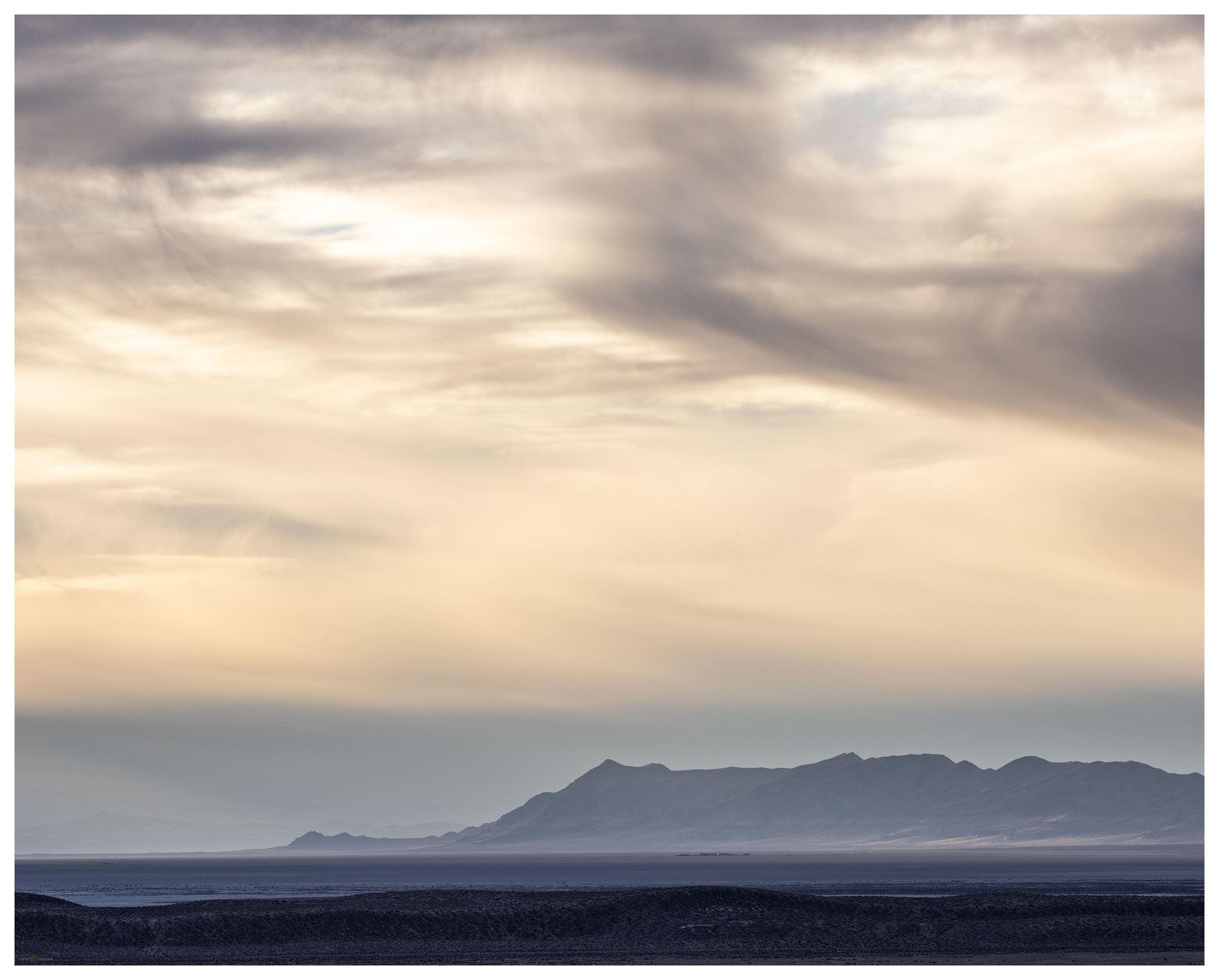
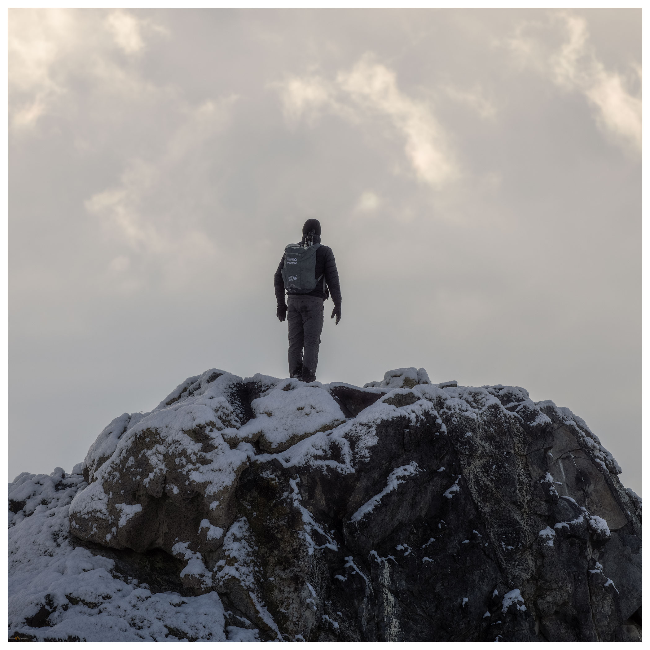
We were closing out the 2021 field season in Owens Valley, and I had been on a long circuitous road trip working on projects in San Diego, California, visiting with colleagues in Henderson, Nevada, and traversing Death Valley to return to our team working on the fans of the Owens Lake basin. While we wrapped up our fieldwork, the first solid winter storm bore down on the Sierra. Travel home was not possible. The storm meant steady rain in Lone Pine, California, our lodging and logistical base, with the Sierra massif clouded over. I took some time to wrap up some field mapping in the southern valley, taking advantage of the road closures that precluded a homebound journey.

Eastern Sierra – Winter’s Coming Collection

Inyo squalls. Strom clouds clearing from the Inyo Mountains, Great Basin Desert, CA, USA

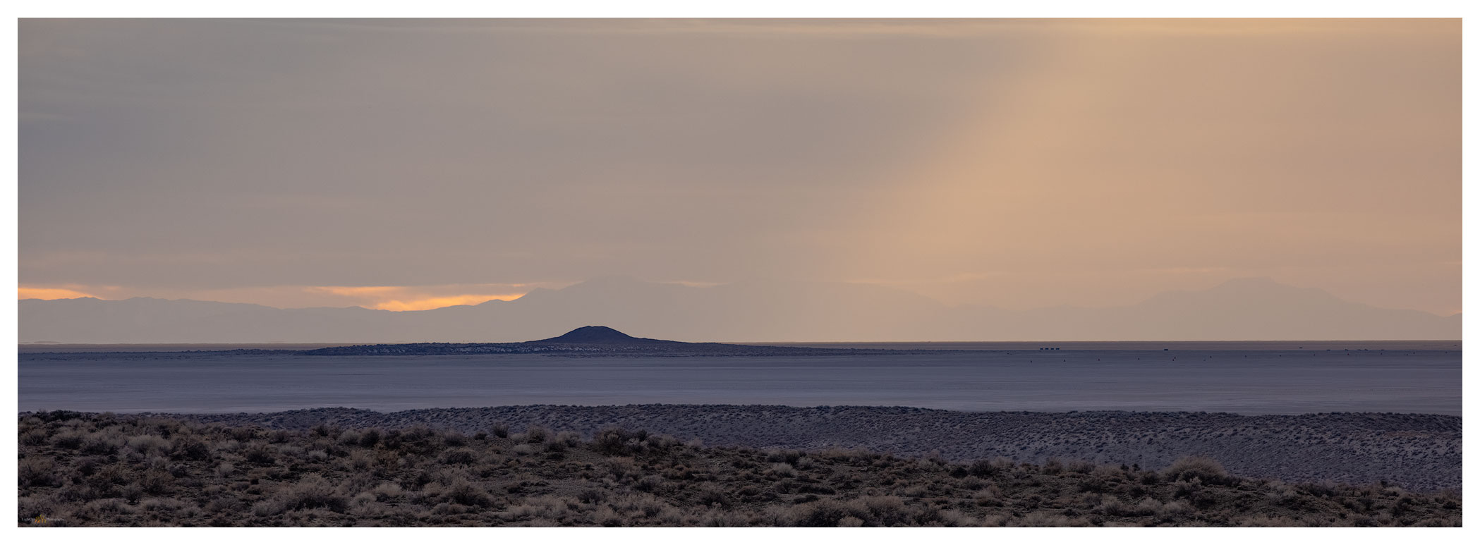
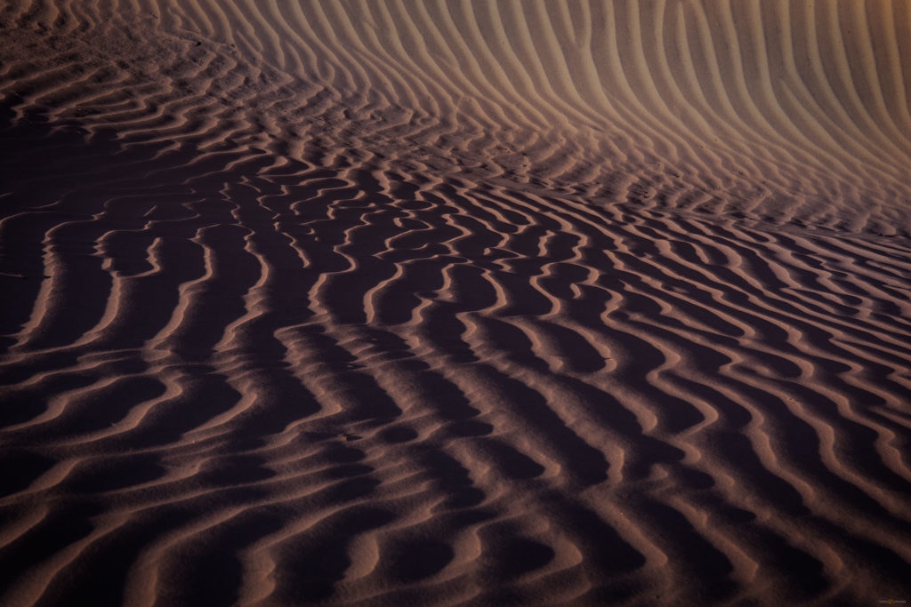
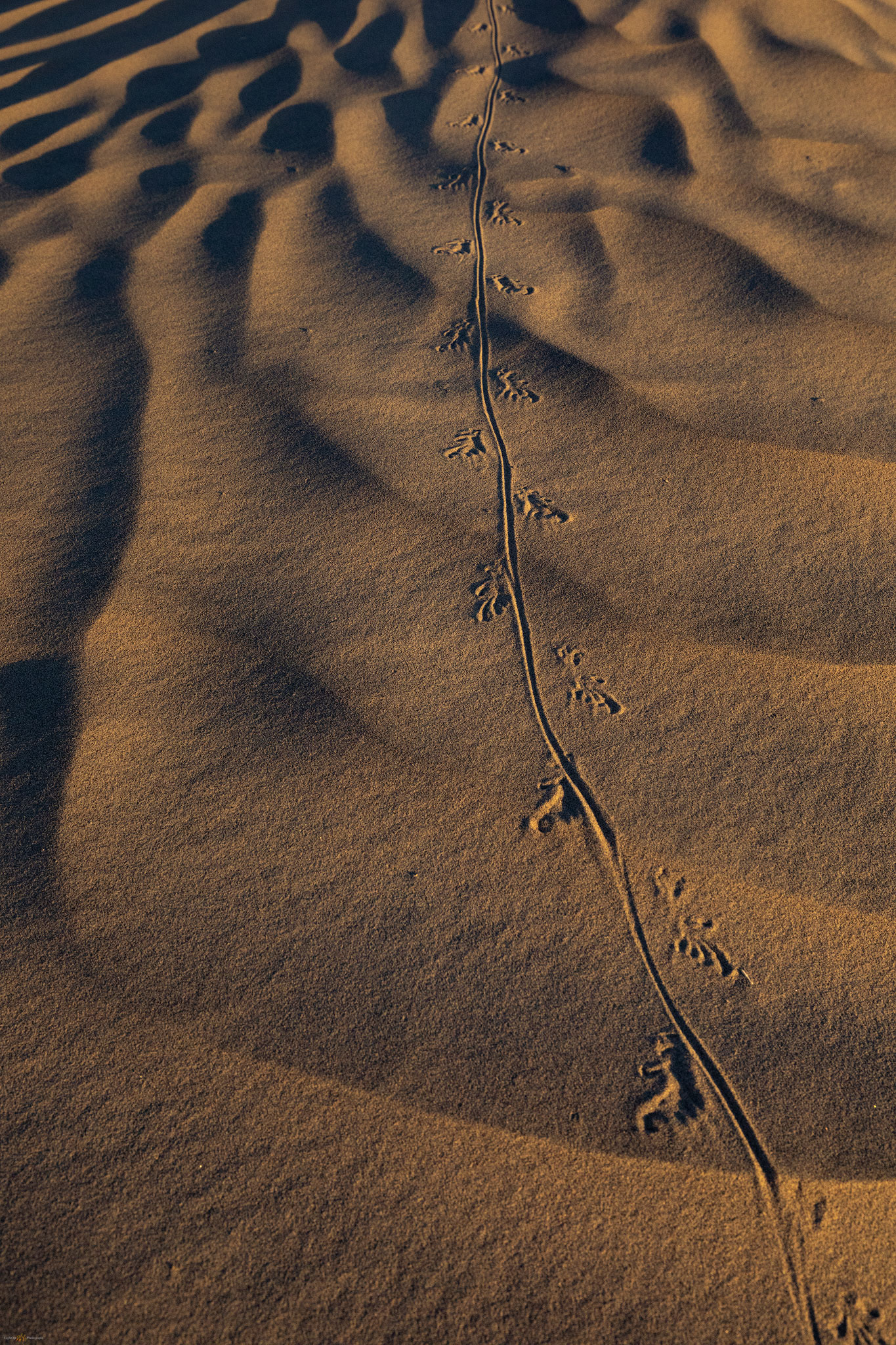
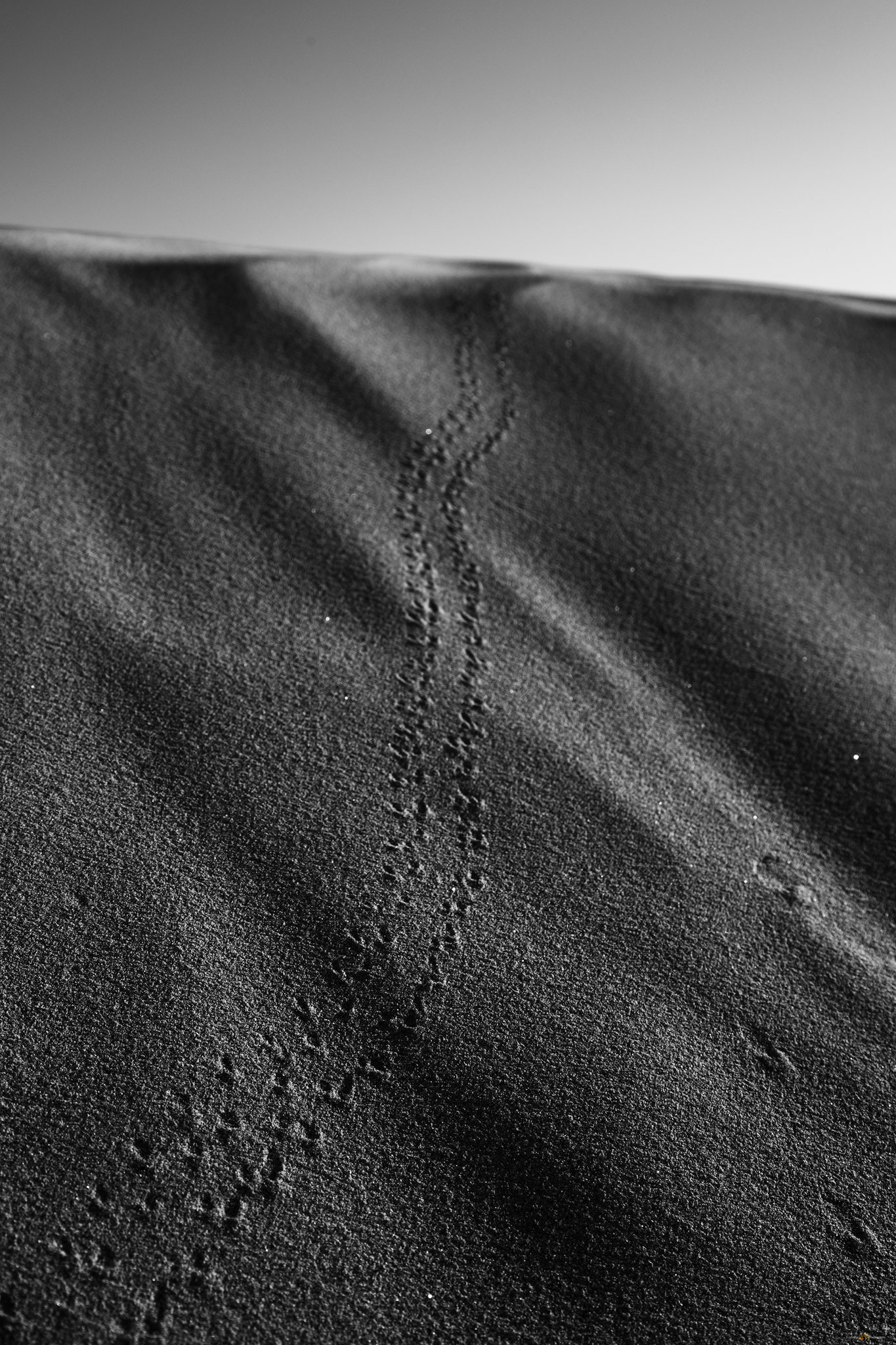
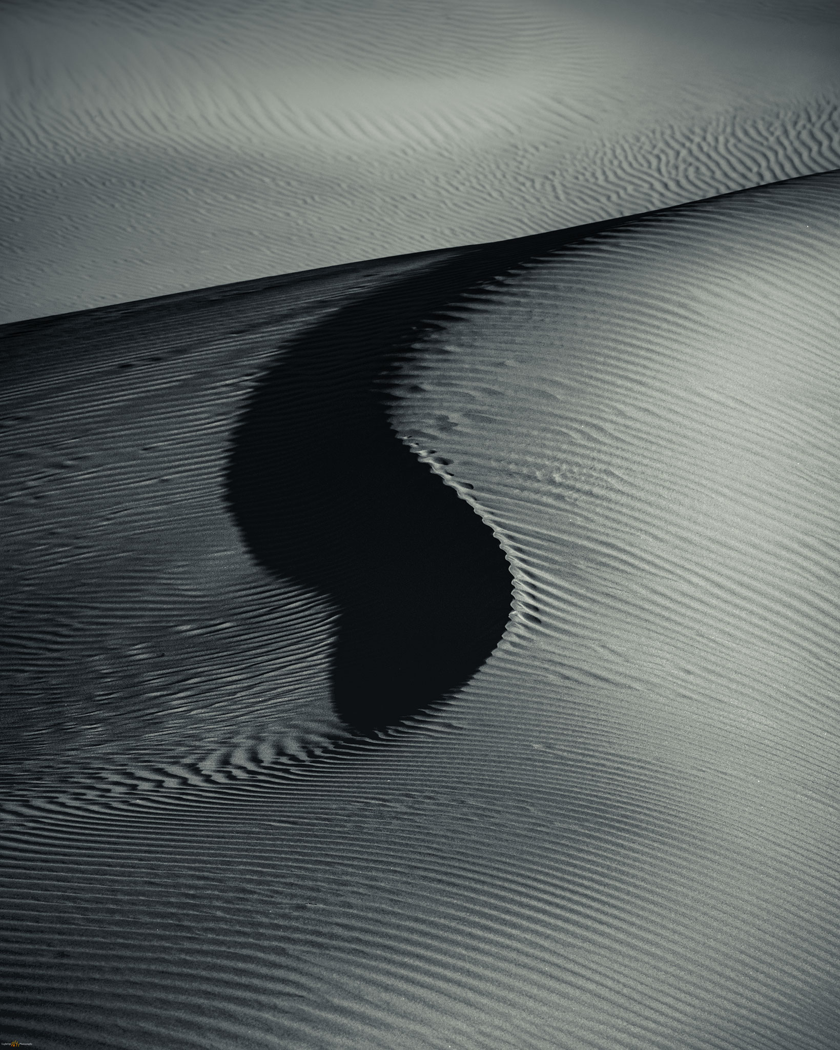
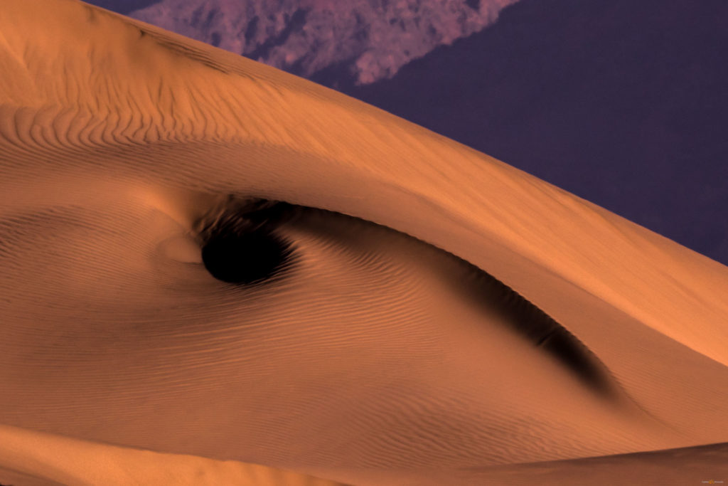
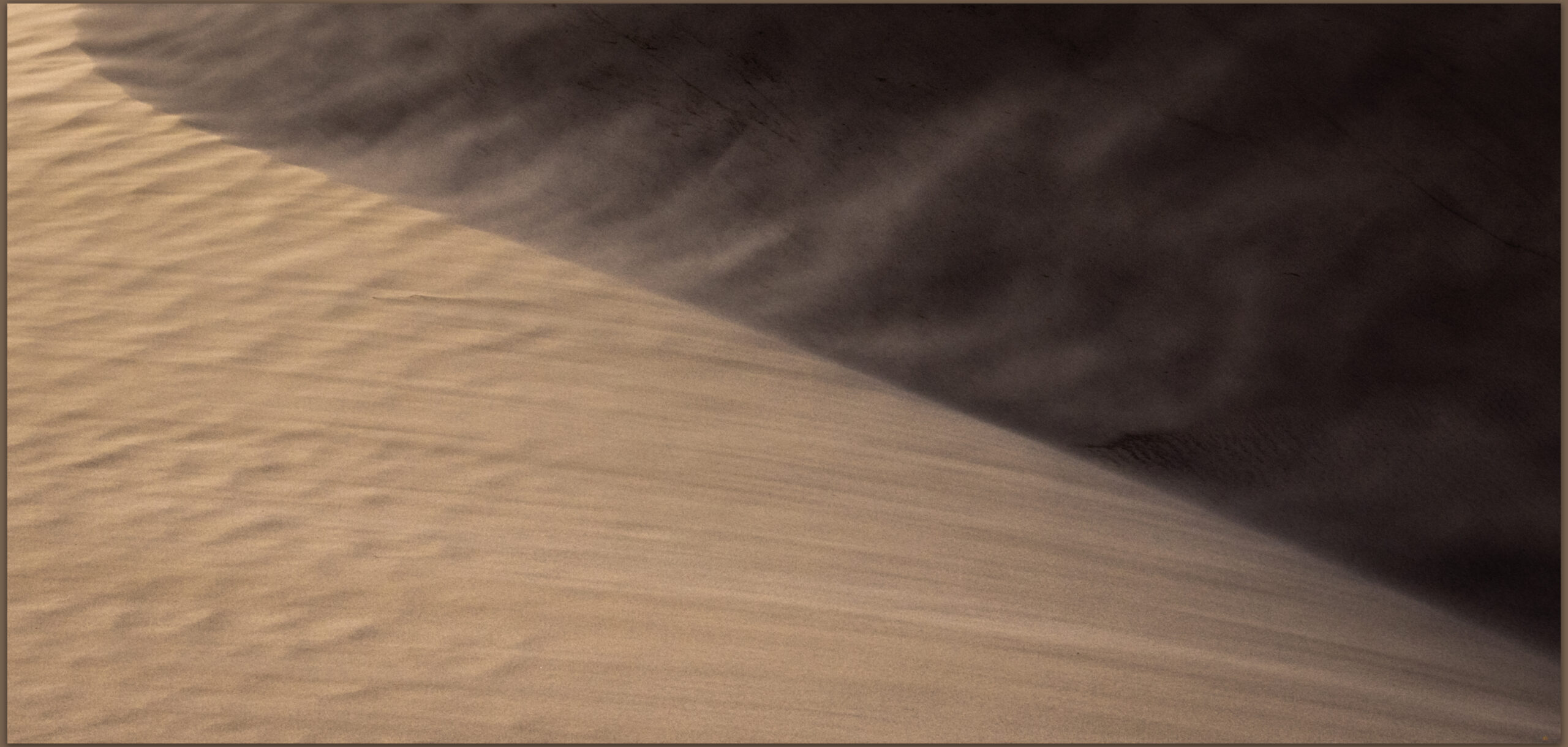
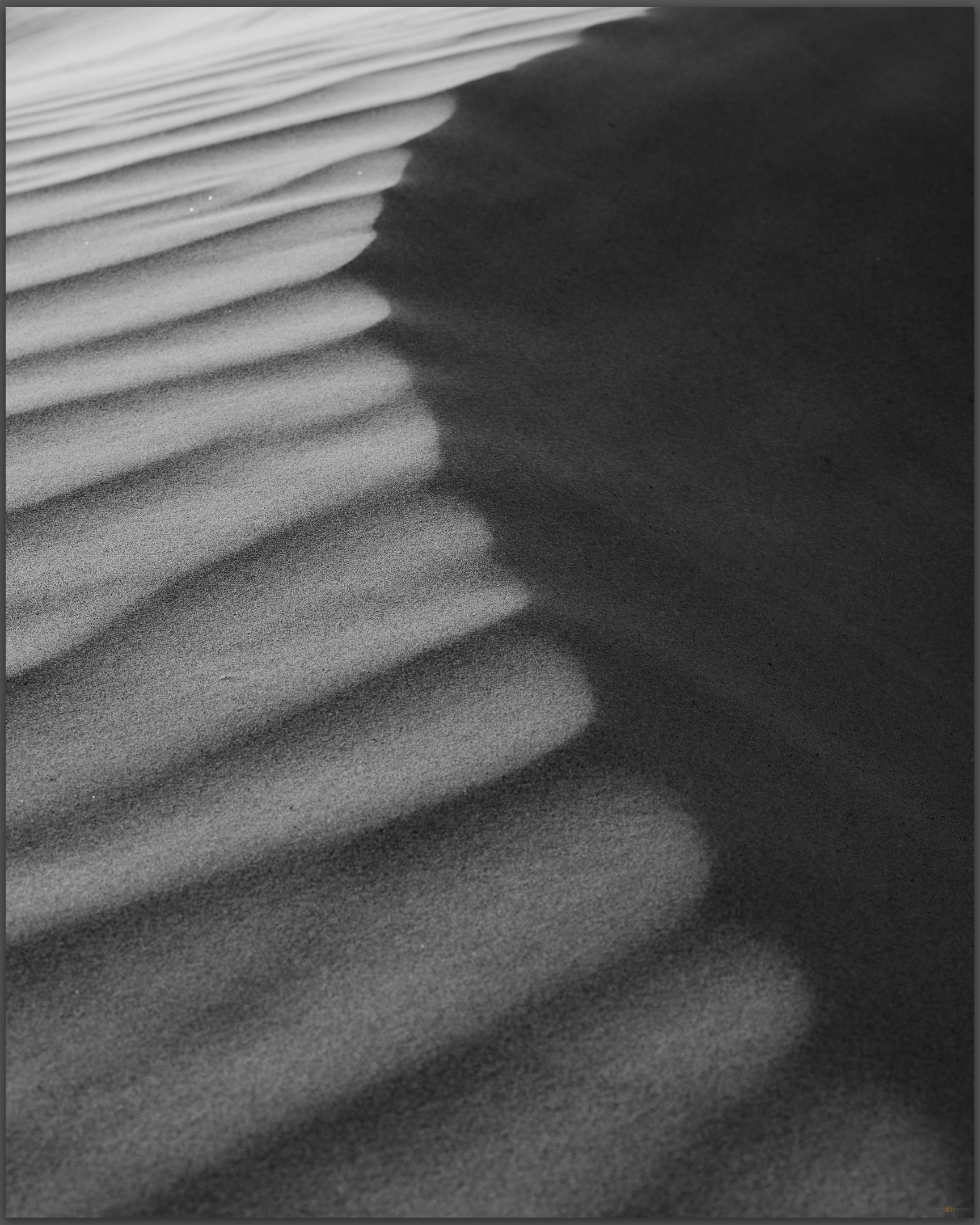
Soon, however, the storm caught up with me and the graded roads of the Olancha and Walker fans were flooded. I retraced my way around to the east side of the valley and visited the falling dunes of the Centennial benches, a small dune-set on the Highway 190 as it climbs out of Owens Valley. I really enjoy this small falling dune and adjacent sand ramps as they move across the dramatic black basalt of the local rimrock benches. Today, the wind was the subject. I was pushed by gusts and polished by grains as a worked low on the dune to tell the story of the wind and its motive power. No changing lenses in these conditions, but I chose well, and I am happy with the results.

Aeolian rush. Reworking of a falling dune, Owens Valley, Great Basin Desert, CA, USA
Ripples repose. Storm winds rearrange the falling ripples, Owens Valley, Great Basin Desert, CA, USA

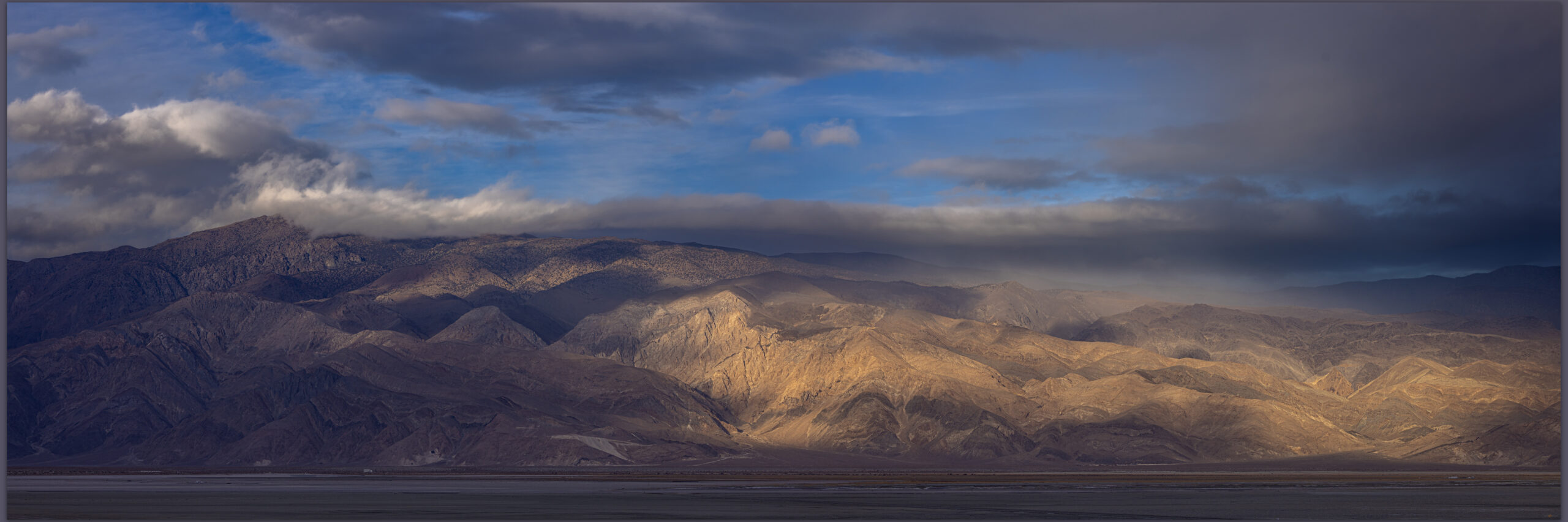
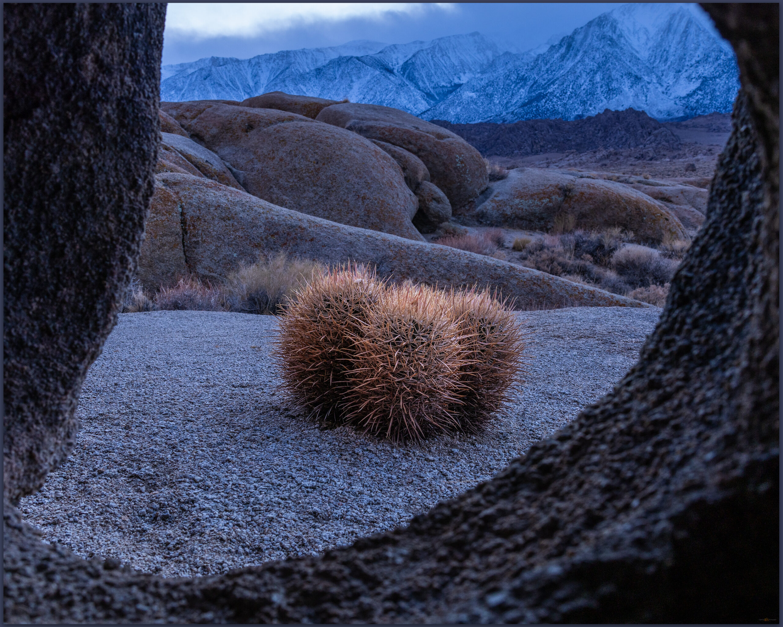
The rains finally reached the desert side with the Inyo and Coso mountains soon engulfed in clouds and sheeting rain. I was not quite finished, however. I worked my way into blue hour in the Alabama Hills looking for small scenes in the fading light under the stormy clouds – only the lower mountain-front was visible. The barrel cactus seemed to bend the blue light into a kind of warmth, needles glowing against the cold rocks and sandy grus. Looking for a different perspective, I crawled into a tight cave-like alcove to keyhole small cactus. I am not sure it works but the contortion effort of lifting the camera into the slotted crevices to frame a hoped for subject had me laughing out loud; I am sure a strange solitary sound in the windy evening.

Barrel window. Blue hour and cactus in the Alabama Hills, Eastern SIerra, CA, USA
Storm ball. Alabama Hills, Eastern Sierra, CA, USA

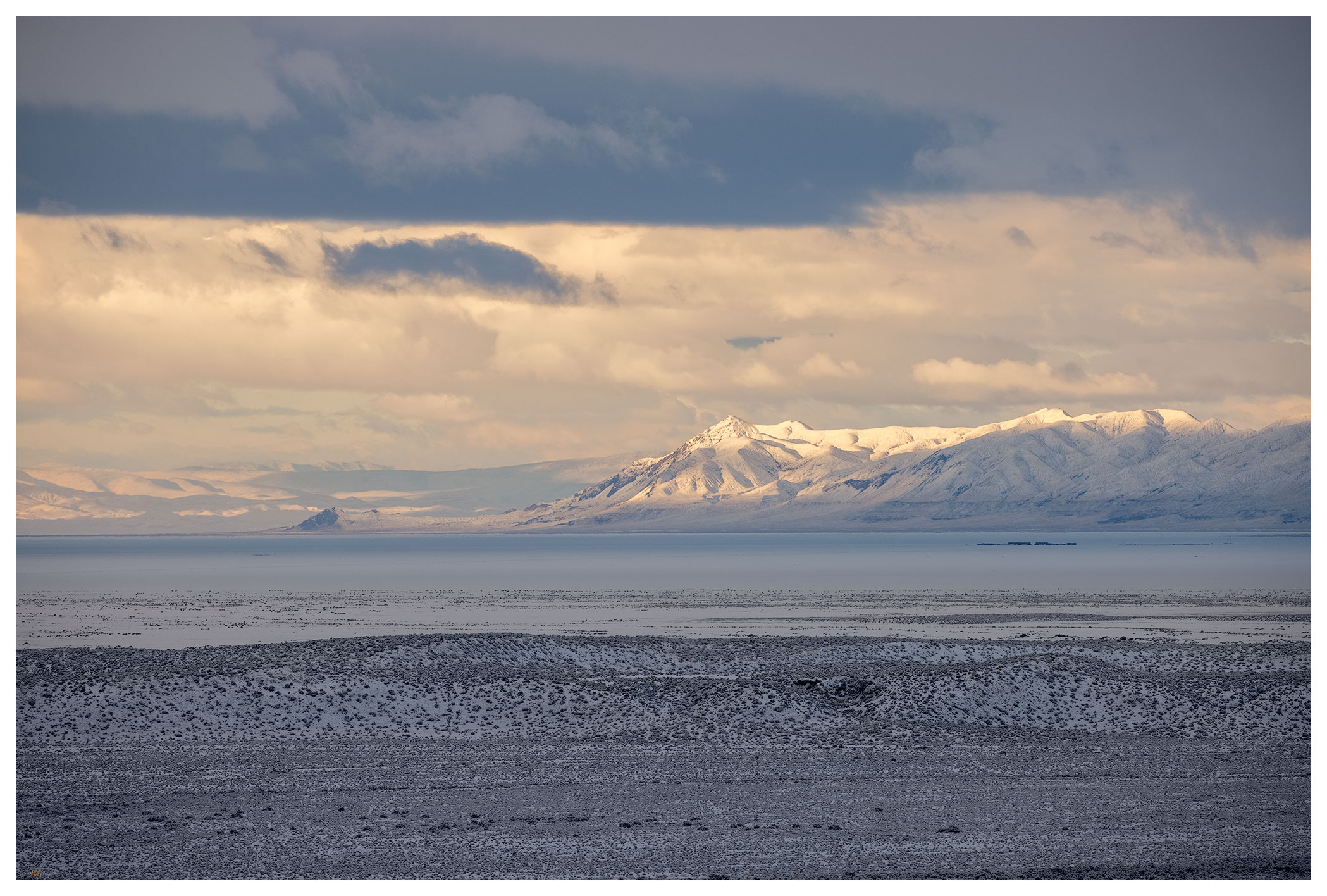
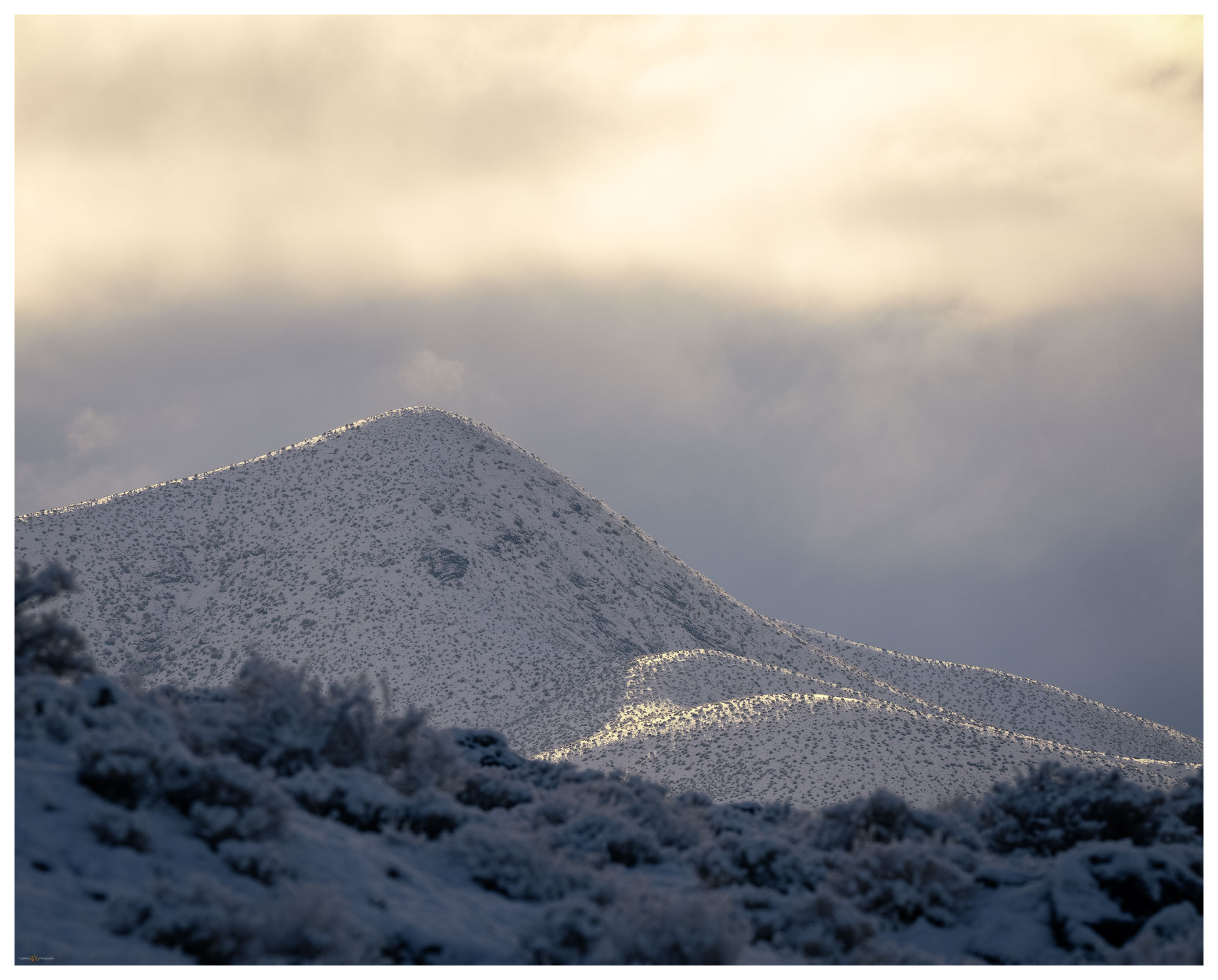
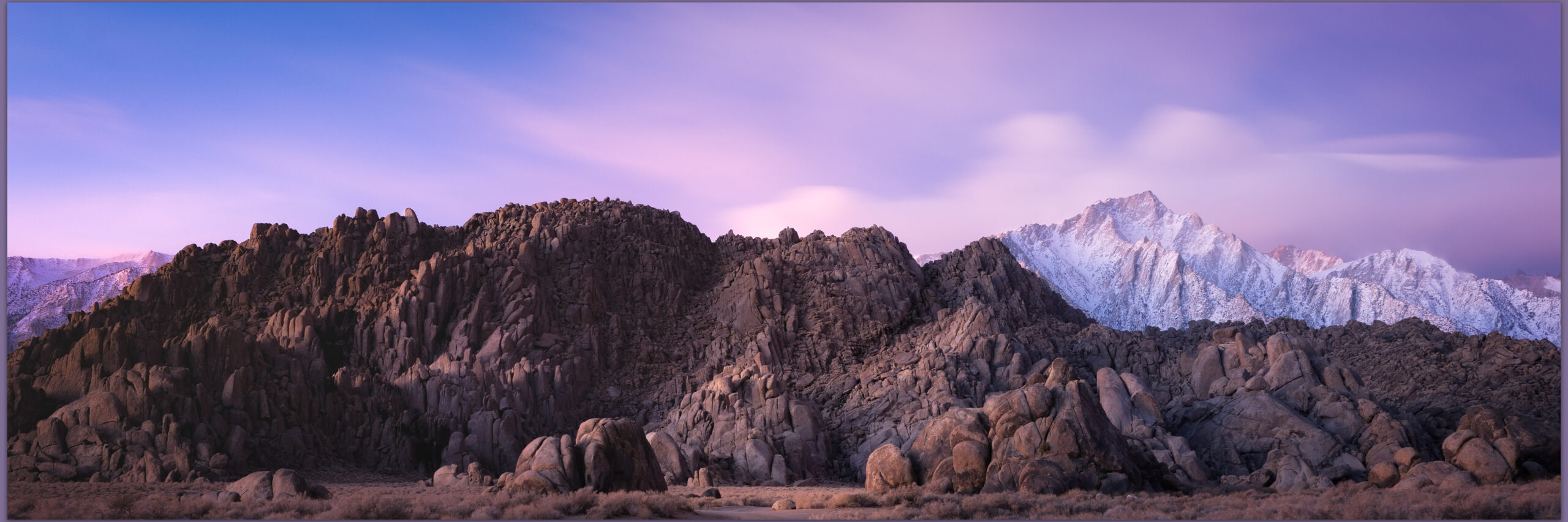
I returned to the hotel to hope for a break in road conditions so I could get home. I had logged over 1600 miles on this outing, and the first pangs of homesickness are more acute when conditions change the plan. Clearing skies of the following morning brought reward. Forecasting the changing conditions, I hurried back into the Alabama Hills before dawn. I once again patrolled Movie Road. Driving its full extent and returned eventually to the newly restricted ‘Day Use’ area where the road first bends sharply east. The Sierra crest beckoned, and I had great pleasure watching the refreshed skies on Lone Pine Peak. The light of the Sierra, a gift accepted once again.

Eastern Sierra – Winter’s Coming Collection

Interior pipes. Early sun and texture in the Alabama Hills, Eastern Sierra, CA, USA

Keep going.

Please respect the natural and cultural resources of our public lands.

#naturefirst #keepgoing

Landscape Photography: Overland in Nevada’s Carson Sink

D. Craig Young · December 20, 2020 · 2 Comments

The Carson Sink is the terminal basin of the Carson River, draining from the Sierra into western Nevada. The sink is also, at times, the terminus of the Humboldt River; in years of high winter precipitation, the combined flows can result in an expansive, shallow lake in the typically barren sink. And yet, even in dry times, the Stillwater Marshes — a National Wildlife Refuge — reach into the basin at the delta of the Carson River. The life-giving and ever-changing wetlands have been the homeland of North Paiute people and communities for millennia; the still are.

Although the sink is relatively close to home, I have spent more time in the surrounding ranges and valleys than I have looking into the vast desert basin. I am beginning to take a closer look at the landforms, their timing and process, of this distal basin and an overland journey and geo-recce was in order. A pre-holiday storm dominated the forecast, so there could not be a better time for this trip.

North sink.

Darren — my brother — and I turned off Highway 95 and onto the dirt track on the northern margin of the sink, along the toe slopes of the West Humboldt Range which separates the Carson and Humboldt drainages. The blue sky seemed to hide any evidence of the coming storm. Our traverse took us across desert fans where dusty badlands intersected the soft, effervescent playa of the former lakebed. We were alone and would be for the next few days.

Lone rock light.

Carson Sink Collection

We set camp south of Chocolate Butte on a series of bars and berms formed when Pleistocene-age, pluvial Lake Lahontan cut into the Buena Vista Hills. Our perch provided an overlook of the western sink with Lone Rock, a buried volcanic plug that protrudes from the playa, rising like a beacon. The landform, so significant to the Paiute people, captured our attention with sunset and at sunrise following.

Lone one.

The snow came in the night. Hearing the quiet that sometimes hints at morning fog, I looked out of the camper to see three inches of new snowfall. The desert landscape was now a white expanse, a few dark hills standing in relief. We wandered the old lake strands and berms under dramatic clouds with fog-laden breaks underneath.

Long view of the West Humboldt Range across the snow-covered playa of the Carson Sink.
Strandline snow.
Early light.
Darren at sunrise.

The squalls seemed to be breaking up by mid-morning. Under clearing skies we made some breakfast on the skottle, re-loaded our coffee, and secured camp for the day. It had been many years since I had traversed the western bajada of the Stillwater Mountains — the bajada formed of numerous alluvial fans emanating from the many canyons along the mountain front. The coalesced fans form a two-tiered apron below the mountain and lead to a sand dune that piles and re-piles along the margin of the playa. Wind transports sand, momentarily paused in the dune-form, but water is the sand’s source. The delta is downwind where the river, mostly the Carson, sometimes the Walker, and maybe, though long ago, the Truckee, delivered sand to the fluctuating lake. The conveyor is still operating, but it has been running on little energy since the Pleistocene. Southerly winds, with the occasional redirection of a north-westerly storm pulse, push the sand to the valley margins. Starving for sediment, the dunes are now their own sand source, with new parabolic racers leaving exposed dune-core badlands in relief. Traversing the high sand faces and walking quietly through the skeletal-core, we soon encroach the playa expanse.

Dune core badlands.
Checking the level, Carson Sink, Nevada.

Our second night is long and cold. The darkness of the Winter Solstice is almost upon us; nightfall is early and we pass the long hours of the evening with a camp dinner and a quiet fire. The Geminids meteor shower teases disappointingly, so we share stories and plans for the new year — ways to make the most of our time in the pandemic. Outback travel continues to seed hope and heal with a bit of distraction.

Carson Sink Collection

A second storm approaches on Sunday morning. We pack camp and continue southward; today entering the east side of the Stillwater Marshes so that we can cross the delta from east to west before once again hitting the highway. Rain squalls come and go as we traverse the silt dunes of the North Road and finally venture into recent snow-cover at Papoose Lake.

I will have several field seasons of work coming in the geography of the Carson Sink. This refresher overland re-set my thinking and provided a new foundation for investigating the open space surrounding that vast playa.

Keep going.

Please respect the natural and cultural resources of our public lands.

#naturefirst #keepgoing

Patterns and process — Death Valley, Part 2.

D. Craig Young · May 18, 2020 · Leave a Comment

Our night in the overflow camp was not that bad, and we were up early covering the short distance to the iconic viewshed of Zabriskie Point. We were the first parking-area arrivals – Erno, Jeremy, Quinn, Sandy, and Randy – but were soon followed a good-sized crowd as the developed walkways of the overlook absorbed the people and numerous tripods. Despite the early morning visitors, it is not difficult to spread out and focus on some small scenes in the Zabriskie badlands while not missing out on the iconic expanse overlooking Death Valley. I climbed the hills to the north to wait for sunrise. From the small summit, I looked down on the geometric patterns written in the tilted volcanic tuffs. Odd to watch the iconic view come to life in the sunrise – a scene I had seen in so many images, and although I had passed the parking area numerous times, avoiding the crowds by never stopping, it was a good spot to take in the morning. I was glad I was here.

Zabriskie Sunrise. This shot presents itself on most winter mornings.
Badland mark. A subtle light preceded the drama of dawn on the colorful badlands of Zabriskie.
Surface lands. The golden light and cool contrast absorb me.

The weekend crowded faded into Monday morning, allowing us to move camp to empty spaces in the Texas Spring campground. We set up and relaxed into the late morning and growing afternoon. We had scouted out the area southward into Badwater Basin, selecting some locations where fine-grained alluvial fans crossed the road and extended into the bottomlands. Now we rested in camp and let time pass, making plans for the coming days. Tonight and tomorrow, we would hunt for the patterned ground of polygonal cracking – Erno kept cleaning his gear in anticipation, or maybe he kept telling Jeremy he should clean his gear. We were all looking forward to it, dust spots or not.

Death Valley Collection

We spent the evening and the following morning, below sea-level, wandering the broad fans looking for compelling patterns in the mud cracks. Sediment carried by the last energy of a flash flood, maybe a year or two ago, all other large clasts dropped along the flow, creates a fine-grained veneer between gullies and rocky berms, cracking as it dries and repeating the swelling and shrinking with each new wetting cycle. We spend a long evening on the middle fans. The backdropping sky is subtle, lacking the fireworks of our previous night, but we wait and hope. The following morning, my preparation for capturing sunrise over the polygonal patterns started early. I crept out of the dark parking area, heading toward a more distal position on the fine-grained fans of Badwater Basin. Walking in the dark of pre-dawn, I wandered down-fan looking for some interesting patterns or rocks to the foreground of sunrise. It was quiet and dark, great to be walking. As dawn approaches, I see the rest of the team parking along the road as they work into the sunrise.

Death Valley Poly Cracks. I waited and waited for a closing image to our long day.

It is difficult, for me, to have the patience to choose one small scene in the multitude of patterns, when my typical mode is to continuously recon for profiles and exposures. This is something I need to improve. I often leave a scene too early, wanting to look around the next bend or investigate the next outcrop. It is perfectly ok and fun but creating images the speak to the experience becomes rare. I wait and enjoy the slow sunrise, playing with a few cobbles and cracks.

Pre-dawn rest.

It is our day to take the long, looping road of washboards and rutted dust to the Racetrack Playa, always the highlight of any journey in the Desert Valley outback. We leave my trailer and Erno’s rig in our Texas Spring campsite and spend the day traveling to the Racetrack; we will camp one night at Homestake Camp and return to Texas Spring. Arriving in late afternoon, we explore the Grandstand, an inselberg poking through the northern end of the playa and then visit the tracks of racing rocks nearer the plays southern end.

The trails speak. Enigmatic boulders and traces of the Racetrack Playa, one of my favorite places and a perfect geo-puzzle.

It is a puzzling spectacle viewing the cobbles and boulders (and occasional sticks) with ephemeral trails marking their ‘race’. How do they move? In sum, it is the occasional and timely interaction of water, temperature, and wind. The Racetrack is a somewhat unique playa setting given the large limestone outcrop at its southern end – most playas being isolated in the middle of vast basins far from rocky outcrops. At Racetrack, the outcrop provides the rocks; as the outcrop weathers and crumbles, cobbles fall onto the playa. Winter rains drain to the playa forming dispersed, shallow pools around the scattering of rocks. Basically shallow sheets of water, the pools freeze into thin sheets in a winter’s night (our water bottles were frozen solid overnight here at Racetrack). The rocks become wrapped in the ice sheet, like peanuts in a brittle – the rocks are not submerged, protruding from the sheet of ice, top and bottom. Wind across the frozen sheet starts a cohesive drift as the ice becomes an expansive ‘wing’, acres in size. It takes only a good breeze to move the sheet, dragging its entrapped rocks as they slide and scrape along the lubricated silty clay between ice and underlying playa. All the rocks in a locally frozen pool move in concert; it is why sets of tracks look to be in parallel, matching patterns – a choreography of geomorphic process. In the sunny warmth of a coming day, the ice melts and the water evaporates quickly, leaving only rocks and their trails as circumstantial evidence on the signature dry playa. It is a wonderfully simple and simply wonderful – easily in my ‘top 5’ natural phenomena.  I have seen tracks on other playas, but there is no place that brings it all together like the Racetrack. Please do not disturb the rocks, their travels begin again soon.

Death Valley Collection

We set camp at Homestake, thankfully gathering around tailgates for a generous buffet. I would say it was potluck, but we were mostly lucky to have Erno as our cutting board host. Nothing better than a desert camp, tasty treats, and random beverages after wandering among the racing rocks.

Racetrack trails. I struggled to create a compelling image of my long night at the Grandstand. In the end it was about the slow (and cold) passage of night.

Later, I tried for some late night to early morning star trails over the Grandstand, but it basically meant sitting on the very cold playa for most of the night. The stars did not align, as they say, and my results were disappointing. With little sleep, I gathered with the team back on the Racetrack. Despite of, or maybe because of, our weary, silly state, Jeremy and Sandy teamed up to choreograph the perfect group picture. Frameable and available for order, I am sure.

Flight of the puffins. Randy, DC, Jeremy, Erno, Quinn.

We traversed back through Teakettle Junction and Ubehebe Crater to arrive, at last, in our spot at Texas Spring Campground. Although we attempted some night photography at Zabriskie (hey, it was easy access after the long drive), I have not seen many team images from that night. The outings cannot all be gems, even in this group.

A meditation on the repeating patterns on a small dune in the Mesquite Dunefield.

The morning was another matter.  We were outbound, heading for the Alabama Hills, but we took a timely and deserved stop at the Mesquite Dunes. Sunny, calm skies forced us to turn inward, looking for small scenes in the golden contrast of the morning. We approached from the southeast to avoid the tracked-out areas of the previous day’s visitors. These dunes appear in thousands of images in as many ways, but the attraction of contrasting patterns in the ever-changing landscape is profoundly magnetic.

Locals only.
Into distance.
Balance.
Revealed. The intimacy of patterned ground.
The Watching.

Death Valley Collection

We dispersed and enjoyed our time before beginning our journey home.  We had one more stop to make, so driving again, we emerged from sea-level to greet the valley at the foot of the High Sierra.

Keep going.

Please respect the natural and cultural resources of our public lands.

#naturefirst #keepgoing

Trail Option

Copyright © 2025 · Monochrome Pro on Genesis Framework · WordPress · Log in

  • Contact TrailOption
  • Substack
  • Waypoints Bibliography
  • Young Archives