• Skip to primary navigation
  • Skip to main content

Trail Option

A personal geography of landscape and place, art and geo-science.

  • Home
  • About
  • Contact TrailOption
  • Subscribe!
  • Lost Journals
  • Show Search
Hide Search

dust

Nevada High Points #100 – New Pass Range

D. Craig Young · April 26, 2022 · 1 Comment

New Pass Peak. The north slopes and upper reaches of Gilbert Canyon, New Pass Range, Great Basin Desert, Nevada

New Pass Peak

9002 ft (2744 m) — 2901 ft gain

2022.04.08

New Pass Peak Collection

Big, round numbers are cool, and here I am at High Point #100. It is simply a step on the journey, but it is also a great measure of motivation and experience in getting here. I started this quest in 1995 visiting high points in earnest for a couple years until, some would say, bigger responsibilities got in the way. But like the 100-mile ultraruns I have completed, the long experience takes time and consists of many unique steps on many different trails. It is the process that matters. I am happy that the earnestness has returned, and I have reached the century mark – New Pass Peak, west of Austin (Nevada, of course).

I chose New Pass because the approach would be relatively straight-forward and due to an upcoming travel schedule, I did not have a full weekend. I also liked it because I see the peak commonly while traveling Highway 50, and I would have a common visual reminder of #100 as I travel across the state. As usual, Darren agreed to join the experience; we would get at least one camp night in.

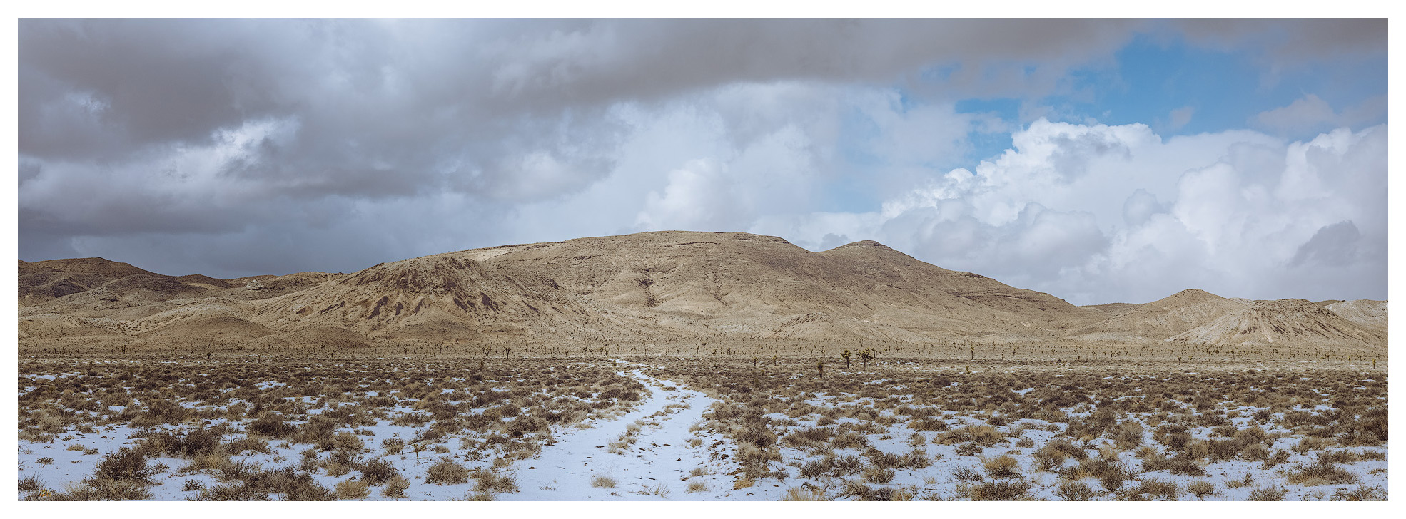
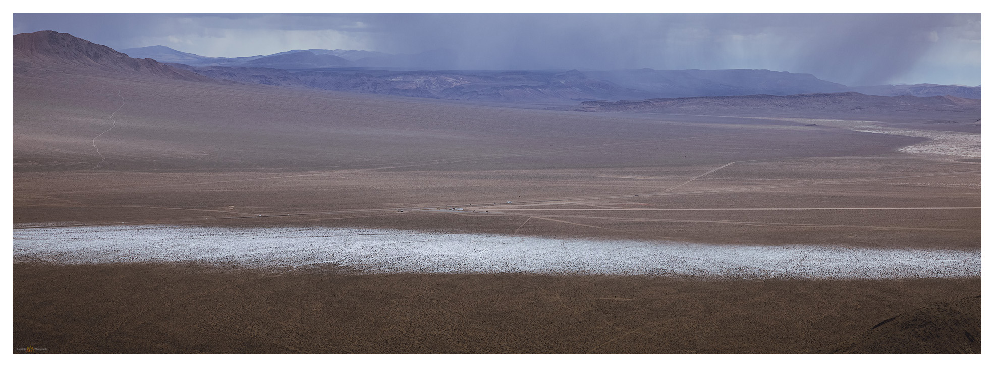
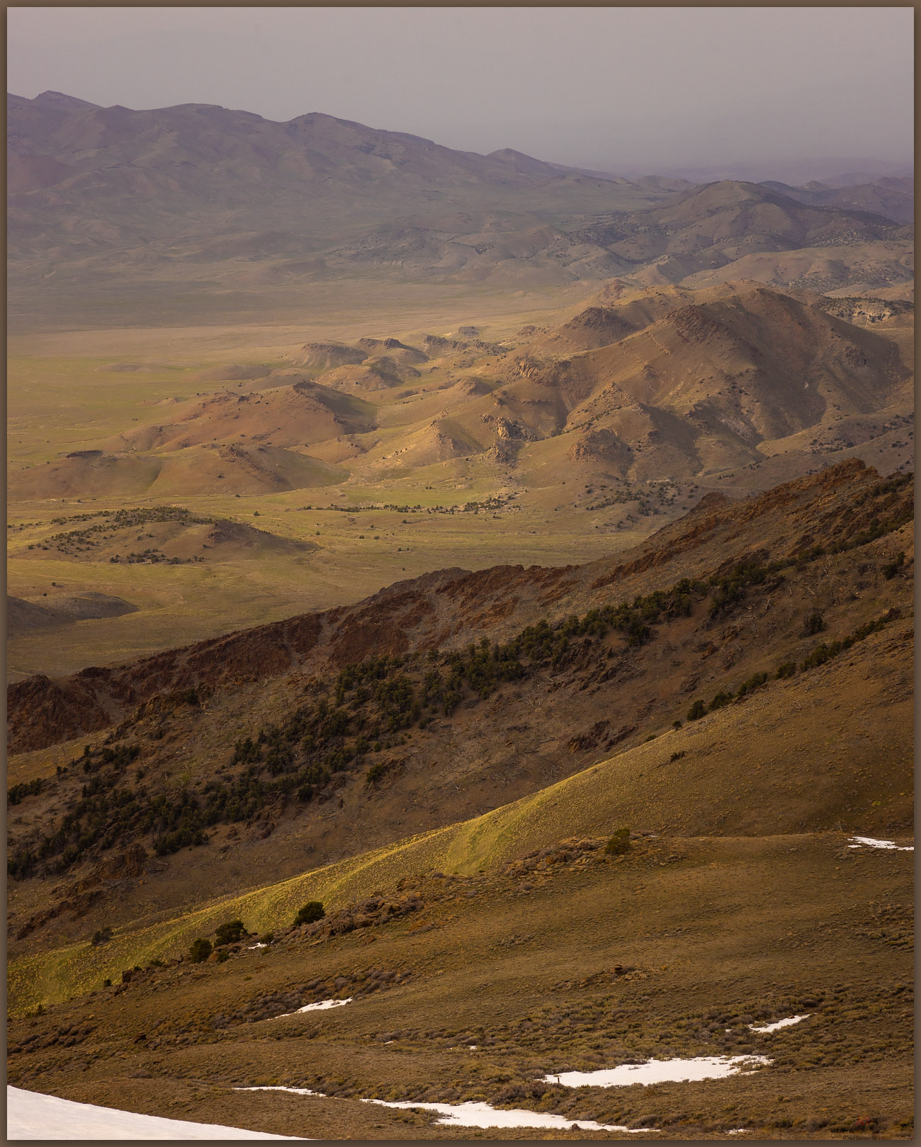
We set camp on a small outcrop at the edge of the dry lakebed (playa) of Edwards Creek Valley. I have a geologic fascination with dust, so the silt dunes and fine-grained alluvium of valley bottoms are always interesting; I would have occasion to regret that interest later today. With my little camp trailer and Darren’s tent stashed in the valley, we began a driving traverse of the mountain front where the New Pass Range rises abruptly to the east. The road took us along the fire-barren alluvial fans and relict pediments, revealing a general absence of roads or tracks on mountain’s western front. Exploring further north we dropped into Antelope Valley (one of many Antelope Valleys) and explored its high basin with way too many parched wild horse herds. The fires and horses have had a significant adverse impact in this dry and ever-drier basin.

Skeletal pines. The bones of fire on the eastern slopes of New Pass Peak, New Pass Range, Great Basin Desert, Nevada

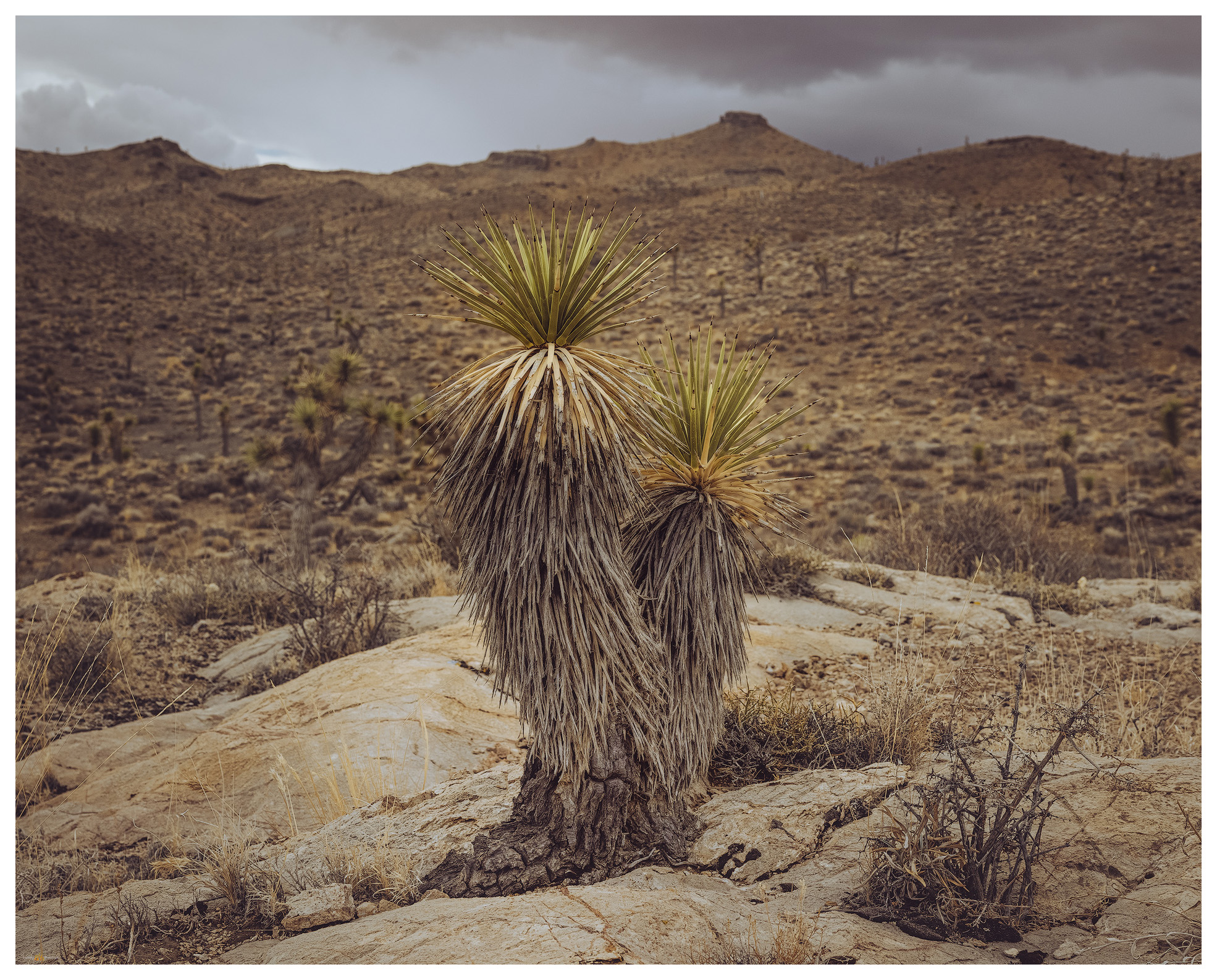
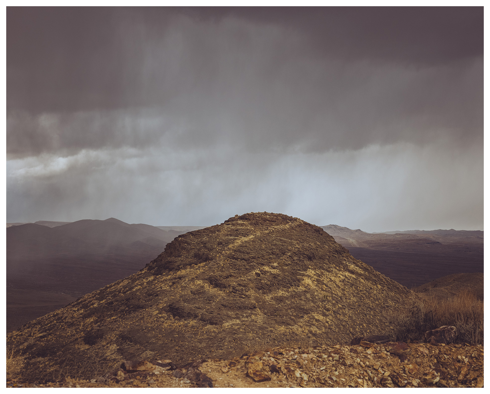
Our round-about tour led us in full circle to the old New Pass Mine Road where we thought we could start our three-mile (one-way) walk along a south-to-north ridgeline. We were met, however, by private property and cable gates that turned us away. At first disappointed, we felt encouraged when we finally found the roads leading along Gilbert Creek – learning that this is the route to access the communications facilities on the summit. We parked well down-canyon and started up a steep slope to intersect our original ridge route. Skeletal pinyon snags circled small groves that somehow survived the latest fire. Will the surviving groves be enough to seed the pinyon’s return?

New Pass approach. Circuitous ridge-walk toward the high point, New Pass Range, Great Basin Desert, Nevada
Followers. Pronghorn on the trail behind us, New Pass Range, Great Basin Desert, Nevada

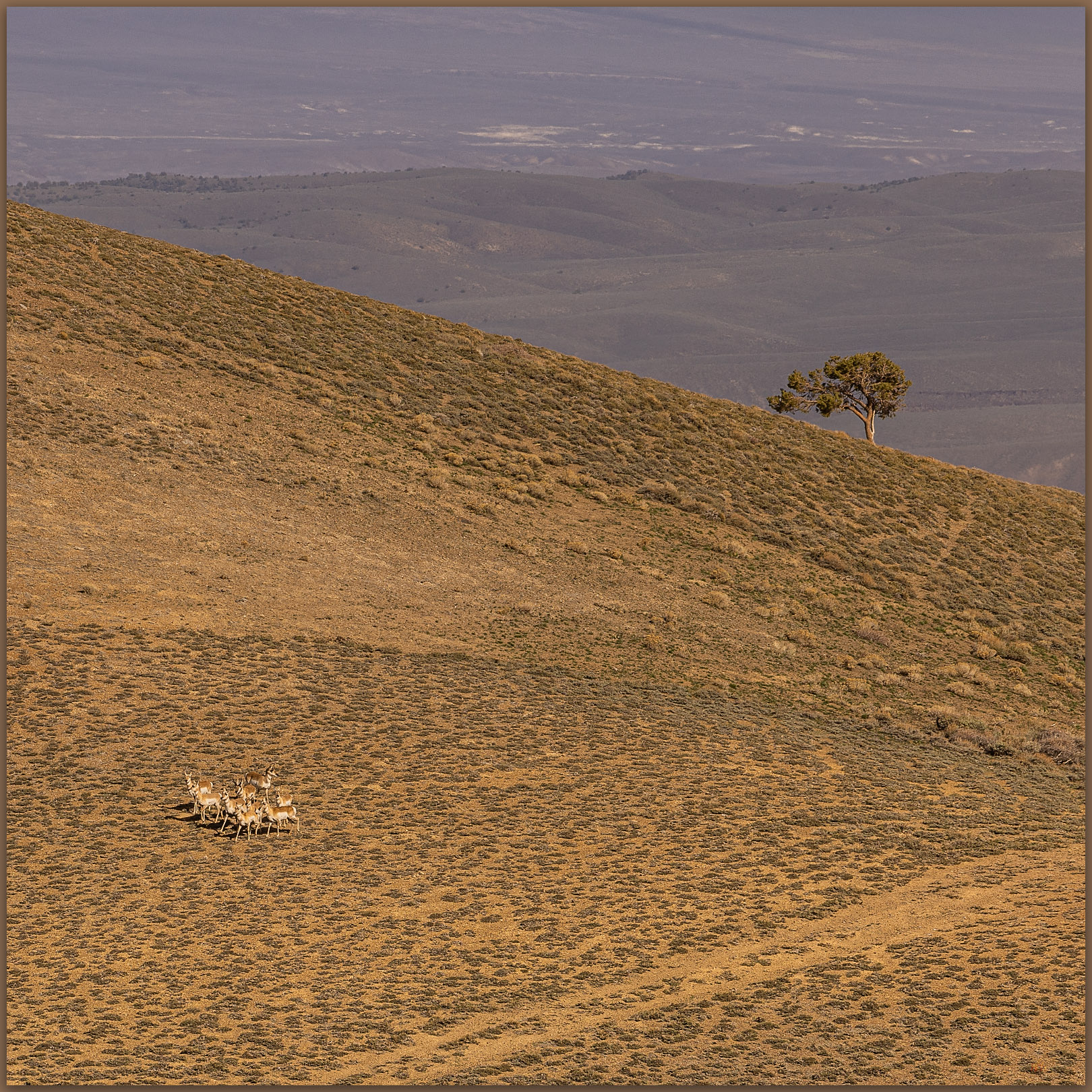
Pronghorn find us near the ridgeline.  We only notice them when looking back on our route, and there they are, standing in the saddle we had passed through only moments ago. Not sure where they came from, but they watched us curiously and similarly as we kept moving away.

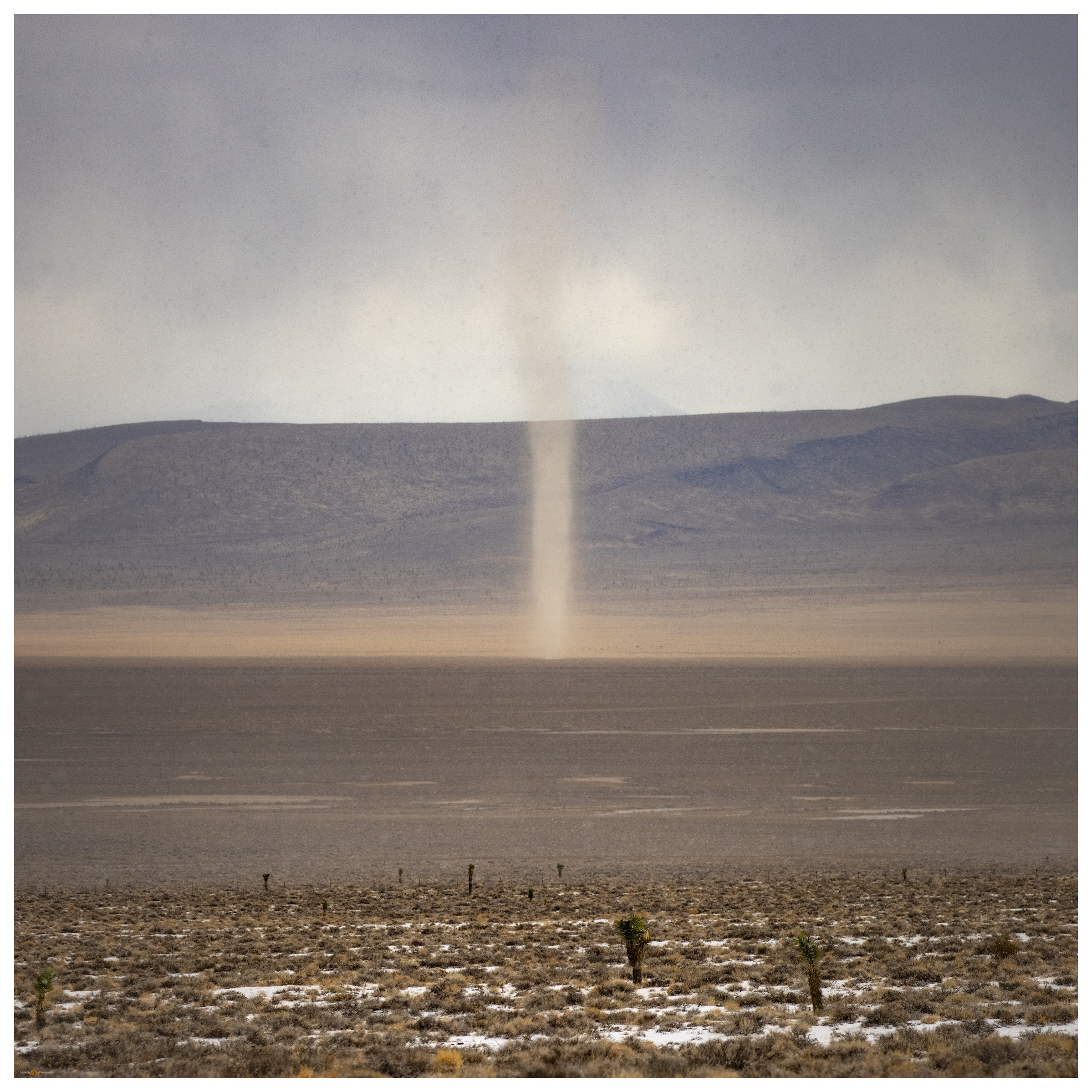
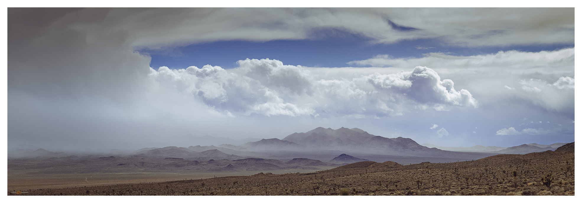
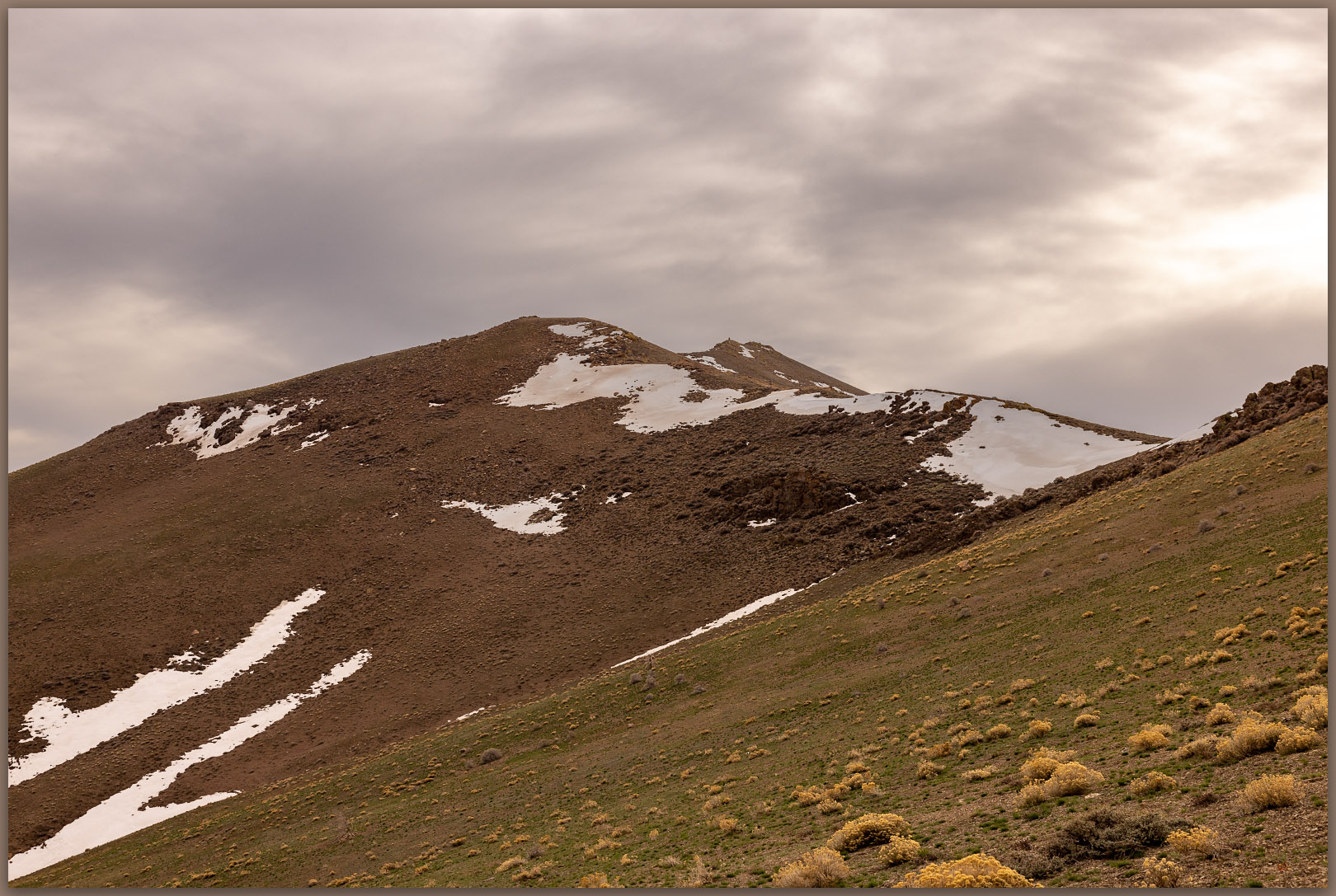
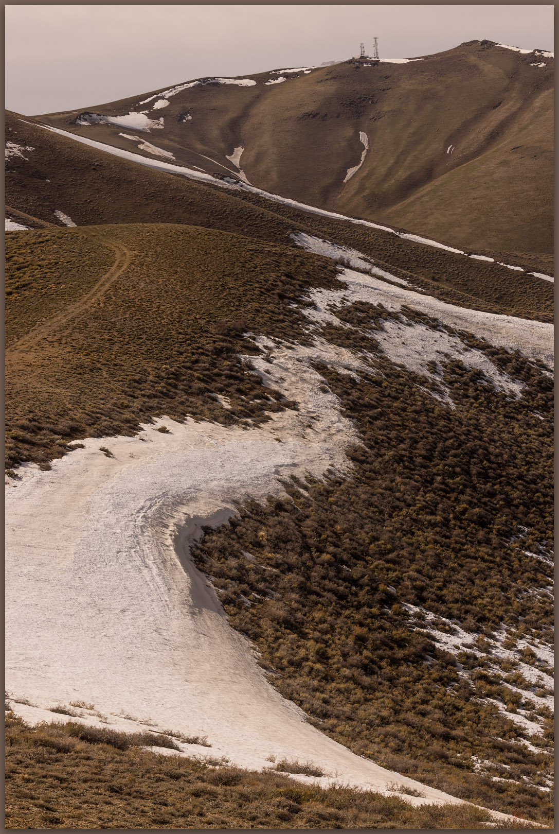
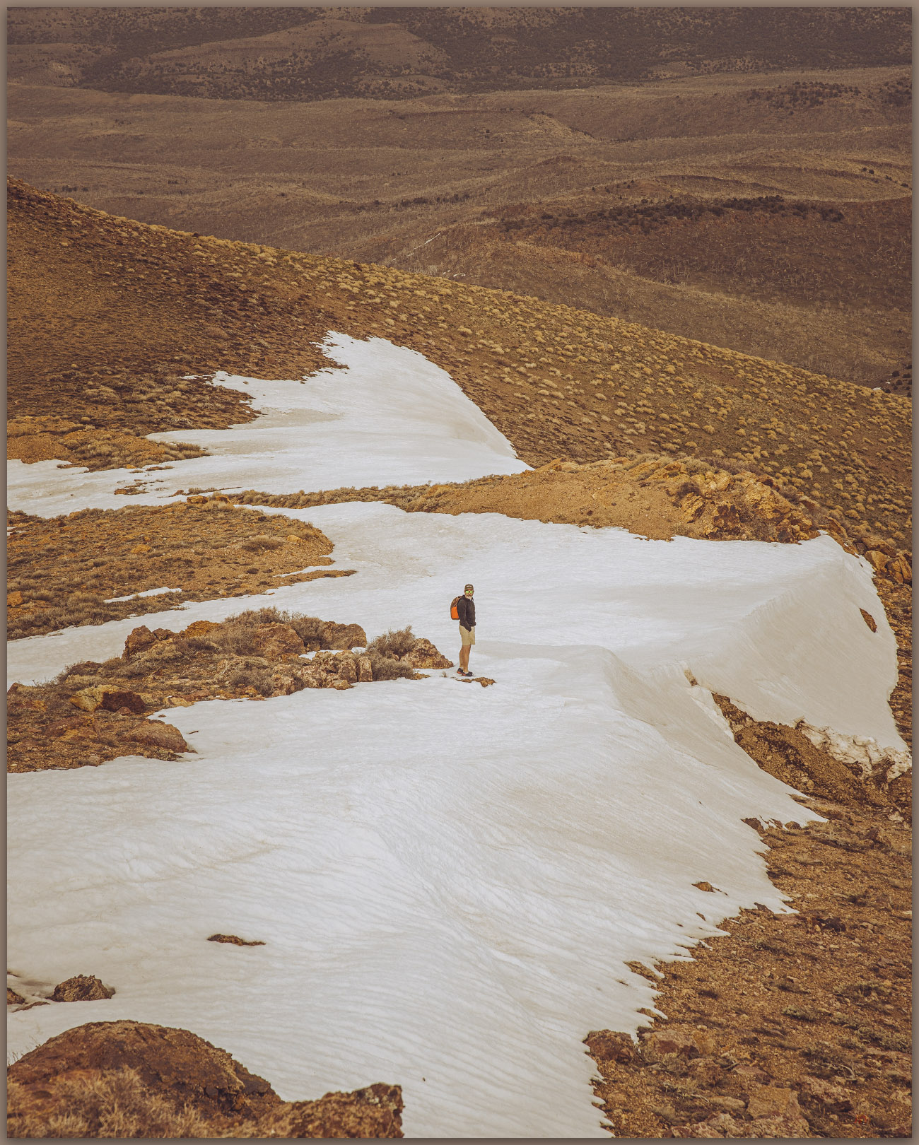
It was now windy, the skies smudged with dust from distant dry lakes and playas. We pushed through a few patches of snow to gain the final summit where the communication overwhelmed small patches of snow and glowered from the hilltop. It was nice that the actual highpoint was isolated a bit to the north, peaking at a rocky outcrop that overlooked the facilities and everything else. We tucked into the outcrop to sign the few scraps of paper that made up the register – if we scurried out from the rocks, the wind blasted our jackets into a noisy frenzy. We could see that Edwards Creek Valley was embroiling a dust storm of its own, and, somewhere in that cloud, our camp (or its remnants) was set. Sometimes dust is a bit too interesting and present.

Toiyabe distance. Bunker Hill, high point of Lander County, Toiyabe Range, Great Basin Desert, Nevada
Hints of spring. Green hillsides in the dusty breeze of Edwards Creek Valley and New Pass Range, Great Basin Desert, Nevada
Snow patches. Darren exploring the descent from New Pass Peak, New Pass Range, Great Basin Desert, Nevada
Two-track descent. Darren wanders the road into the upper reaches of Gilbert Canyon, New Pass Range, Great Basin Desert, Nevada

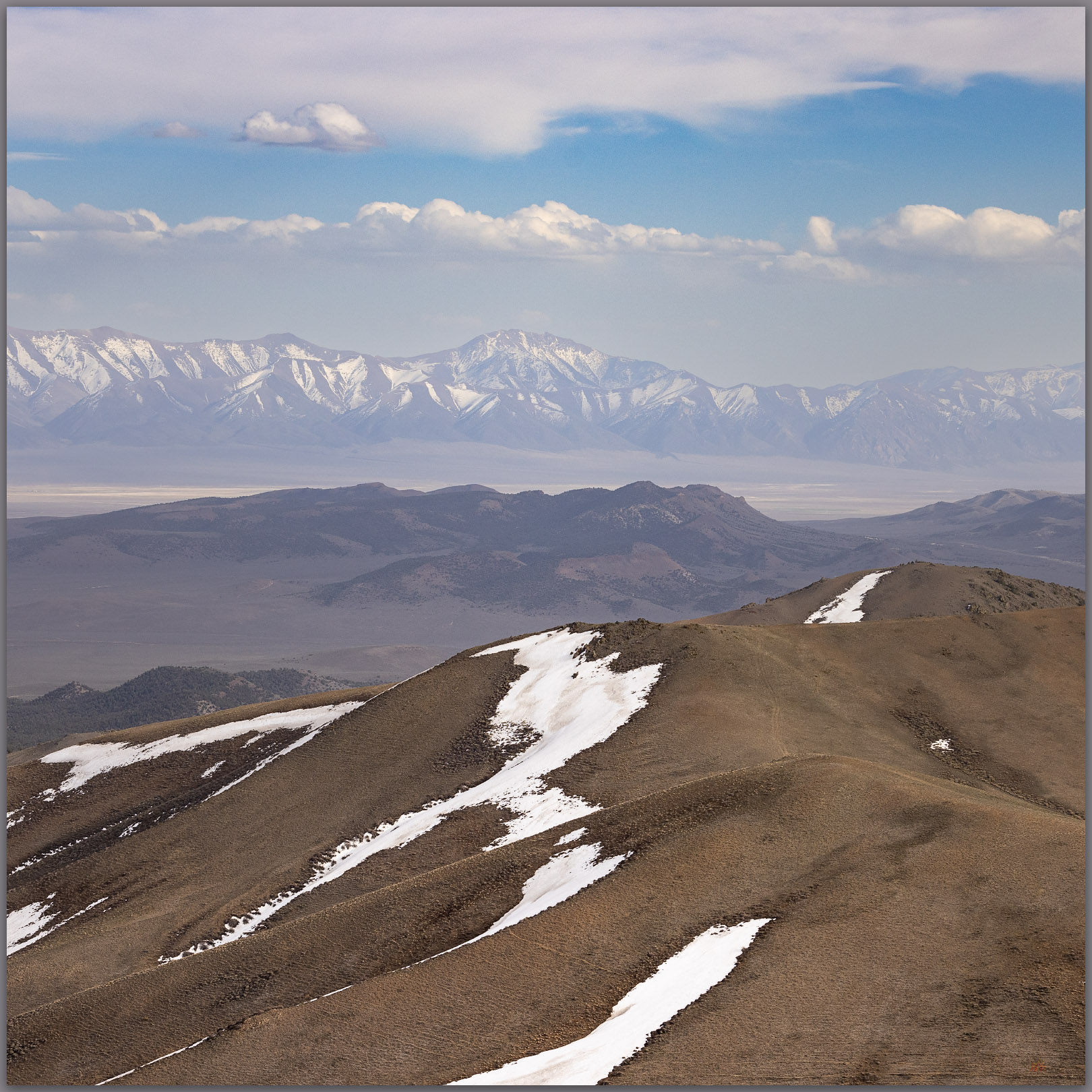
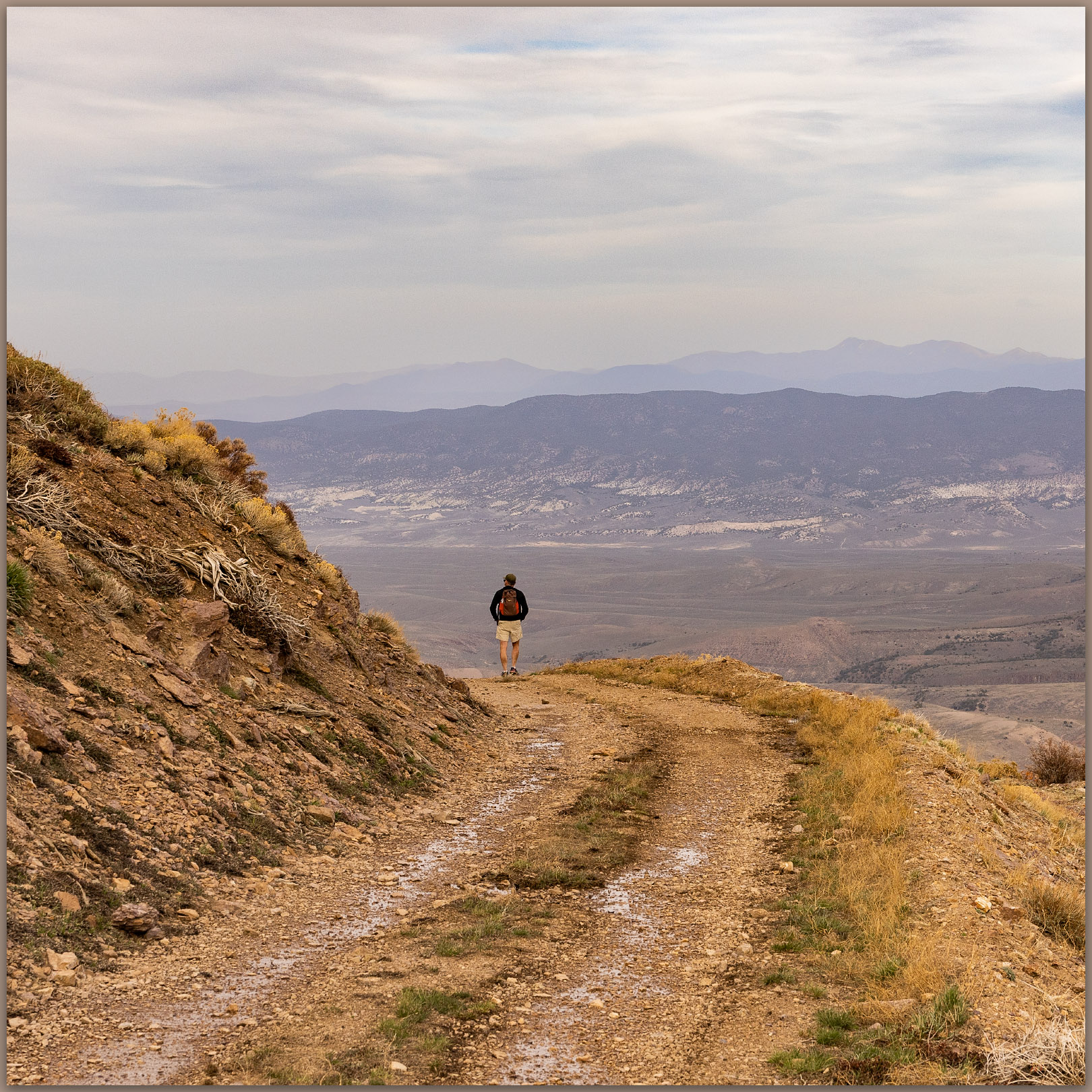
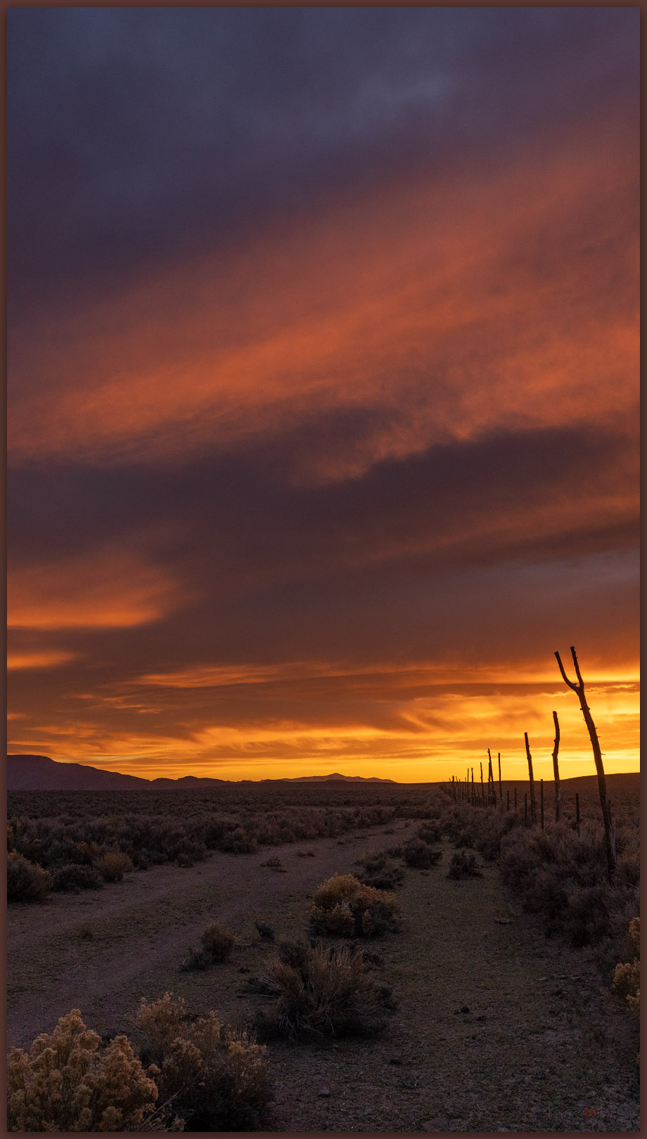
Never mind the gusts, the summit was splendid. Good views of the Toiyabe Range and Shoshone Mountains, along with some colors of the late afternoon working through the storm clouds and whirlwinds. The conditions calmed as we dropped onto the road into Gilbert Canyon where it soon became clear that we might have left the summit a bit early. It took about an hour to get back to the truck but in that time the sun reached the cloud gap at the horizon and shed glorious light on our area of central Nevada. At first, we raced the light on our return drive, hoping to catch a golden hour scene to photograph, but we settled quickly on the simple enjoyment of our warmly lit drive. We slowed considerably to take in the wonderful transition to night.

Closing tracks. Ending the day, leading toward camp, New Pass Range, Great Basin Desert, Nevada

Our camp was a mess. Darren’s tent had clammed into a single dimension but was otherwise in its original location. The wind had calmed after powder-coating everything in sight – an amount, if measurable, would likely have been in the tons per acre for this one event. Dust influx occurs in those kinds of amounts, year after year, throughout the Great Basin. It is awesome (and dusty).

Click here for New Pass Peak Collection

Our skottle dinner provided special celebration. Darren had joined me on #100, a few days before my 58th birthday. Good times. The wind would return in the night, turning cold and occasionally waking us enough to witness new dust clouds blurring the Milky Way and the last of the winter constellations.

In the morning we scouted future access routes into the Clan Alpine Mountains where Mount Augusta awaits. We will get there soon. Of course, we have only 217 yet to go.

Keep going.

Please respect the natural and cultural resources of our public lands. #naturefirst #keepgoing

Nevada High Points #80: Cuprite Hills

D. Craig Young · March 20, 2021 · 2 Comments

Torrential graupel storms track across Stonewall Flat toward Mud Lake playa.

Cuprite Hills HP (Peak 6071)

6071 ft (1850 m) — 1503 ft gain

2021.03.10

When I first imagined a quest of climbing to the high point of each of Nevada’s named mountain ranges, as I studied my collection of topographic maps, it came as a solution to a problem. As a relatively new student of geoarchaeology, I wanted to experience the variety of landforms, eco-systems, and places in the outback of the Great Basin. How best to do this? I did not want to focus on the well-known, recreational hot spots or prominent, obvious peaks – if only to satisfy my occasional mountaineering urges. So, the quest was born; its goal not simply to conquer mountains large and small but to get out and visit the widest variety of terrain across Nevada, the epitome of Great Basin variability. I have managed to stay on the quest, in fits and starts, for over 25 years. I have recently returned to the journey in earnest, reaching high point #80 – a rather poor average of three a year, I admit – in the Cuprite Hills.

I had a field project mapping alluvial fans along the Gila Mountains near Yuma, Arizona, and that required a drive south on Highway 95 to Las Vegas and beyond. I checked my list and consulted my geographic database to see the Cuprite Hills standing lonely along my route. A hike into the dry hills would make a nice break from the day’s drive. Fortunately, the weather forecast called for stormy conditions with snow at elevation and scattered showers throughout the day – I prefer this to an unbearably clear blue sky when traversing the desert. The forecast was spot-on as I left the Walker River to climb into the landscape where the Great Basin eco-system (not necessarily congruent with the area of internal drainage defining the ‘hydrographic’ Great Basin) transitions to the warmer, drier Mojave Desert. The change becomes apparent south of the mining town of Tonopah with the appearance of iconic Joshua trees (Yucca brevifolia).

Cuprite Hills Collection

A stunted Joshua Tree (Yucca brevifolia) clings to an outcrop at the base of the Culprite Hills.

Dropping out of the Goldfield Hills, dramatic squalls intersect the highway and I am soon immersed in a rampaging graupel down-burst. Wipers on full throttle did little to improve the visibility, and nothing could compete with the sound of the pelletized snow pummeling the windshield. And here, at Lida Junction, I needed to turn onto a desert two-track to find my ‘trailhead’, an arbitrary dirt intersection on the alluvial fan somewhere beyond the squall. The graupel-depth could be measured in inches as I dropped into 4×4 and slowly worked my way up-fan. A coyote stared at me at a fenceline, his posture clearly showing his frustration with the incessant downpour. The battery dead in my camera, I missed his portrait. Of course.

I entered a graupel squall as I approached the snow-covered track on the fans of the Cuprite Hills. With snow building on the ground before me, I turned to see a dust devil approaching from the valley bottom.

From inside the storm, I could see the swirl of winds along the margins of the down-bursts where a swarm of dust devils raced ahead. Thinking this possibly a dream, I pulled my jacket on and packed up. I was two miles from the summit and had a mile and a half, give or take, to walk up the fan before hitting the quick slope of the mountain front. Starting out as frustrated as the coyote as the pummeling continued, I suddenly walked from the squall onto dry ground and into the calm on the storm’s back side. Odd and beautiful.

Left the truck in the turbidity of the graupel squall to walk a two-track to the slopes; summit high point on the right.

It is an easy walk up the two-track past some mining prospects to the moderately steep, cross-country climb to the hilltop ridge. I am back in the wind, more squalls climbing the western front of the range where views are truncated by curtains of storms. The isolated downbursts leave tracks of graupel in their wakes, like the wet trails of snails on a morning sidewalk. I can see my truck in the midst of a well-marked storm-track on the desert floor; the track at my truck seemed the most prominent, but it was accompanied by multiple white tracks across the valleys and up mountain sides. This is not something I had experience previously and would not have had the vantage point to observe the tracks if I had not been on a quest to this relatively minor Nevada high point.

Peak 6107 — the Cuprite Hills high point; the storm providing the drama for a typically undramatic hill.

On the ridge, which I thought would hold the high point, I noticed that an abrupt hill to the north was higher, if only slightly. I dropped into a swale and then climbed again to gain the actual high point, finding a little cairn where a small jar held a few pages of a rarely signed summit register. It had been a couple years since another visitor had signed in.

A track of snow marks the storm I left as I began the short climb of the Cuprite Hills.
Dust and snow swirl around Mount Dunfee to the southwest.

Storms continued to track the desert below me, leaving ephemeral white trails as they ran. I seemed to be standing just below the clouds and the wind tried in vain to push me northward. I needed to drop southward on my return, and into the leeward shelter of the hillslope I went. Number 80 on my list, some 272 left to visit. Summiting the Cuprite Hills, and other minor bumps in Nevada’s mountainous landscape, is not an impressive feat of mountaineering – it is not even a difficult walk, but when conditions are right, these small hills provide an experience equal to, or surpassing, any climb I have done. This was a good day, and I am glad to have taken a few hours out of my drive to enjoy these mostly unnoticed hills of scattered yucca, where the storms race to the horizon and dust devils dance in snow.

Cuprite Hills Collection

Please subscribe for monthly (give or take) updates and news of upcoming excursions and projects.

Keep going.

Please respect the natural and cultural resources of our public lands. #naturefirst #keepgoing

Using socials responsibly…

Trail Option

Copyright © 2023 · Monochrome Pro on Genesis Framework · WordPress · Log in

  • Contact TrailOption
  • Waypoints Bibliography
  • Young Archives