• Skip to primary navigation
  • Skip to main content

Trail Option

A personal geography of landscape and place, art and geo-science.

  • Home
  • TrailOption Blog
  • About
  • Contact TrailOption
  • Subscribe!
  • Lost Journals
  • Show Search
Hide Search

Death Valley

Nevada High Points #123 — Cucomungo Mountains

D. Craig Young · September 17, 2024 · Leave a Comment

Alum outcrops. With the summit shaded in pinyon, we sought the skies of the badlands marking the northern edge of Death Valley, in the Cucomungo Mountains, NV, USA (Map point #1).

Peak 7602

7602 ft (2317 m) — 600 ft gain

2024.08.10


It is easy to get caught up in the numbers. My list of Nevada high points, based on named ranges drawn from a wonderfully descriptive catalog created by Alvin McLane in Silent Cordilleras, consists of 324 mountains and hills spread across the most mountainous state not called Alaska. I have added a few to Alvin’s list of 314 because I thought they had some prominence that he did not consider – he had added some to the list of USGS topographic names, most of which were eventually accepted by USGS as named ranges. My ten additions are informal and already named one way or another; I thought simply that they stood apart enough that I should count them. It is all rather arbitrary and merely provides a goal for excursions in a wide range of landscapes across Nevada’s fascinatingly varied Basin and Range.

Edges. Volcanic tuffs and fills of the Alum Creek Badlands, Cucomungo Mountains, Great Basin Desert, NV, USA

My brother and I visited the Cucomungo Mountains recently. It was here that I stumbled upon a couple numerical oddities that made us wander a bit. One of the oddities is surprisingly common across Nevada ranges; the other is simply a long-standing error on my list.

Aerial image of Cucomungo Hills with route and photo points

The Cucomungo Mountains are hardly recognizable from the any direction. An old mining road in Palmetto Wash leads almost to the summit – or, I should say, summits. The road is like any other in the area, winding as a two-track of gravel and dust through a healthy, if dry, pinyon-juniper woodland. Climbing along a shallow grade, only a couple miles from the highway – Darren and I had been walking for about a mile – the road culminates suddenly at a precipice of wonderful depth. This surprising switchback is the northern rim of Death Valley, where Alum Creek drops in a series of badlands and flashy drainage toward Ubehebe Crater many miles and thousands of feet below. Coming from the north, it seemed we had barely changed elevation to find this wonderful view.

Northern Death Valley from the Cucomungo Mountains, Great Basin Desert, NV, USA (Map point #2).

We turned south along the rim to reach the high point at Peak 7602. We found the register, but soon puzzled at what seemed a slightly higher, rounded summit to the southwest, on the opposite side of the switchback viewpoint. Using the level in my camera, it was clear that the south and west ridge held the high point. It was barely higher, maybe a couple feet or so; it is difficult to tell accurately without actual survey gear. Checking my notes, I thought the western summit was a better match for Alvin’s description even if several of the local ridges fell within the same range of contours shown on the maps I could access. Then again, the western spot did not have a register; we decided to visit both.

Summit trees. Darren among the pinyon on the likely summit of the Cucomungo Mountains, Great Basin Desert, NV, USA

I have found a few low ranges in the state that have several ‘summits’ with very similar, if not equivalent, elevations. This probably has something to do with common geologic structures driving local uplift, or simply your basic conspiracy of cartographers. This is not the first time I have questioned whether I had arrived at the definitive high point; indeed, I have twice had to return to mountains to attain the ‘true’ summit. Today, we climbed both to cover our guesses.

Linkage. Rock art in the Cucomungo Mountains, Great Basin Desert, NV, USA
Stripes. The badlands of Alum Creek, northern Death Valley, Cucomungo Mountains, Great Basin Desert, NV, USA

More time in the hills is never a bad thing, and we spent the walk marveling at the astounding and surprising view into Death Valley. The switchback overlook would be a great location to watch storms from the eastern Sierra fall into the depths of the desert valley. I will return.

Pinyon and Badlands. Alum Creek into the northern reaches of Death Valley, CA, USA (Map point #2).

It was only as I sat to write this high point story that I came across the second numerical puzzle. As I opened my list – after 100s of other visits – I noticed Dun Glen Peak as high point #2. Dun Glen Peak is in the northern reaches of the East Range, but that range’s summit is at Granite VABM. I walked up Dun Glen almost 30 years ago, and my journal expresses my pleasure of summiting that peak even though, as I wrote at the time, it was not the high point of the range – I have yet to visit Granite. I have no idea why it came to be on my list – although in the 1990s I likely had a growing list of ‘climbs’ that I eventually transformed into the larger goal.

Aerial defense. A Prairie Falcon (left) pushes a Peregrine Falcon (right) away from the outcrops, Cucomungo Mountains, Great Basin Desert, NV, USA

Arbitrary as this all is, it means I have lost one high point on my tally. Oh well, the puzzles of Cucomungo are resolved – we wandered the hills and renumbered the list, even if I now have two #123s in the headlines of TrailOption. It really does not matter – the 324 is aspirational, and I will keep going.  

Please respect the natural and cultural resources of our public lands.

#naturefirst #keepgoing

Patterns and process — Death Valley, Part 2.

D. Craig Young · May 18, 2020 · Leave a Comment

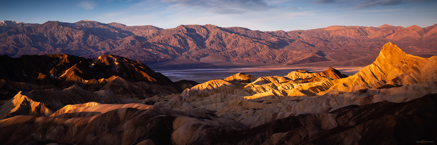
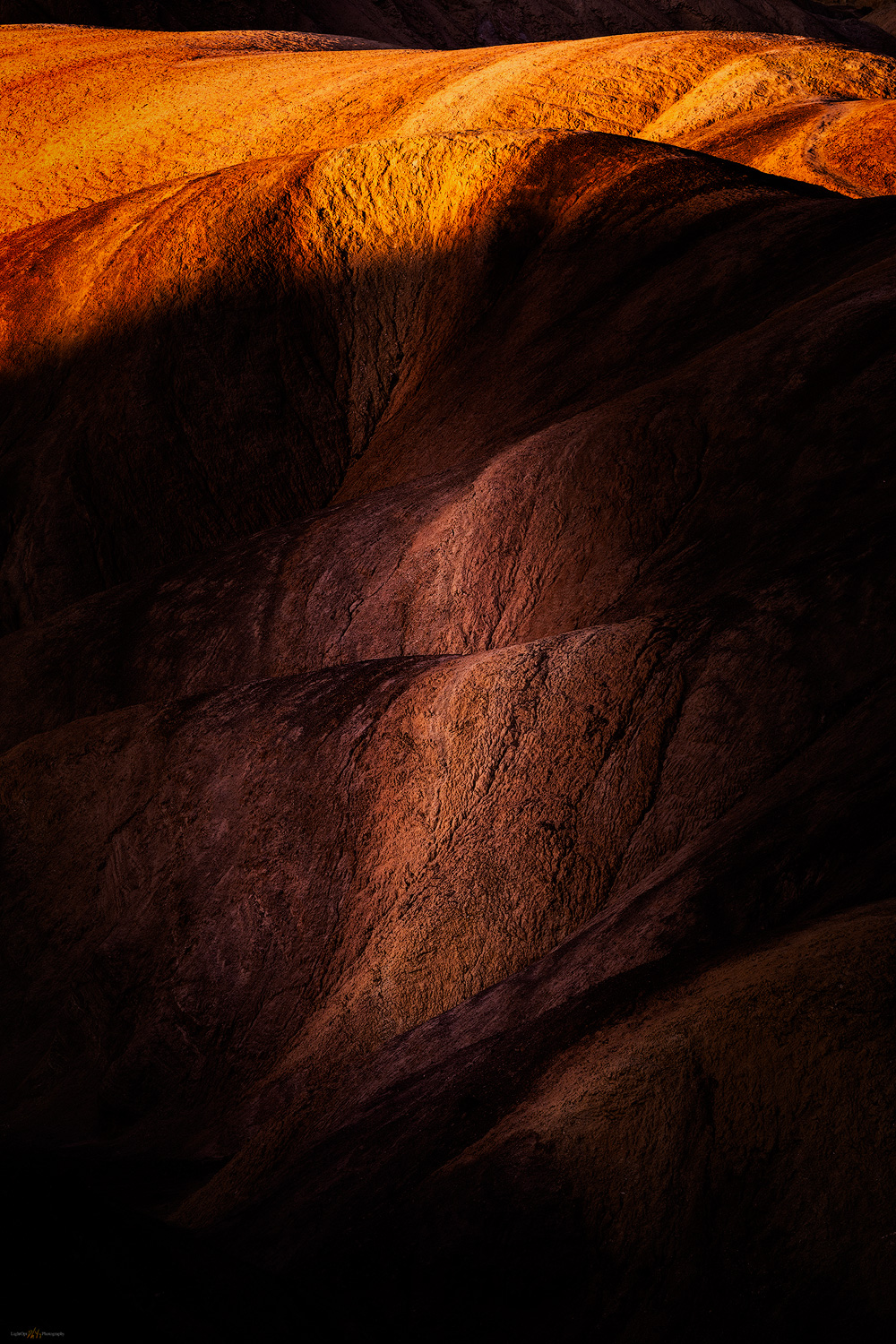
Our night in the overflow camp was not that bad, and we were up early covering the short distance to the iconic viewshed of Zabriskie Point. We were the first parking-area arrivals – Erno, Jeremy, Quinn, Sandy, and Randy – but were soon followed a good-sized crowd as the developed walkways of the overlook absorbed the people and numerous tripods. Despite the early morning visitors, it is not difficult to spread out and focus on some small scenes in the Zabriskie badlands while not missing out on the iconic expanse overlooking Death Valley. I climbed the hills to the north to wait for sunrise. From the small summit, I looked down on the geometric patterns written in the tilted volcanic tuffs. Odd to watch the iconic view come to life in the sunrise – a scene I had seen in so many images, and although I had passed the parking area numerous times, avoiding the crowds by never stopping, it was a good spot to take in the morning. I was glad I was here.

Zabriskie Sunrise. This shot presents itself on most winter mornings.
Badland mark. A subtle light preceded the drama of dawn on the colorful badlands of Zabriskie.
Surface lands. The golden light and cool contrast absorb me.

The weekend crowded faded into Monday morning, allowing us to move camp to empty spaces in the Texas Spring campground. We set up and relaxed into the late morning and growing afternoon. We had scouted out the area southward into Badwater Basin, selecting some locations where fine-grained alluvial fans crossed the road and extended into the bottomlands. Now we rested in camp and let time pass, making plans for the coming days. Tonight and tomorrow, we would hunt for the patterned ground of polygonal cracking – Erno kept cleaning his gear in anticipation, or maybe he kept telling Jeremy he should clean his gear. We were all looking forward to it, dust spots or not.

Death Valley Collection

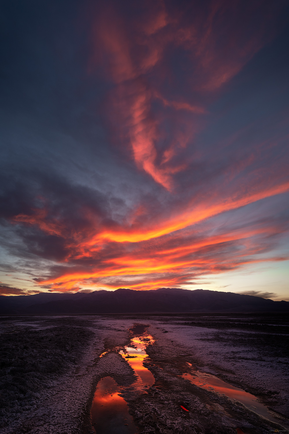
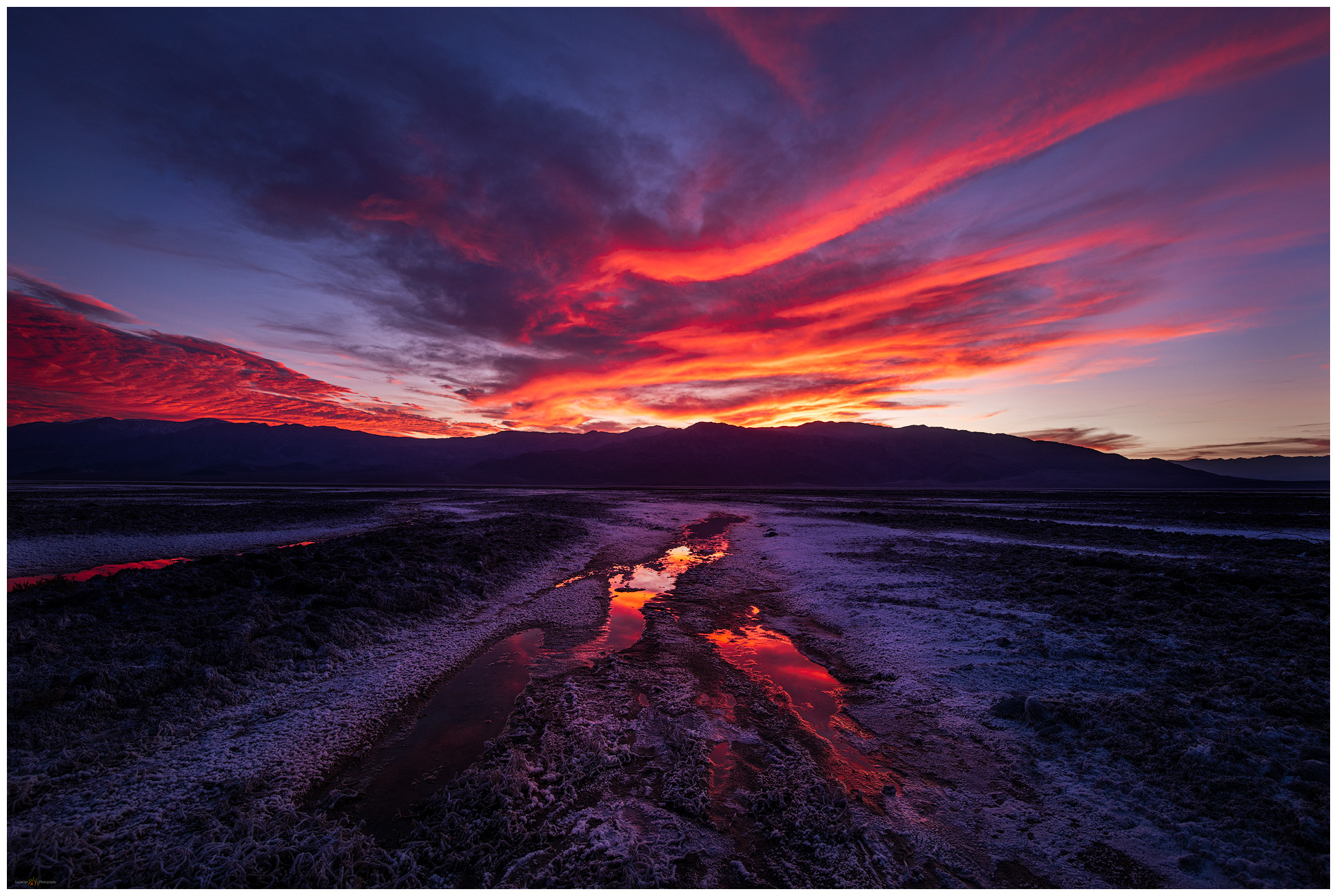
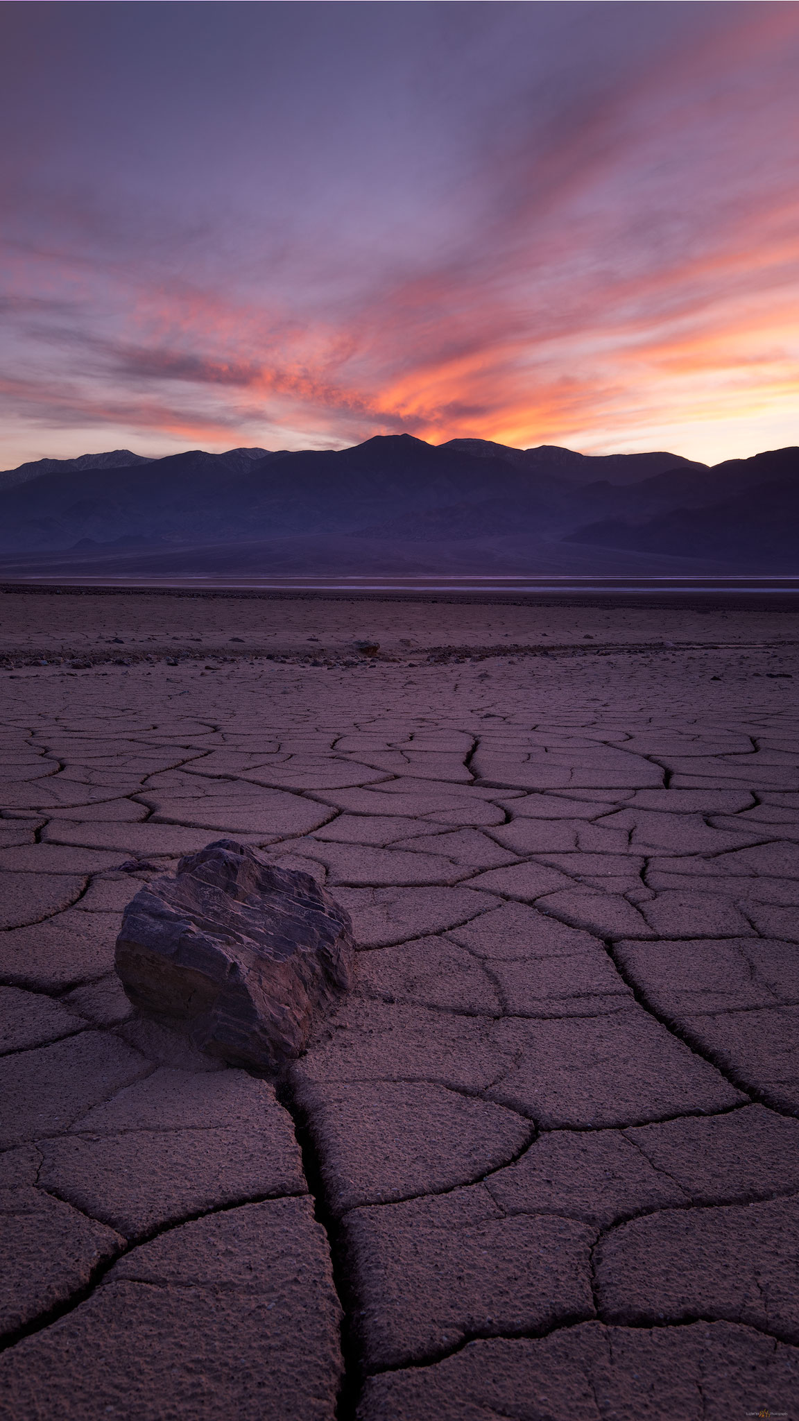
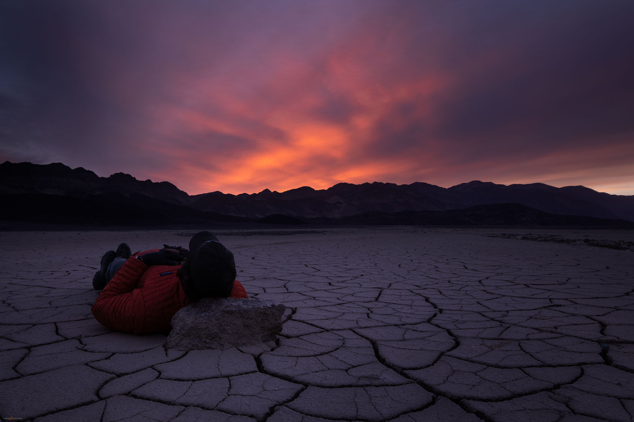
We spent the evening and the following morning, below sea-level, wandering the broad fans looking for compelling patterns in the mud cracks. Sediment carried by the last energy of a flash flood, maybe a year or two ago, all other large clasts dropped along the flow, creates a fine-grained veneer between gullies and rocky berms, cracking as it dries and repeating the swelling and shrinking with each new wetting cycle. We spend a long evening on the middle fans. The backdropping sky is subtle, lacking the fireworks of our previous night, but we wait and hope. The following morning, my preparation for capturing sunrise over the polygonal patterns started early. I crept out of the dark parking area, heading toward a more distal position on the fine-grained fans of Badwater Basin. Walking in the dark of pre-dawn, I wandered down-fan looking for some interesting patterns or rocks to the foreground of sunrise. It was quiet and dark, great to be walking. As dawn approaches, I see the rest of the team parking along the road as they work into the sunrise.

Death Valley Poly Cracks. I waited and waited for a closing image to our long day.

It is difficult, for me, to have the patience to choose one small scene in the multitude of patterns, when my typical mode is to continuously recon for profiles and exposures. This is something I need to improve. I often leave a scene too early, wanting to look around the next bend or investigate the next outcrop. It is perfectly ok and fun but creating images the speak to the experience becomes rare. I wait and enjoy the slow sunrise, playing with a few cobbles and cracks.

Pre-dawn rest.

It is our day to take the long, looping road of washboards and rutted dust to the Racetrack Playa, always the highlight of any journey in the Desert Valley outback. We leave my trailer and Erno’s rig in our Texas Spring campsite and spend the day traveling to the Racetrack; we will camp one night at Homestake Camp and return to Texas Spring. Arriving in late afternoon, we explore the Grandstand, an inselberg poking through the northern end of the playa and then visit the tracks of racing rocks nearer the plays southern end.

The trails speak. Enigmatic boulders and traces of the Racetrack Playa, one of my favorite places and a perfect geo-puzzle.

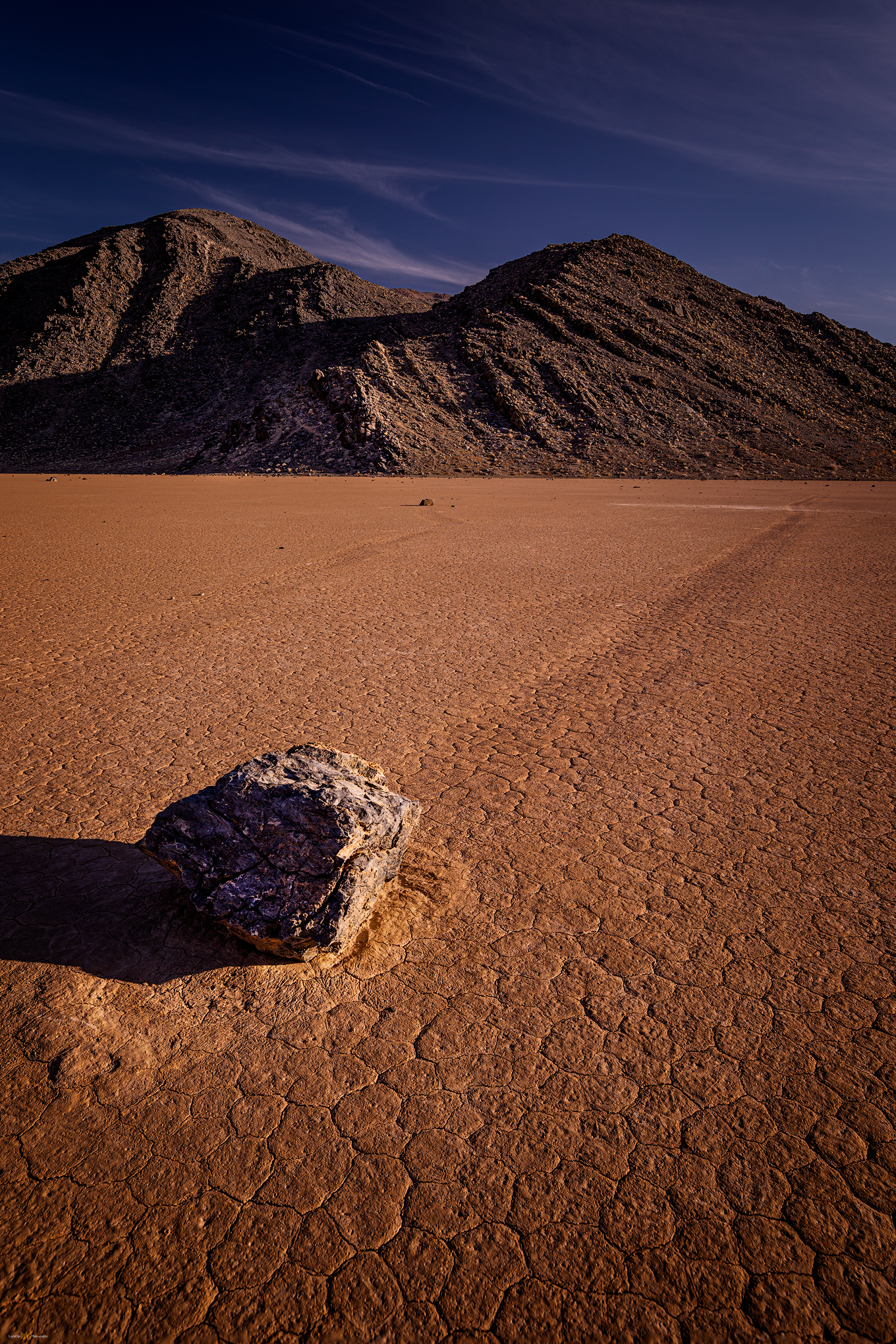
It is a puzzling spectacle viewing the cobbles and boulders (and occasional sticks) with ephemeral trails marking their ‘race’. How do they move? In sum, it is the occasional and timely interaction of water, temperature, and wind. The Racetrack is a somewhat unique playa setting given the large limestone outcrop at its southern end – most playas being isolated in the middle of vast basins far from rocky outcrops. At Racetrack, the outcrop provides the rocks; as the outcrop weathers and crumbles, cobbles fall onto the playa. Winter rains drain to the playa forming dispersed, shallow pools around the scattering of rocks. Basically shallow sheets of water, the pools freeze into thin sheets in a winter’s night (our water bottles were frozen solid overnight here at Racetrack). The rocks become wrapped in the ice sheet, like peanuts in a brittle – the rocks are not submerged, protruding from the sheet of ice, top and bottom. Wind across the frozen sheet starts a cohesive drift as the ice becomes an expansive ‘wing’, acres in size. It takes only a good breeze to move the sheet, dragging its entrapped rocks as they slide and scrape along the lubricated silty clay between ice and underlying playa. All the rocks in a locally frozen pool move in concert; it is why sets of tracks look to be in parallel, matching patterns – a choreography of geomorphic process. In the sunny warmth of a coming day, the ice melts and the water evaporates quickly, leaving only rocks and their trails as circumstantial evidence on the signature dry playa. It is a wonderfully simple and simply wonderful – easily in my ‘top 5’ natural phenomena.  I have seen tracks on other playas, but there is no place that brings it all together like the Racetrack. Please do not disturb the rocks, their travels begin again soon.

Death Valley Collection

We set camp at Homestake, thankfully gathering around tailgates for a generous buffet. I would say it was potluck, but we were mostly lucky to have Erno as our cutting board host. Nothing better than a desert camp, tasty treats, and random beverages after wandering among the racing rocks.

Racetrack trails. I struggled to create a compelling image of my long night at the Grandstand. In the end it was about the slow (and cold) passage of night.

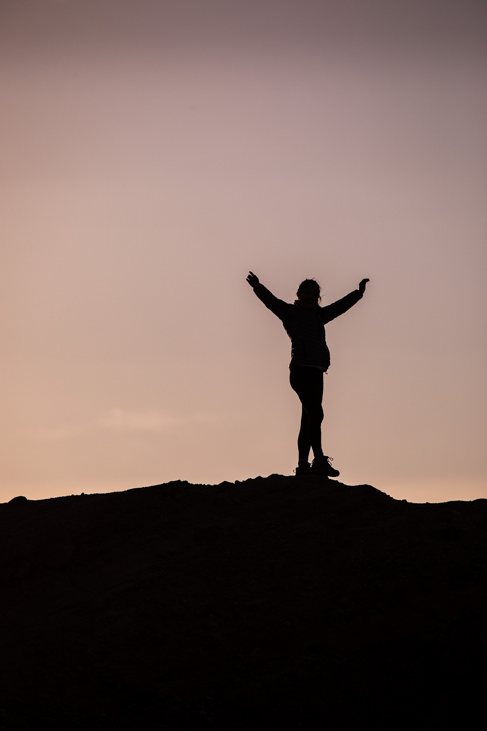
Later, I tried for some late night to early morning star trails over the Grandstand, but it basically meant sitting on the very cold playa for most of the night. The stars did not align, as they say, and my results were disappointing. With little sleep, I gathered with the team back on the Racetrack. Despite of, or maybe because of, our weary, silly state, Jeremy and Sandy teamed up to choreograph the perfect group picture. Frameable and available for order, I am sure.

Flight of the puffins. Randy, DC, Jeremy, Erno, Quinn.

We traversed back through Teakettle Junction and Ubehebe Crater to arrive, at last, in our spot at Texas Spring Campground. Although we attempted some night photography at Zabriskie (hey, it was easy access after the long drive), I have not seen many team images from that night. The outings cannot all be gems, even in this group.

A meditation on the repeating patterns on a small dune in the Mesquite Dunefield.

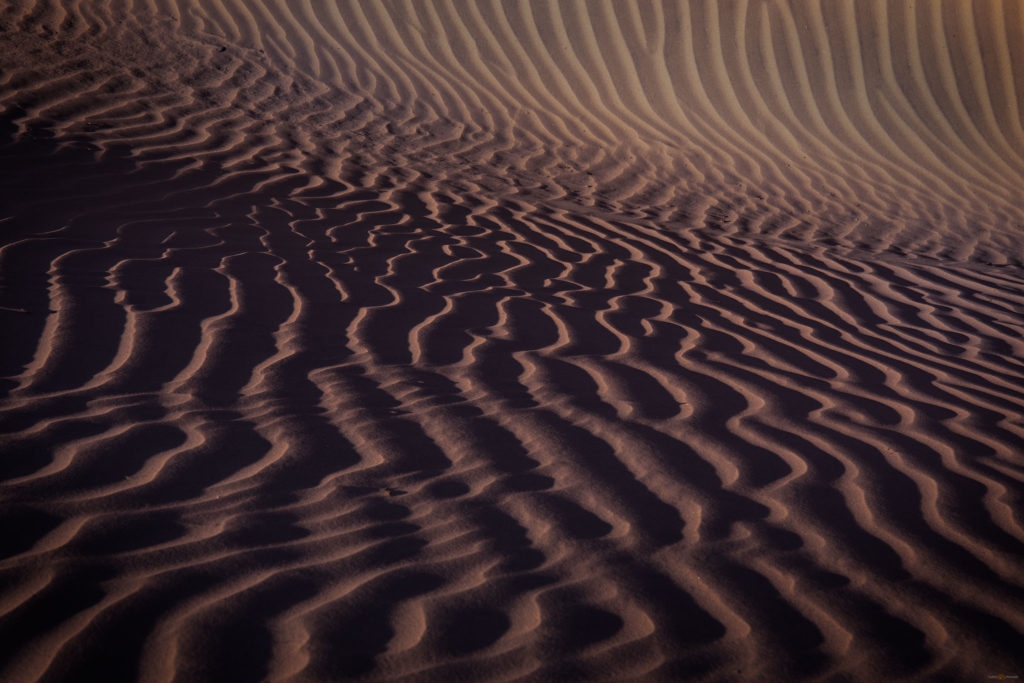
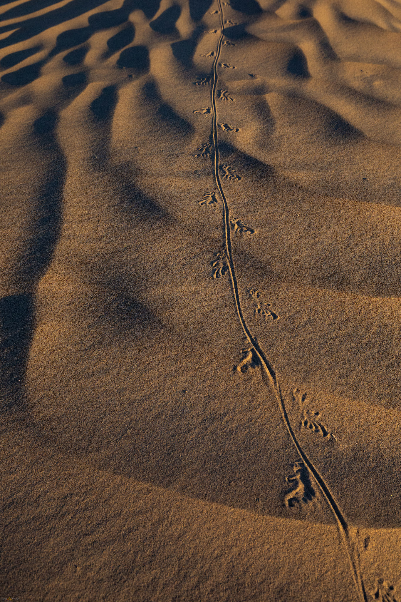
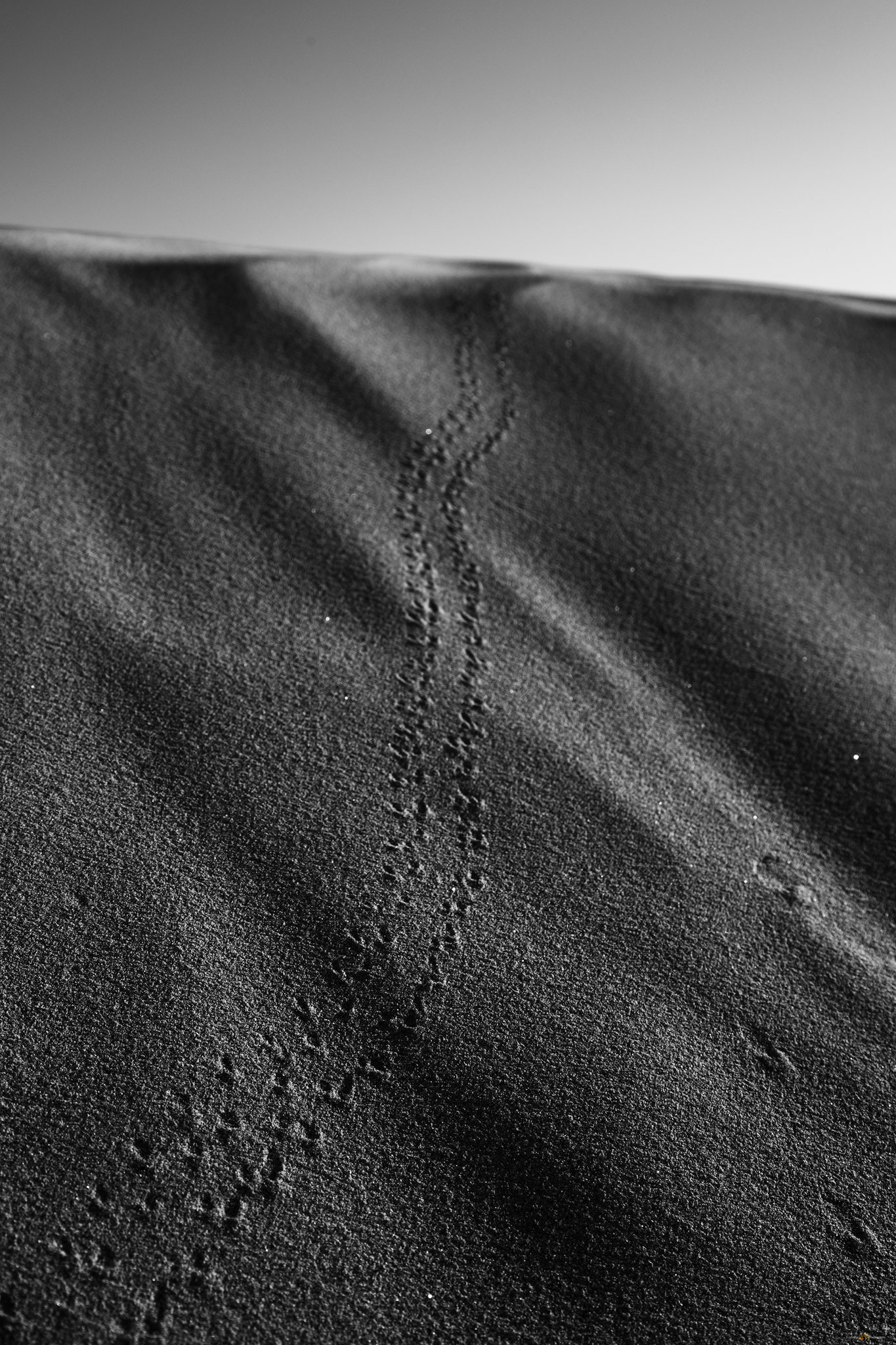
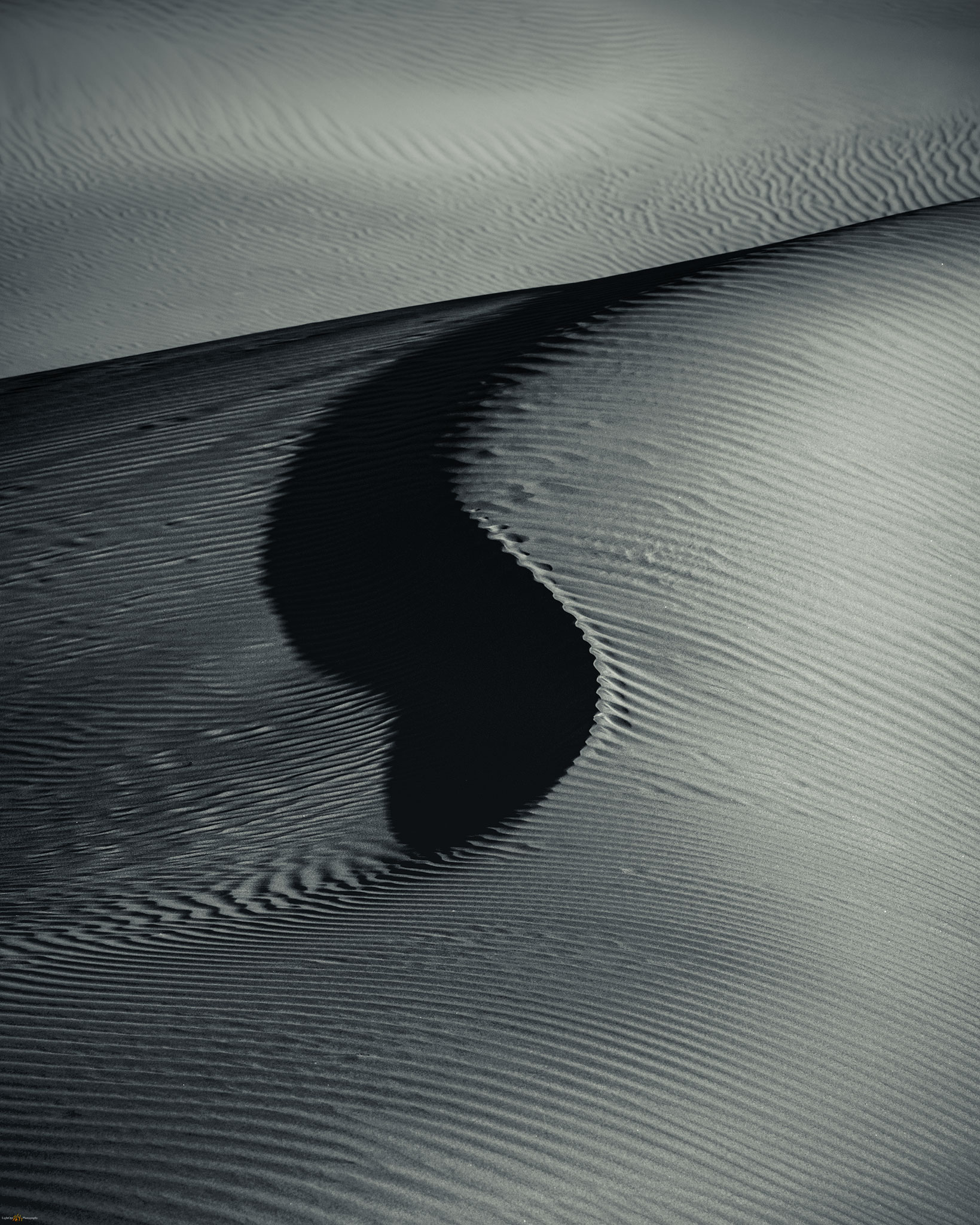
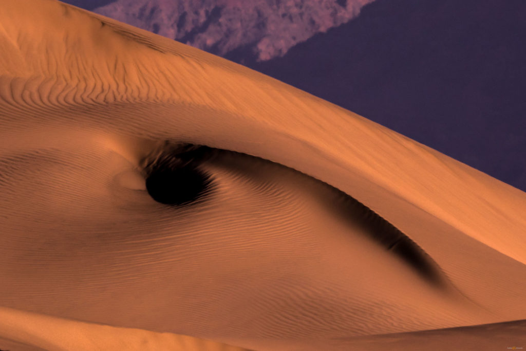
The morning was another matter.  We were outbound, heading for the Alabama Hills, but we took a timely and deserved stop at the Mesquite Dunes. Sunny, calm skies forced us to turn inward, looking for small scenes in the golden contrast of the morning. We approached from the southeast to avoid the tracked-out areas of the previous day’s visitors. These dunes appear in thousands of images in as many ways, but the attraction of contrasting patterns in the ever-changing landscape is profoundly magnetic.

Locals only.
Into distance.
Balance.
Revealed. The intimacy of patterned ground.
The Watching.

Death Valley Collection

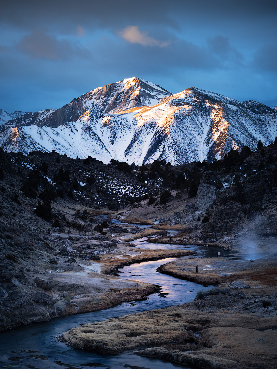
We dispersed and enjoyed our time before beginning our journey home.  We had one more stop to make, so driving again, we emerged from sea-level to greet the valley at the foot of the High Sierra.

Keep going.

Please respect the natural and cultural resources of our public lands.

#naturefirst #keepgoing

In the days when we could wander… Death Valley, Part 1.

D. Craig Young · April 21, 2020 · 6 Comments

There is always the desert. Although I thrive in arid landscapes, I find them difficult to photograph. Of course, there are waves of contrast in sand dunes, brilliant rocky outcrops, and magical golden-hour light, but so much of desert space is a great wide open, playas to mountains with subtle shifts in color. I occasionally come across exceptional images by the few who take the time to learn the desert light, and I continue to accept the challenge of capturing personal images in these cherished, sharp-edged lands. 

We would meet in the Eastern Sierra, Erno had the idea, heading into Death Valley for a wide-ranging, end-of-winter tour. The Iceland team – ‘the stud puffins’ – gathered at StoneHeart at the foot of the Carson Range on a Saturday afternoon mid-February; Jeremy, Quinn, and Sandy had timely flights, and the weather cooperated to let Erno and Randy drive over from California’s Central Valley. We formed a little caravan of camping rigs, departing Nevada for the short drive to Mono Lake, our first stop. 

Simple evening. The start of the trip was a pleasure, though my early images were difficult.

I scouted the sand tufa a few weeks earlier, but I have not had much luck here.  I need to take more time with these unique tufa formations, but, for now, I am drawn to the lake. This is a pattern; I am still drawn to the big landscape but want to learn to focus on compelling foregrounds and the emotion of intimate scenes – I just need to take the time to do so. 

Beneath starry skies, we camped just off the quiet highway – closed for winter a mile up from our sideroad stopover. The sunrise promised good light, so we were off in the pre-dawn to Hot Creek, a semi-iconic photo spot along a classically wandering Sierra-fed trout stream. Mist from the mid-stream hot springs can add perfect atmosphere under the right conditions. I have been here many times, but always focused on a post-climb/ski hot spring bath. And yet, in the past decade or so, the hot springs have become a dawn-t0-dusk managed and fenced viewpoint, deterring the use of the springs, which at times can be dangerously active and, well, hot. Enough people have gotten themselves into trouble, and not survived the hot pools, that even considerate use has been curtailed. One of those things. 

Hot Creek rise. First light at the local icon.

Death Valley Collection

We took good advantage of the scudding clouds at sunrise, looking up canyon towards the Sierra highlands above Sherwin Creek. As is often the case, there were a few other tripods along the outcrop above Hot Creek, but it was worth the stop. We headed for Bishop under clearing skies, grabbing a late breakfast in town – seems a luxury now – before the long drive, chasing the day into Death Valley. The traffic increased, almost exponentially, as we worked our way through typically lonely desert, crossing through Panamint Valley and dropping into Stovepipe Wells. It was there we remembered that it was a three-day weekend (forgetting that was part of our plan too) and that it turned out to be a fee-holiday in the National Park. The roads and parking areas hummed with traffic, and campgrounds appeared near capacity. 

Our evening photo target was the playa-margin known for polygonal patterned ground and salt formations. It would be a short hike, so we knew that we would have some solitude even amongst the pavement-bound crowd. Erno and Jeremy picked a pull-out and the team began the hike into the basin. In the meantime, I decided to roll into Furnace Creek to check our chances of getting a camp spot – would we have to head out of the park to find public land access in the dark? I rolled into Sunset Campground working my way among wind-blown pup tents, burly jeeps, cruise ship-sized RVs, random generators, and oddly lit banners on towering flag poles, to find some clear gravel at the terminus of the overflow parking. It’ll do. I ditched the trailer, paid the camp fee, and headed back to the sunset location. 

With the light fading, I began my hike before I reached our team’s parked rigs. I worked my way into some salty seeps forming shallow swales that drained further basinward. I liked the lines leading in two directions, upslope toward the eastern mountains or directly into the western skyline. The clouds looked promising, but I could not decide which direction would be most promising at sunset’s illumination. I did not want to chase tonight – I had just finished chasing campsites! I wanted to settle in for a shot. After finding a long linear pool of still water, I stood for a while, gazing back and forth to opposite horizons. I sat down, watching the east, watching the west. As I decided on the eastward view and began composing an image, I turned to grab a lens cloth from my bag. At that moment the western sky, which had been at my back and not at all in my composition, caught fire. So much for the patience of avoiding the chase. This was why I was here, and it was only two or three steps backward to compose the convergence of the reflective line of the pool and the fiery wisps of evening cloud.  

Convergence. The desert aurora of sunset in Death Valley. This is what you hope for.

For a few, all-too-short minutes, the clouds danced in a desert aurora as waves of orange, red, and violet descended into the evening. In the quiet I could hear the others whooping it up somewhere to the north, far out in the glow of the salty basin.  

Convergence 2, Death Valley, California. The flames of sunset race to earth shadow.

Death Valley Collection

Keep going.

Please respect the natural and cultural resources of our public lands.

#naturefirst #keepgoing

Trail Option

Copyright © 2025 · Monochrome Pro on Genesis Framework · WordPress · Log in

  • Contact TrailOption
  • Substack
  • Waypoints Bibliography
  • Young Archives