• Skip to primary navigation
  • Skip to main content

Trail Option

A personal geography of landscape and place, art and geo-science.

  • Home
  • TrailOption Blog
  • About
  • Contact TrailOption
  • Subscribe!
  • Lost Journals
  • Show Search
Hide Search

Darren

Nevada High Points #77: Desert Creek Mountains

D. Craig Young · February 26, 2021 · 1 Comment

Desert Creek Peak

8969 ft (2734 m); Gain 2740 ft

2021.01.17

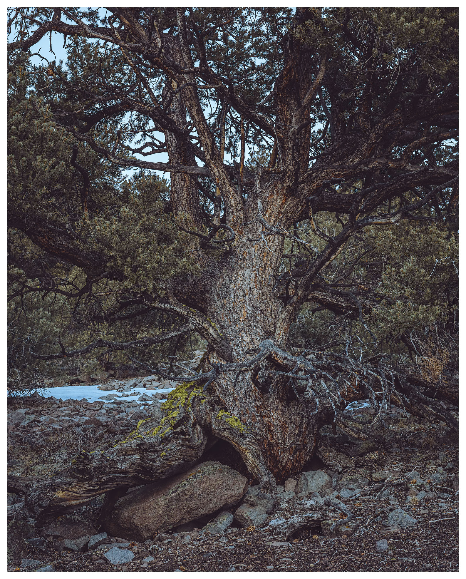
With the post-holiday, pandemic surge still upon us, Darren and I continue to focus on target High Points in relative close proximity to home. The Desert Creek Mountains are basically a northern extension of the Sweetwater Mountains, but the local ranges and hills take on some isolated character. These relatively low mountain groups are cloaked in pinyon woodland where thick stands and downfall makes cross-country travel difficult. There are rarely trails in these brushy hills — I have been turned back on a few occasions because route-finding can take time. We would not be turned back on Desert Creek Peak, though we had a few moments of straight-on bushwhacking.

Desert Creek Peak Gallery

The road up Desert Creek is well-traveled and it seems a longer drive than I remember — Desna and I were in here to climb the Wellington Hills in 2004 (Christmas Eve, it was, 17 years ago). Darren and I, here in January 2021, navigate the rig through a couple creek crossings and then are stopped cold, literally, by the ice-choked creek. No need to be overly adventurous, we are here to walk, so we stash the truck and set out.

Frozen approach. The road turned cold, deep in the shade of Desert Creek.

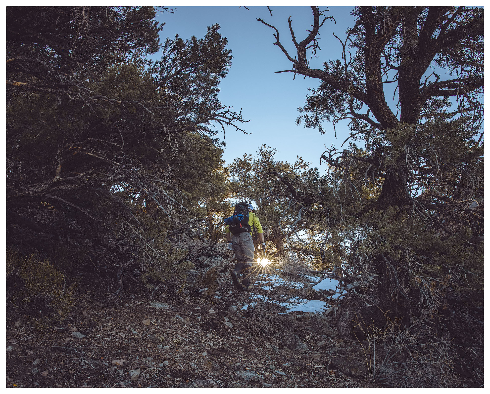
Beyond the frozen crossing, most of the road was dry and snow was hit and miss on north-facing slopes. Crossing directly below the summit, only a mile away, but almost 3000 feet above us, we chose the southern ridge to begin the steep hike.

Desert Creek Peak. We hiked the right-hand, pinyon-covered ridge to approach the summit from the south.

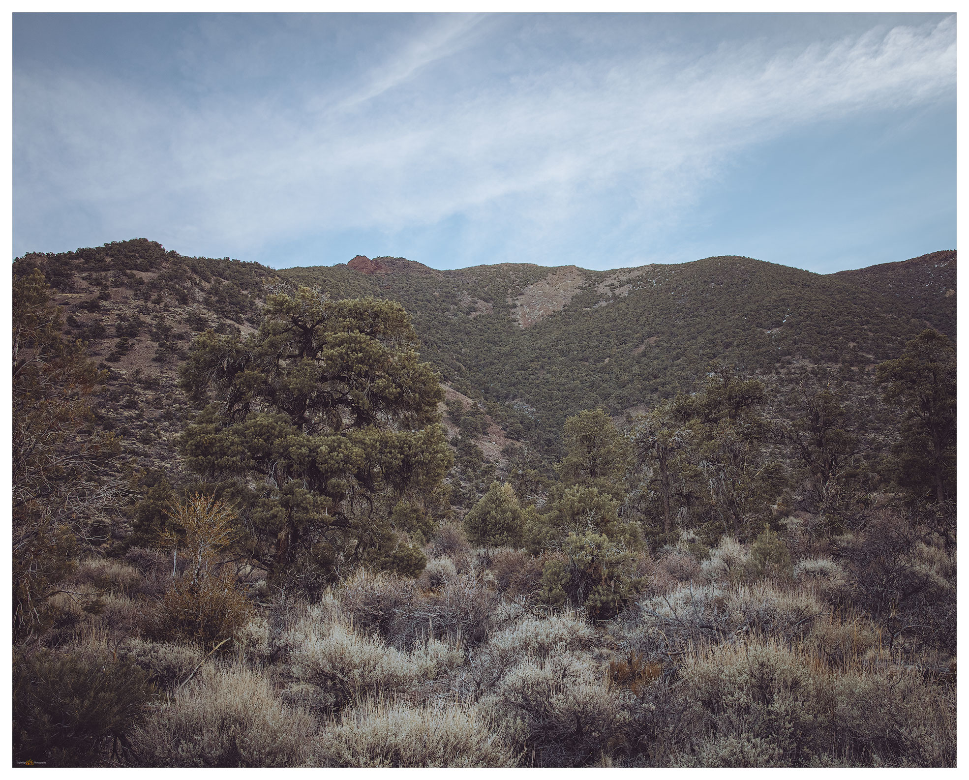
The weather was perfect for this outing, sunny and calm. We worked our way through pinyon, taking snow patches and frosty gullies to avoid heavy stands but otherwise following game trails in switchbacks among the pines.

An old one. Pinyon of the local ranges is rarely more than a century old, though trees that survived the logging of the gold and silver days, can still be found.
Into the sun. Darren pushing through the pinyon on the western slopes of Desert Creek Peak.

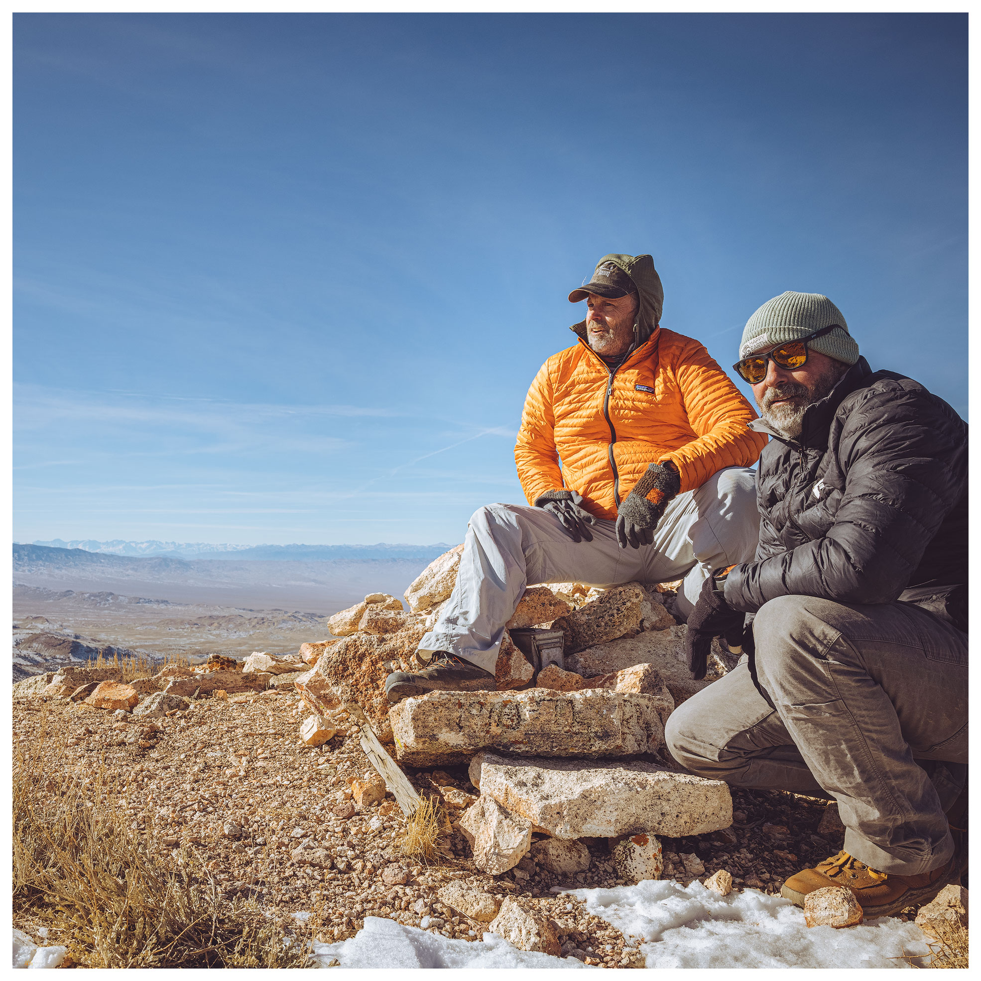
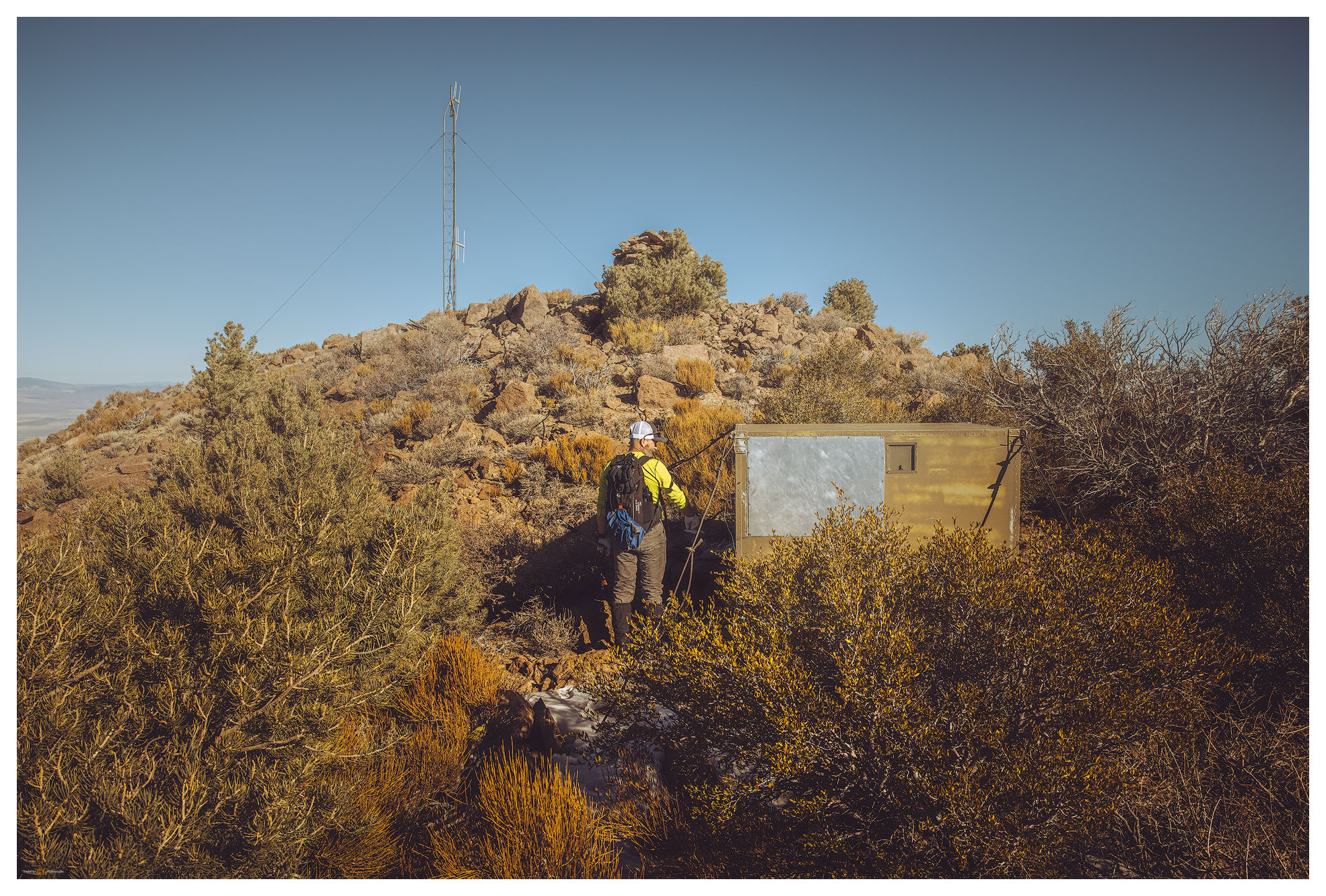
In a steady hour of climbing through the woodland, we eventually made the summit ridge, following a series of rocky steps with scattered young pinyon and bitterbrush. An antennae and the large rock cairn marked the summit just shy of 9000 feet in altitude. An amazing blue and very calm sky met us, and we soaked in the sun.

Summit things. Battery storage for the 1960s repeater or receiver — maybe a game-tracking station?

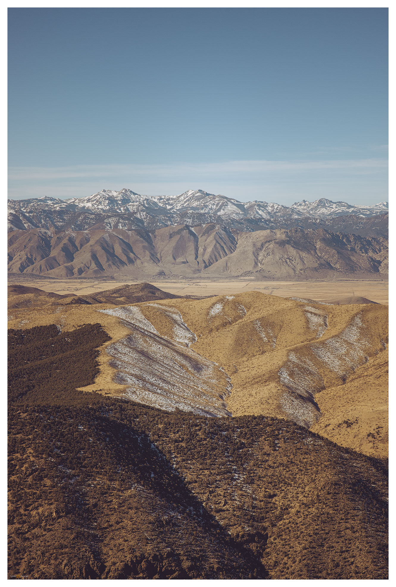
Steep descents of trail-less slopes pound the quads and, I could be sure, these would echo for a few days afterward. Desert Creek Peak is prominent from southern Smith Valley, and what it lacks in adventure, it makes up for in views of Sierra and the Sweetwaters. Mount Grant and the Pine Grove Hills rest under the sun to the east. It is nice to fill in this gap on the map with #77, every step worthwhile.

It is also nice that we are home in the early afternoon. Bonus points: stopping at Rosie’s in Wellington to bring home dinner!

Click on image for larger view.
Summit view. Antelope Valley and Silver King area of the Sierra to the west.

Desert Creek Peak Gallery

Keep going.

Nevada High Points #76: Montezuma Range and Clayton Dunes Overland

D. Craig Young · February 22, 2021 · 7 Comments

Clayton Dunes.

Montezuma Peak

8373 ft (2552 m); Gain 1624 ft

2021.01.09

It was time for the initial ‘Second Friday’ excursion in 2021. Snow squalls had come and gone during the week, so our plan was to head south into the southern Great Basin so that the daytime temperatures would be somewhat warm and snow might be less in the higher elevations. Darren and I chose Montezuma Peak for our target, and I picked the dunes of Clayton Valley for our two-night camp.

Clayton Valley. View from Montezuma Peak with Clayton Dunes, Silver Peak Range, and the White Mountains in the distance.

I met Darren in Carson City late on Friday morning. With a stop for fuel and a few supplies, we were soon on the straightaways of Highway 95 heading toward Tonopah, Nevada. We turn south toward Silver Peak, dropping past ‘The Crater’ and into Clayton Valley. I camped in Clayton Valley on my first Second Friday excursion in January of last year — in the before times. At the time, I had made the dunes a future destination and worthy of a look.

Clayton Dunes Collection

We arrived at the dunes at sunset. Rising prominently about a mile from the road, the dunes have no maintained access and off-road vehicle activity appears to be quiet in the winter. A sandy (obviously) two-track leads into the dune’s east side; however, I was not sure the truck and trailer would make it — a meter-deep arroyo had taken over portions of the track and small dunes rolled across others. We ditched the trailer by the turn-out and explored the two-track with the truck. It was fine and sandy. Returned for the trailer and set camp as the darkness closed in.

Winds were forecast, but at dinner we commented on the calmness and its relative warmth. A coyote sang in the distance. Watching the stars and mapping out the lights on the distant side of the valley, we noticed the lights of the evaporation ponds dimming and disappearing. The pinpricks of streetlights at Silver Peak were bright against the mountains. Slowly they, too, vanished.

We sat perplexed until a quick gust of wind rattled the table and an empty beer can. The smell of the night changed. Another gust. Dust storm!

The silt engulfed us reflecting a fog of headlamp and not much else. The vanishing lights explained. We hunkered in momentarily and then thought we should make the most of this. Let’s climb the dunes. We worked our way in our silt halos watching white-outs of sand blast from dune crests — the dunes migrating under our feet.

Clayton Camp. My Taxa Cricket with Darren’s tent; our common overland camp configuration.

The morning was bright, a low cloud at the horizon evaporating at sunrise. We waited for golden light on the dune, but the uplands to the east were calling. The road to Montezuma, a historic-era mining town, is well-maintained and its upper reaches access private property and modern infrastructure, but respecting the properties is easily done.

A so-called ‘pack trail’, variously marked on different maps, led to a pass that crests at the northeast ridge of Montezuma Peak. It is a simple, enjoyable hike from there. Snow patches were not deep even though we approached on north-facing slopes.

Montezuma Peak Collection

Montezuma approach. Leaving the pack trail we enjoy rock cross-country hike toward the rounded summit.
Toward Mud Lake. Summit view to the northeast toward the playa of Mud Lake.
Summit moment. The night’s wind brought the day’s cold — we did not linger.

Back at in the dunes we wandered, following animal tracks and composing photographs for the promising sunset. I also wanted to get the know the dunescape so we could catch the early light and the great shadow play of mid-morning sun angles on the curving dunes. I tried a few things but the cold was coming hard and fast. We prepared for dinner noticing that any liquid that hit the table froze immediately. Our hands numbed if we moved anywhere away from the stove. I turned on the trailer heater so we could lounge inside, but we kept to star-gazing and the pleasure of our well-contained campfire. It is something of a challenge to stay up in the winter-darkness, so we were relieved that the time passed quickly among our conversations about future trips, natural history, photography, and video ideas. And likely a myriad other things.

Clayton Dunes. Basin alluvium arranged by wind the basin bottomlands.

Because the evening shoot in the dunes did not materialize, I wanted hoped for success in the morning. I climbed the dune well before dawn, it was dramatically cold (in camp, our five gallon water jug was a solid block). The simple star dune in the midst of the dunefield provide the S-curve I wanted. I could have a play with first light against the dark of the dune shadow. The shadow area held a frost, giving it some highlights reflecting the sky, something I had not seen on a dune previously — of course, I’m not often on a dune in single-digit (F) temperatures. It was very satisfying, and I warmed quickly with my success.

Frosted dune. Feeling the mood of the dune at first light (three-image focus stack).

Darren was hiking his own quadrant of the dune but soon joined me for a few long moments enjoying the quiet, expansive views. This first overland of 2021 had worked out nicely; we had a fast peak and some slow time in the dunes. We had the excitement of the dust storm and the calm of the refreshed, trackless dune on the cold morning. It was, however, time to head home and plan our next overland/photo excursion.

Clayton Dunes Collection

North dune. A five-image pano from the dune apex, looking north across Clayton Valley.

Keep going.

Please respect the natural and cultural resources of our public lands.

#naturefirst #keepgoing

Trail Option

Copyright © 2025 · Monochrome Pro on Genesis Framework · WordPress · Log in

  • Contact TrailOption
  • Substack
  • Waypoints Bibliography
  • Young Archives