• Skip to primary navigation
  • Skip to main content

Trail Option

A personal geography of landscape and place, art and geo-science.

  • Home
  • TrailOption Blog
  • About
  • Contact TrailOption
  • Subscribe!
  • Lost Journals
  • Show Search
Hide Search

Black Rock Desert

Nevada High Points #120 — Kamma Mountains

D. Craig Young · May 9, 2024 · 1 Comment

Pano play. Double fun on Rosebud overlooking the Black Rock Desert. Photo credit: Bryan Young.

Rosebud Peak

6496 ft (2070 m) – 2070 ft gain

2024.04.13

Rosebud Collection


Once in a while – a great while evidently, a trio of brothers share an adventure. It is my 60th birthday, an adventure of its own; and while a decadal birthday is event enough, this one found Bryan with Darren and me at the foot of Rosebud Peak, in the Kamma Mountains at the edge of the Black Rock Desert playa. This excursion was set up several months ago.

My brother Darren lives close by here in Nevada, and he joins me on various wanders among the state’s highpoints. Bryan, our middle brother, lives in Texas where he manages an amazing family and a less adventurous plastic bag factory, taking great responsibility and pleasure in both. It means, however, that his trails wander among the concrete and steel of Dallas, Texas, as Darren and I follow a somewhat more natural topography across Nevada. Bryan was missing out, even as his passions focused elsewhere. Eventually, Heather, my sister-in-law, intervened. It was time to get Bryan to the desert, to join the fraternal adventures. A plane ticket appeared, he got on a plane, and he dropped into the Great Basin. We then began a simple adventure seeking my 120th highpoint; it would be Bryan’s first in Nevada, while Darren, focusing on the experience, does not really count these things. As we drove toward the Black Rock, I realized we had never had an experience involving the three brothers. Never; at least not one that expanded on a bunch of kids playing along the fields and creeks of north Texas. I am happy those kids could once again gather in the low hills of the Black Rock Desert in northern Nevada.

Dust wave. Desert dust lifting from the Black Rock playa, Black Rock Desert, NV, USA

Thunder. Wind. Dust. Obsidian. Miles of endless sky among shockingly green hills of the springtime desert. While I often rue the clear skies and sharp light of the desert – it would not be desert without it, my birthday was a gift of variability, giving us the experience of desert dynamics that make it memorable, whether you are here for the first or hundredth time.

Tracing obsidian. Planning a transect of Granite Springs Wash and Rabbithole Creek. Photo credit: Bryan Young
Incoming squalls. These squalls preceded a later rain. Photo credit: Bryan Young

Our drive took us along the puddled margin of the Black Rock playa, following the ‘high road’ toward Sulphur and Winnemucca, beyond. Blue skies turned dark as white dust rose to meet grey-black virga, an ill-formed haboob rolled toward the Jackson Range with churning dust devils leading the way. I had first thought of camping at the small playa of Wetweather Flat, but the name gave me second thoughts; if the clouds get organized, we might be wet soon. We had some time, however, so I led us on a few obsidian transects having seen reference to ‘obsidian’ in some archaeological notes written on a nearby mine project – I have spent some time mapping the Majuba and Seven Troughs toolstone sources but had been snowed out the last time I was in the area. We wandered among the dry washes of Granite Springs Wash and Rabbithole Creek where I had observed nodules previously. The obsidian is here in the gravel bedload, but most of the clasts are not of toolstone size.

Camp before the storm. Good drama at the end of the day. Photo credit: Bryan Young.
Camp in trees. Cottonwoods of the Rosebud Mine, Kamma Mountains, NV, USA

During our afternoon wandering, we found a campsite among cottonwoods of the historic Rosebud Mine. The storm reached us just as we set up our tents, unleashing a refreshing rain punctuated by flashes of lightning and rolling thunder. It was the full experience, and we stood exhilarated under my awning for the short downpour. Things dried quickly however, and the sun raked toward its setting horizon, streaming warm light in a haze of remnant dust. We created our tailgate dinner and got a nicely contained fire going. This gave us the relaxing time we had been waiting for, and we settled in for a long evening of conversation and thoughts of an early hike to Rosebud Peak which rose gradually to our northeast.

Desert green. Rosebud Canyon leading toward Rabbithole, Black Rock Desert, NV, USA
Rain arrives. Finding shelter from the brief downpour. Photo credit: Bryan Young.
Birthday dinner. Prepping dinner after the rains. Photo credit: Bryan Young.

Sunrise found us at the foot of a series of broad, gradually sloping pediments leading to a long series of rocky ridges bounded by steep, gravelly slopes. The pediments are old alluvial fans or long rocky steps beveled to gradual slopes by long periods of erosion; the ridges of altered volcanics jump from the beveled surfaces and rise in a long line toward the summit of Rosebud Peak. Below us, along the roadway, small alluvial fans push from small canyons delivering pulses of sediment to the generally dry, underfit drainage of Rosebud Canyon. The map of young landforms is obviously simple.

Laying back. Dissected pediment of the southern Kamma Mountains, Black Rock Desert, NV, USA
Rosebud slopes. Beveled pediments reach to inset alluvial fans of Rosebud Canyon, Black Rock Desert, NV, USA

I had chosen this relatively gradual walk knowing that Bryan was coming from the low-elevation cross-timber country of northern Texas, and it was his first outing in mountainous country in a long time. The Kamma Mountains are cut by mining roads, and our walk is generally easy with only a few steep sections. The hills are open with dots of juniper trees tucked into rilled alcoves where volcanic tuffs form small, dramatic outcrops. If the outcrops are small, our views are expansive. While the hills and valleys seem barren, there is a green blush spread across the springtime desert; it makes for yet another splendid walk even as the wind builds into the early day.

Camp breakfast. Getting ready for Rosebud Peak. Photo credit: Bryan Young.
A band of brothers. Heading out at sunrise, Rosebud Peak, Kamma Mountains, NV, USA. Photo credit: Bryan Young.
Lower slopes. Onto the beveled pediments below Rosebud Peak. Photo credit: Bryan Young. (Map point #1)
A good walk. Two miles of ridges and roads to the Rosebud Peak. Photo credit: Bryan Young. (Map point #2)

We summit in mid-morning, following a two-track road to the rounded summit. Although we are only at 6,500 feet, Rosebud Peak is prominent at the southeastern margin of the Black Rock Desert and affords an expansive view of ranges that I have climbed and several that I will soon visit. The snow-lined crags of King Lear Peak rise to the north; I reached that summit in 1994, half a life ago. That makes no sense.

Kings distance. King Lear’s throne rises in the Jackson Mountains, Black Rock Desert, NV, USA

Rosebud Collection

Our descent takes little time. , and we are soon back in camp preparing a well-deserved breakfast. As we clean things up our discussions turn to other mountains, especially the ones that at first seem uninviting or that are generally obscure when compared to the soaring summits requiring significant effort. The surprises are the ‘why’. I have repeated this often, and it is clear that this band of brothers understands. Rosebud Peak, almost chosen at random, has brought us together. We rallied and made it happen, coming from different directions to experience the subtlety of the little things. The prelude of dust and thunder set the stage for a relaxed morning of effort and conversation. Perfect.

Lost in conversation and the joy of unusual company, I did not spend time on photography, and I am surprised I came home rather empty-handed – I let the drama run its course, sharing the experience with my brothers. Many of the photos I share here are Bryan’s as he chronicled his adventure to Rosebud. Perfect, again.

Keep going.

Nevada Highpoints #104 – Bluewing Mountains

D. Craig Young · October 29, 2022 · Leave a Comment

Foothills. Bluewing Mountains, Great Basin Desert, NV

Black Mountain

6617 ft (2017 m) – 2205 gain

2022.08.12

Bluewing Photo Collection


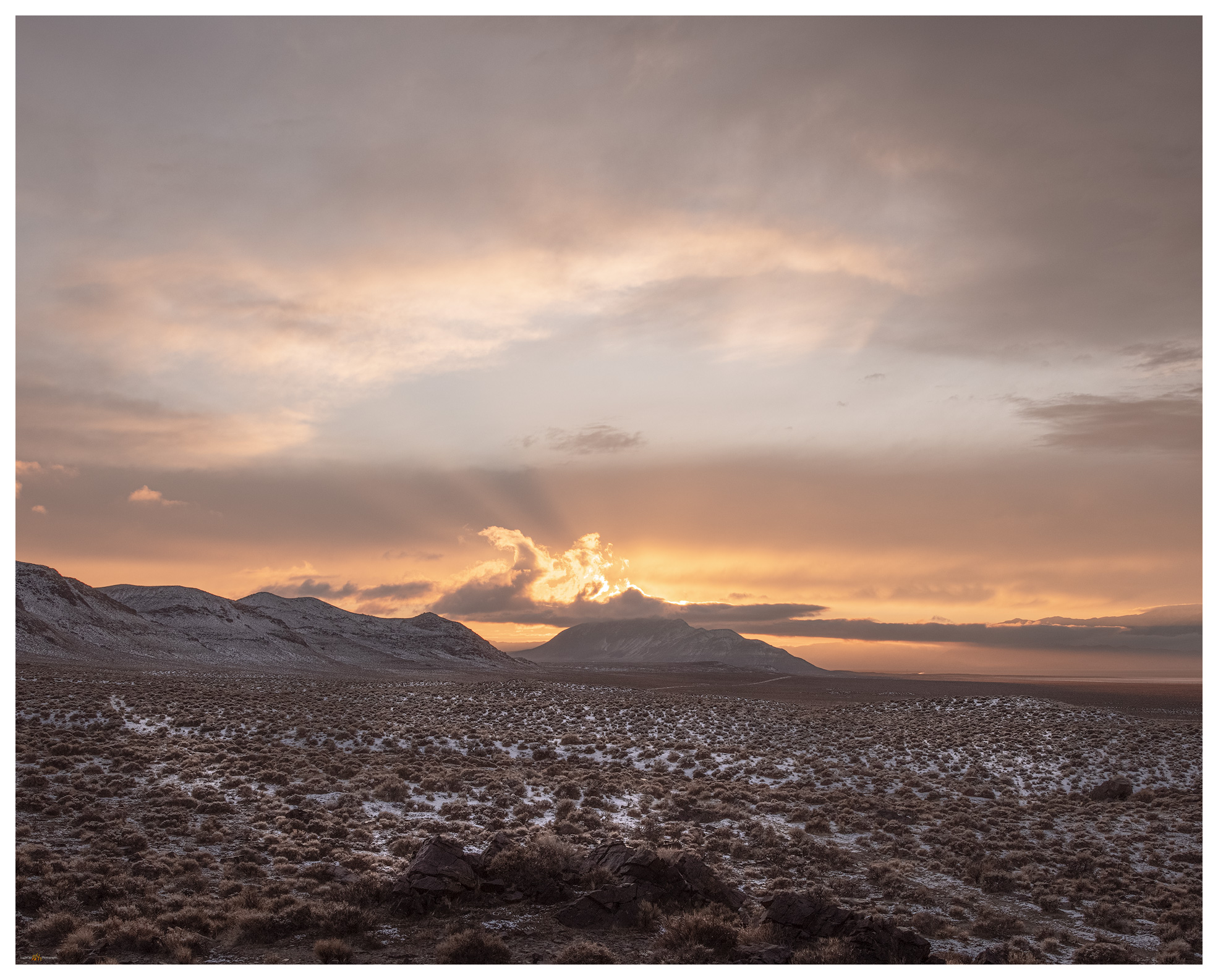
It’s hot. The sky is clear, and a parched blue horizon rests abruptly on the dusty brown of the Nevada desert. It is August, of course, when desert landscape photography is a challenge. It’s difficult to think about photography or exploring another high point when the heat is so seemingly relentless. It also seemed I could not escape from work today, so my departure moved later and later, and I considered turning around for home even as I approached my turn-off along the southern margin of the Black Rock Desert playa. I cannot, however, let the noise of the day-to-day get so overbearing that I can’t find rest in the wild. I turn south toward Bluewing Playa and begin to feel better – putting the scurrying activity of the pre-Burning Man busy-ness at Gerlach behind me and going into the quiet lonesome of Bluewing, a metaphor for the seemingly hectic week that was. I won’t see another vehicle until I reach the highway tomorrow afternoon.

Monsoon remnant. Bluewing Playa, Great Basin Desert, NV

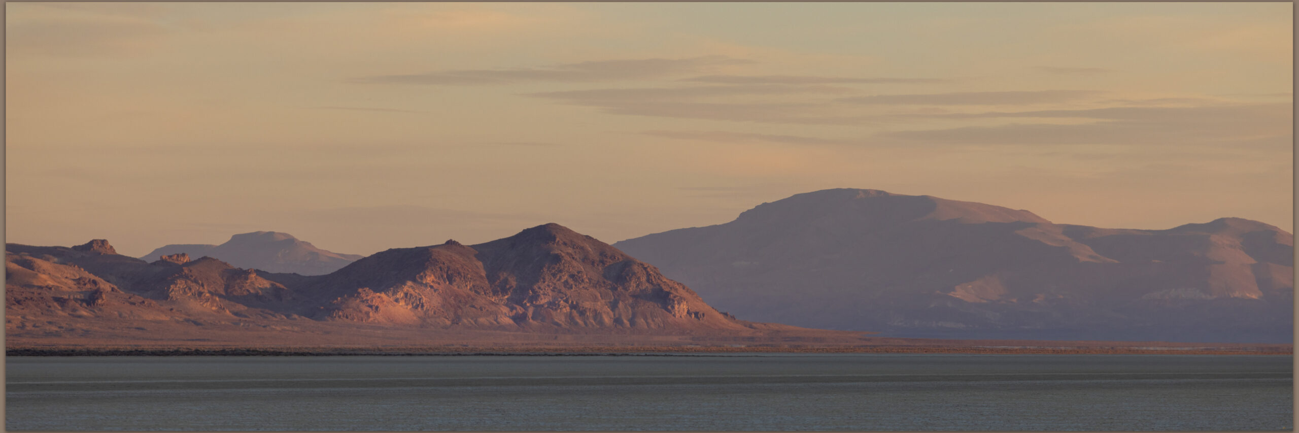
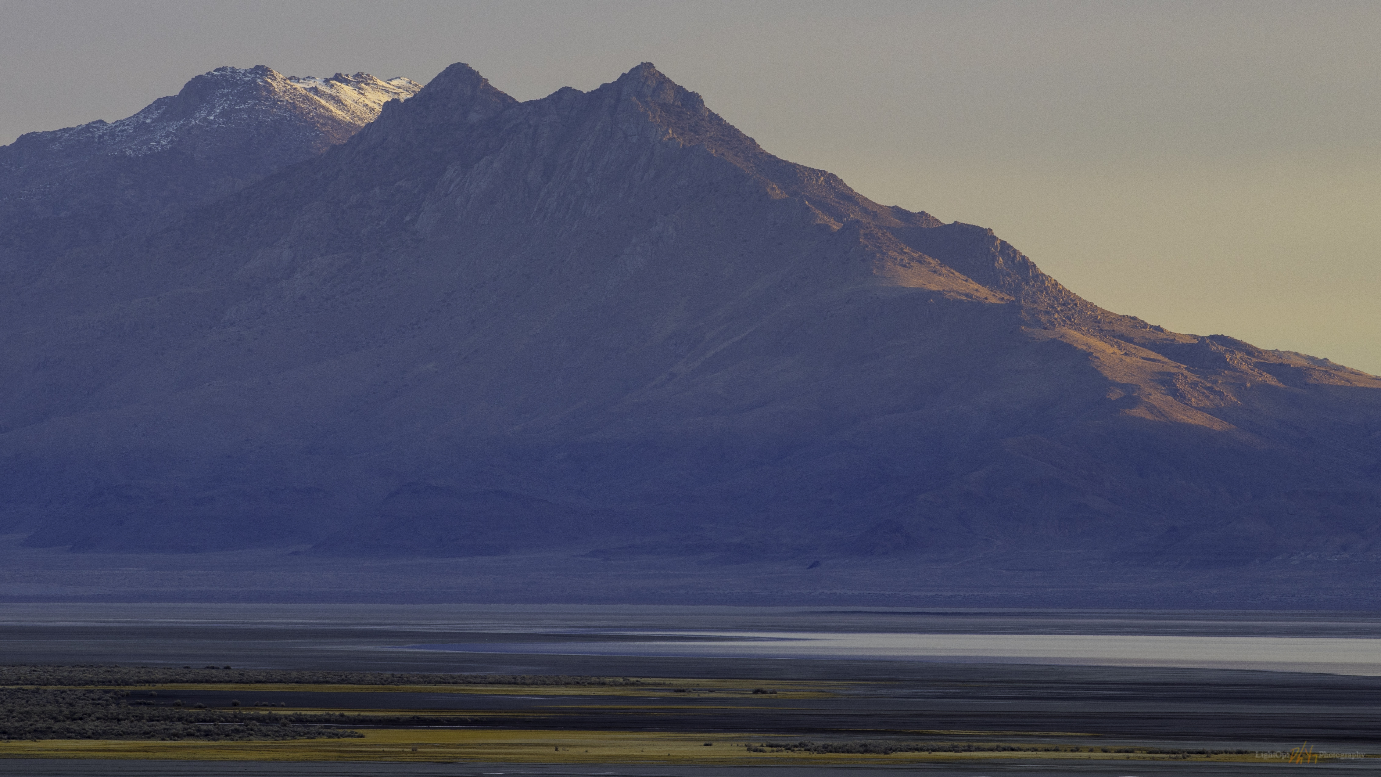
I roll through beach lines of pluvial Lake Lahontan and drop into Kumiva Valley where sandy pediments and alluvial fans extend in a broad flat to the playa below Black Mountain, the high point of the Bluewing Mountains. If this basin held a pluvial lake it only filled a shallow pan before overflowing to Granite Springs Valley to the east. I need to spend some more time here when the days are not so hot.

Bluewing Playa. Limbo Range to the west, Great Basin Desert, NVq

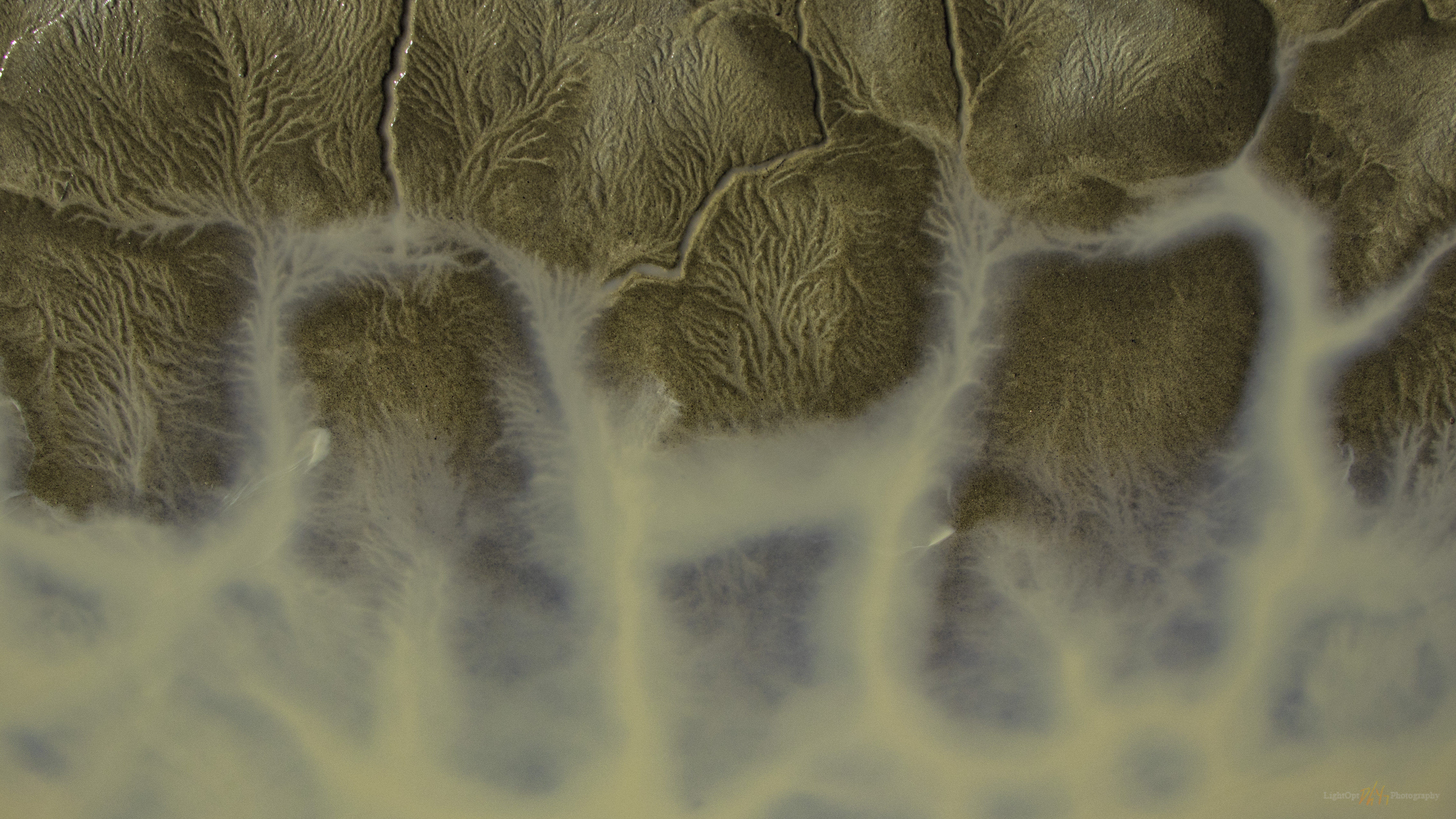
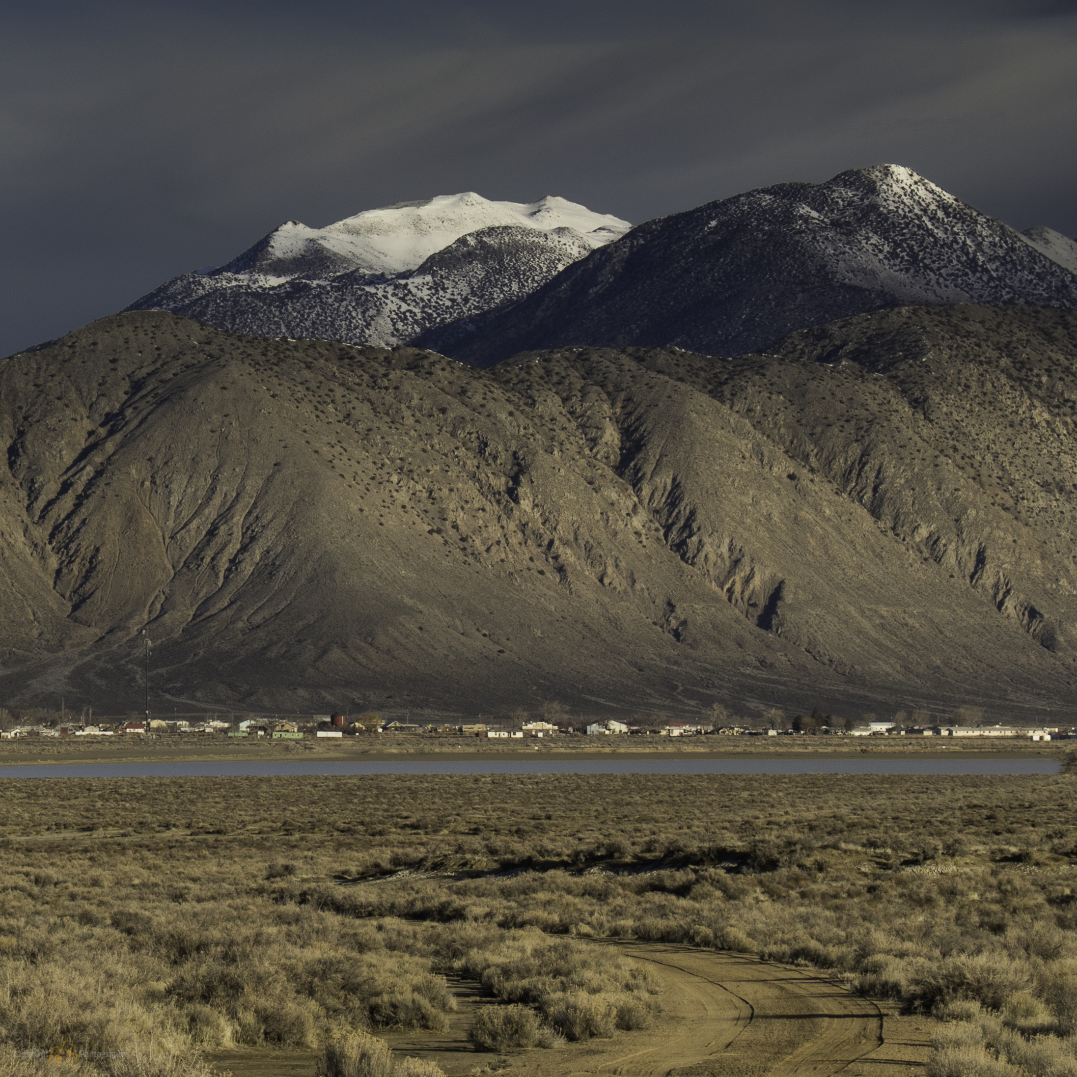
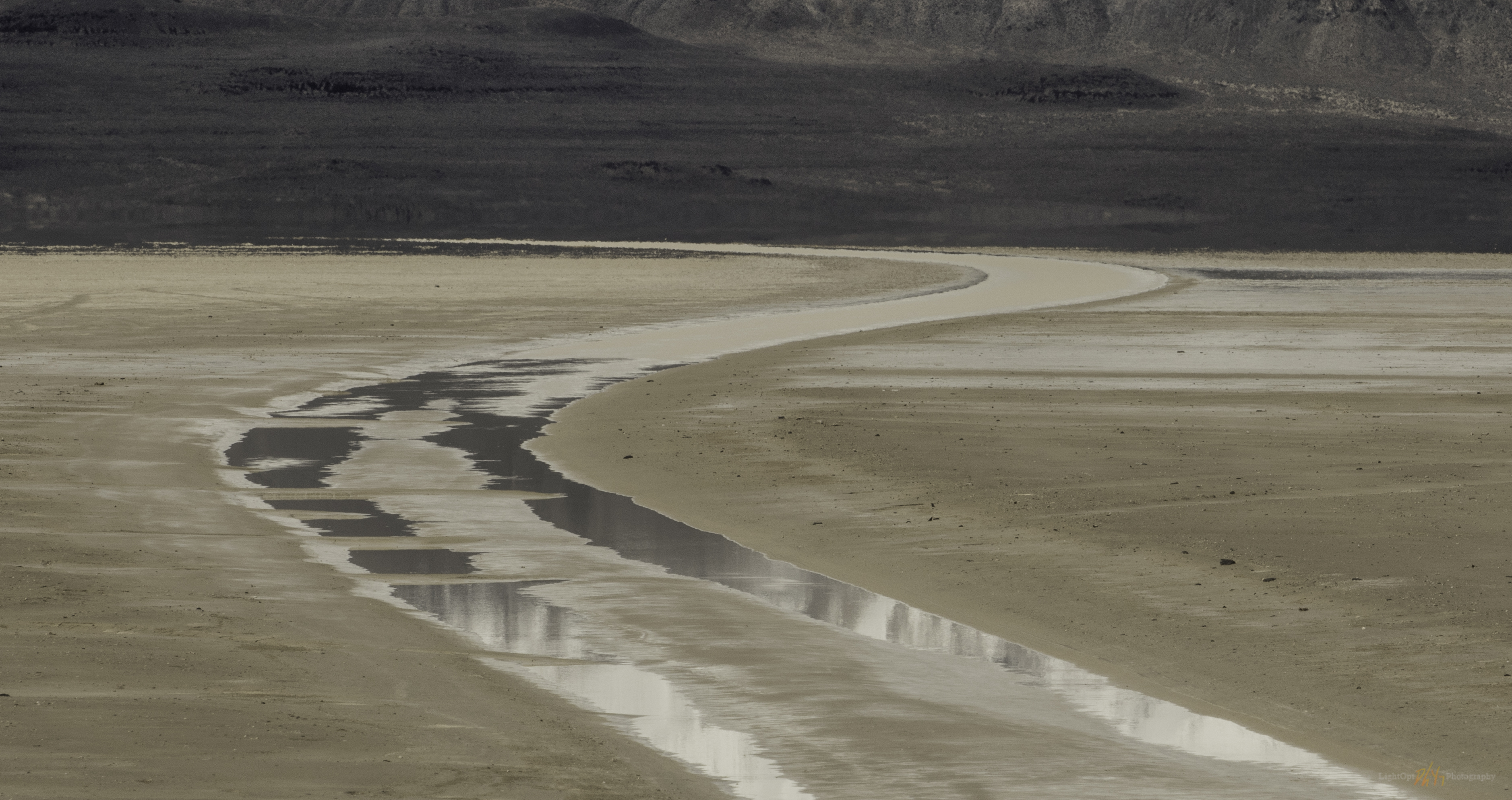
A dusty plume follows until I turn slowly onto a bare two-track that leads to the southern margin of Bluewing Playa. There are a few puddles, surprisingly, but I remember that we had some productive monsoonal storms a few days ago and they clearly tracked across this valley. Feral donkeys stare as I pass slowly by. The playa is dry, and I set camp near the base of Black Mountain, letting the heat seep into every movement; I look toward evening for cooling respite.

Black Mountain, Bluewing Mountains, Nevada, highpoints, summits
Black Mountain. High point (#104) of the Bluewing Mountains, Great Basin Desert, NV

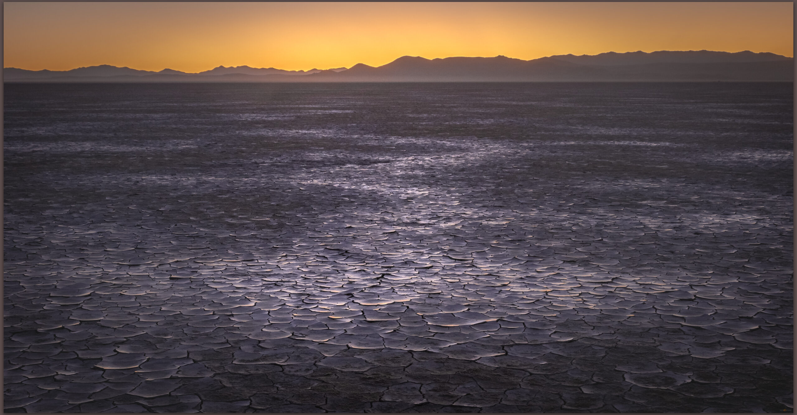
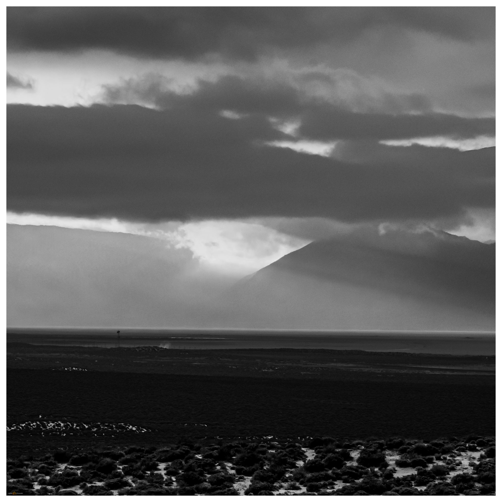
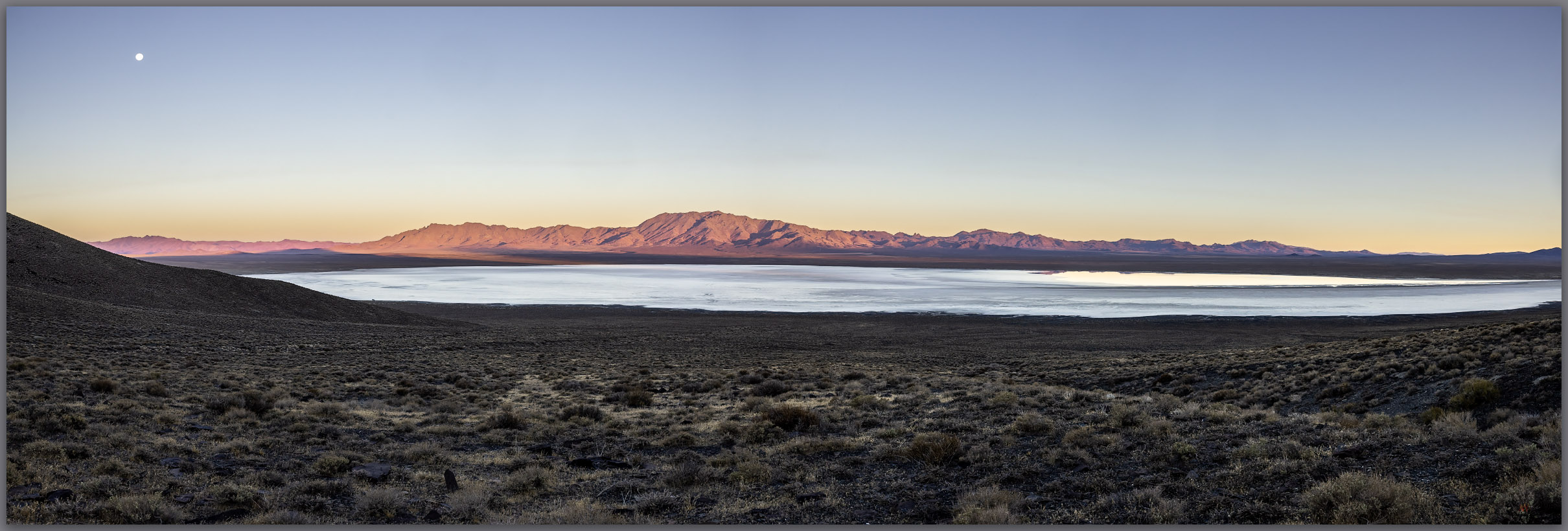
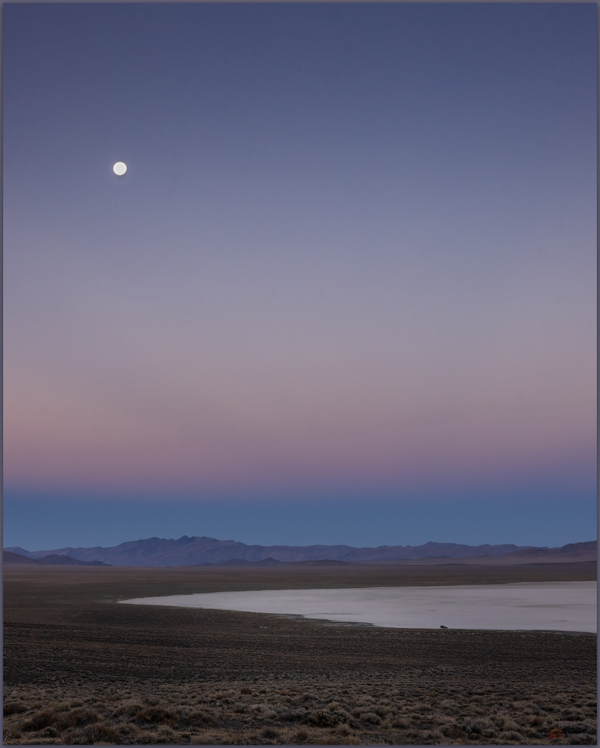
Black Mountain rises abruptly, reaching 2000 feet of prominence above the basin floor. Sitting in the shade of the camp-trailer I plot a steep route to the summit, mapping a sloping descent off the backside of the mountain. I’ll leave in the pre-dawn and hopefully beat the sun at the beginning of yet another scorching August day. Night falls and there is some relief, the southerly breeze stays warm but at least there is movement. I wait in perfect quiet as the moon rises, racing its own shadow along a band of light and dark that moves west to east across the playa. When it arrives at camp, the moon practically jumps above the horizon. Sleep comes surprisingly easy as I listen to the desert silence, the quiet only broken by the rare breying of a donkey far off in the valley – maybe they trail to the remnant pool of monsoon runoff on the playa’s northern margin.

Earth shadow at Bluewing Playa. Great Basin Desert, NV
Mountain shadow. Walking the southern limb above Bluewing Playa, Great Basin Desert, NV

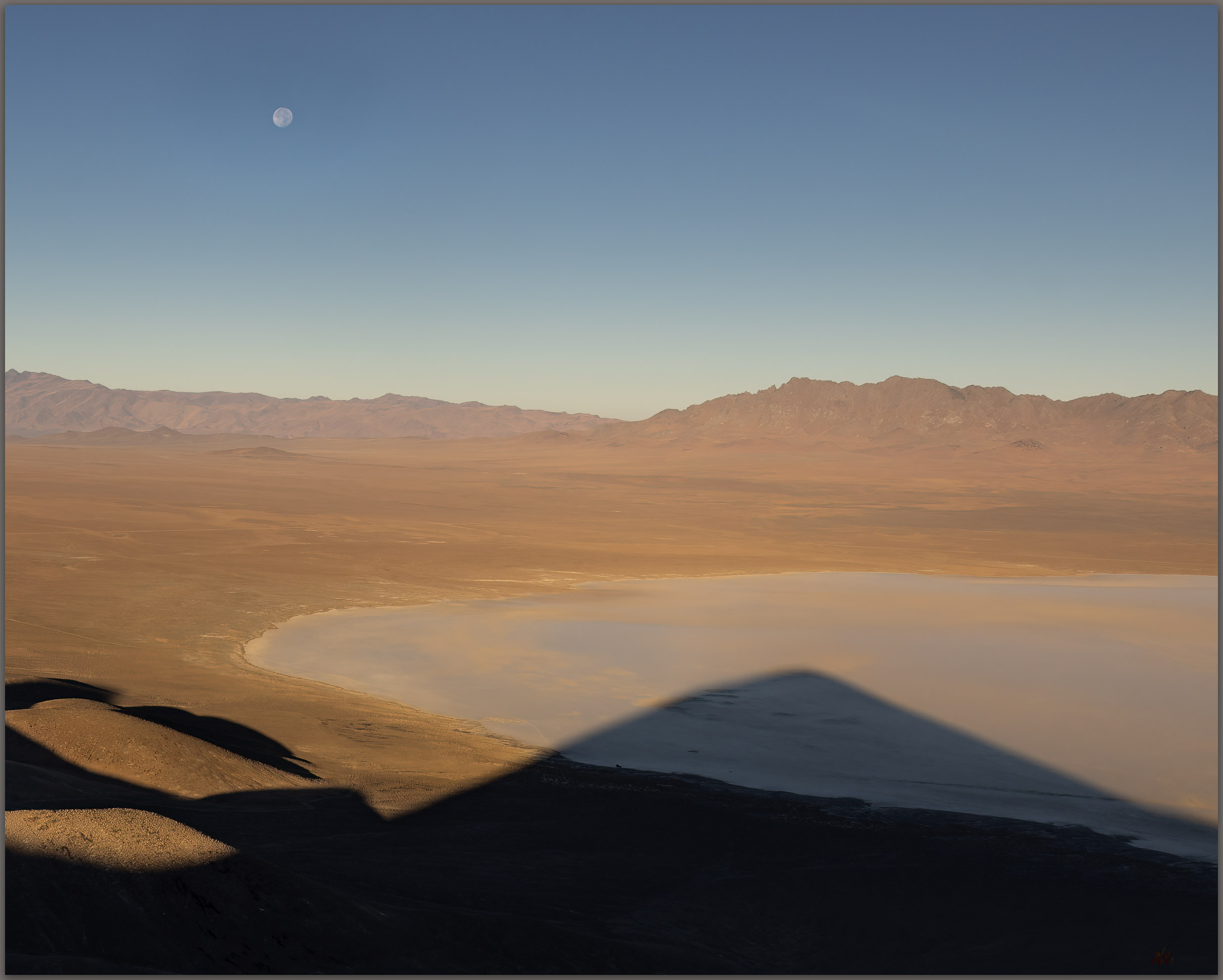
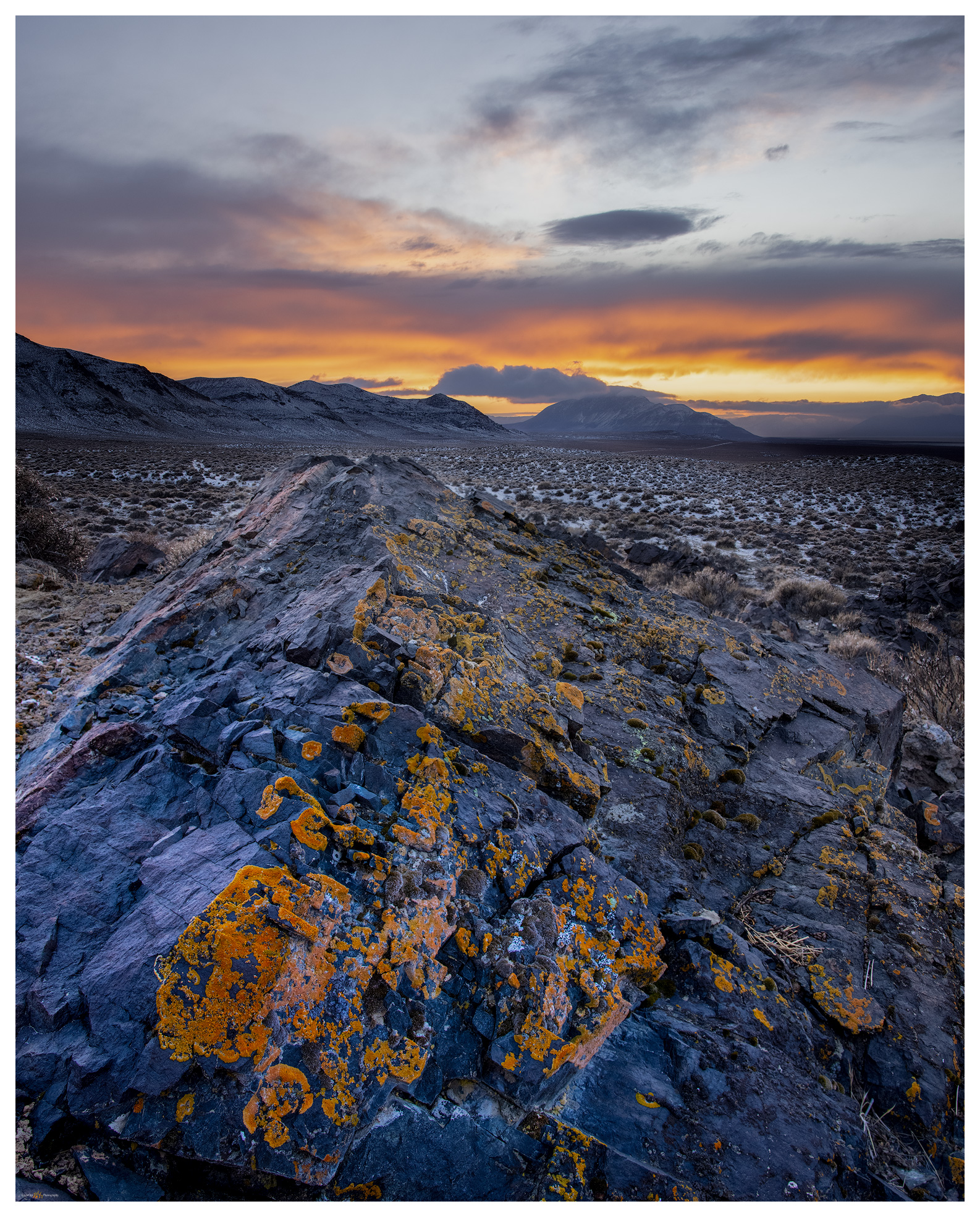
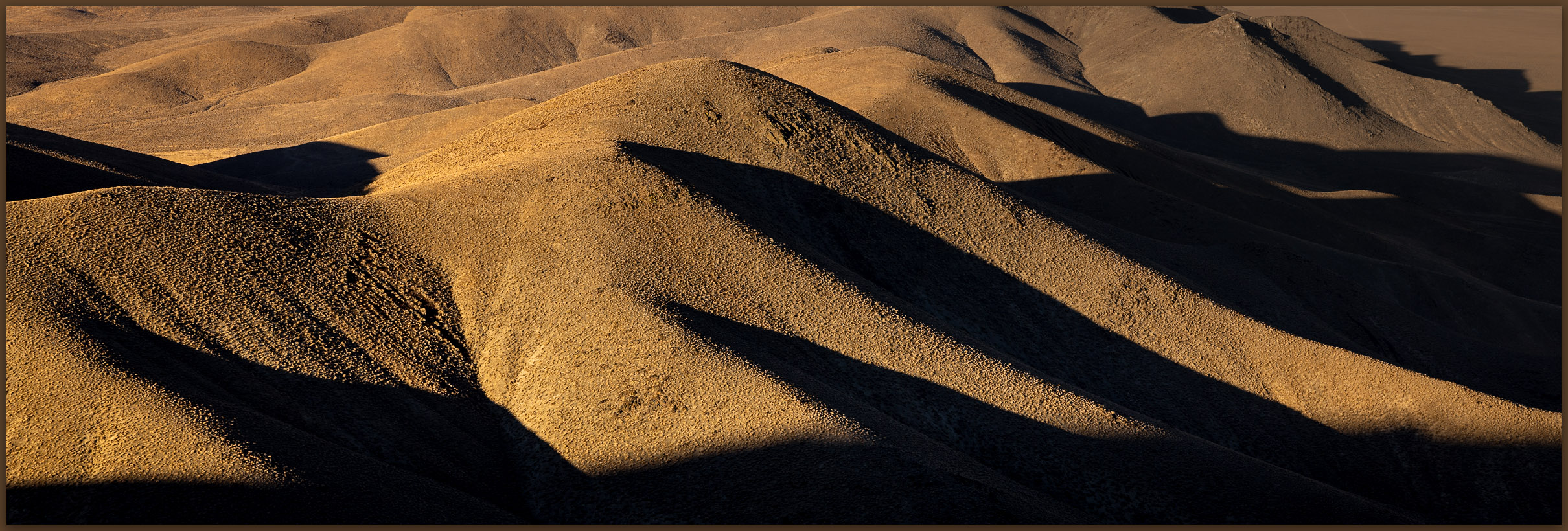
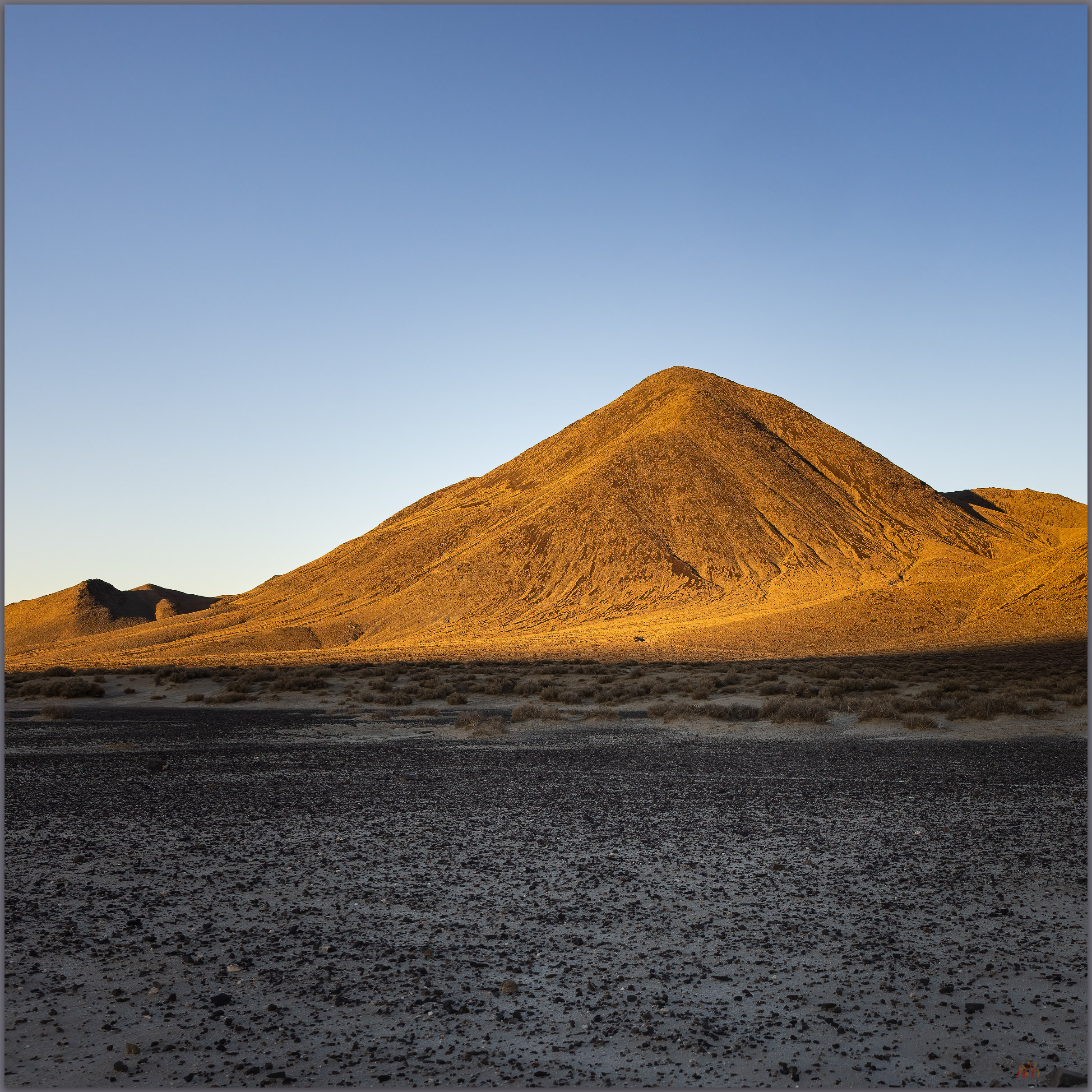
I am awake in the darkness of early morning, brewing coffee and preparing a quick breakfast to fuel the walk. It is cross-country from the playa edge, crossing a set of silt dunes before ascending a gently sloping alluvial fan that emanates from a canyon below the steep southern backslope of Black Mountain. I don’t need my headlamp because the moon lights the way and there is little to impede forward progress on the sparsely vegetated fan. A bat flits randomly in front of me and disappears. I turn into the mountain’s rise as get due south of the summit. I worry briefly that I might encounter scree-sheets of colluvial talus that could impede upward movement, but the talus cones are inter-locked nicely and the clasts provide relatively easy steps. Hands are required occasionally but upward momentum is good, and I climb quickly. The views are splendid even if the clear skies show neither depth nor drama.

Armored talus. Black Mountain, Bluewing Mountains, Great Basin Desert, NV
Rills. Bluewing Mountains, Great Basin Desert, NV
Outcropping. Bluewing Mountains, Great Basin Desert, NV

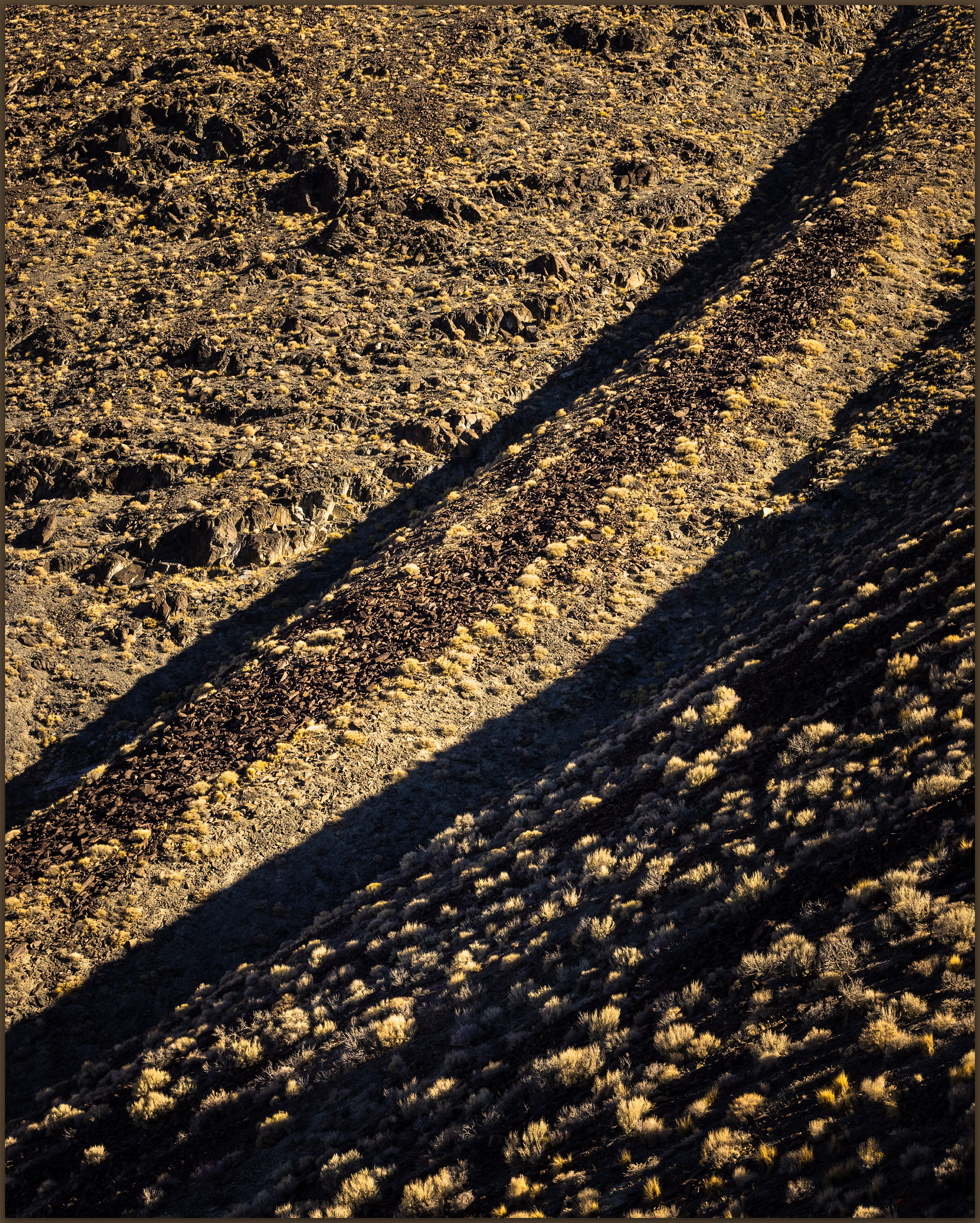
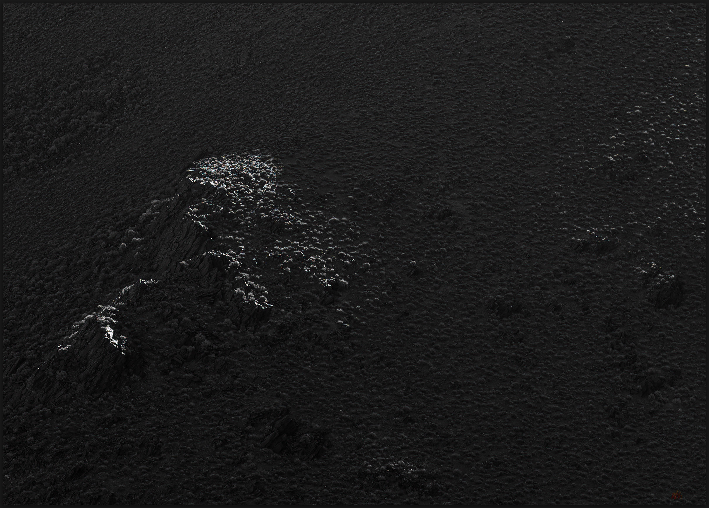
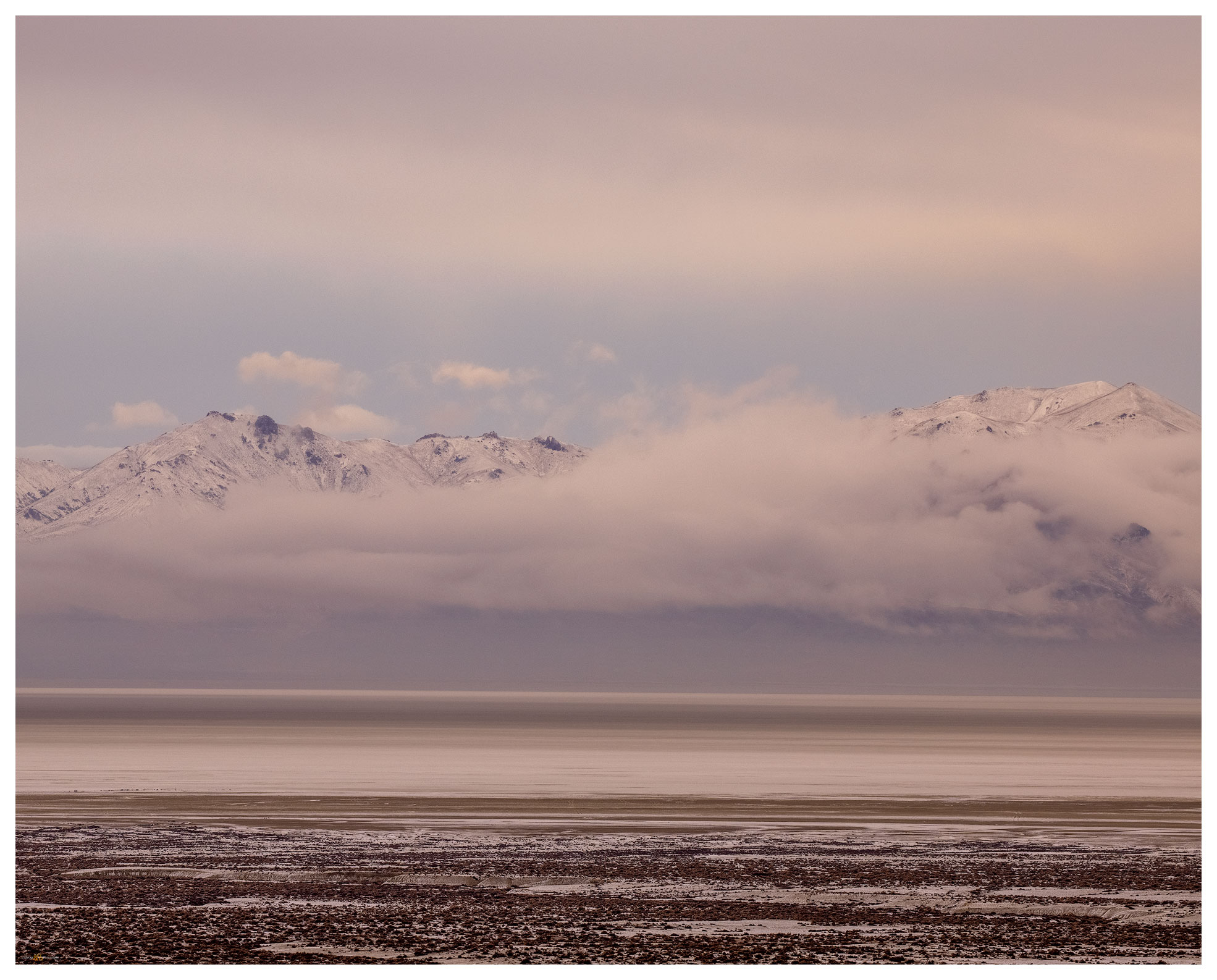
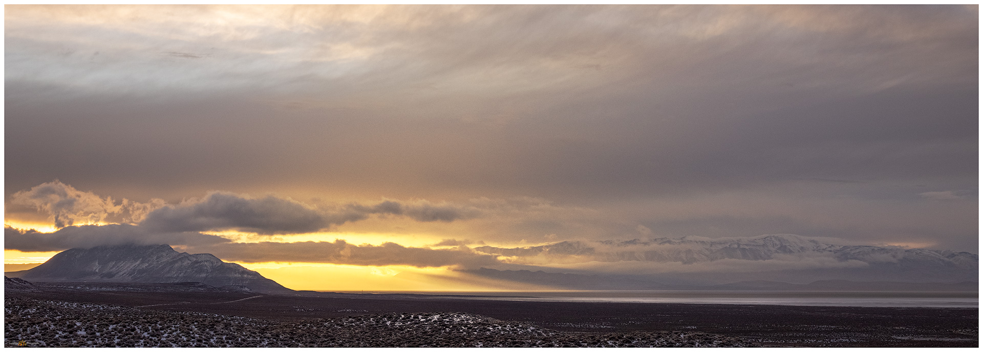
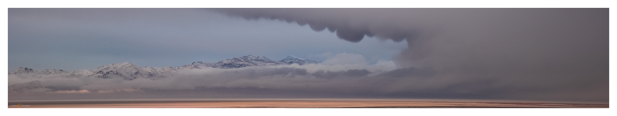
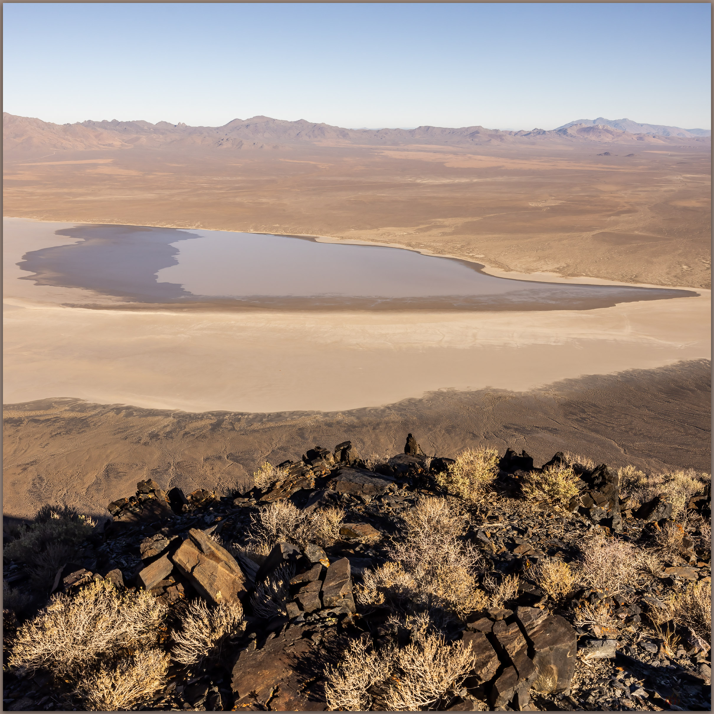
I move from outcrop to outcrop, skirting scree and talus where I can. Preparing for the coming heat, I reward myself with a good drink of water with each outcrop. I can almost walk steady as the upper slopes begin to lay back, so I work in little switchback to reach the northwestern ridge to look over the full extent of the playa, my camp a small speck on the playa edge. I break over the summit to meet the sun with a vast panorama of hills and valleys. I can see far south toward the Virginia Range above Reno, into the eastern distance beyond the Trinity and Humboldt Ranges, and Granite Peak towers in the north – I’ve attempted Granite Peak previously only to be snowed out, its summit pulls at me once again.

Bluewing Photo Collection

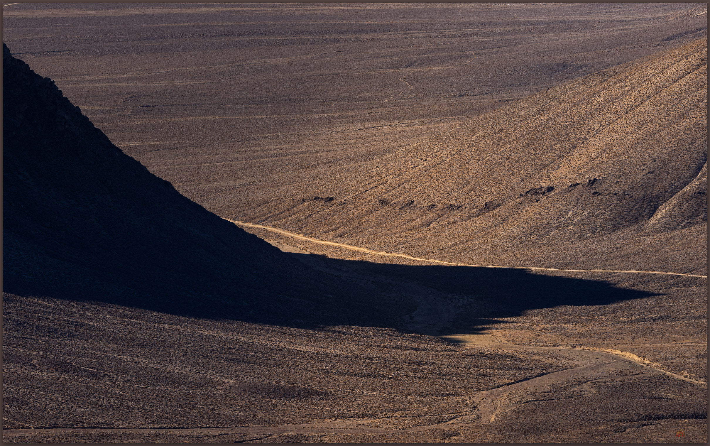
The walk off the east side is gradual and an easy pleasure. I am soon back in the south-side canyon that feeds the fan above my little camp. I have timed the excursion well; the morning is still relatively cool as I return to camp and begin preparations to roll out. It is a short outing, though I will have some time to gouge around the playa margins and explore the overland tracks eastward into Granite Springs Valley. I want to retrace a route to Highway 80 via Ragged Top and Toulon. There are several additional high points to explore in ranges of the ‘Bluewing Triangle’, that vast space between the Black Rock, the Humboldt River, and the Pyramid Lake highway. It’s a lonely, desolate space, precisely why it is such a pleasure to experience. The triangle remains.

Keep going.

Heat waves. Bluewing Mountains and eastward beyond, Great Basin Desert, NV

Please respect the natural and cultural resources of our public lands.

#naturefirst #keepgoing

Playa and Pottery – Black Rock Desert Region, NV

D. Craig Young · January 4, 2022 · 2 Comments

Calico morning. Black Rock Desert, NV, USA

The playa passes quietly beneath the truck, a narrow path traced by the headlights in the predawn darkness. I had left Desna at Planet X to see what the sunrise might bring on the Black Rock Desert playa. A canopy of bright stars suggested that the desert sunrise would be quick; a transition from an early glow to generally blue skies. I had been spoiled by a few Sierran storms and had hoped for something, anything to add some variety to the vast skies above the expanse of the playa – even as the forecasts had ridiculed my fervent wishes.

Black Rock and Planet X Collection

Playa before dawn. Black Rock Desert, NV, USA.

I rolled to a stop as the eastern sky brightened and turned to brewing coffee on the tailgate as a trolled for mud cracks to highlight a foreground. The regular patterns revealed little other than general chaos; I tried to stack a few frames in the long vertical panorama but was unsuccessful. It was the distance the drew my newly caffeinated awareness. Nothing overly dramatic, but the dusty sky held its own glow and I played a bit in the quickly changing light. I was happy that the playa was relatively quiet, only a few camps this late in the season.

Playa horizons. Black Rock Desert, NV, USA

It is time for some winter rain and runoff to rejuvenate the playa surface. With the quickly harsh light, I returned to Planet X Pottery to browse among the artwork as John and Rachel prepared for another day of the holiday show and sale. Always a quiet pleasure to visit the oasis that is Planet X.

Greeters. Planet X Pottery, Smoke Creek Desert, NV, USA
Dragonfly. The art of Planet X Pottery, Smoke Creek Desert, NV, USA
Pendulum desert. Planet X Pottery, Smoke Creek Desert, NV, USA
Four horses once. Planet X Pottery, Smoke Creek Desert, NV, USA

Black Rock and Planet X Collection

Please respect the natural and cultural resources of our public lands. #naturefirst #keepgoing

Landscape Photography: Late Snow and Last Light on the Black Rock Playa, Nevada

D. Craig Young · February 27, 2021 · 1 Comment

I spent the day, having started well before sunrise, on an overland obsidian recce focused on the geomorphology and distribution of the Majuba and Seven Troughs toolstone sources. A series of dramatic snow squalls cut that effort short just as I reached the ‘High Road’ from Sulphur to Gerlach. However, as I broke out of the western margin of the storm, I could see a blanket of new snow across the dark space of the playa of the Black Rock Desert.

The playa is typically a dry, dusty basin — most experience this place in the summer and fall, with the denizens of Burning Man transforming the space annually (though the playa got a break in 2020). Snow is not typically in the playa experience. But as I dropped past Cholona, a white blanket spread before me and a long horizontal crack at the sky-horizon promised a show. I ditched the truck and climbed into the hills below Pahsupp Peak. I would wait and be ready.

Calico snow. The playa in its atypical blanket of white below the breaking storm.

Late Snow Collection

Traversing a series of alluvial gullies cut into lacustrine sediment of pluvial Lake Lahontan, I worked my way to a set of rocky outcrops highlighted by orange lichen dampened by the recent snow. From these rocks I could play with a variety of compositions in all directions.

I kept telling myself to go slow, pick a composition and work with the light that was building as the sun began to peak from the horizon on its way to evening. However, the receding squalls behind me — to the east — continued a shadow-play of cloud shapes and snow-fall curtains. While I concentrated on the light show in the west, I did turn for the occasional image in the darkening clouds — sometimes the two interacted and rewarded me with fantastic opportunities. This perspective called for a wide-view. Other times, I just watched in the moment. It was a special evening.

Black Rock Playa at Trego. As the storm receded it allowed the sunset to spread into the Black Rock Playa. (Please click for full view).
Passing snow. Dramatic mammatus clouds as the storm moves out of the Calico Mountains. (Please click for full view).
Two track to Trego. Traces in the snow hint at the old roads above the playa margin, it also makes a subtle pattern through the image.
Shadows of Trego. An experiment in black and white; I am happy with the compressed view of the sunset and the break in the Granite Range. The steam of hot springs rise in the mid-ground.
Last Light at Trego. The requisite near-far rock-to-sky scene. Not at all subtle, but this was the feeling at the close of a wonderful day.

Late Snow Collection

A long drive home remained, but everything about the day contributed to a perfect overland excursion. From obsidian maps to playa snow to the requisite afterglow, I count this among the special ones.

Keep going.

Please respect the natural and cultural resources of our public lands.

#naturefirst #keepgoing

Black Rock Desert Recon

D. Craig Young · March 13, 2017 · 2 Comments

Dendritic sheet. Dendritic, tree-like, drainages form in each drying polygon as puddles dry, and a few square centimeters of playa becomes a whole other world. When the sky doesn’t add to the story, look close. 1/1250 sec, f/5, ISO 100; Canon 80D, 18-135mm.

The Black Rock Desert of northern Nevada is the epitome of expansive space as its vast playa, the remnant lakebed of pluvial Lake Lahontan, rolls off the horizon in all directions. I have been wandering and researching this awesome landscape since the 1980s. Although popularized by denizens of Burning Man – a conceptually nice idea, run amok by human desire for community and expression, that which, it seems, cannot be created at home – the desert playa and its surroundings hold a place in my heart. It is also a splendid research laboratory for investigating the paleogeography – geology, climate, and culture – of a vastly changed landscape.

Anyway, Black Rock Desert photography has transformed into street photography set in somewhat ephemeral Black Rock City. Burning Man imagery dominates any search for any genre of Black Rock photography. That’s fine, the event produces compelling and evocative images. But the Black Rock is more than Burning Man, and I hope to remind myself, and others, that there is beauty and drama beyond the now lost utopia of Burners. A primary goal is to make the desert and its surroundings a focal point of my photographic journey. We’ll see where it takes me…

Black Rock Recon Collection

Limbos and Kumiva Peak. Stopped along the highway to watch the sunrise and take first images with new telephoto lens. 1/13 sec, f/11, ISO 100; Canon 80D, 70-200mm.

Not that this quick trip really initiates anything, but it was my first time out to Black Rock with photography in mind. There had been some late winter storms in the previous few days, but the light did not reward me. My opportunities were somewhat narrow as I also needed to recon an archaeological site for an upcoming project, a long drive for a single day out – days still short here in the late winter.

I was hopeful as this this was my first day in the cold desert with my new 70-200 mm f/4L lens. I didn’t make a lot of use of it, still too focused on the wide compositions in a big space; I see now that this should change, especially on days when the sky doesn’t add to the story. I did pause along Winnemucca Lake at sunrise to capture the Limbo Range and Kumiva Peak. The colors of the distant foreground, salt grass on the playa margin, make the image work for me.

Small town. The town of Gerlach, NV, dwarfed by the Granite Range. 1/160 sec, f/11, ISO 100; Canon 80D, 18-135mm.
Anansi’s Trail. Playa track after fleeting rain. Tried dozens of compositions to capture the metallic curve on the Black Rock Playa. 1/80 sec, f/14, ISO 100; Canon 80D, 18-135mm.

Near Trego Hot Springs, I walked onto the playa where I really wanted to capture the water-filled path and the curve of the former lakebed. I tried several different compositions of the same pattern, working hard to catch the mirage shimmering on the edges of any distant boundary. Finally, I cropped the far-away mountains, were former shorelines cut into volcanic rocks, to highlight the metallic S flowing to the middle horizon. An ephemeral day on the playa.

Black Rock Recon Collection

Keep going.

Trail Option

Copyright © 2026 · Monochrome Pro on Genesis Framework · WordPress · Log in

  • Contact TrailOption
  • Substack
  • Waypoints Bibliography
  • Young Archives