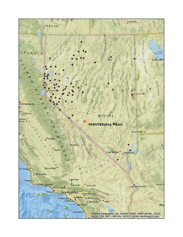
• Skip to primary navigation
  • Skip to main content

Trail Option

A personal geography of landscape and place, art and geo-science.

  • Home
  • TrailOption Blog
  • About
  • Contact TrailOption
  • Subscribe!
  • Lost Journals
  • Show Search
Hide Search

Clayton Valley

Nevada High Points #76: Montezuma Range and Clayton Dunes Overland

D. Craig Young · February 22, 2021 · 7 Comments

Clayton Dunes.

Montezuma Peak

8373 ft (2552 m); Gain 1624 ft

2021.01.09

It was time for the initial ‘Second Friday’ excursion in 2021. Snow squalls had come and gone during the week, so our plan was to head south into the southern Great Basin so that the daytime temperatures would be somewhat warm and snow might be less in the higher elevations. Darren and I chose Montezuma Peak for our target, and I picked the dunes of Clayton Valley for our two-night camp.

Clayton Valley. View from Montezuma Peak with Clayton Dunes, Silver Peak Range, and the White Mountains in the distance.

I met Darren in Carson City late on Friday morning. With a stop for fuel and a few supplies, we were soon on the straightaways of Highway 95 heading toward Tonopah, Nevada. We turn south toward Silver Peak, dropping past ‘The Crater’ and into Clayton Valley. I camped in Clayton Valley on my first Second Friday excursion in January of last year — in the before times. At the time, I had made the dunes a future destination and worthy of a look.

Clayton Dunes Collection

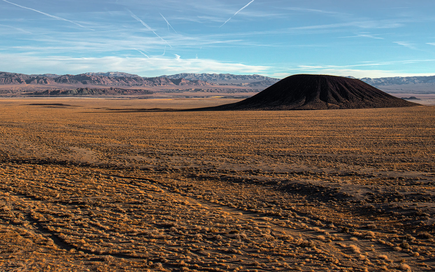
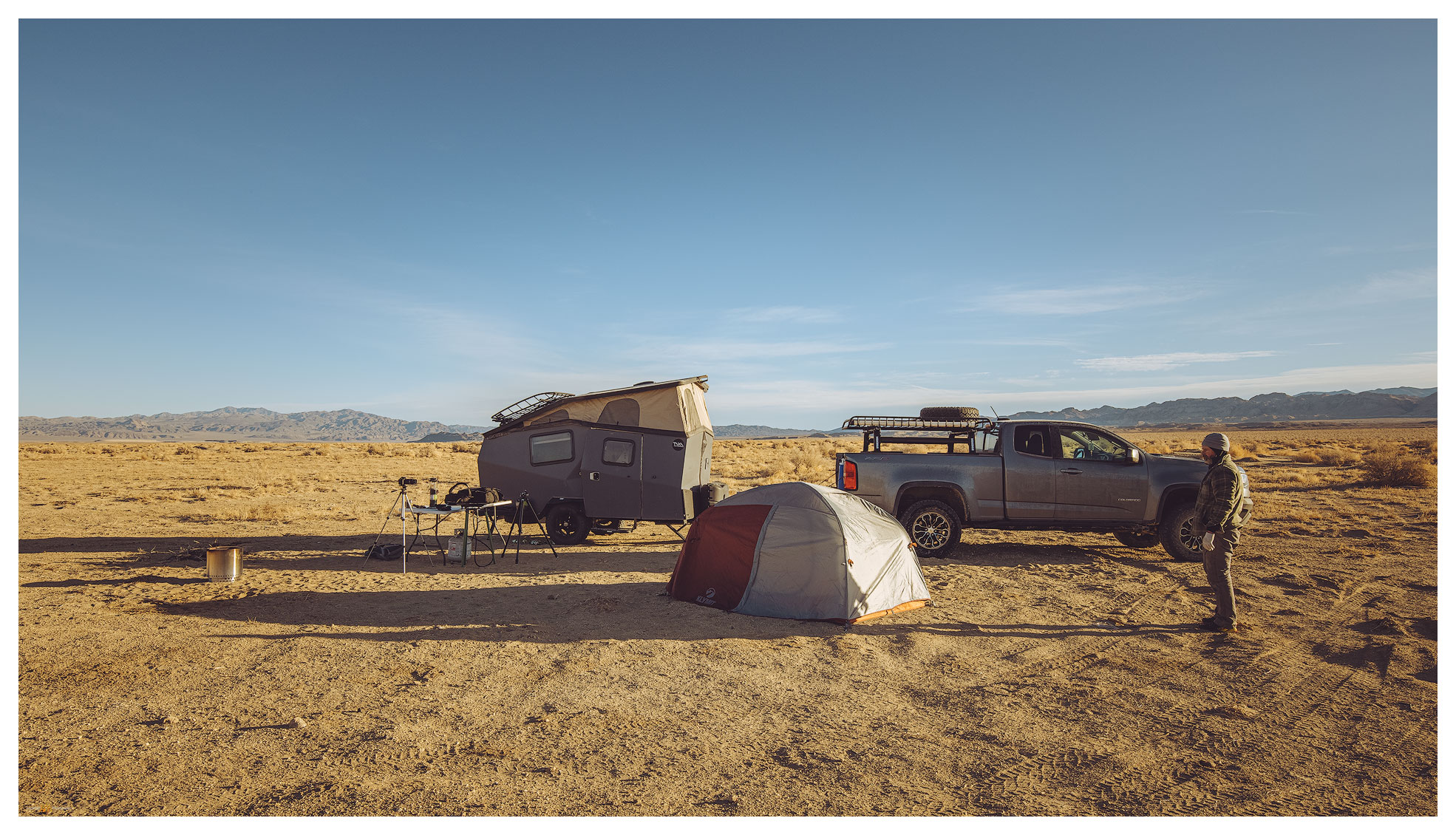
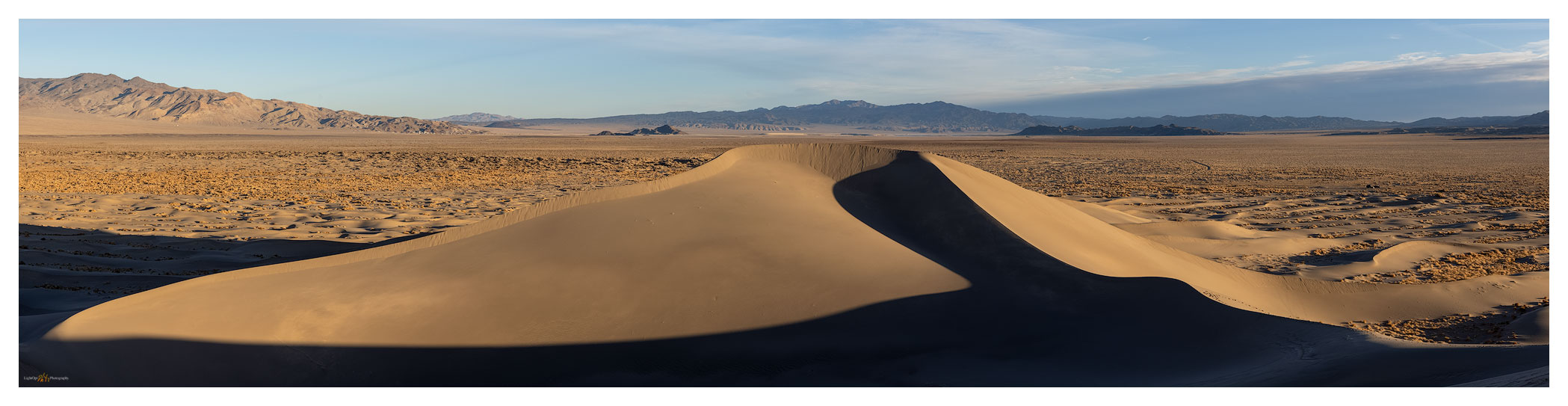
We arrived at the dunes at sunset. Rising prominently about a mile from the road, the dunes have no maintained access and off-road vehicle activity appears to be quiet in the winter. A sandy (obviously) two-track leads into the dune’s east side; however, I was not sure the truck and trailer would make it — a meter-deep arroyo had taken over portions of the track and small dunes rolled across others. We ditched the trailer by the turn-out and explored the two-track with the truck. It was fine and sandy. Returned for the trailer and set camp as the darkness closed in.

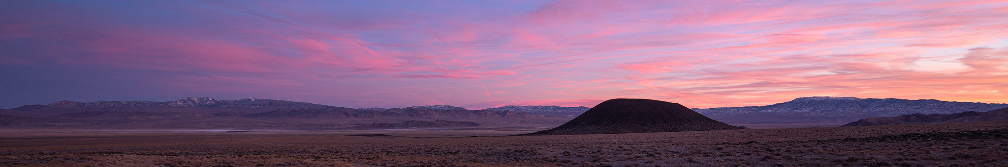
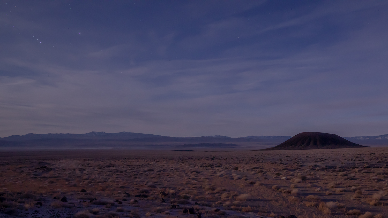
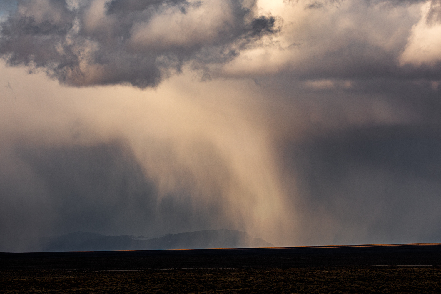
Winds were forecast, but at dinner we commented on the calmness and its relative warmth. A coyote sang in the distance. Watching the stars and mapping out the lights on the distant side of the valley, we noticed the lights of the evaporation ponds dimming and disappearing. The pinpricks of streetlights at Silver Peak were bright against the mountains. Slowly they, too, vanished.

We sat perplexed until a quick gust of wind rattled the table and an empty beer can. The smell of the night changed. Another gust. Dust storm!

The silt engulfed us reflecting a fog of headlamp and not much else. The vanishing lights explained. We hunkered in momentarily and then thought we should make the most of this. Let’s climb the dunes. We worked our way in our silt halos watching white-outs of sand blast from dune crests — the dunes migrating under our feet.

Clayton Camp. My Taxa Cricket with Darren’s tent; our common overland camp configuration.

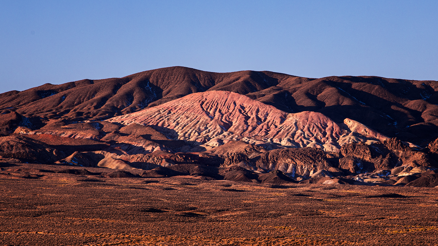
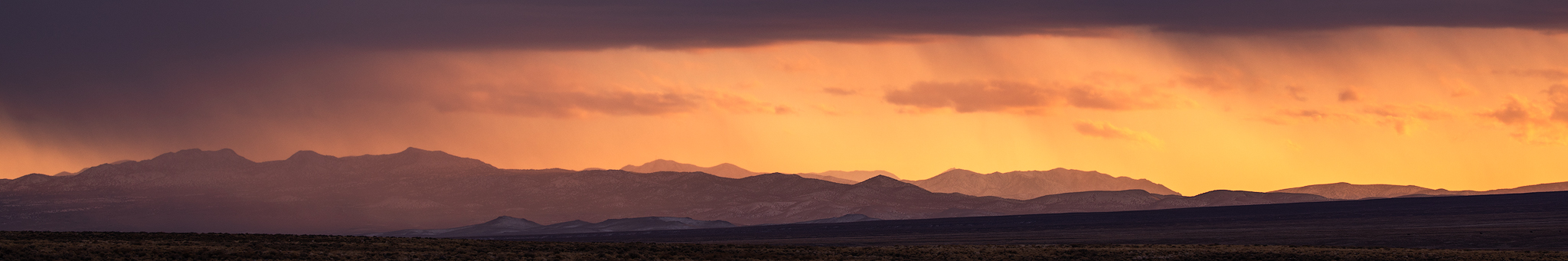
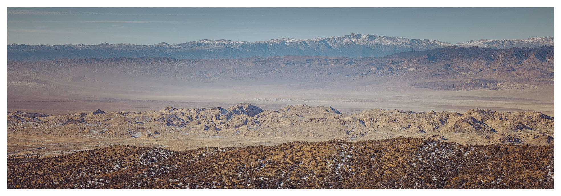
The morning was bright, a low cloud at the horizon evaporating at sunrise. We waited for golden light on the dune, but the uplands to the east were calling. The road to Montezuma, a historic-era mining town, is well-maintained and its upper reaches access private property and modern infrastructure, but respecting the properties is easily done.

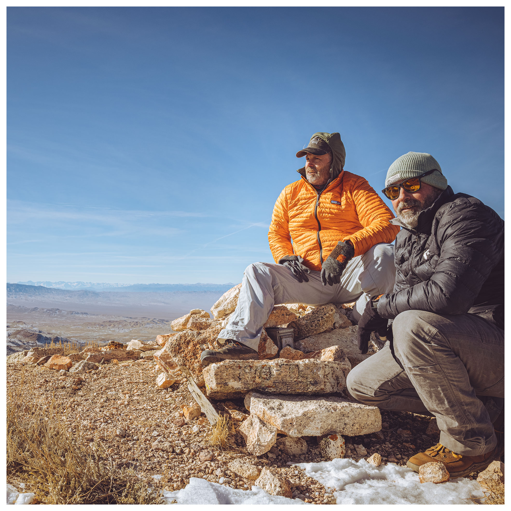
A so-called ‘pack trail’, variously marked on different maps, led to a pass that crests at the northeast ridge of Montezuma Peak. It is a simple, enjoyable hike from there. Snow patches were not deep even though we approached on north-facing slopes.

Montezuma Peak Collection

Montezuma approach. Leaving the pack trail we enjoy rock cross-country hike toward the rounded summit.
Toward Mud Lake. Summit view to the northeast toward the playa of Mud Lake.
Summit moment. The night’s wind brought the day’s cold — we did not linger.

Back at in the dunes we wandered, following animal tracks and composing photographs for the promising sunset. I also wanted to get the know the dunescape so we could catch the early light and the great shadow play of mid-morning sun angles on the curving dunes. I tried a few things but the cold was coming hard and fast. We prepared for dinner noticing that any liquid that hit the table froze immediately. Our hands numbed if we moved anywhere away from the stove. I turned on the trailer heater so we could lounge inside, but we kept to star-gazing and the pleasure of our well-contained campfire. It is something of a challenge to stay up in the winter-darkness, so we were relieved that the time passed quickly among our conversations about future trips, natural history, photography, and video ideas. And likely a myriad other things.

Clayton Dunes. Basin alluvium arranged by wind the basin bottomlands.

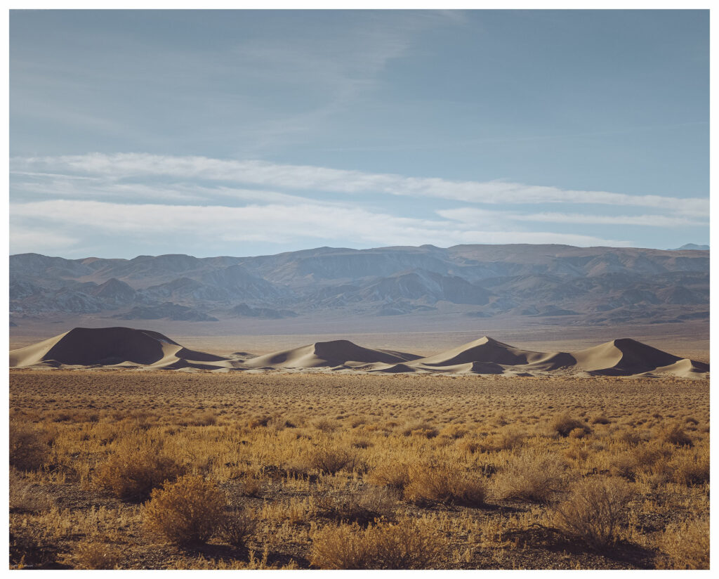
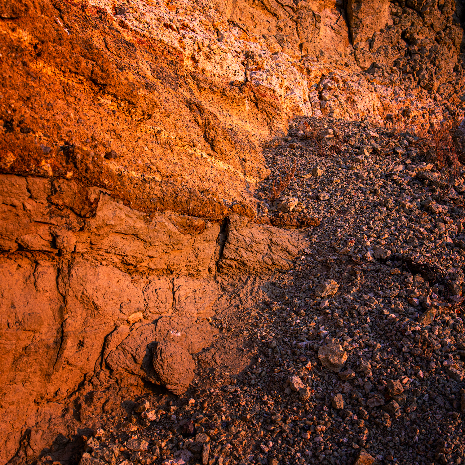
Because the evening shoot in the dunes did not materialize, I wanted hoped for success in the morning. I climbed the dune well before dawn, it was dramatically cold (in camp, our five gallon water jug was a solid block). The simple star dune in the midst of the dunefield provide the S-curve I wanted. I could have a play with first light against the dark of the dune shadow. The shadow area held a frost, giving it some highlights reflecting the sky, something I had not seen on a dune previously — of course, I’m not often on a dune in single-digit (F) temperatures. It was very satisfying, and I warmed quickly with my success.

Frosted dune. Feeling the mood of the dune at first light (three-image focus stack).

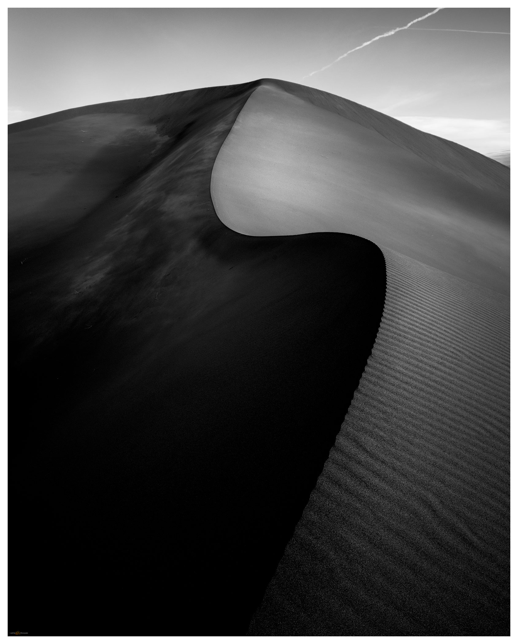
Darren was hiking his own quadrant of the dune but soon joined me for a few long moments enjoying the quiet, expansive views. This first overland of 2021 had worked out nicely; we had a fast peak and some slow time in the dunes. We had the excitement of the dust storm and the calm of the refreshed, trackless dune on the cold morning. It was, however, time to head home and plan our next overland/photo excursion.

Clayton Dunes Collection

North dune. A five-image pano from the dune apex, looking north across Clayton Valley.

Keep going.

Please respect the natural and cultural resources of our public lands.

#naturefirst #keepgoing

The Crater to Ione, NV: The resolution of ‘Second Friday’

D. Craig Young · January 13, 2020 · 2 Comments

It is a new year, 2020. I thought of doing a retrospective of last year’s favorite journeys and images. “My 12 Best Photos”, calendar-like (to follow a theme), or something similar. A look back, however, reveals several gaps in my photography journey. Those gaps opened as my vocational world (not too mention much of our national and global community experience) encountered turbulence. I turned to field studies and photography as escapes – I had many good field sessions, but they were escapes, nonetheless. Not escapes from the management attention that my business requires, but escapes as relief and rejuvenation. So, leaving the turbulence behind and motivated by it, I am looking forward to a new year and another trip around the sun.

What were the gaps? I had one new blog post in 2019 and I basically avoided sharing either images or field observations on social media. The latter does not bother me all that much, the pitfalls of social media are best avoided. The former is a strange conundrum.  I very much enjoy the blog medium. I spent considerable time with new formats and published several blogs based on journeys that took place in previous years; I still have a few drafts in the works. I kept thinking I would catch up eventually. Still, that is ‘looking back’; this is about looking forward.

Clayton – Ione Collection

Friends, family, and colleagues know me as a scheduler. I keep a detailed calendar charting my day and keeping time for the various things I consider significant. Do I stick to it?  Some days or weeks are better than others; I have never, however, considered any calendar as legally or emotionally binding. Other than engagements or appointments I should not miss, it is generally aspirational. But it is very structured. When I do stick to it, there is pleasure and satisfaction there, and, as a result, when I realize a successful calendar, I find I get things done.

A given workday, for example, has ‘Prime’ tasks and ‘Focus’ tasks. During ‘prime-time’ I allow disturbances and it is about collaboration and teamwork; it usually takes up the mornings. I turn off phones and email during ‘focus-time’, picking a specific project for the day or week that needs or can benefit from undivided attention, typically several hours in the afternoon. Field work negates the schedule for a while. Hey, it is fieldwork, that is why I do this!

My wife and I have a pretty simple home life, and I am not one to separate ‘work’ from ‘play’. I can and do unplug, but I am fortunate (I think) that my interests intertwine, mostly to mutual benefit. Like the workday, evenings revolve around a few key, calendared activities. Mondays and Tuesdays are about geoarchaeological research, notes, or projects that don’t get time at the office. Thursdays are for photography – processing, printing, and study. Other days I let randomness have its way, and I do not berate myself if the occasional distraction rips the day from the calendar.

So, what is this about? This is something of a forward-looking resolution and promise to me – discipline and practice around growth in my photography and my geoarchaeological science. It is all about the weekends!

I will call them ‘Second Friday’ and ‘Fourth Friday’, calendared and planned weekends of each month. Second Friday marks a monthly field trip, getting out on the ground with emphasis on areas where I have research interest and where I can bring my photography to that setting and topic. I head out on a Friday with a geography in mind and camp through the weekend. I might make a basecamp, or I could ramble on a reconnaissance of roads and trails untraveled. Fourth Friday begins a local weekend focused on practicing my photographic skills. I might chase golden light in the mornings and evenings, forage for images on a quick daytrip, or simply hunker into intensive processing or printing sessions. I may break from the focus to see to chores, of course, but the weekend revolves around a photography theme or themes.

Will this work? We will see. With this blog post, it is January’s Second Friday and I am in Clayton Valley, east of Tonopah, NV.

The Crater.

The Crater rises from the Pleistocene-age, coalesced alluvial fans that stream from the northeast margin of the Silver Peak Range. The fans engulf the volcano, but it rises in the classic composite cone, weakened only along its east side, where lavas poured into the valley, leaving black scoriated lobes paralleled the later flashy flows of the ever-reaching alluvial fans. Hwy 268 is one of the few remaining paved roads in Nevada that I have not explored, and while planning the field excursion The Crater is a highlight of my Google Earth flyby. This is where the weekend begins.

The Crater at Dusk, Clayton Valley.

The weather is perfect. There are rumors of a coming weak storm system, but the sky remains placid, the sun unduly warm for early January. I climb The Crater and explore its blown-out center; I continue southward to circum-navigate its perimeter. The walk is crispy on the young volcanic pumice and scree. Dust profiles on the cone’s south slopes, downwind of the Clayton Valley basin-bottom playa (today a focus of Lithium production), are fascinating. Fine-grained sediments always attract my attention.

Moonlight Crater, from the Monocline, Clayton Valley, NV.

I drive about a mile north with the approaching evening. Some basalt-capped badlands, called The Monocline, provide a stage for sunset and moonlight photography of the dark volcanic crater against the light-colored desert fans. It is the composition I visualized for the evening practice. The light is subdued, but I enjoy the quiet evening and the invitation of the full moon.

Tuffs in badlands of Black Canyon alluvial fans.

Camp is a non-descript wide spot at the intersection of cardinal two-track roads in the middle of the Black Canyon fan extending from the Silver Peaks. I am in the Big Smoky Valley drainage system now, but only a short distance north of the low pass to Clayton Valley. With the sunrise I detach the trailer and scurry in the ZR2 toward some badland outcrops far up the fan. The roads cut into the desert pavements and it is a short hike to Miocene badlands where ashflows and lakebeds encapsulate occasional pockets of petrified wood. Clear sky sunrise with few clouds. I am enthralled by the expanse of fans with inselberg islands of partially buried outcrops revealing remnant landscapes, but how to express the expanse and document the temporal incongruities through photography? I will return again and again.

Remnants. The volcanic outcrops of Black Canyon, Silver Peak Range, NV.

Circling toward Ione via the Gabbs Pole Line road, the forecasted squalls finally intersect the weekend. There is a bit of drama in the sky as I drop into quarry pits and arroyos to walk fine-grained profiles. There is temporal information in the sequence of ancient soils separating deep packages of gravelly Pleistocene alluvium and Holocene dust reworked into the basin as loessic alluvium. The Ione Wash arroyo is fantastic, a deep slice along the axis of this vast inland valley. I walk the profiles searching for fire histories, volcanic ash, and soil formation, hoping for an archaeological trace from the basin’s past.

Ione Valley Squalls.
Misty Mountain.

I camp by the roadside where I can photograph the squalls sailing through the Paradise and Shoshone ranges. Few flurries hit camp, but the evening is a pleasure, the trailer is warm, and I sleep well. The morning is clear but for some scudding clouds on the mountain tops. I tour homeward, joining traffic on Hwy 95 until skipping south at Yerington. I’m home in the early afternoon.

Last squall.

Clayton – Ione Collection

This is the pleasure of the weekend of Second Friday in all regards. I had some targets highlighted as little more than excuses to get into new landscapes where I could consider the natural setting and its process. I augmented my taste of dirt with the slow build of landscape photography, choosing a few scenes to maybe tell the story of the traveled stage. This is how planning, and a calendar, brings discipline that ultimately evolves into the pleasure of an outback journey and experience.

Keep going.

Trail Option

Copyright © 2025 · Monochrome Pro on Genesis Framework · WordPress · Log in

  • Contact TrailOption
  • Substack
  • Waypoints Bibliography
  • Young Archives